 |
|
|
|
 |
|
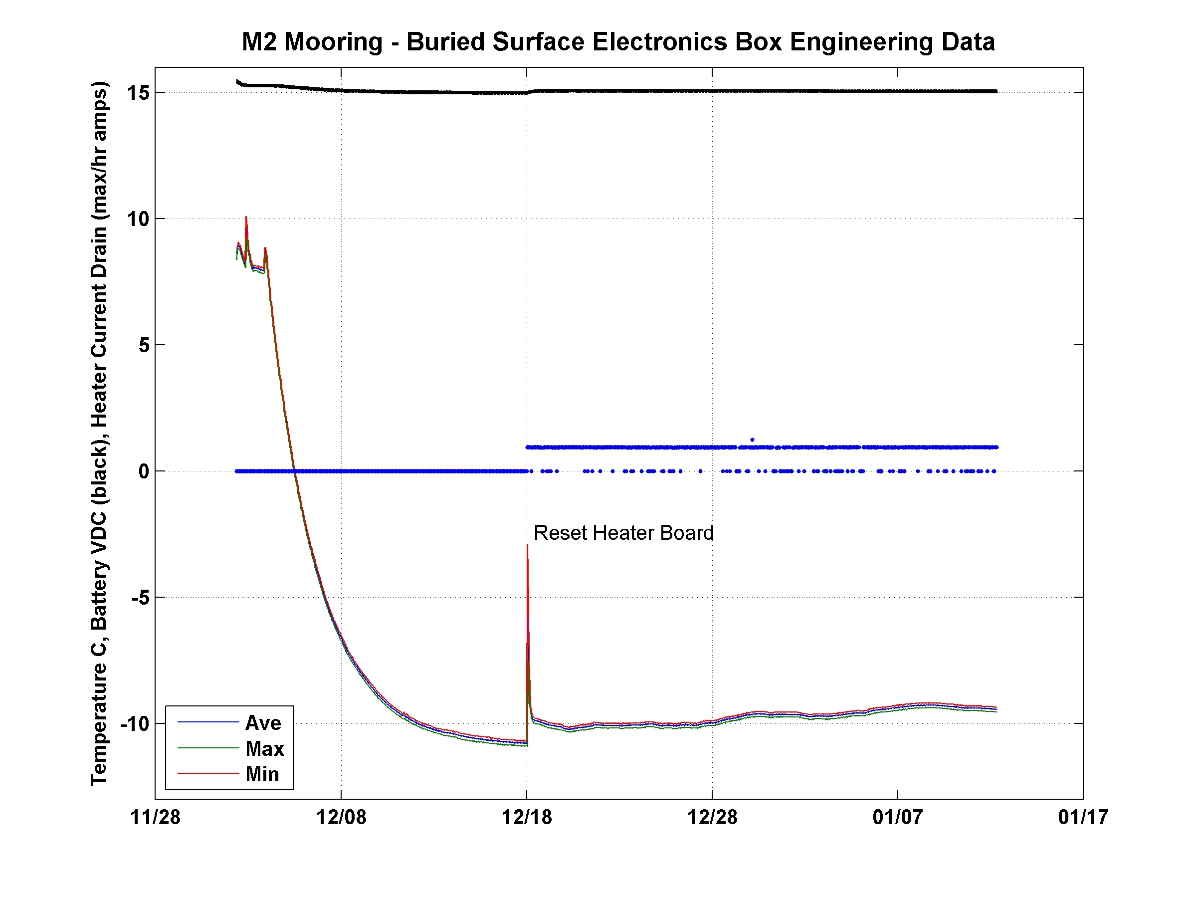
Figure 1- Engineering data (temperature C, battery voltage, heater circuit current drain (max/hr amps) from the WHOI Mooring M2 surface electronics insulated box buried 1-m below the RIS surface. |
|
 |
|
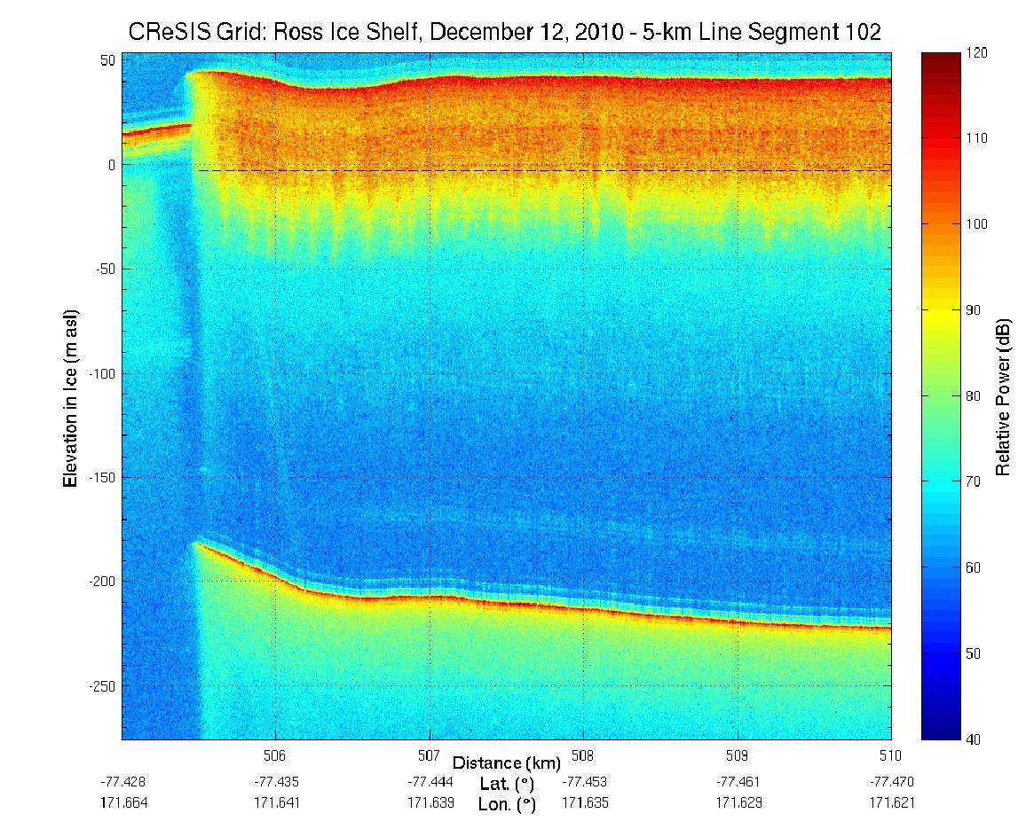
Figure 2- Andrill Ross Ice Shelf ice thickness (m) above/below mean sea level from airborne radar provided by the CReSIS group at the University of Kansas and Steve Fischbein at University of Nebraska Lincoln. |
|