 |
|
|
|
 |
|
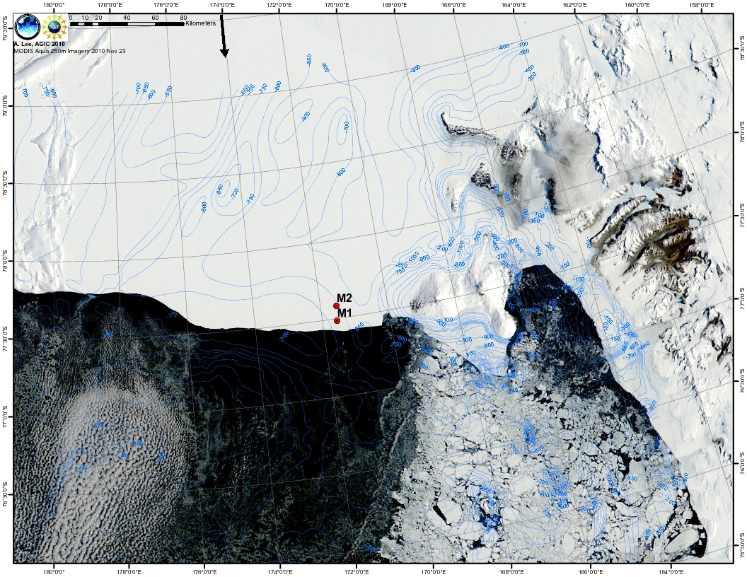
Figure 1- High resolution map showing the mooring locations and regional bathymetry (referenced to mean sea leve) by Aubrey Lee and Michelle LaRue from the Antarctic Geospatial Information Center (AGIC) , University of Minnesota. The ANDRILL mooring locations are nicely overlying MODIS AQUA visible imagery from 23 November 2010, about the time the moorings were deployed. Bathymetry from Stan Jacobs (LDEO). |
|