|
|
 |
|
 |
|
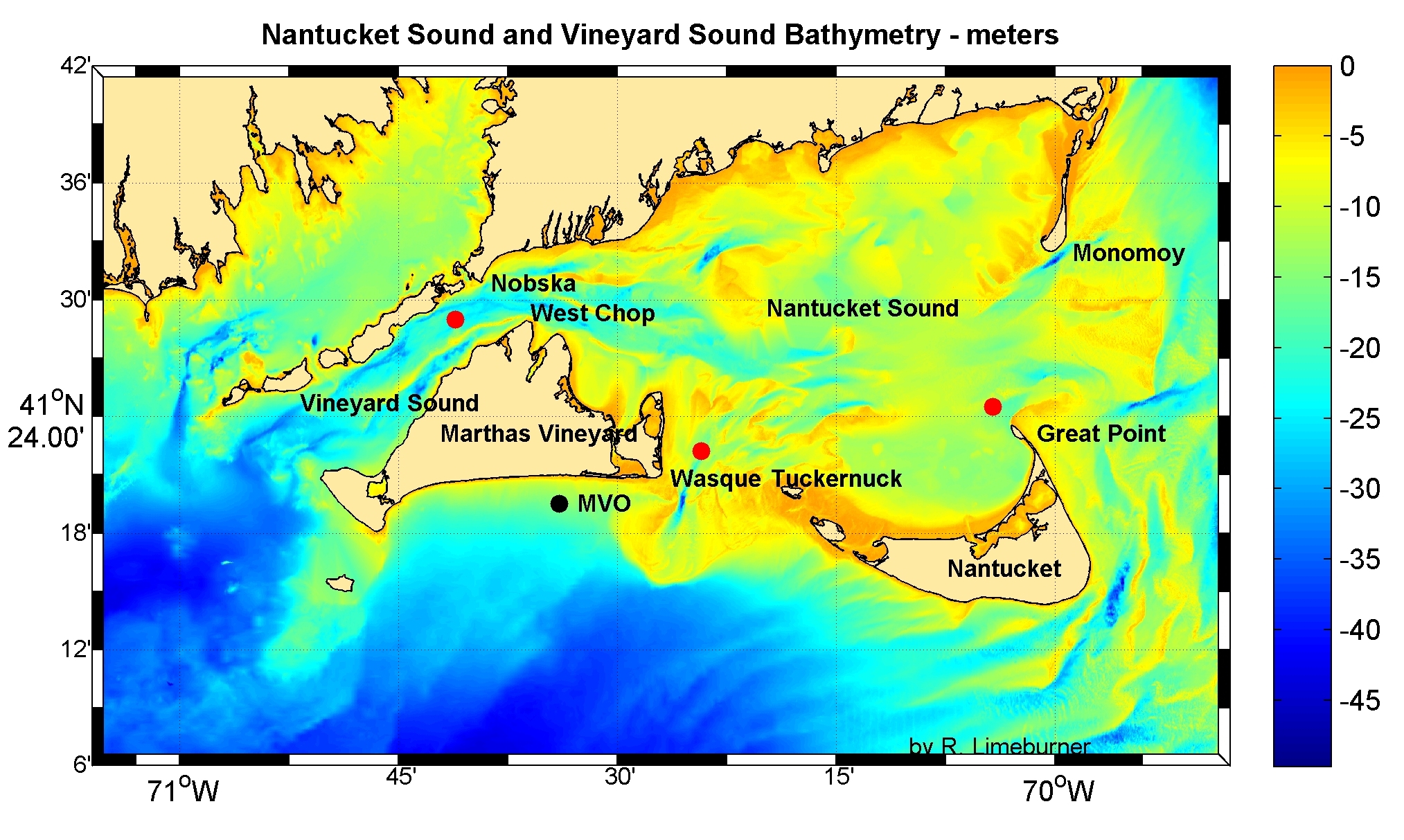
Figure 1- Nantucket Sound and Vineyard Sound Bathymetry - meters. Solid red circles are the locations of the 3 moorings. Click here
to see the most recent observations from the Martha's Vineyard Observatory (MVO).
|
Principal Investigators
Robert Beardsley, Richard Limeburner and Changsheng Chen
Brief Outline
Moored measurements of velocity, pressure, temperature and conductivity (salinity) were made on a bottom tripod located at a depth of 26m approximately half way between Nobska Point, Woods Hole and West Chop, Marthas Vineyard on five deployments during July 16, 2004 to September 4, 2007. The currents were dominated by strong semidiurnal tidal currents up to 200 cm/s. The maximum tidal current was in phase with the maximum tidal elevation indicating the local tide is characterized by a progressive wave. The mean flow was southwestward throughout the well mixed water column. The low-frequency current variability was dominated by the windstress. The moored data compared well with newly developed FVCOM model output (Chen et. al., 2007). FVCOM features an unstructured grid in the horizontal and a bottom-following sigma coordinate system in the vertical that provides excellent geometric flexibility and solves the governing equations in integral form, thus ensuring conservation of mass, momentum, heat, and tracers such as salinity. These results are now being used to develop an operational coastal management model system for the New England Shelf (NES) with the focus on Nantucket Sound (NS) and Buzzard Bay (BB).
Recent Observations
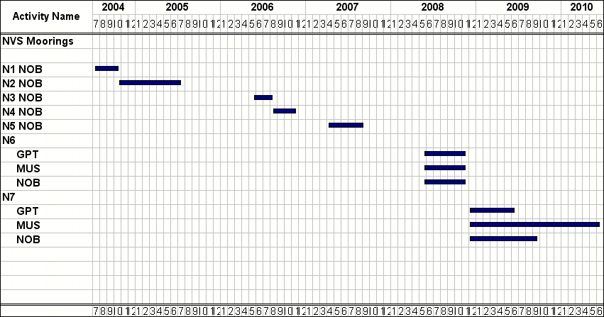
We deployed 3 moorings in May 2008 - one mooring in each of the 3 openings of Nantucket Sound to estimate the annual mean flow and spatial and temporal variability of the transport. The Nobska mooring was recovered in June, 2009 but the other 2 moorings were not located at that time. In May of 2010 we recovered the 2 lost moorings by acoustically tracking Sonotronics pingers on the bottom tripods and recovering the units with scuba divers. The ADCP's lost battery power after about 9 months, the Muskeget Microcat and Seagauge did not return useful data. The Great Point Microcat worked well for 18 months but the data contained biofouling of the conductivity cell.
The subtidal flow in NS is thought to be driven by local surface wind forcing and pressure fluctuations at the three openings caused by larger- scale surface forcing and buoyancy forcing.
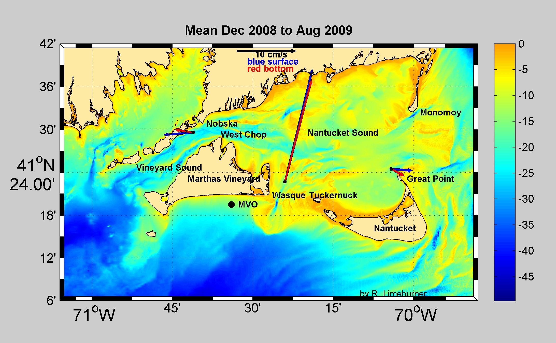
Figure 2. Mean and tidally dominated principal axes in Vineyard Sound.
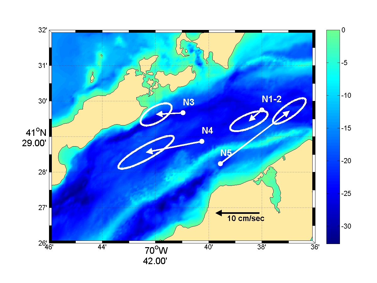
Figure 3. Low pass filtered mean and principal axes.
To read the full proposal (PDF format), click here.
This project is funded by the MIT Sea Grant.
Website Updated October 3, 2007. R. Limeburner
|
|
|
