| Overview | |
| Science | |
| Data | |
| |
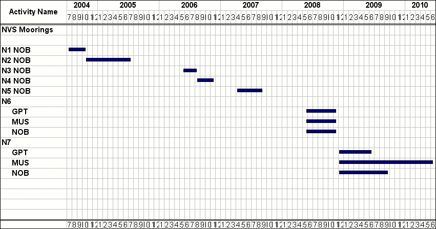
 | Nobska Mooring Locations |
Data 2008 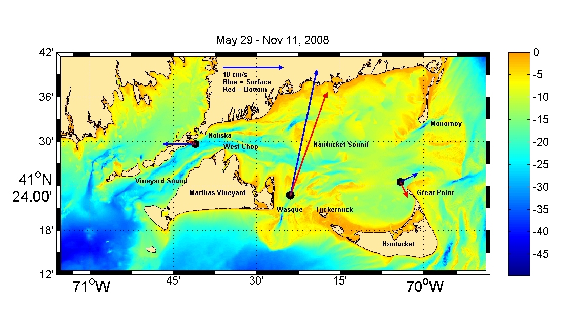 The N7 Deployment locations and mean currents are shown above. The Nobska mooring was recovered in June 2009 and the Muskeget and Great Point moorings were not located at that time. We returned to the lost moorings in May 2010 and recovered all the instruments acoustically by tracking Sonotronics pingers with scuba divers. 2010 Meteorological Data Station BUZM3 - Buzzards Bay, MA ascii file bbmet2008.mat. 
2010 Data ascii files in n7.zip. n7mgptwh016m900s.mat is the Great Point N7 WHADCP V/Backscatter data at a depth of 16-m averaged every 900s Variables jday (julian day), u/v/w cm/sec, bs (backscatter), bindepth m, depth m instr depth m) n7gptmc015m300s.mat is the Great Point N7 Microcat T/C/S data at a depth of 15-m averaged every 300s Variables jdaymn (julian day), tempmc (temperature C) and saltmc (salinity ppt) n7muswh014m900s.mat is the Muskeget Channel N7 WHADCP V/backscatter data at a depth of 14-m averaged every 900s Variables jday (julian day), u/v/w cm/sec, bs (backscatter), bindepth m, depth m instr depth m) n7muswh016m900s.mat is the Muskeget Channel N7 WHADCP V/backscatter data at a depth of 16-m averaged every 900s Variables jday (julian day), u/v/w cm/sec, bs (backscatter), bindepth m, depth m instr depth m) n7nobwh027m900s.mat is the Nobska N7 WHADCP V/backscatter data at a depth of 27-m averaged every 900s Variables jday (julian day), u/v/w cm/sec, bs (backscatter), bindepth m, depth m instr depth m) |