| Overview | |
| Science | |
| Data | |
| Movies | |
| |
 | Nobska Mooring Locations |
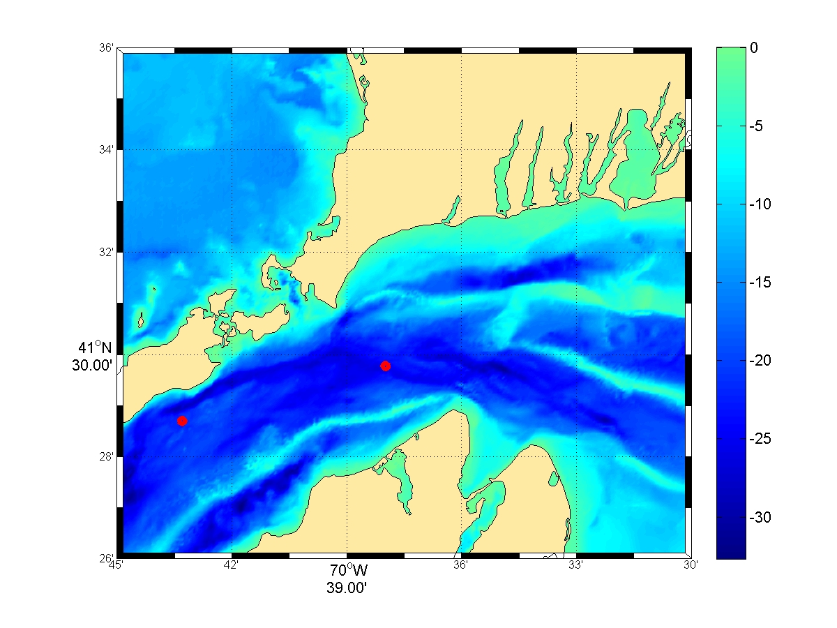
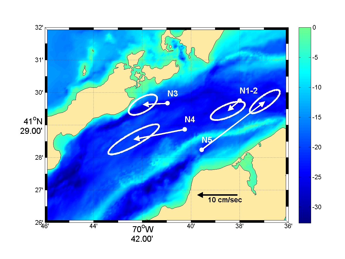
Robert Beardsley, Chen Changsen and Richard Limeburner Brief Outline Moored measurements of current, pressure, temperature and conductivity (salinity) were made on a bottom tripod located at a depth of 26m approximately half way between Nobska Point, Woods Hole and West Chop, Marthas Vineyard on four deployments during July 16, 2004 to November 22, 2006. The currents were dominated by strong semidiurnal tidal currents up to 200 cm/s. The maximum tidal current was in phase with the maximum tidal elevation indicating the local tide is characterized by a progressive wave. The mean flow was southwestward throughout the well mixed water column. The low-frequency current variability was dominated by the windstress. The moored data compared well with newly developed FVCOM model output (Chen et. al., 2007). FVCOM features an unstructured grid in the horizontal and a bottom-following sigma coordinate system in the vertical that provides excellent geometric flexibility and solves the governing equations in integral form, thus ensuring conservation of mass, momentum, heat, and tracers such as salinity. These results are now being used to develop an operational coastal management model system for the New England Shelf (NES) with the focus on Nantucket Sound (NS) and Buzzard Bay (BB). Scientific Background Coastal waters in southern New England have exhibited significant warming in the last 40 years due to global atmospheric forcing. This warming trend is most noticeable in winter temperatures; in Woods Hole, the increase since 1965 is ~ 1.5° C (Nixon et al 2004). There is growing evidence that continued warming could lead to significant changes in coastal ecosystems. In particular, it is hypothesized that continued warming could cause the seasonal plankton cycle to shift from the present 'cold' regime (with a distinct winter/spring phytoplankton bloom) to the 'warm' regime (with increased zooplankton grazing preventing the formation of the winter/spring bloom and allowing only a late summer bloom) presently found in estuaries and embayments. The impact of this plankton regime change on higher trophic levels could be dramatic. Oviatt (2004) suggests that some of these changes have occurred in several recent warm winters in Narragansett and Massachusetts Bays. NS is shallow (mean depth ~ 9 m), with openings to the west (Vineyard Sound-VS), the south (inner New England shelf-NES), and east (western Gulf of Maine-GoM). Located between the energetic GOM and weaker Mid-Atlantic Bight tidal regimes, tidal currents in NS are quite strong (the dominant M2 component has current amplitudes of ~ 1-3 m/s), generating sufficient turbulence to keep the local water column essentially vertically well mixed. Like many other New England sounds and bays, NS is a partial flow-through system, with two-way exchange of water, heat, salt, nutrients and biota through its three openings. A time sequence of depth-averaged tidal currents maps for NS and adjacent waters produced using the UMASSD regional GoM/GB/NES FVCOM (Chen et al, 2005a) illustrates the large tidal fluxes through each opening. Even with the relatively course model resolution of ~ 300-500 m in NS, the model shows good agreement and the few short-term tidal current measurements reported by Haight (1942) and illustrates the asymmetry between inflow and outflow through the eastern opening due to flow separation at both sides of its narrow restriction. Bi-monthly hydrographic surveys made in 1978-79 over Nantucket Shoals (that included NS) show a persistent frontal zone in eastern NS between more saline western GoM and fresher NS waters (Limeburner and Beardsley, 1982). While clearly generated in part by mixing driven by the large tidal flux though this opening, it is unclear if this frontal zone requires a mean inflow of GoM water into NS. Despite heavy use, there is surprisingly little known about currents in NS. Aside from Haight's (1942) tidal measurements, the subtidal flow is virtually unknown (not even the direction of flow through its three openings). Sanford and Flick (1975) report a mean eastward water flux though the Woods Hole (WH)/Martha?s Vineyard (MV) opening in July 1970, while our 2004 pilot mooring in this opening showed a mean westward flow Approach In July 2004, we began a pilot field program to obtain long-term measurements of current and water properties in the narrow passage between NS and VS. The times when the moorings were deployed are shown below. 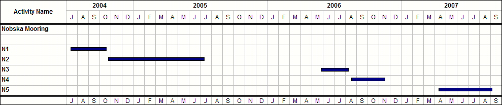
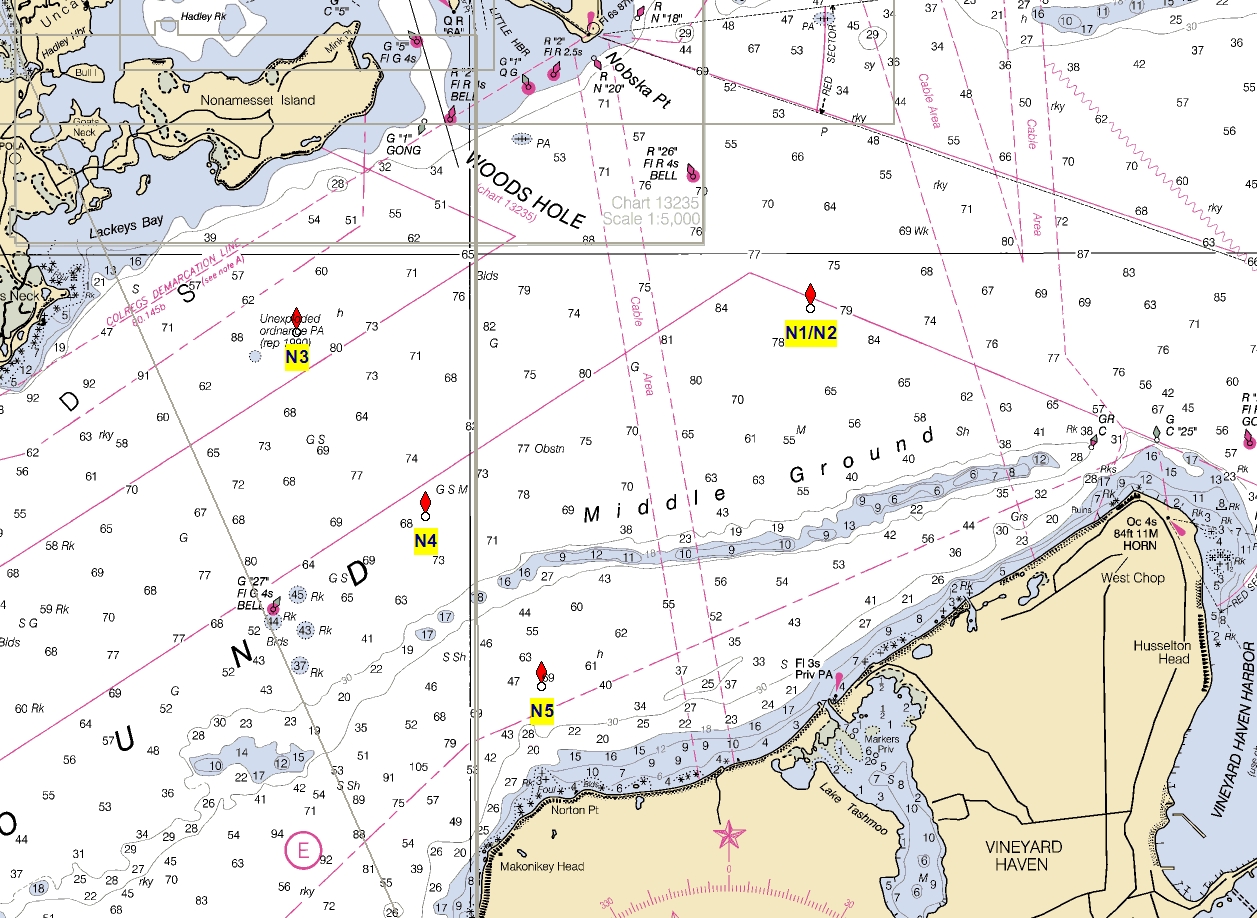
A bottom tripod equipped with an upward-looking RDI 300 kHz Workhorse broadband Acoustic Doppler Current Profiler (ADCP), a Sea Bird SeaGauge 26 pressure and temperature recorder, and a Sea Bird MicroCAT 37 temperature and conductivity recorder was deployed about mid-way between WH and MV (site N1, red dot in Figure to the left) in 26-m water depth on July 16 and returned a full dataset through October 14 when it was recovered. Wind data at the NOAA Buzzards Bay tower were obtained for the same period. The currents were dominated by strong semidiurnal tides, with maximum currents of ~ 200 cm/s at 4 m and ~170 cm/s at 22 m (4 m above the bottom) and a mean speed of ~ 80 cm/s. The depth-averaged currents were strongly polarized (major axis 90.0 cm/s, minor axis 2.6 cm/s) with the major axis oriented towards 76°, roughly along the local bathymetry. The mean depth-averaged current was 3.3 cm/s oriented towards 283° (WNW). With such strongly nonlinear tidal currents (note the harmonics M4 and M6 in Table 2), it is likely that tidal rectification contributes to the mean current. Recent Observations The N1 mooring deployment location 41º 29.750 N and 70º 38.000 W and N2-N5 locations are plotted here. The subtidal flow in NS is thought to be driven by local surface wind forcing and pressure fluctuations at the three openings caused by larger- scale surface forcing and buoyancy forcing. To investigate local wind forcing, we show low-pass filtered time series of (a) the depth-averaged current component oriented along its major axis (76°) and (b) the wind component oriented towards 54°. This angle was chosen to maximize the current-wind correlation (correlation coefficient squared CC2 = 0.37).While a number of clear cases of strong wind forcing towards the SW driving strong currents towards the WSW occurred (e.g., August 9, September 29) occurred, there is a tendency for a weaker current response for winds towards the NE, and some current events with no obvious associated wind events. This supports the idea that local wind forcing plays an important but probably not dominant role in driving low-frequency flowin NS. This is consistent with the lack of any significant correlation between the susurface elevation fluctuations at this site (standard deviation ~ 11 cm, maximum variationof 60 cm) and the subtidal current or winds, suggesting that the subtidal elevation presumably the surface pressure gradient) is strongly influenced by processes at larger scales than NS. To read the full proposal (PDF format), click here. This project is funded by the MIT Sea Grant. Website Updated Oct 10, 2006. R. Limeburner |