| Overview | |
| Science | |
| Data | |
| Movies | |
| |
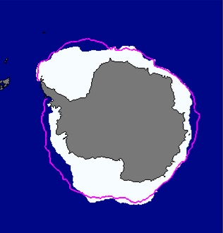 |
Sea Ice May 2007 |
| Current view of sea ice concentration (AMSR via Uni-Bremen) | |
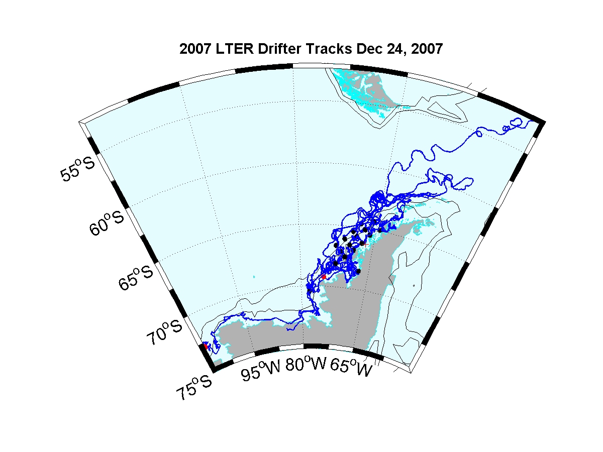
Palmer LTER Lagrangian Current Measurements Brief Outline We deployed satellite-tracked near surface drifters during the annual austral summer Palmer Long Term Ecological Research (LTER) program January cruises during 2005-2007 in order to investigate the near-surface Lagrangian currents over the Western Antarctic Peninsula (WAP) shelf between 63 and 68 S. Scientific Background Palmer Antarctic LTER seeks to understand the structure and function of the Antarctic marine and terrestrial ecosystem in the context of physical forcing by seasonal to interannual variability in atmospheric and sea ice dynamics, including forcing by long-term climate change. Focused on the western Antarctic Peninsula (WAP) region, the PAL LTER measurement system is explicitly designed to study changes in time and space of marine foodwebs consisting principally of diatom primary producers, the dominant herbivore Antarctic krill, Euphausia superba, the apex predator Adélie penguin, Pygoscelis adeliae, and a microbial foodweb in which planktonic Bacteria, Archaea and bacterivorous protozoa may play an important role as food for zooplankton. Approach The LTER investigators have focused their studies in this region since 1990, and have collected much valuable hydrographic and biological data on this ecosystem, but to date there have been very few direct measurements of currents. Satellite-tracked drifters provide a simple yet powerful tool to track the motion of near-surface water on time scales ranging from the tidal/inertial band to monthly and longer. Recent Observations Many 2006 LTER drifters have been moving southwestward during the March-June period of increasing sea ice formation. This was never observed in the SOG drifter deployments during 2001-2003. There are presently 5 drifters in the Bellinghausen Sea and they appear to be coherently moving together although sea ice covers the region. Also, on April 14, 2006 one LTER drifter moved southward through the inner passage east of Adelaide Island and continued to flow southward past Rothera and into Marguerite Bay. Below is a summary of the mean near surface drifter velocities and principal axes for regions where the mean is greater than the standard error. < 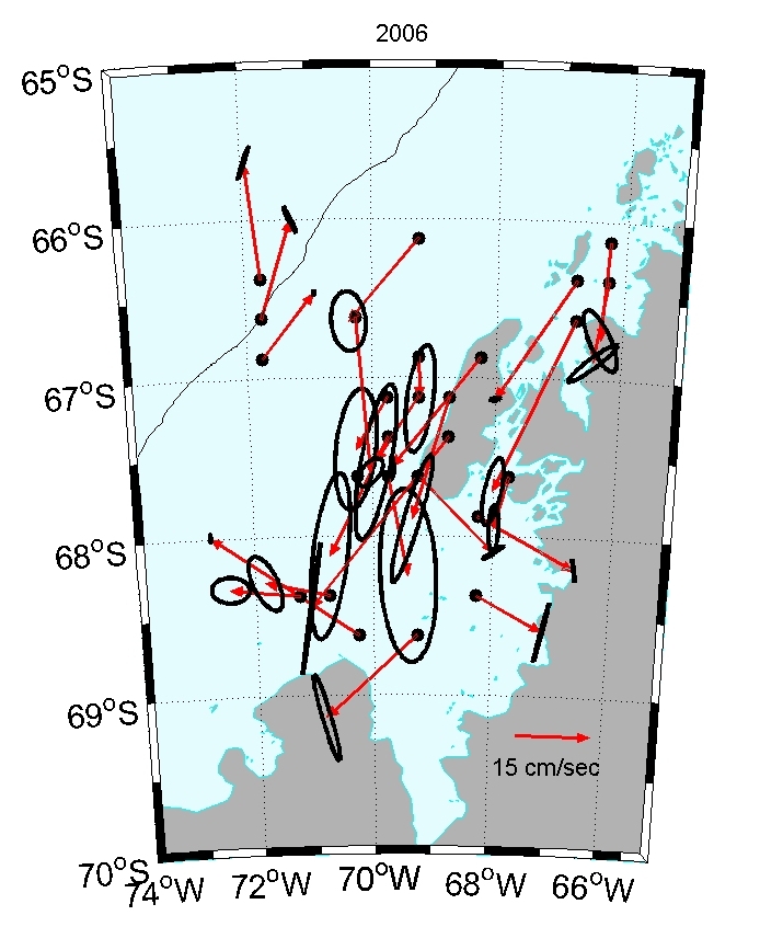
The January 2007 drifter deployments are completed and an initial plot of the tracks is shown above. To read the full proposal (PDF format), click here. To read the drifter specifications, click here This project is funded by the National Science Foundation. Website Updated October 24,2007. R. Limeburner |