INBOUND
October 2, 2013
Tweet
The mountains, islands, and headlands on the north coast of Norway hove into sight at 0930 Monday, the last day of September, 2013. Shall we call that the end of our cruise, though we’re still 24 hours from the dock at Tromsø? When does an oceanographic expedition end? When the science is complete? When we pull within cell phone range of civilization? When we pose on the bow for the group photo? When the heaving lines arc over the rail onto the dock?
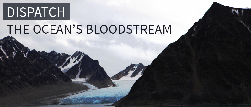
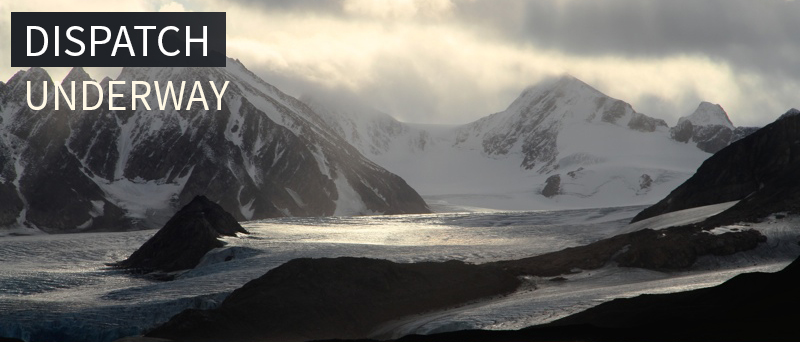
 We ran the final CTD section on Friday, across a deep trench trending north-south, another likely conduit of warm Atlantic water. Then we turned onto 180°, Tromsø bound. But the “tourism” was not complete, some fantastic sights still to see on the northeast coast of Svalbard. The west coast of the archipelago is largely ice free—because of the very same inflow of warm water that we were here to study—but the east coast is covered with ice. We saw it. The big island of Nordaustlandet is subsumed beneath a Greenland-style ice sheet rising with stutter-step crevasses into the seemingly endless white distance. But its seaward face looks more like an ice sheet in Antarctica, with 40-meter-high, beryl-blue ice cliffs soaring vertically out of the ocean. Facing into the wind, elegant little kittiwakes perched shoulder to shoulder on the floating bergy bits. The sky was bright blue with a few dark clouds to punctuate the clarity. Here was another exquisite, unforgettable Arctic moment.
Still three or four miles off the ice cliffs, I noticed the Captain standing up on the footrest of his fancy helmsman’s chair to see his echo sounder over the spectators’ heads. “There’s only five meters beneath our keel,” he said, prudently turning his ship to port. (On our first night aboard, Captain Iversen gave a little speech to the science party in the day room. Among other points, he said that there was an “open-bridge policy” aboard Lance; we were welcome topside any time. However, that chair of his was off-limits. He was smiling when he called it the “holy of holiest,” but he wasn’t kidding.)
That afternoon, still southbound, we reconvened on the bridge and the bow as we approached Kongsøya, the largest island in a three-island set called Kong Karls Land. Though it appears tiny on the chart, Kongsøya is enormous, layers of sedimentary rock, deposited during the Cretaceous and Jurassic ages 145-251 million years ago, skirted by huge talus slopes, forming three separate mountains. It was discovered in 1617 by Thomas Edge futilely searching for the fabled passage to the East; he called it Witches Land. You can see why. The world forgot about the place until it was rediscovered in 1859. 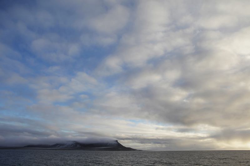 It was frost-bite cold on the windy bow as we searched the flat, shingle beach for bears. Kongsøya is the place for polar bears. Over 100 of them call it home, but the island is off limits, no landing allowed, except for Ursus maritimus scientists with all the proper clearances. As if to up the dramatic effect, white fog flowed over the tabletop-flat mountain summits.
Svalbard, like other western-Arctic landscapes, the east coast of Greenland, for instance, seem too extravagant to be actual, more the product of some over-caffeinated scene painter’s brush than of tectonics, sedimentation, and erosion, of nature. Grasp them now, hurry, fix them in memory, because if you look away too soon, they’ll vanish. However, in these essays, I don’t want to leave the impression, with all this focus on land- and seascape, on evocative mood and scene, that we’re in it for the tourism, the adventure. No, let’s remember that this was a scientific expedition.
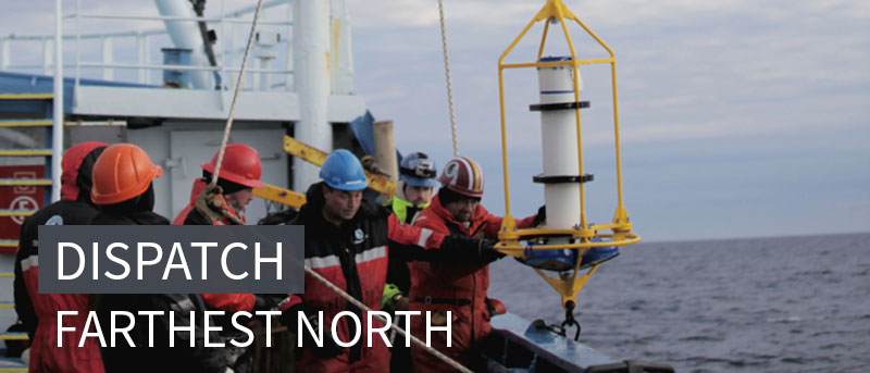
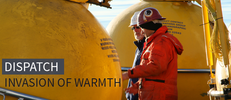
We came here, a truly international team, to measure the inflow of warm Gulf-Stream water through the Fram Strait (on that west side of Svalbard) and to begin to understand how that warmth spreads into the body of the Arctic Ocean. To do that we recovered seven of the eight moorings that have been gathering temperature, salinity, and velocity data for the last year. One mooring was lost, probably to a fisherman’s trawl net, and another returned no data, but these are fine odds in this excruciatingly hard region. This is the first-ever high resolution view of the Atlantic water boundary current using moorings, and it will provide insight into the ways warm water invades the Arctic.
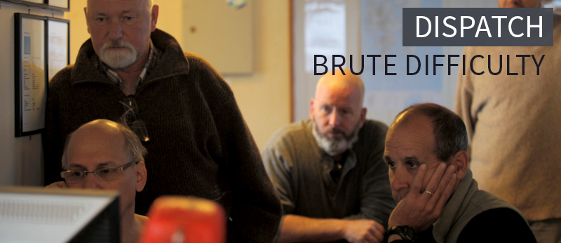
 Unlike others elsewhere, this current does not appear content to hug the edges of the basin in a well-behaved manner. No, it’s contrary, dynamic, turbulent. The CTD data have captured pulses, squirts of warm water, and that very pulsing turbulence might be one of the mechanisms that spread hot water into the basin, where it lurks in a layer some 100 meters beneath the surface—and beneath the ice. But why does the hot water pulse in the first place? We don’t know. Yet. Like most oceanographic expeditions, this one does not conclude with completely understood data or answers to all the questions. The former will take time, years, to parse, and the latter will come only with additional expeditions. That’s how it is with oceanography, because its subject is too complex, too variable, too vast; this is about as far as one can get from test-tube science.
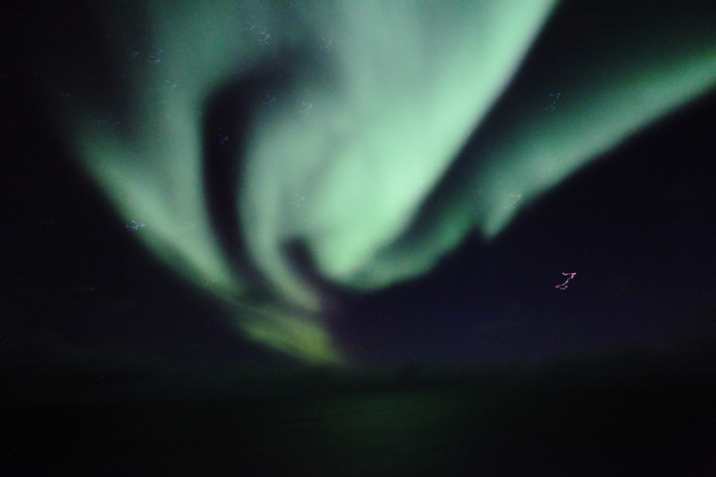
However, last night on deck, we watched the Northern Lights cranking up their majesty and chatted with Vladimir, who has more experience in these waters than others aboard Lance. He said that on this cruise he’d measured water temperature of 5.5° C, and he was shocked by that. He’d never seen the like on previous cruises. Secondly, he said that, there we were above 82°N latitude, less than 480 nautical miles from the North Pole—and we saw no sea ice. Everyone knows that the Arctic, more than anywhere else, is in peril from global warming, perhaps even from the warm water we’ve been measuring for the last three weeks, should that layer of warmth find its way up to the ice layer. But, then, as always what we’ve seen might be variability, here today, gone tomorrow. That’s the way of the ocean, another aspect of the brute difficulty of measuring it. So we won’t know, not yet, anyway, but maybe we will before it’s too late, assuming it’s not already too late. But speaking for the now, for the September 2013 cruise of R/V Lance, the science, as Bob put it has been “tremendously successful.”
" Bon voyage, Lance, fair weather to all who sail in her. "
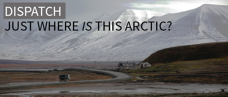
At this writing, October 1st, we’re docked, in a chill rain, at an industrial wharf in Tromsø. By any standards, taut dock lines mean the cruise is ended—except for the goodbyes. There’s that personal aspect to all these cruises. Some of us come as strangers aboard a strange ship in a northern port. We live for weeks in close quarters, see each other every day, work in cooperation and coordination. Friendships form at an accelerated pace compared to land-bound association. The ship herself becomes a kind of friend; seamen for centuries have humanized their ships in ways that the land-bound may understand intellectually, but not emotionally. Lance and her fine people have treated us with all possible kindness (not to mention their professionalism). Some, but not all of us, will meet again on other research vessels in other oceans. Some, but not all of us, will cross her gangway again, but few of us will forget her. Should I be one of those who will not walk her decks again, then I’ll take this opportunity to say goodbye and thank you to my new friends. Bon voyage, Lance, fair weather to all who sail in her.
-Dallas Murphy