Stream Coordinate Averaged Sections
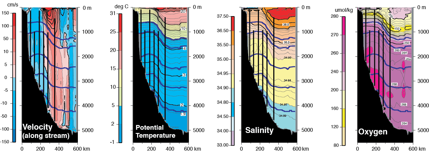
Stream-coordinate averaging the sections effectively eliminates smearing effects of lateral meandering and provides broader spatial context to the moored measurements. To construct these mean sections, individual occupations were combined using the Gulf Stream North Wall to align the synoptic data, mapping each set of stations from a cruise onto a common along-track grid, isopycnally averaging the ensemble of realizations at each grid site, then remapping the averages into depth space. The mean position of the North Wall in the full suite of occupations was found to be 240 km from the shelf break. On each panel are shown the positions of the moorings and the 5 neutral density surfaces used to define water mass layers of the DWBC. On average, the Gulf Stream at Line W extends over the full water column with a characteristic tilt of the zero velocity contour in the offshore direction with increasing depth. The core speed approaches 2 m s at the surface and decays to less than 0.5 m s below 500m. The DWBC lies shoreward of the Stream over the continental slope. Typical mean DWBC speeds are ~ 5 cm s , with comparatively little variation in depth.