|
|
 |
 |
Science
Crew Facts

Tom
Weingartner has lived in Fairbanks, Alaska for nearly 20
years. He owns six sled dogs and he and his family take the
dogs mushing in winter. |
Daily Update
Calendar
Dispatch 05 - September 5, 2004
By C. A. Linder
Weather conditions: Partly cloudy skies, 15 kt winds, calm
seas, air temperature 48° F
Through the Strait
In the darkness of early morning, we passed through Bering Strait
and entered the Arctic Ocean. This narrow (only 53 miles separates
the United States and Russia) passageway is the only connection between
the Pacific and Arctic Oceans. Tom Weingartner, a professor at the
University of Alaska, Fairbanks, has been studying the passage of
waters through Bering Strait for over 14 years.
 |
|
 |
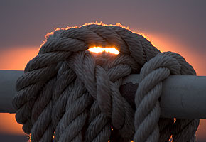
| The peach hues of sunrise light up some lines tied to a rail. |
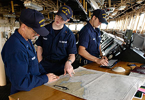
From left, Warrant Offier Jim Robson, Ensign Jason Plumley, and Seaman Jonathan Bilby keep a close eye on our course. |
| Click to enlarge | |
Click to enlarge
|
Tom agreed to answer some questions for me about this very important body of water.
It's difficult for me to picture how much water flows through this Strait, can you put it in perspective?
"On average the transport here is about 800,000 cubic meters per second northward through this narrow (85 km) and shallow (50 m) strait. This seems like a huge amount of water, and it is, when compared to major rivers such as the Mississippi (18,000 cubic meters per second) or the Yukon (passed earlier yesterday) with an average transport of about 6,000 cubic meters per second. On the other hand, the flow through Bering Strait is merely a trickle compared to the 20 - 100 million cubic meters per second carried by major ocean currents. Thus oceanographers consider the volume of water flowing through Bering Strait to be small, while landlubbers would argue that it is tremendous. Regardless of your perspective, the flow through Bering Strait affects us all, because it has a tremendous influence on the Arctic Ocean and probably on global climate."
Could you elaborate on that? How does this little gap between the continents affect us?
"The waters flowing through Bering Strait are enriched in the nutrients (nitrogen, phosphorous, and silicon) required by phytoplankton. These nutrients come from the deep Bering Sea and fuel the tremendous biological production of the northern Bering and southern Chukchi seas. Indeed this ecosystem is amongst the most productive marine ecosystem on Earth. Some of these nutrients and plankton are carried northward across the Chukchi Sea and into the Arctic Ocean, where they feed the phytoplankton, invertebrates, and arctic cod that in turn feed whales, seals, walrus, and polar bears. In turn these mammals are an important food source for the many Siberian and Alaskan Eskimo coastal communities along the Chukchi Sea. One might speculate that these communities would not exist if Bering Strait had never been established. The strait is also a migratory pathway for a remarkably rich and diverse annual movement of plankton, marine mammals and birds over distances that bridge polar, temperate, and, for some species, tropical waters. And sadly, the strait delivers to the Arctic Ocean pollutants deposited elsewhere into the North Pacific that are eventually carried into the Bering Sea."
 |
|
 |
| Anna Nikolopoulos
works on her research in her stateroom. |
Erik Quiroz seldom gets a day off. He and Dan Schuller prepared chemical reagents in the nutrient lab today. |
| Click to enlarge | |
Click to enlarge
|
You mentioned the global climate. The Strait affects the climate too?
"Definitely. Let me start from the beginning, though--hang with me on this one. The waters flowing through Bering Strait are relatively fresh compared to Arctic and Atlantic Ocean waters. Within the Arctic Ocean, Bering Strait waters form a cold, fresh layer between the surface and 150 meters. That layer is important because it effectively insulates the sea ice cover from warmer (and saltier) waters found at greater depths.
Eventually the waters from Bering Strait flow across the Arctic Ocean and into the northern North Atlantic Ocean and, by so doing, play a vital role in the global hydrologic cycle. The reason for this is that evaporation exceeds precipitation in the Atlantic Ocean, while precipitation exceeds evaporation in the North Pacific Ocean. Thus Bering Strait drains some of the excess precipitation received by the North Pacific into the Atlantic Ocean. This offsets some of the freshwater lost to evaporation in this basin. Changes in the amount of freshwater transported from the Arctic Ocean to the North Atlantic Ocean are believed to play a major role in global climate change. Thus changes in the amount of freshwater carried through Bering Strait are likely important to global climate."
Many thanks to Tom for those answers.
Since there were no scientific tasks scheduled for today, it was a
relaxing day. The science crew spent the day reading,
watching for wildlife, typing emails to family and friends, or catching
up on other research projects... and we'll need that rest, because
around-the-clock science is starting up tomorrow evening!

|
Traducido al Espańol por David |
Atravesando el Estrecho
En la oscuridad de la temprena mańana, pasamos atraves del estrecho de Bering y entramos en el Oceano Artico. Este angosto pasaje(solo 85 kilometros separa Estados Unidos de Rusia) es la unica conexion entre los oceanos Pacifico y Artico. Tom Weingartner, un profesor de la Universidad de Alaska, Fairbanks, ha estado estudiando este paso de agua a traves del estrecho de Bering durante bastantes ańos.
Tom accedio a responderme algunas preguntas sobre la importancia de este cuerpo de agua.
¿Es dificil para mi imaginar la cantidad de agua que pasa a
traves del estrecho--podrias darme una perspectiva?
“ La media del transporte esta cerca de los 800.000 metros cubicos por segundo que cruzan este estrecho ( 85 km ) y somero ( 50 m ) paso. Esto parece una gran cantidad de agua, y si lo comparamos con los mayores rios, como el Mississippi ( 18.000 metros cubicos por segundo) o el Yukon (ayer lo pasamos por la mańana) con una media de transorte de cerca de 6000 metros cubicos por segundo. Por otro lado, el flujo que pasa por el estrecho de Bering es ridiculo comparado con los 20-100 millones de metros cubicos por segundo llevados por las mayores corrientes oceanicas. Por ello, los oceanografos consideramos que el volumen de agua que fluye por el estrecho de Bering es pequeńo, mientras que los que estudian la tierra podrian argumentar que es tremendo. A pesar de su perspectiva, el flujo que atraviesa el estrecho de Bering nos afecta a todos, por que esto tiene una gran influencia en el oceano Artico y probablemente en el clima global”
¿Podrias especificar mas? ¿Como este pequeńo
agujero entre los continentes nos puede afectar?
“ Las aguas que pasan por el estrecho de Bering estan enriquecidas en nutrientes ( nitrogeno, fosforo y silice) requeridos por el fitoplancton. Estos nutrientes proceden de la profundidad del mar de Bering y son el combustiblede la tremenda produccion biologica al norte del mar de Bering y al sur del mar de Chukchi. Por lo tanto este ecosistema es uno de los mas productivos eosistemas marinos en la Tierra. Algunos de estos nutrientes y plancton son arrastrados al norte por la corriente al mar de Chuckchi y dentro del oceano Artico, donde nutren al fitoplancton, invertebrados, y merluza artica, que a su vez nutre a ballenas, focas, morsas y osos polares. Siguiendo la cadena alimenticia estos mamiferos son una fuente importante de comida para muchos siberianos y esquimales de Alaska que viven en comuidades a lo largo del mar de Chukchi. Uno podria especular que estas comunidades no podrian haberse establecido en este lugar si no se dan estas condiciones. El estrecho es una ruta migratoria para una cantidad importante y diversa anual de plancton, mamifros marinos y pajaros que atraviesan grandes cambios polares, de temperatura, y algunas especies llegan hasta a aguas tropicales. Y por desgracia, el estrecho deriva los contaminantes que son depositados en cualquier parte del oceano Pacifico, y de vez en cuando aparecen en el mar de Bering, que los transporta al oceano Artico.”
Tu mencionaste antes el clima global. ¿El estrecho afecta al
clima tambien?
“ Por supuesto. Dejame que empiece por el principio . Las aguas que pasan por el estrecho de Bering son relativamente dulces comparadas con las aguas de los oceanos Artico y Atlantico. Dentro del oceano Artico, las aguas del estrecho de Bering forman una capa de agua dulce y fria entre la superficie y 150 metros. Esta capa es importante dada su efectividad para aislar la capa de hielo de otra capa mas caliente y salada que se enuentra a mayor profundidad .Finalmente las aguas del mar de Bering, fluyen a traves del oceano artico y entran al norte del oceano Atlantico, y de esta manera, juegan un importante papel en el ciclo hidrologico global. Esto se debe a que el exceso de evaporacion precipita en el oceano Atlantico, mientras que el exceso de precipitacion provoca una evaporacion el el oceano Pacifico Norte. Por ello el estrecho de Bering drena parte del exceso de precipitacion recibida del Pacicifico Norte al Oceano Atlantico.Esto compensa parte del agua dulce perdida por la evaporacion en esta cuenca. Cambios en la cantidad de agua dulce transportada desde el oceano Artico al Atlantico norte, juegan un importante papel en el cambio climatico global. De este modo, cambios en la cantidad de agua dulce llevados a traves del estrecho de Bering son bastante importantes en el cambio climatico global.
Muchas gracias a Tom por estas respuestas.
Ya que no hubo ningun trabajo cientifico hoy, fue un dia relajado. El grupo cientifico estuvo todo el dia leyendo, mirando vida salvaje, escribiendo emails a familia y a amigos o preguntando sobre otros proyectos… y necesitaremos este descanso, ya que empezaremos el duro trabajo mańana.
 Previous
Dispatch
Next Dispatch Previous
Dispatch
Next Dispatch

Back to Calendar
|
|