Ice Tethered Profiler 99 Data Data from ITP99 deployed in October 2016
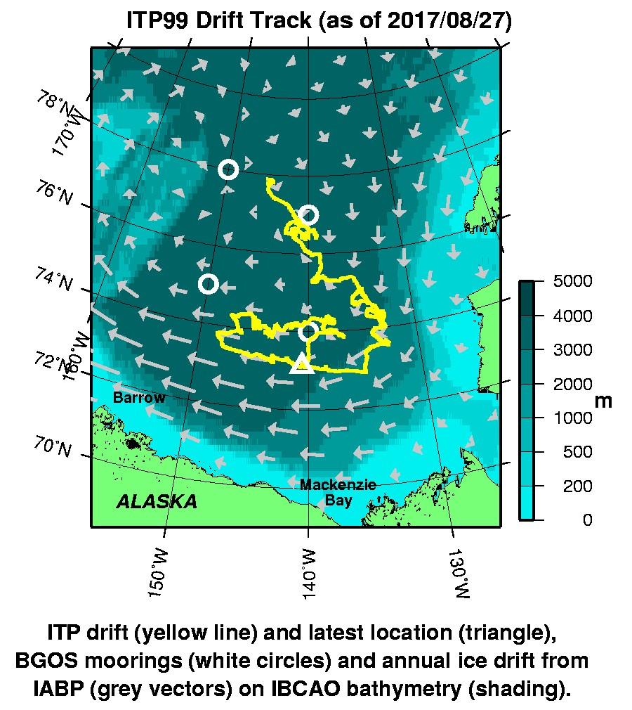
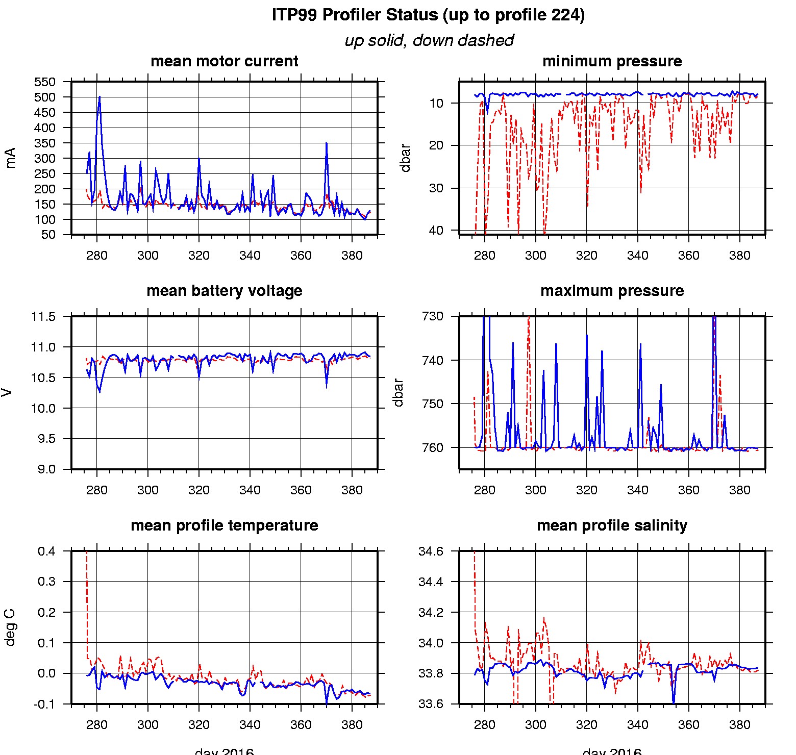
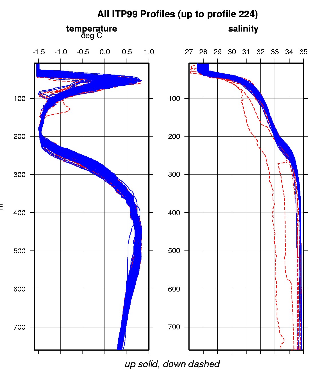
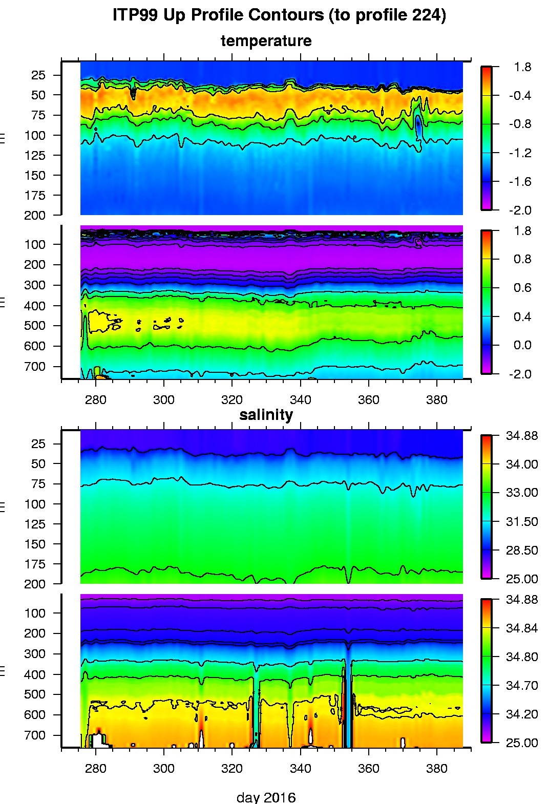
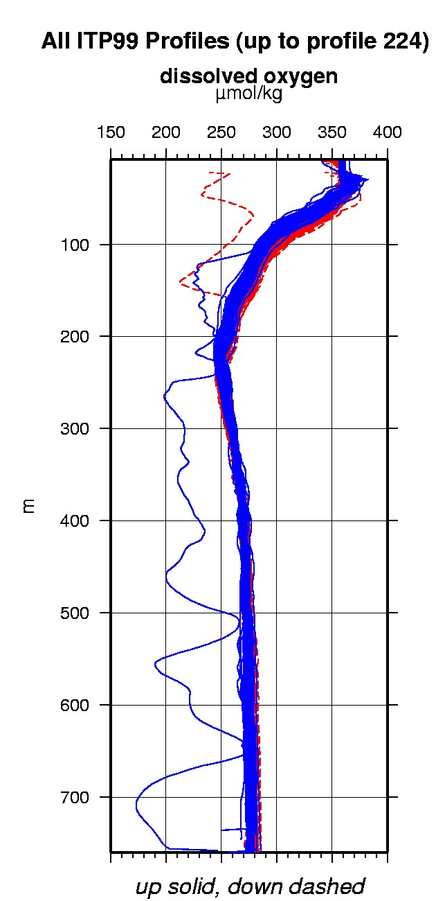
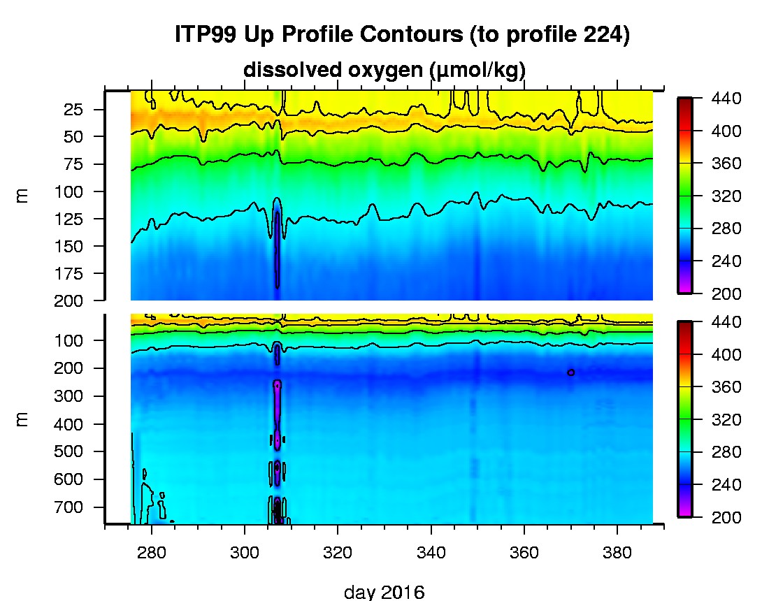
Last buoy status on 2017/8/27 63346 UTC : temperature = 0.875 °C, battery = 11.022 V Last position on 2017/8/27 63346 UTC : 73.1121° N, 140.5998° W Last profile (number 224) on 2017/1/21 602 UTC Last profile mean motor current = 122.5037 mA, mean battery = 10.8149 V Last profile depth: minimum = 8.4783, maximum = 760.5467 m Last profile temperature: minimum = -1.5455, maximum = 0.70013 °C Last profile salinity: minimum = 28.2478, maximum = 34.8572 Last profile dissolved oxygen: minimum = 244.7108, maximum = 360.1362 μmol/kg No SAMI data yet The raw GPS buoy location data are available in an ASCII file: itp99rawlocs.dat Depth averaged profiler data files (with interpolated location) are available in two formats: ITP99 was deployed in open water in the Beaufort Sea on October 1, 2016 at 77° 53.0 N, 145° 7.9 W as part of the Beaufort Gyre Observing System (BGOS) during the JOIS 2016 cruise on the CCGS Louis S. St. Laurent. The ITP includes a dissolved oxygen sensor and is operating on a standard sampling schedule of 2 one-way profiles between 7 and 760 m depth each day and includes a fixed SAMI PCO2 and SBE-37 microcat at 6 m depth.
|