Ice Tethered Profiler 98 Data Data from ITP98 deployed in September 2016
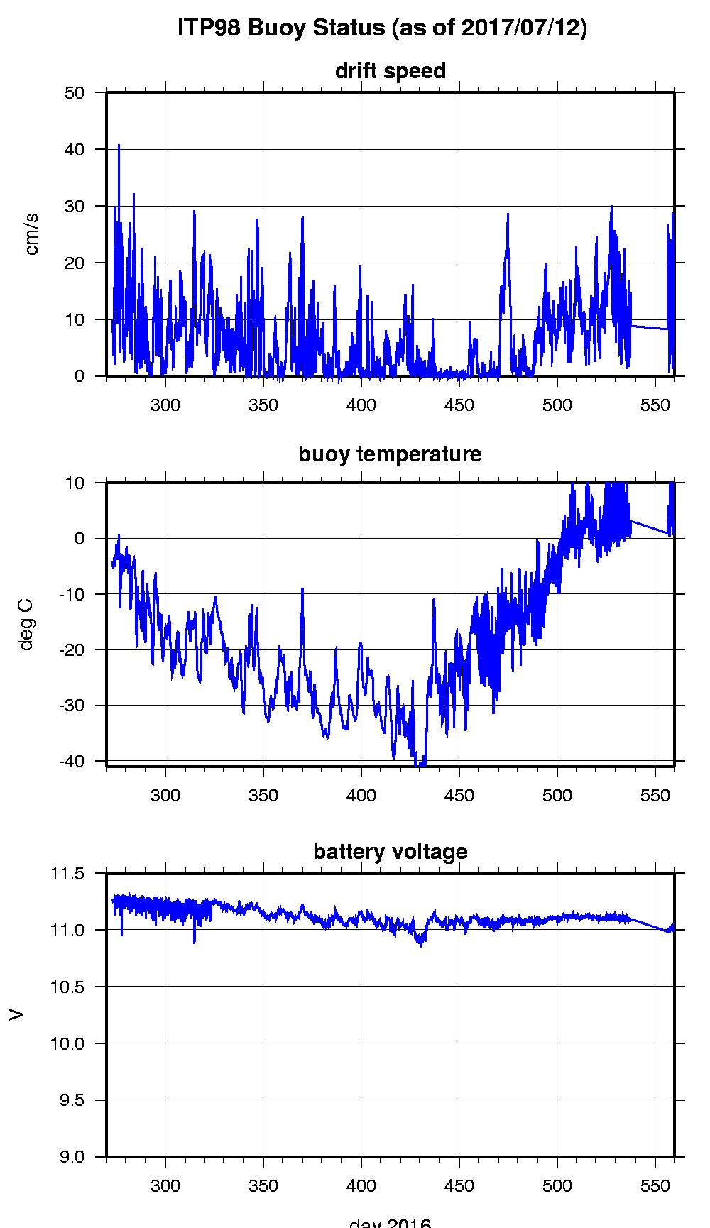
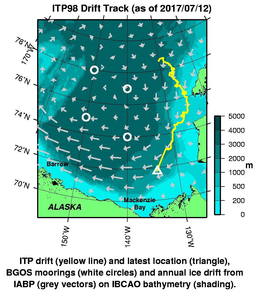
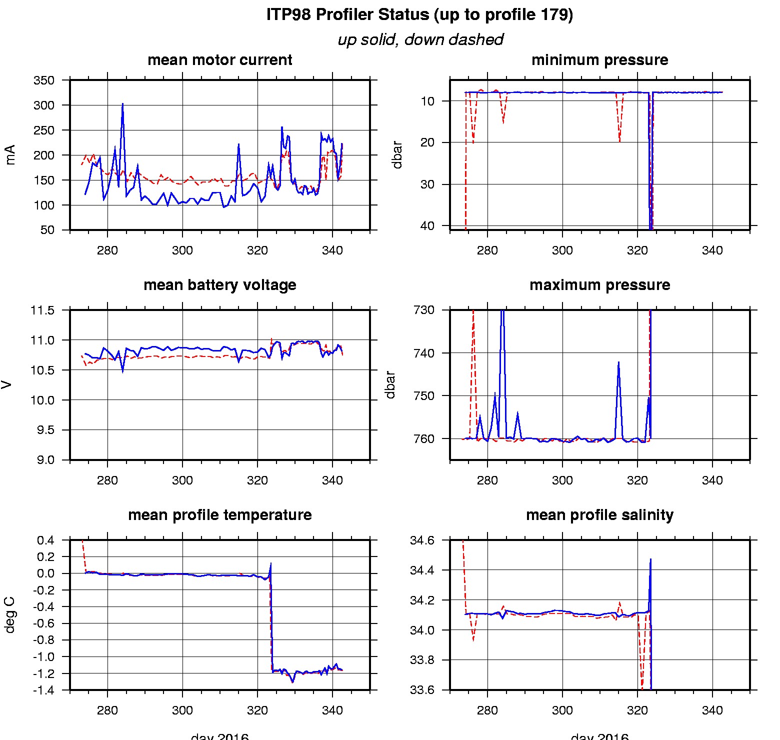
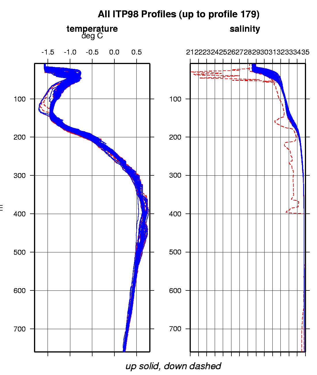
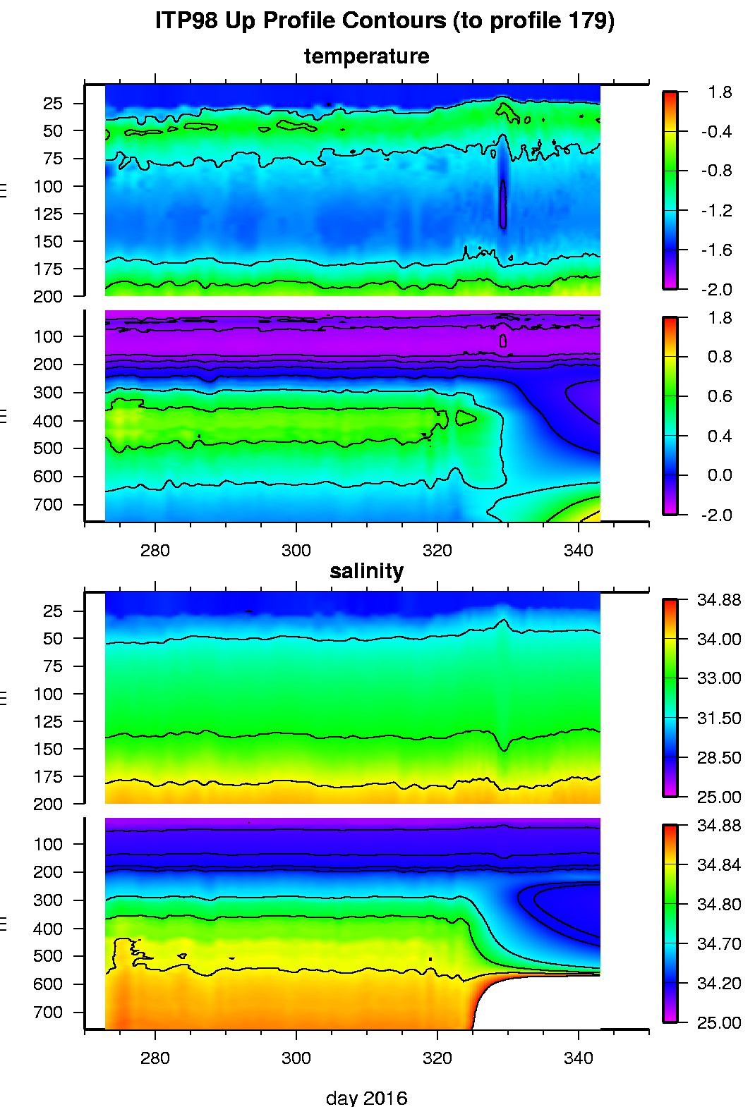
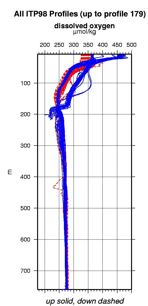
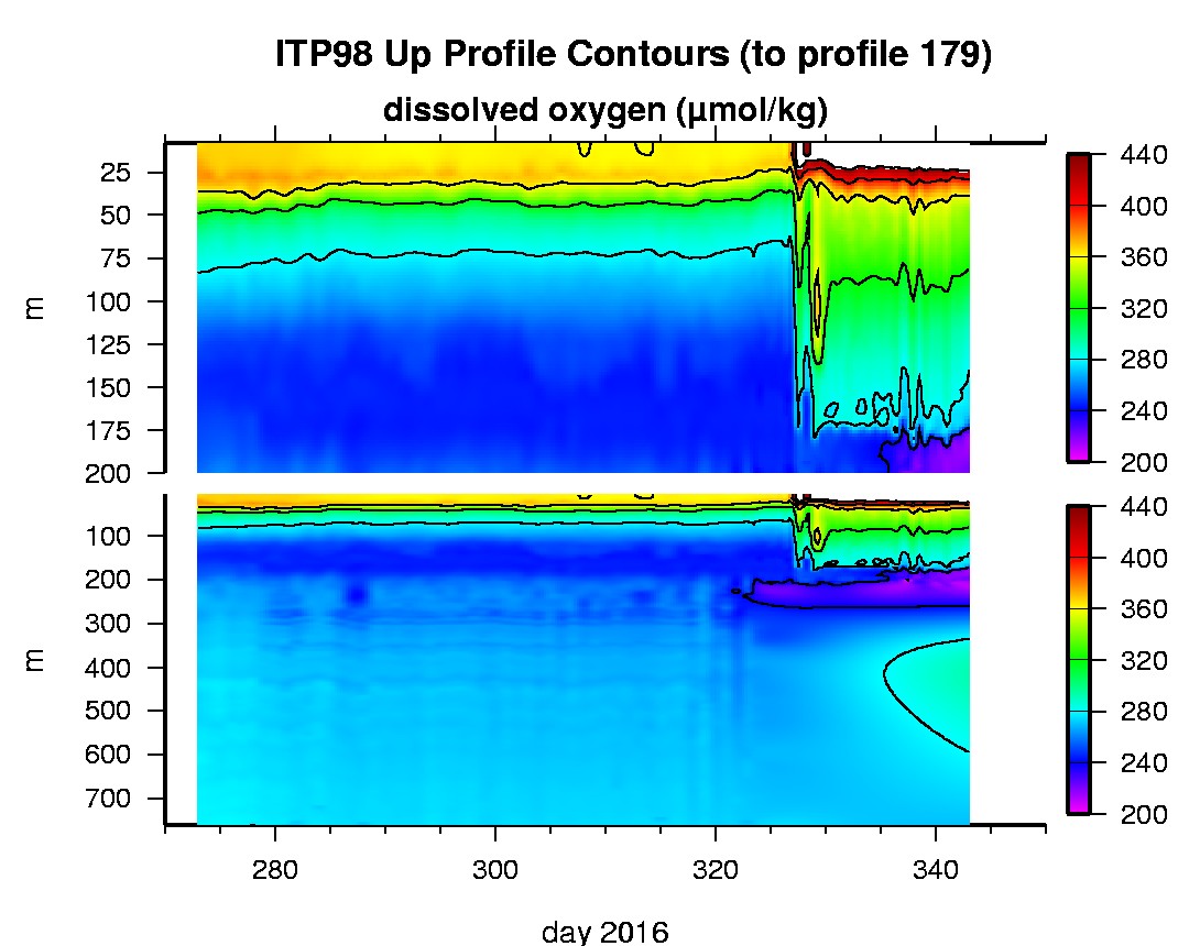
Last buoy status on 2017/7/12 140117 UTC : temperature = 3.375 °C, battery = 10.994 V Last position on 2017/7/12 140117 UTC : 71.7832° N, 134.0873° W Last profile (number 179) on 2016/12/7 1802 UTC Last profile mean motor current = 227.2872 mA, mean battery = 10.7466 V Last profile depth: minimum = 7.8689, maximum = 205.6472 m Last profile temperature: minimum = -1.5862, maximum = -0.33257 °C Last profile salinity: minimum = 28.9819, maximum = 34.354 Last profile dissolved oxygen: minimum = 231.9159, maximum = 325.6534 μmol/kg The raw GPS buoy location data are available in an ASCII file: itp98rawlocs.dat Depth averaged profiler data files (with interpolated location) are available in two formats: ITP98 was deployed on a 0.7 m thick ice floe in the Beaufort Sea on September 29, 2016 at 78° 34.2 N, 130° 3.6 W as part of the Beaufort Gyre Observing System (BGOS) during the JOIS 2016 cruise on the CCGS Louis S. St. Laurent. On the same icefloe, a Naval Postgraduate School Arctic Ocean Flux Buoy (AOFB 34) and a US Army Cold Regions Research and Engineering Laboratory (CRREL) Seasonal Ice Mass Balance Buoy 2 were also installed. The ITP includes a dissolved oxygen sensor and is operating on a standard sampling schedule of 2 one-way profiles between 7 and 760 m depth each day.
|