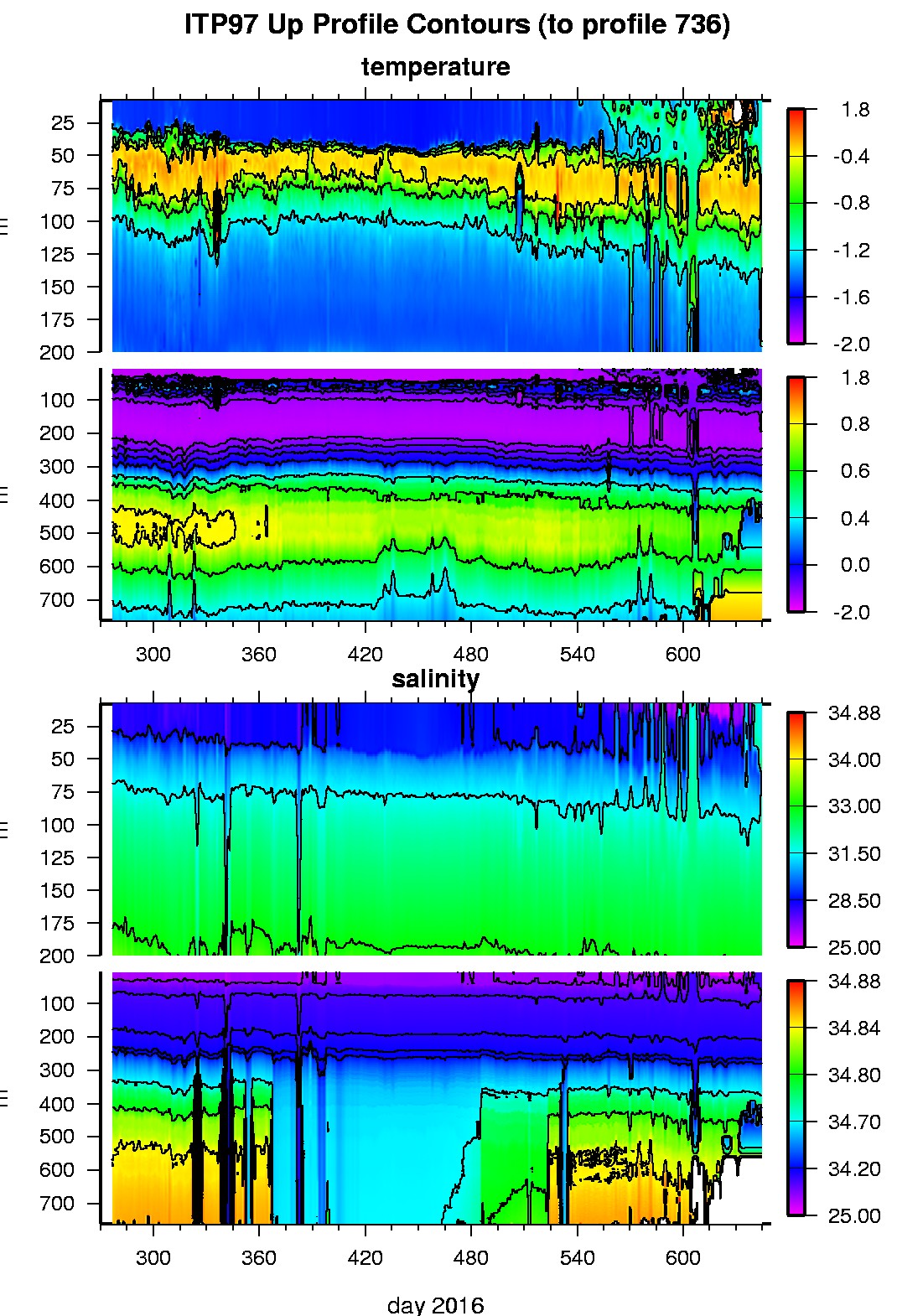
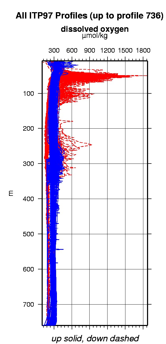
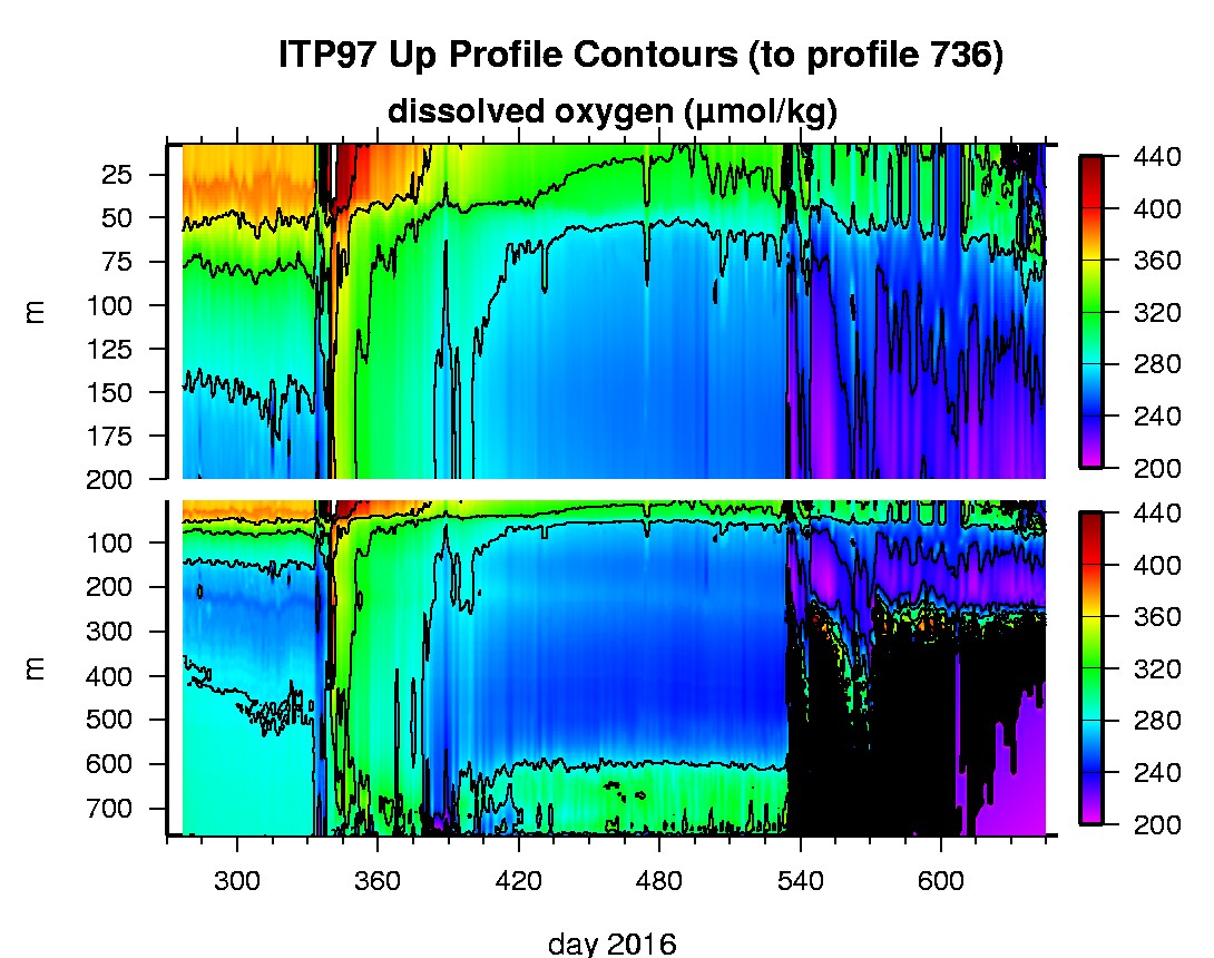
Ice Tethered Profiler 97 Data Data from ITP97 deployed in October 2016
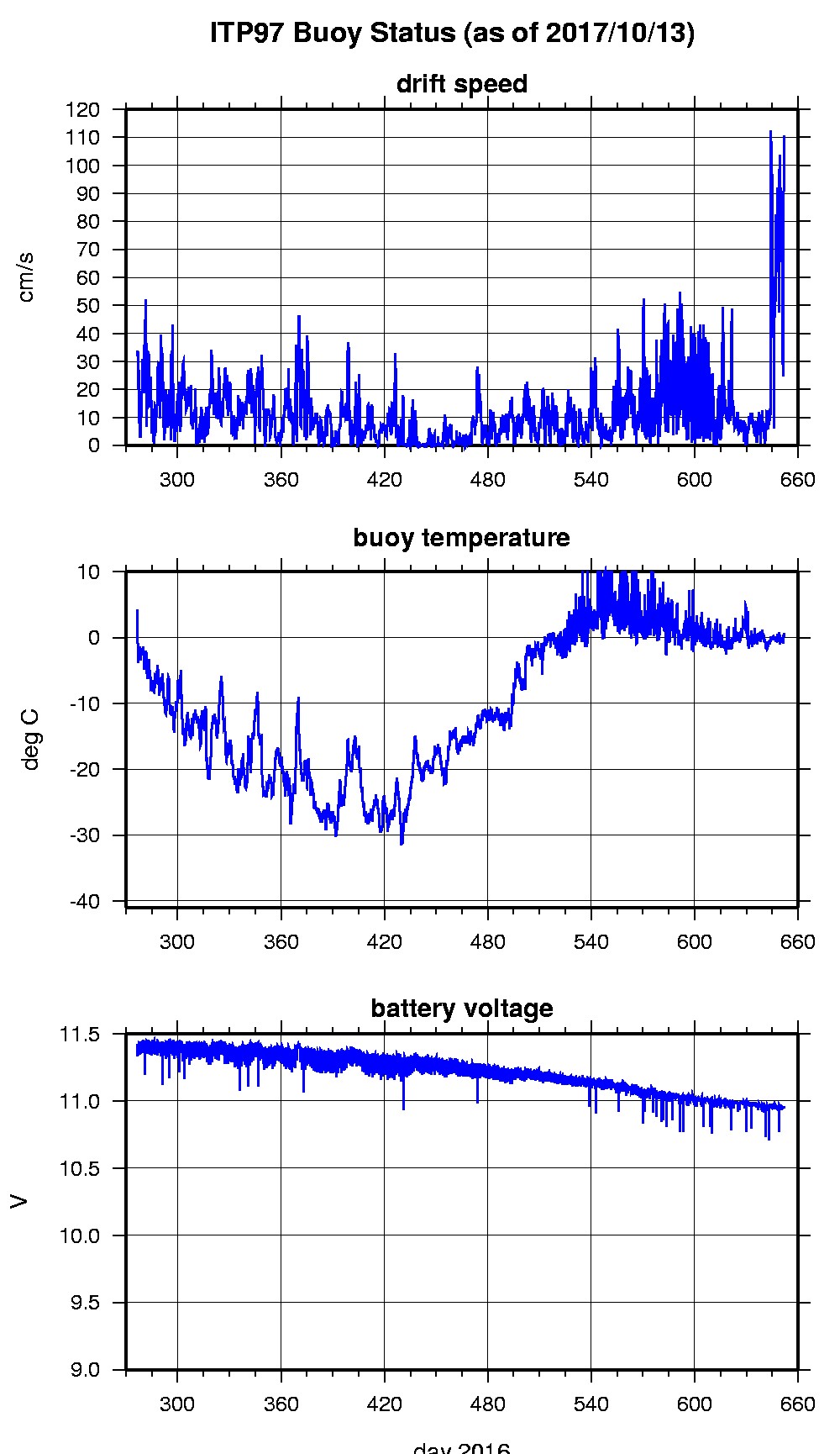
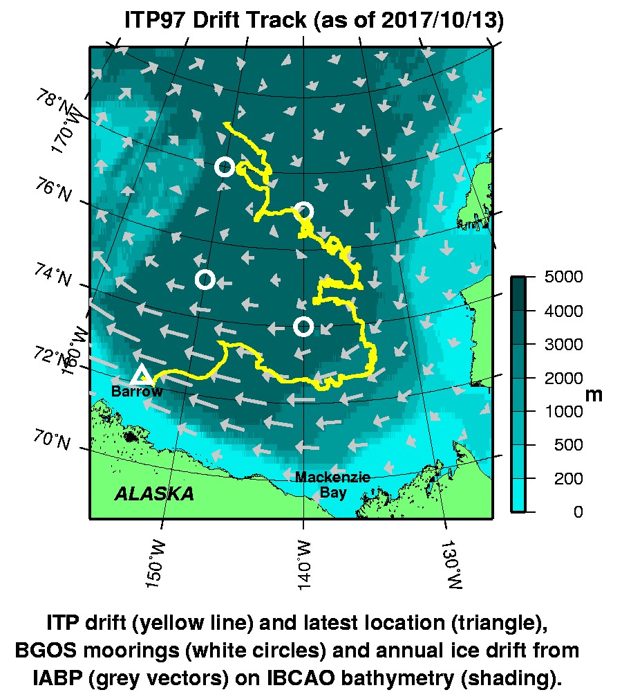
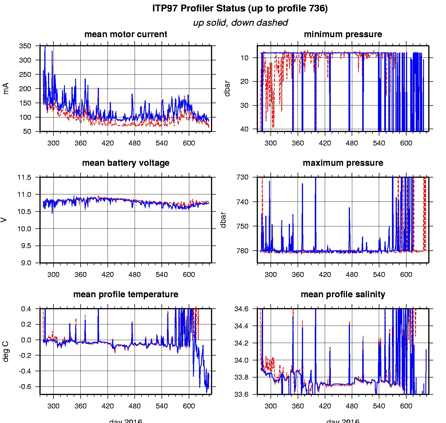
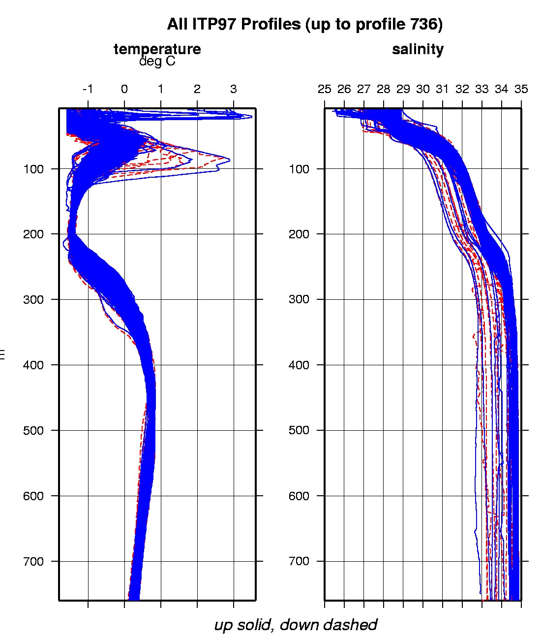
Last buoy status on 2017/10/13 15 UTC : temperature = 0.0625 °C, battery = 10.956 V Last position on 2017/10/13 15 UTC : 72.1731° N, 153.8445° W Last profile (number 736) on 2017/10/5 602 UTC Last profile mean motor current = 63.5146 mA, mean battery = 10.7953 V Last profile depth: minimum = 362.5408, maximum = 571.9158 m Last profile temperature: minimum = 0.33606, maximum = 0.69721 °C Last profile salinity: minimum = 34.677, maximum = 34.8369 Last profile dissolved oxygen: minimum = 174.0167, maximum = 188.3157 μmol/kg The raw GPS buoy location data are available in an ASCII file: itp97rawlocs.dat Depth averaged profiler data files (with interpolated location) are available in two formats: ITP97 was deployed in open water in the Beaufort Sea on October 2, 2016 at 79° 0.9 N, 150° 7.9 W as part of the Beaufort Gyre Observing System (BGOS) during the JOIS 2016 cruise on the CCGS Louis S. St. Laurent. The ITP includes a dissolved oxygen sensor and is operating on a standard sampling schedule of 2 one-way profiles between 7 and 760 m depth each day.
|