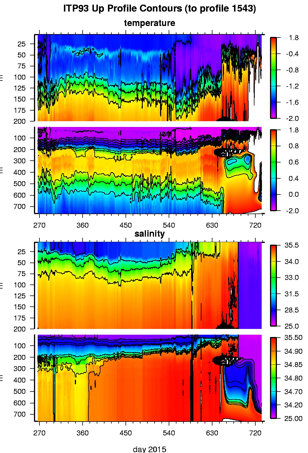
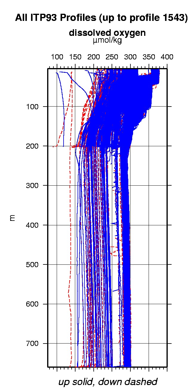
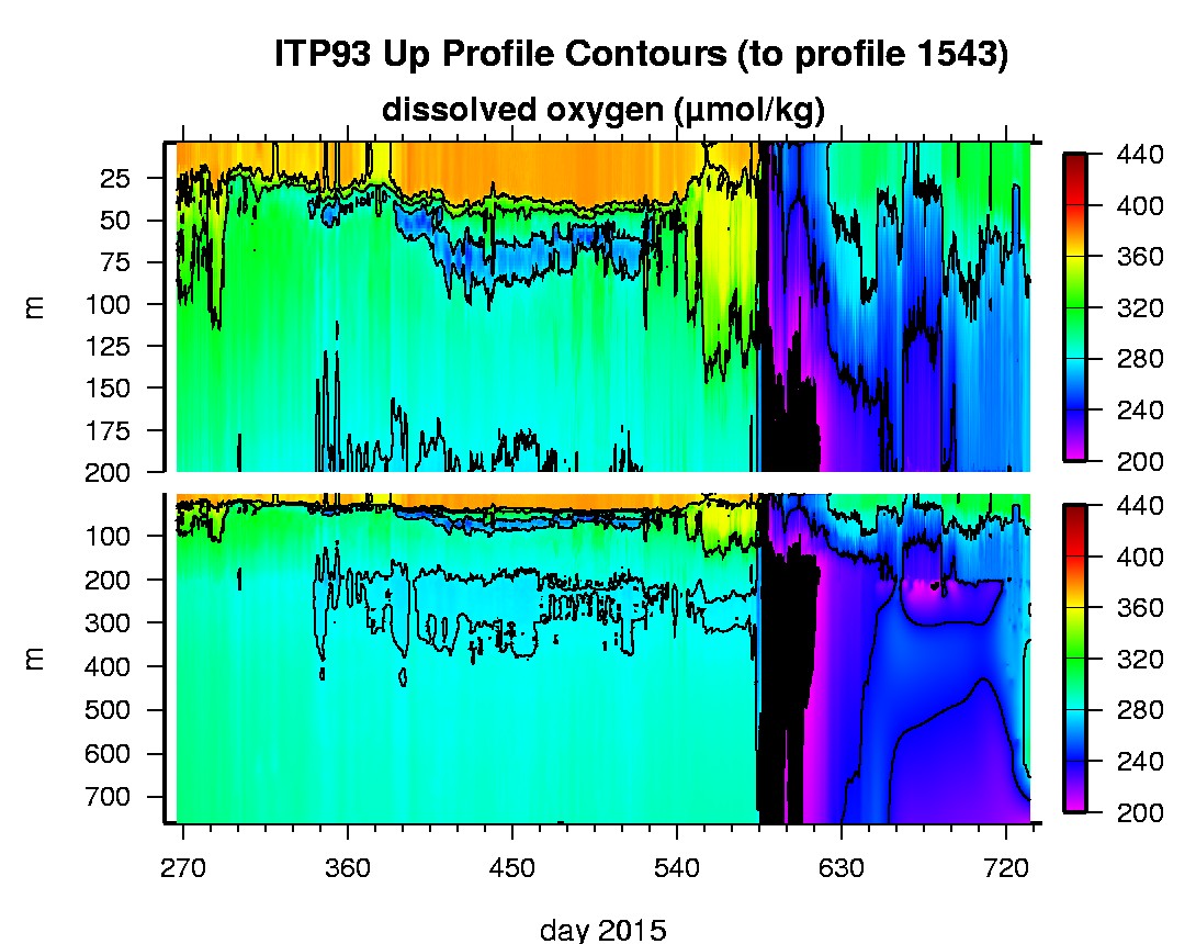
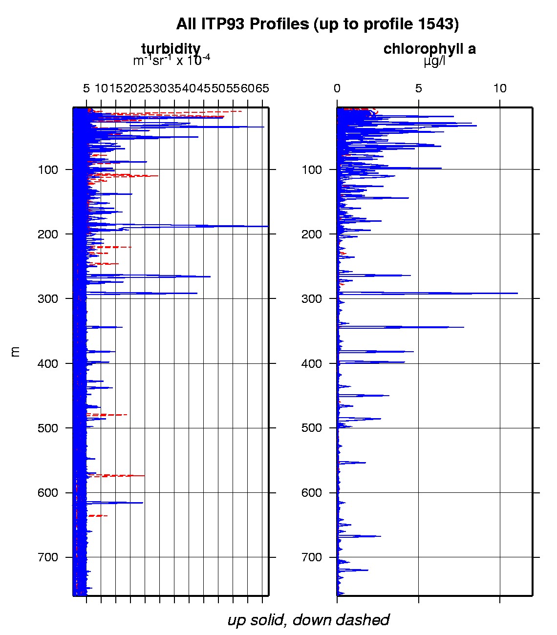
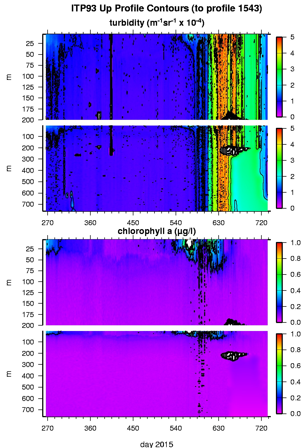
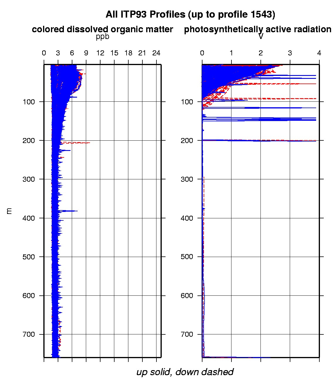
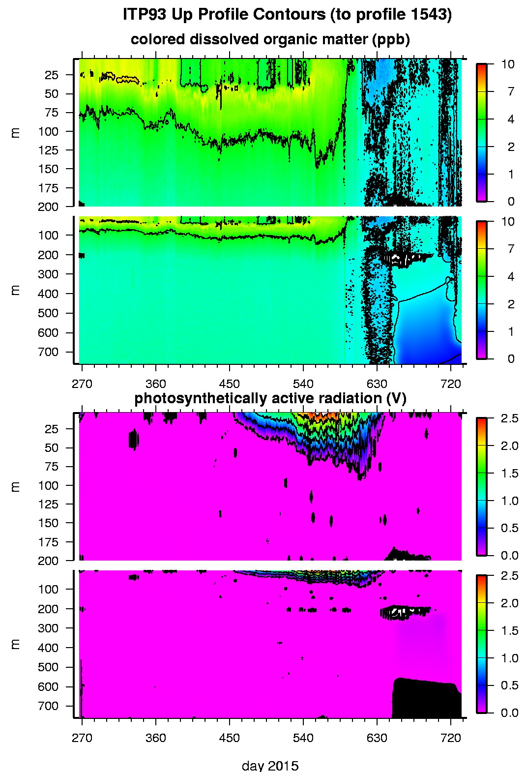
Ice Tethered Profiler 93 Data Data from ITP93 deployed in September 2015
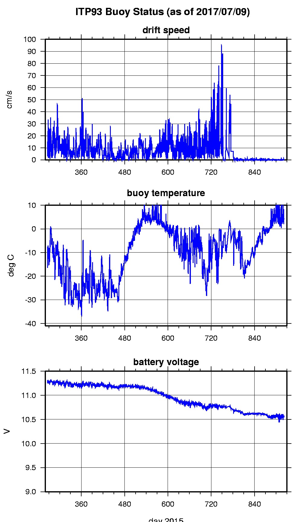
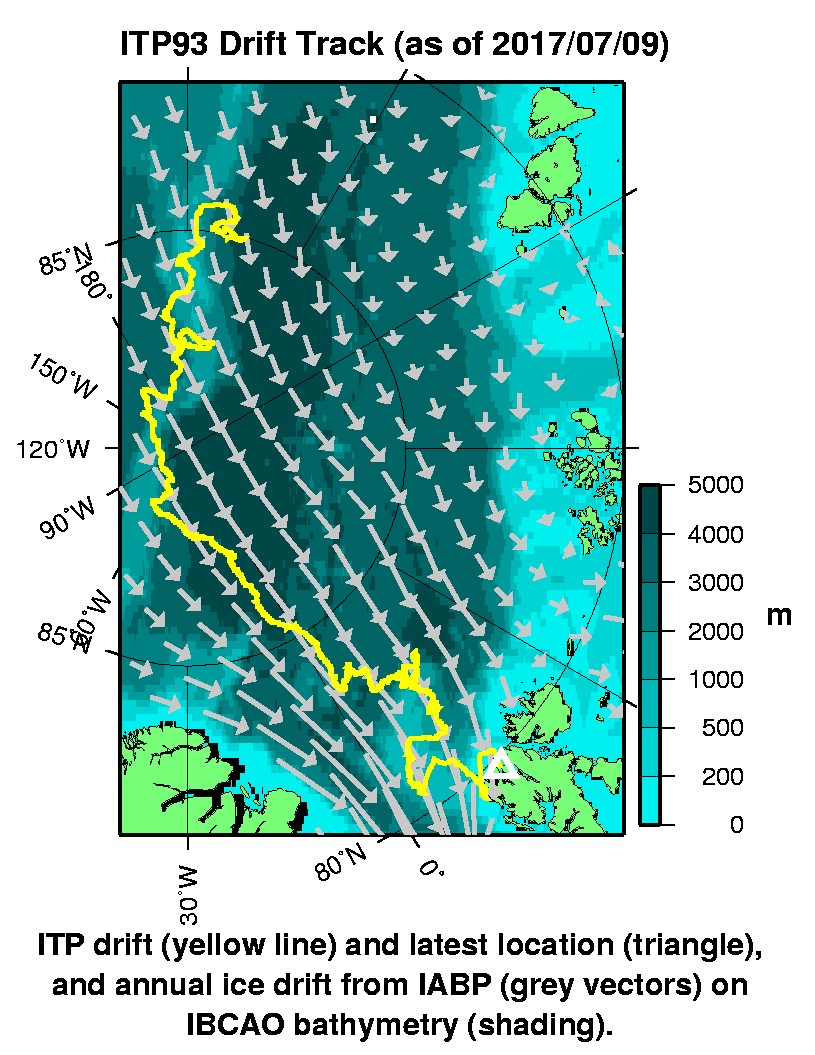
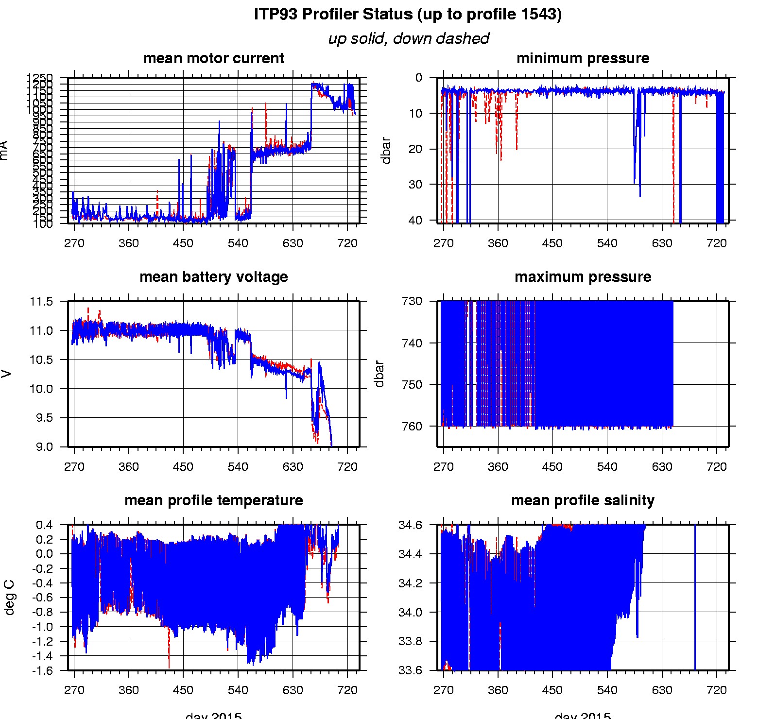
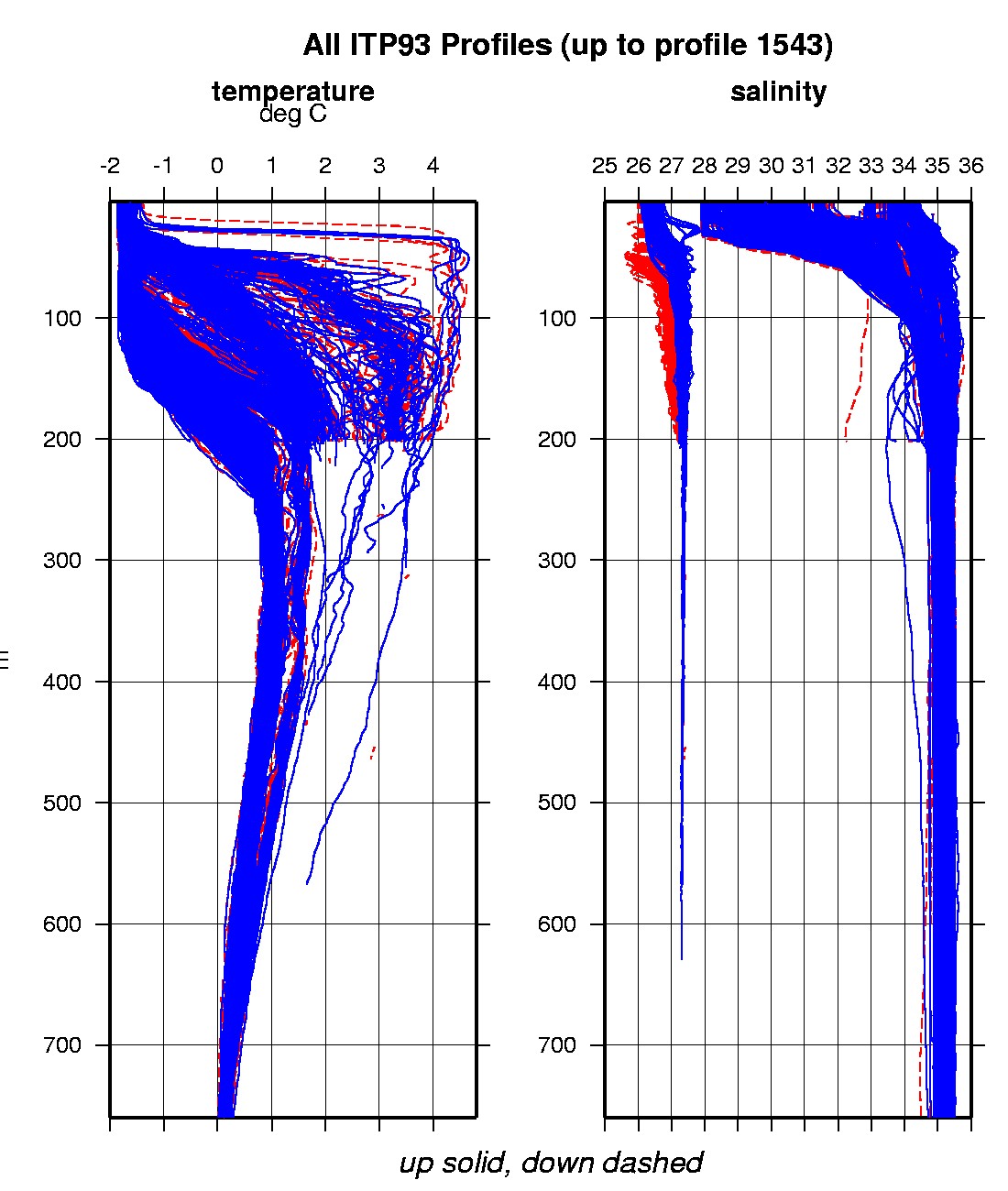
Last buoy status on 2017/7/9 230200 UTC : temperature = 4.01 °C, battery = 10.55 V Last position on 2017/7/9 230200 UTC : 79.7633° N, 14.406° E Last profile (number 1543) on 2017/1/2 2 UTC Last profile mean motor current = 956.7594 mA, mean battery = 7.6963 V Last profile depth: minimum = 3.8791, maximum = 201.0957 m Last profile temperature: minimum = -1.816, maximum = 3.7601 °C Last profile salinity: minimum = 26.18, maximum = 27.3342 Last profile dissolved oxygen: minimum = 264.4657, maximum = 318.0876 μmol/kg The raw GPS buoy location data are available in an ASCII file: itp93rawlocs.dat Depth averaged profiler data files (with interpolated location) are available in two formats: ITP93 was deployed on a 2.0 m thick icefloe in the Transpolar Drift on September 22, 2015 at 85° 5.0 N, 139° 57.6 E during the PS94 cruise (TransArc II) on the R/V Polarstern as a contribution to Frontiers in Arctic Marine Monitoring (FRAM). On the same icefloe, a SAMS Ice Mass Balance Buoy (IMB), a Metocean Polar Area Weather Station (PAWS), a Metocean Snow Height Ice Beacon and AWI Radiation Station were deployed. The ITP includes a dissolved oxygen sensor and bio-optical sensors and is operating on a pattern profiling sampling schedule including one full one-way profile between 7 and 760 m depth every 1.5 days.
|