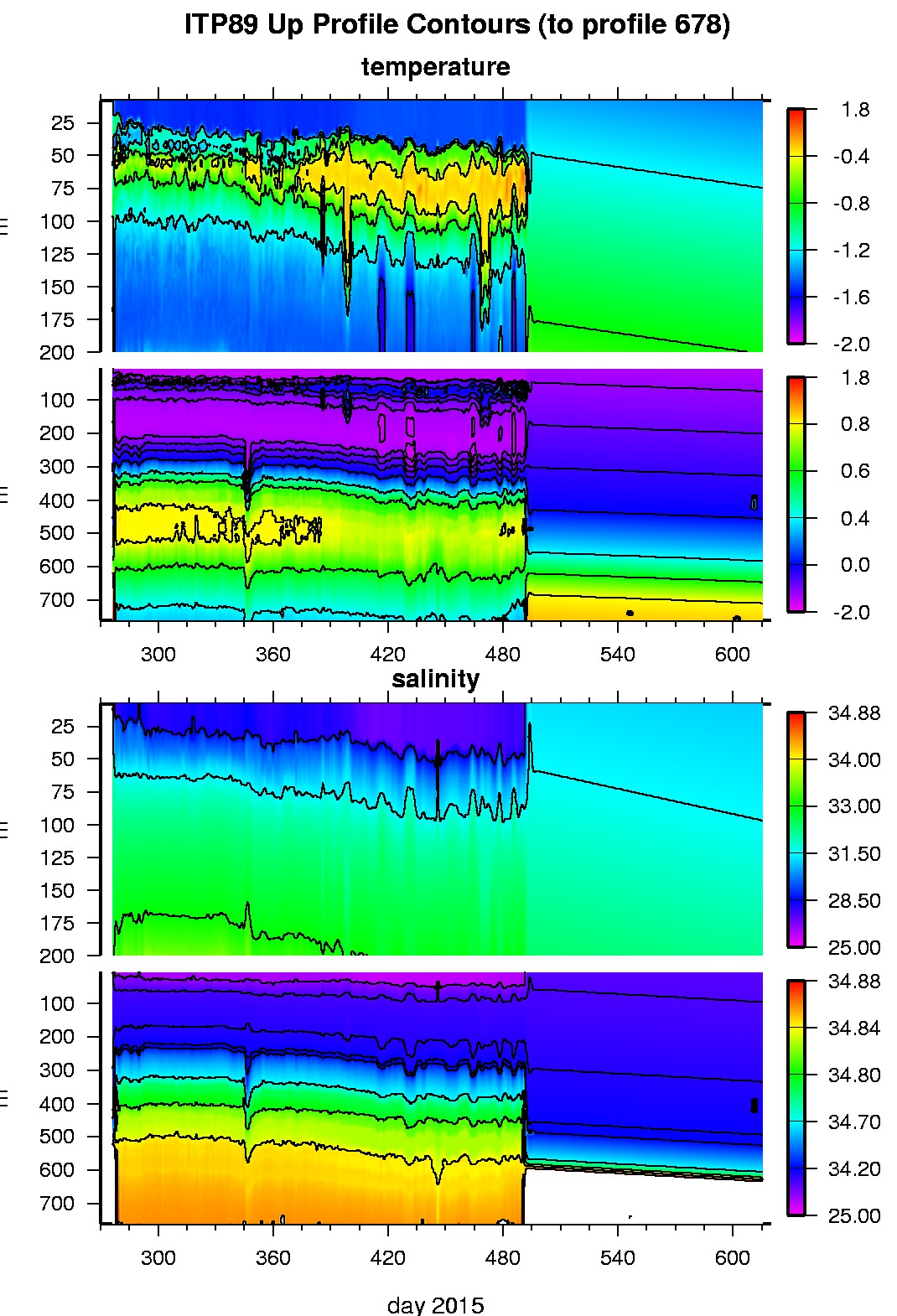
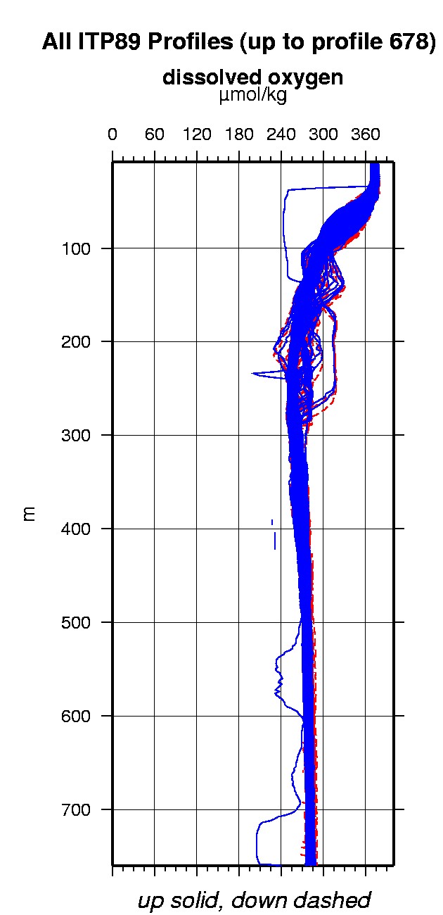
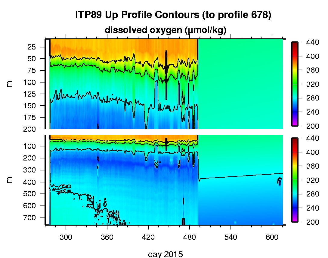
Ice Tethered Profiler 89 Data Data from ITP89 deployed in September 2015
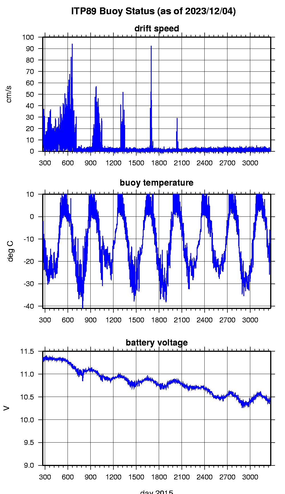
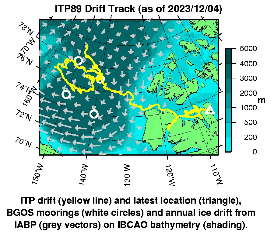
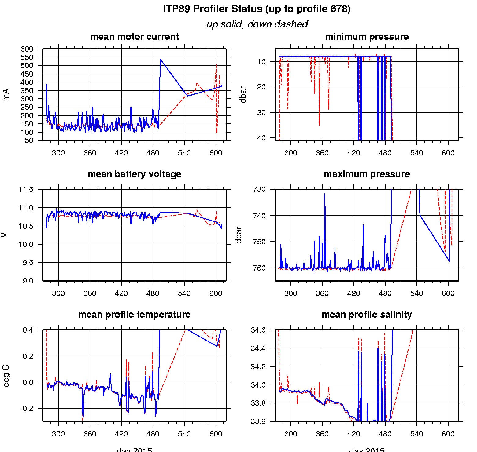
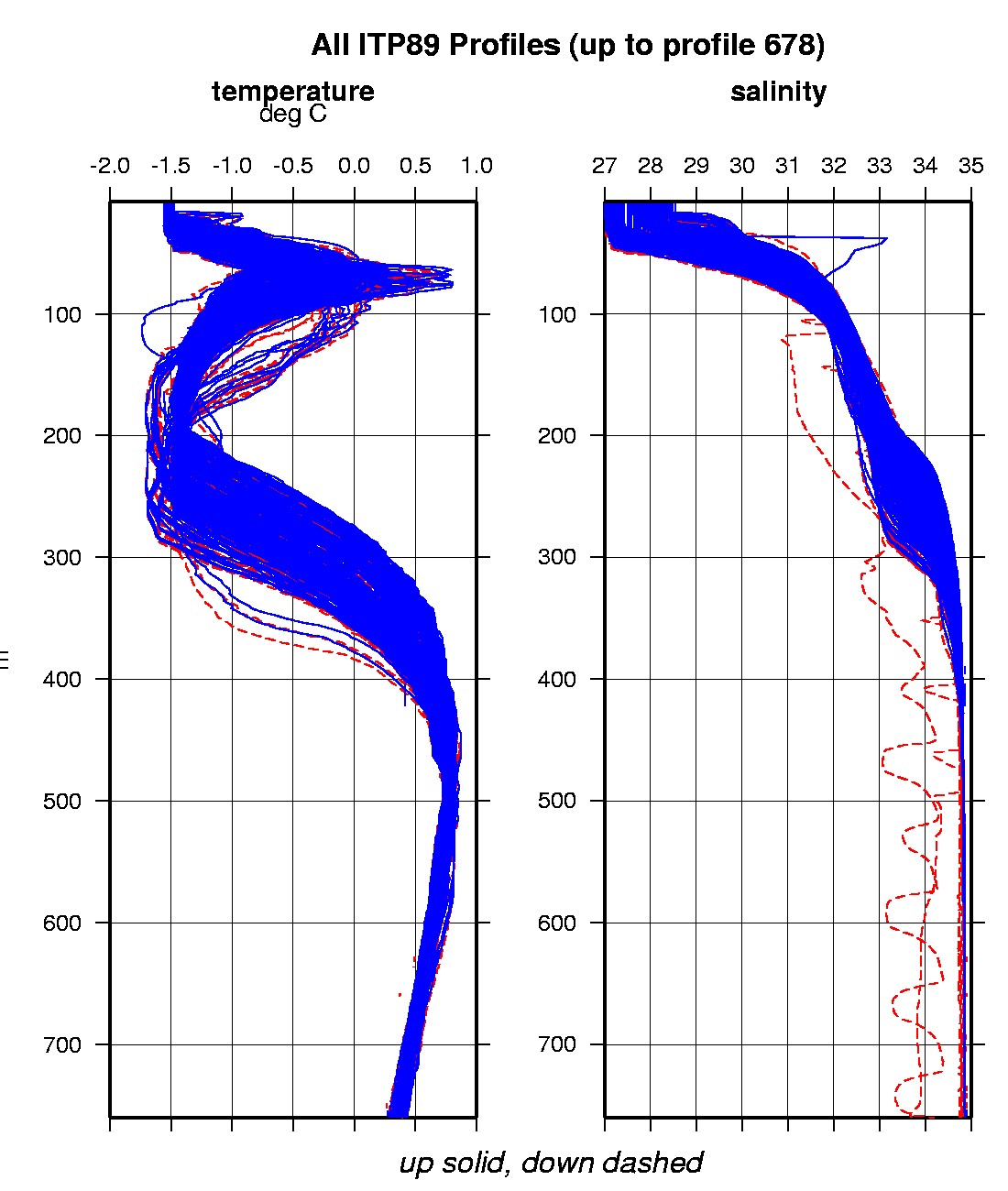
Last buoy status on 2023/12/4 29 UTC : temperature = -11.875 °C, battery = 10.437 V Last position on 2023/12/4 14 UTC : 73.0115° N, 105.6337° W Last profile (number 678) on 2016/9/6 602 UTC Last profile mean motor current = 263.8918 mA, mean battery = 10.4921 V Last profile depth: minimum = 450.8615, maximum = 451.3571 m Last profile temperature: minimum = 0.43739, maximum = 0.43741 °C Last profile salinity: minimum = 34.8768, maximum = 34.8768 Last profile dissolved oxygen: minimum = 259.7762, maximum = 259.8353 μmol/kg The raw GPS buoy location data are available in an ASCII file: itp89rawlocs.dat Depth averaged profiler data files (with interpolated location) are available in two formats: ITP89 was deployed on a 0.5 m thick ice floe in the Beaufort Sea on October 2, 2015 at 79° 27.4 N, 148° 49.3 W as part of the Beaufort Gyre Observing System (BGOS) during the JOIS 2015 cruise on the CCGS Louis S. St. Laurent. On the same icefloe, a US Army Cold Regions Research and Engineering Laboratory (CRREL) Seasonal Ice Mass Balance Buoy , a Naval Postgraduate School Arctic Ocean Flux Buoy (AOFB), andan autonomous atmospheric chemistry buoy (O-Buoy) were also installed. The ITP is operating on a standard sampling schedule of 2 one-way profiles between 7 and 760 m depth each day.
|