Ice Tethered Profiler 85 Data Data from ITP85 deployed in October 2014
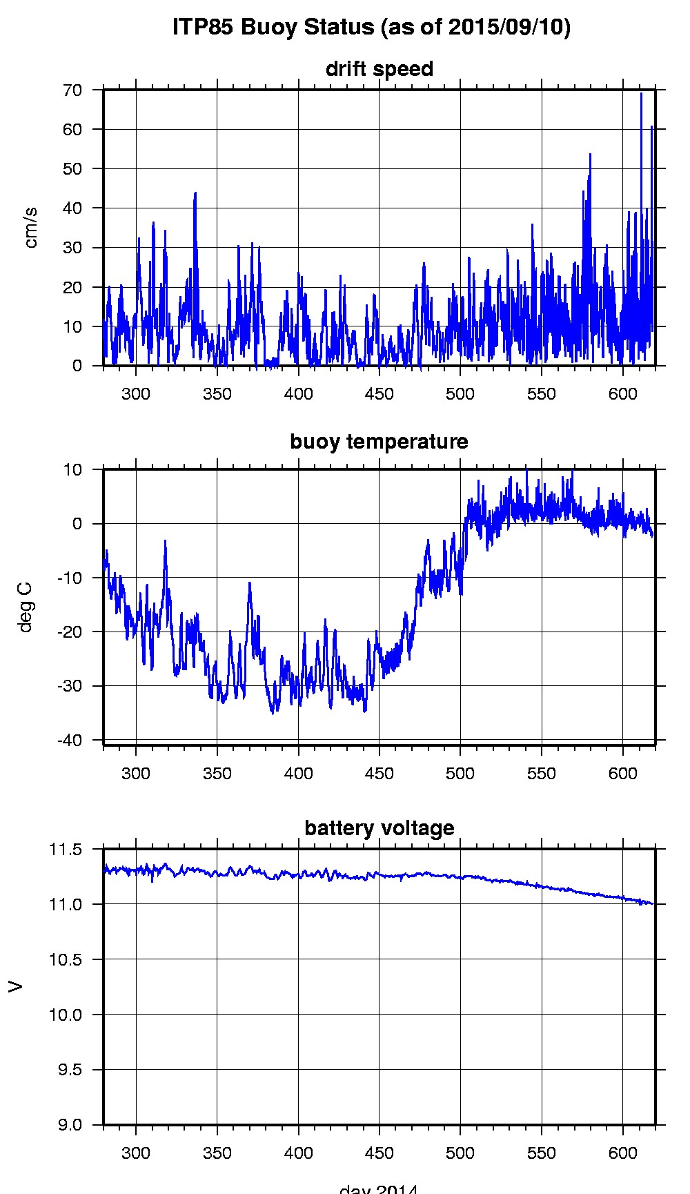
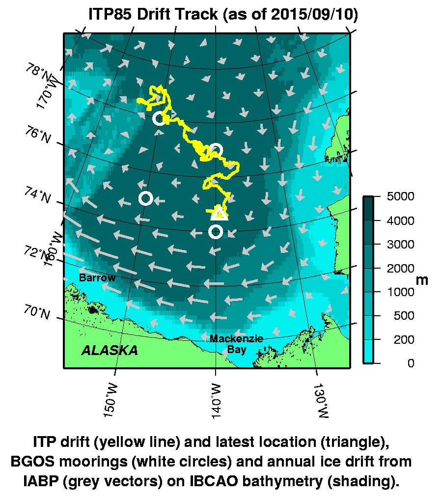
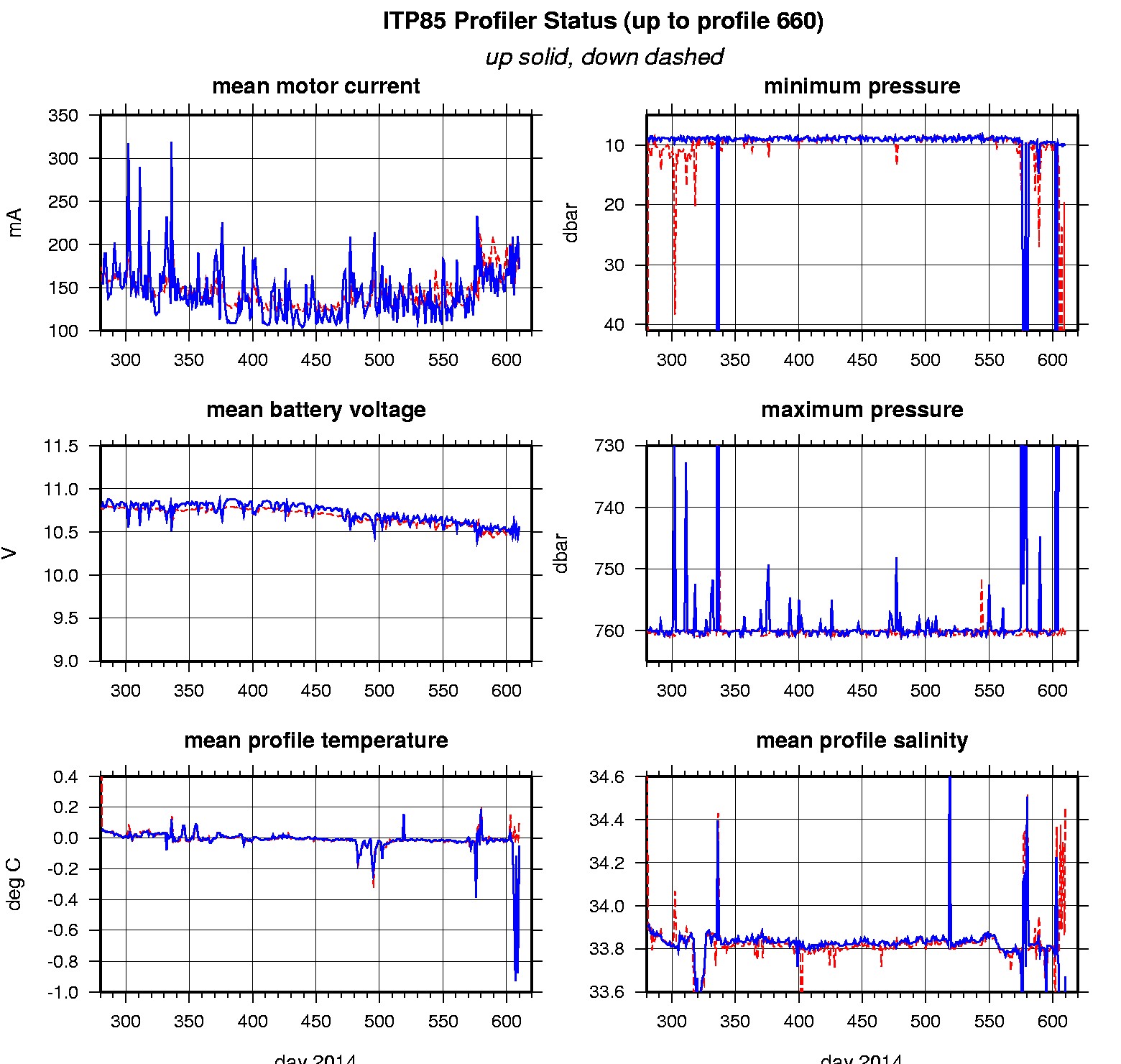
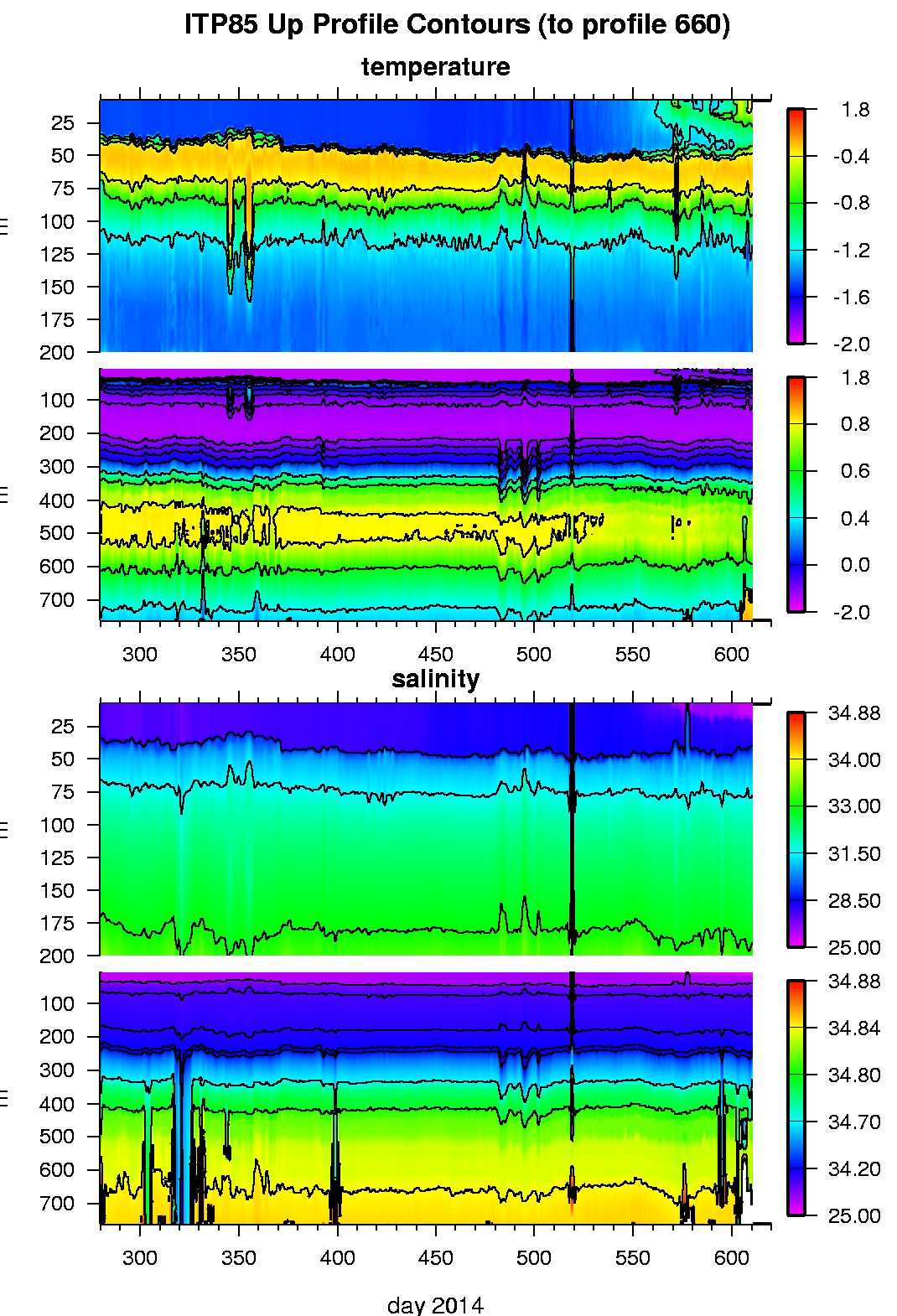
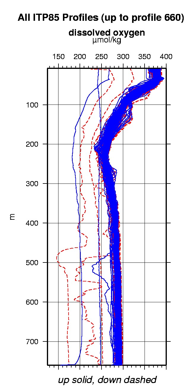
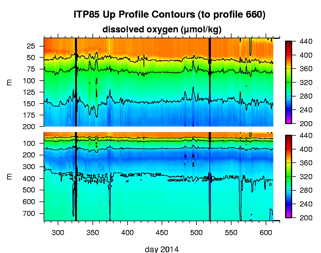
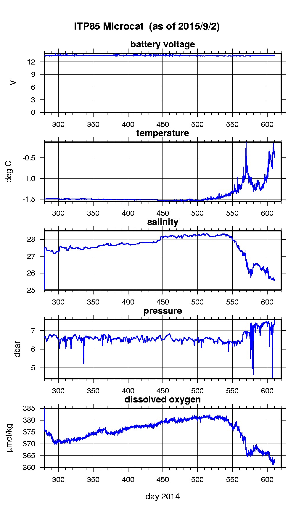
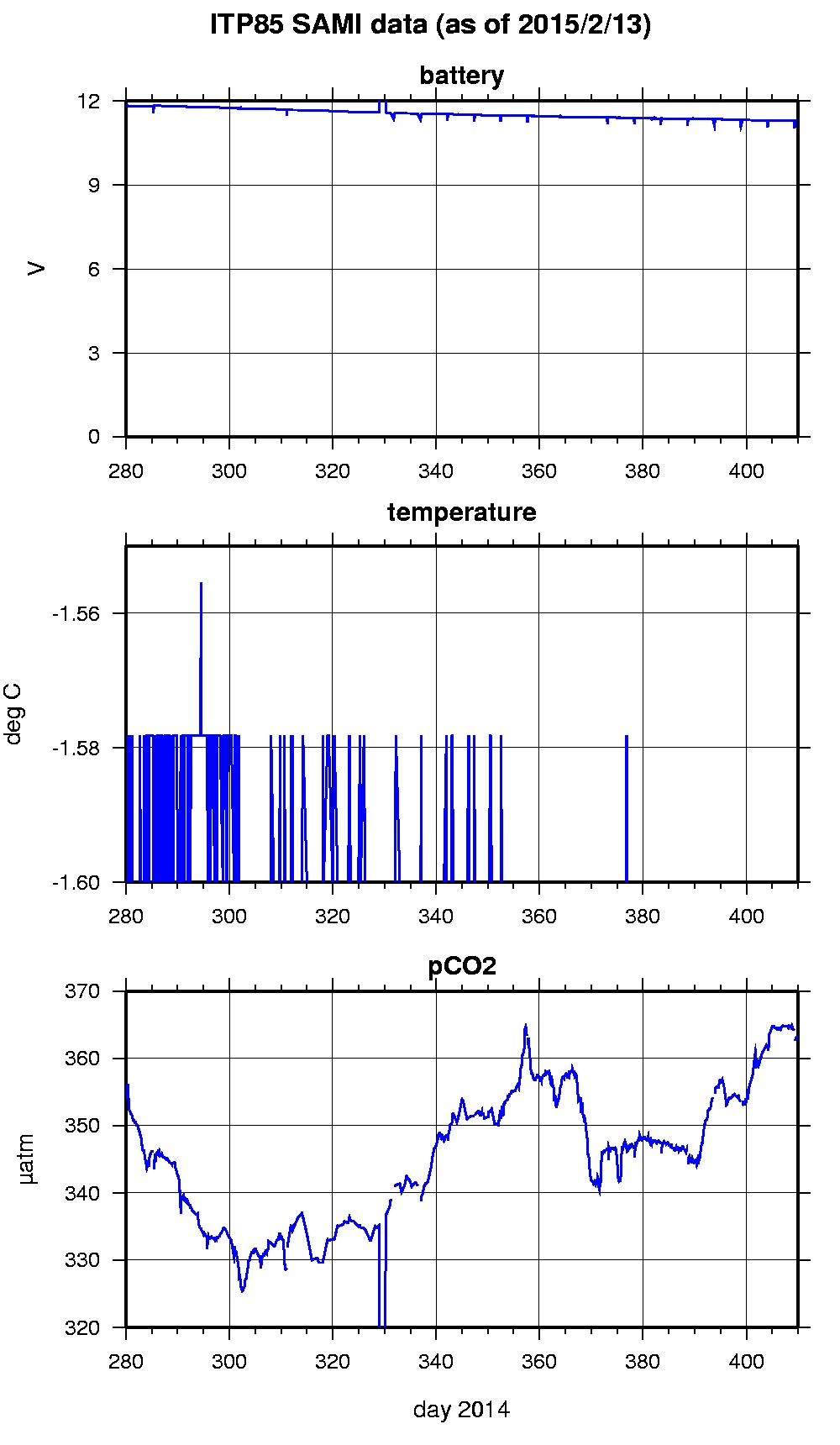
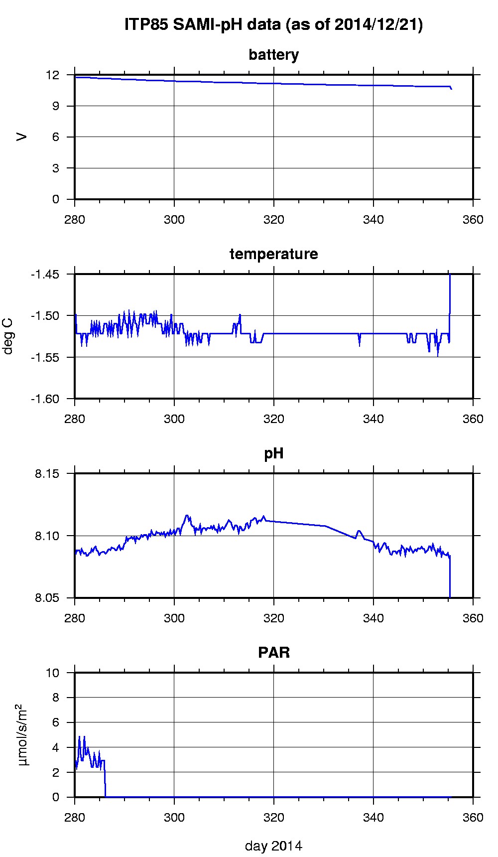
Last buoy status on 2015/9/10 100032 UTC : temperature = -1.875 °C, battery = 11.004 V Last position on 2015/9/10 100015 UTC : 74.6171° N, 139.5183° W Last profile (number 660) on 2015/9/2 602 UTC Last profile mean motor current = 185.0407 mA, mean battery = 10.5451 V Last profile depth: minimum = 136.1461, maximum = 760.0609 m Last profile temperature: minimum = -1.4421, maximum = 0.74116 °C Last profile salinity: minimum = 32.4806, maximum = 34.846 Last profile dissolved oxygen: minimum = 252.1369, maximum = 286.3083 μmol/kg Last Microcat sample (number NaN) on 2015/9/2 70054 UTC Last temperature = -0.4314 °C, salinity = 25.6047 Last Dissolved Oxygen = 362.449 μmol/kg Last SAMI IMM transfer on 2015/2/14 5819 UTC Last SAMI pCO2 sample (number 1139) on 2015/2/13 200017 UTC Last pCO2 = 363.3182 μatm Last SAMI pH sample (number 249) on 2014/12/21 160000 UTC Last pH = 7.2656 The raw GPS buoy location data are available in an ASCII file: itp85rawlocs.dat Depth averaged profiler data files (with interpolated location) and time series SAMI data are available in two formats: ITP85 was deployed on a 1.5 m thick ice floe in the Beaufort Sea on October 7, 2014 at 79° 2.1 N, 149° 58.5 W as part of the Beaufort Gyre Observing System (BGOS) during the JOIS 2014 cruise on the CCGS Louis S. St. Laurent. On the same icefloe, an Environment Canada Ice Mass Balance Buoy (IMB) and an autonomous atmospheric chemistry buoy (O-Buoy) , The ITP is operating on a standard sampling schedule of 2 one-way profiles between 7 and 760 m depth each day and includes a fixed SAMI PCO2 and SAMI pH with SBE-37 microcat at 6 m depth.
|