Ice Tethered Profiler 40 Data Data from ITP40 deployed in November 2010
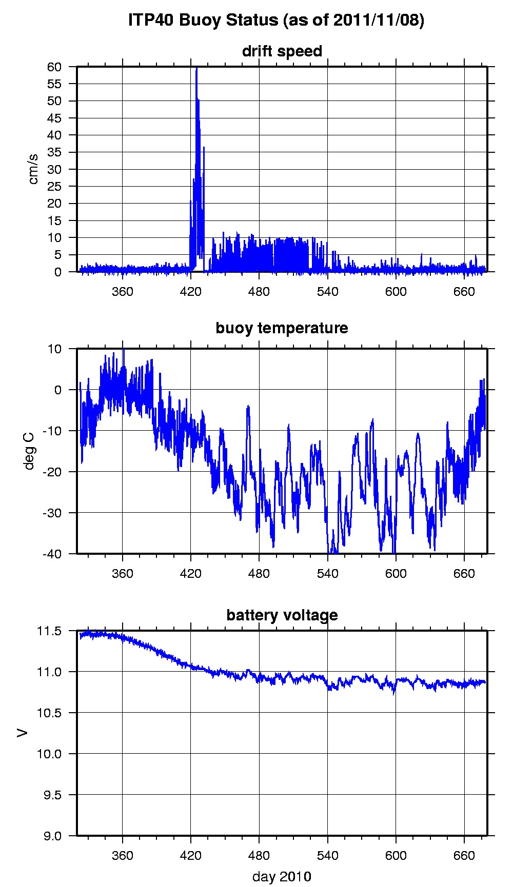
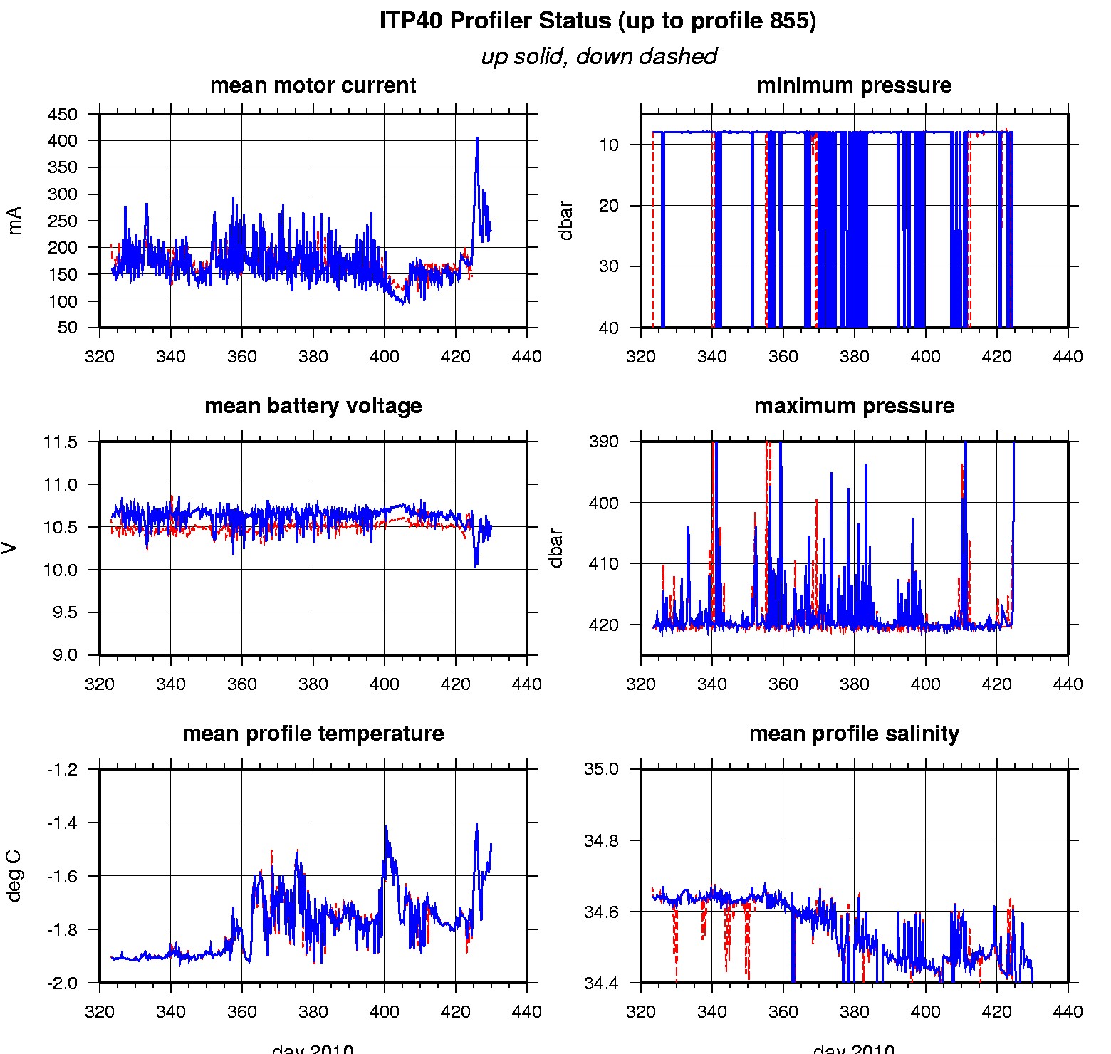
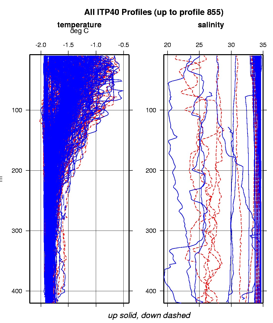
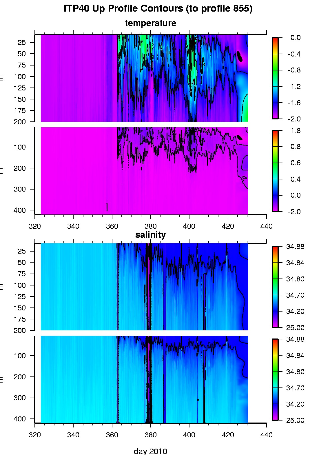
Last buoy status on 2011/11/8 230200 UTC : temperature = -1.35 °C, battery = 10.87 V Last position on 2011/11/8 230200 UTC : -77.1413° S, 163.3397° E Last profile (number 855) on 2011/3/6 0 UTC Last profile mean motor current = 232.1604 mA, mean battery = 10.5248 V Last profile depth: minimum = 218.5162, maximum = 237.8938 m Last profile temperature: minimum = -1.495, maximum = -1.4735 °C Last profile salinity: minimum = 34.3884, maximum = 34.4122 The raw GPS buoy location data are available in an ASCII file: itp40rawlocs.dat Depth averaged profiler data files (with interpolated location) are available in two formats: ITP40 was deployed on 2.85 m thick fast ice on 19 November 2010 at 77° 53.04 S, 166° 47.43 E in McMurdo Sound, Antarctica as part of a National Institute of Water & Atmospheric Research (NIWA) program. The ITP is operating on a sampling schedule of 4 paired (2-way) profiles between 7 and 420 m depth each day.
|