Ice Tethered Profiler 121 Data Data from ITP121 deployed in September 2020
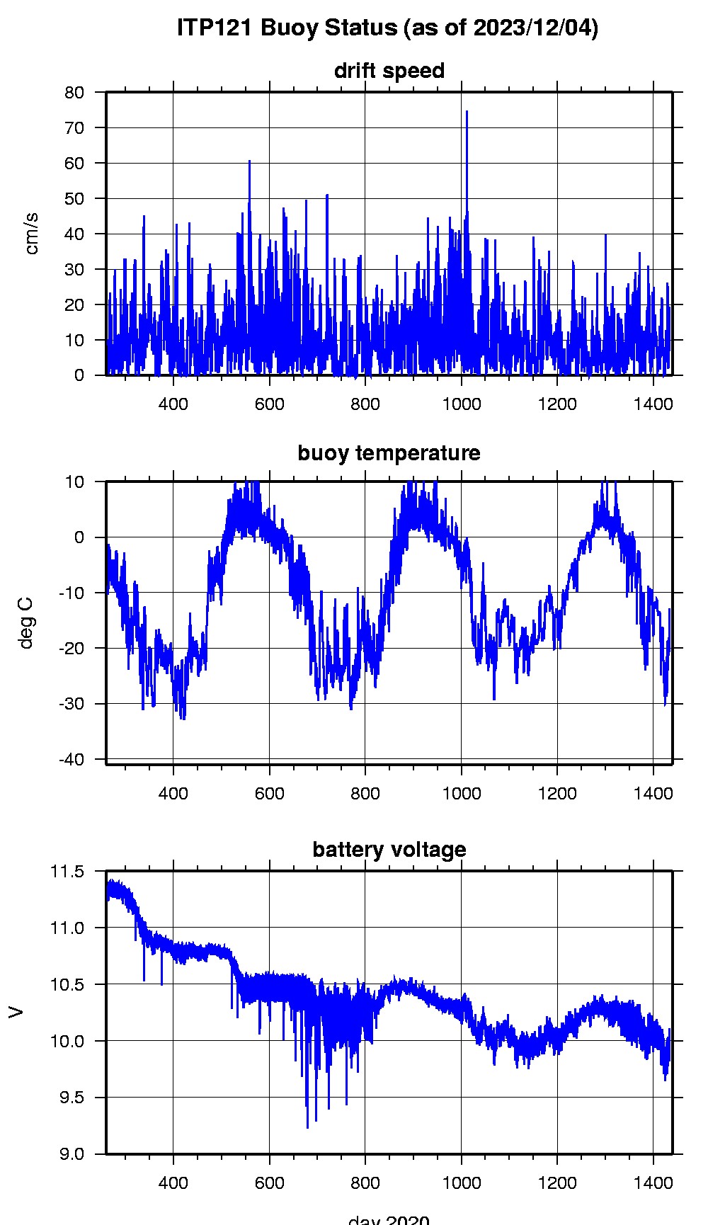
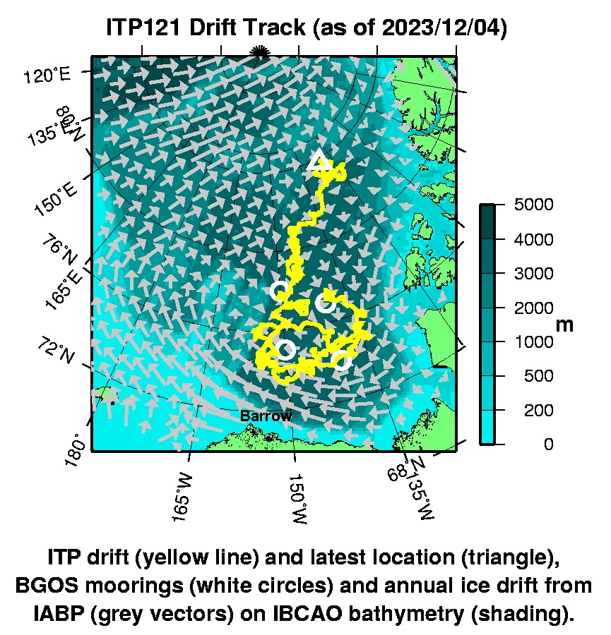
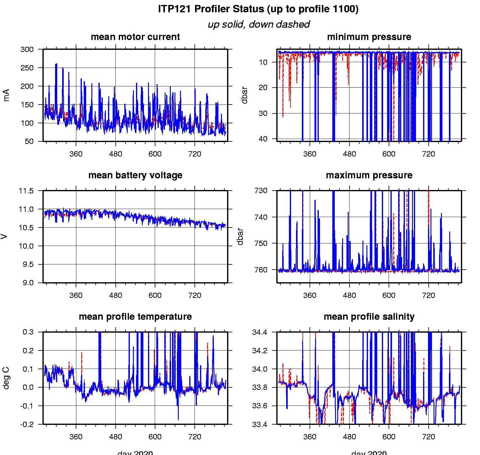
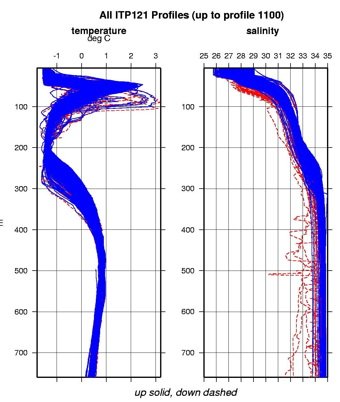
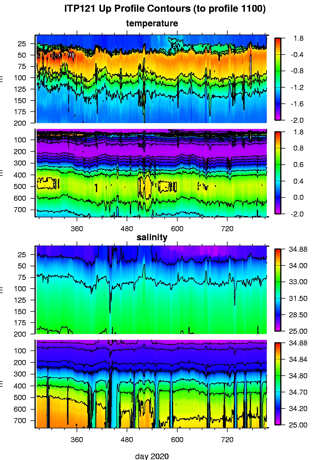
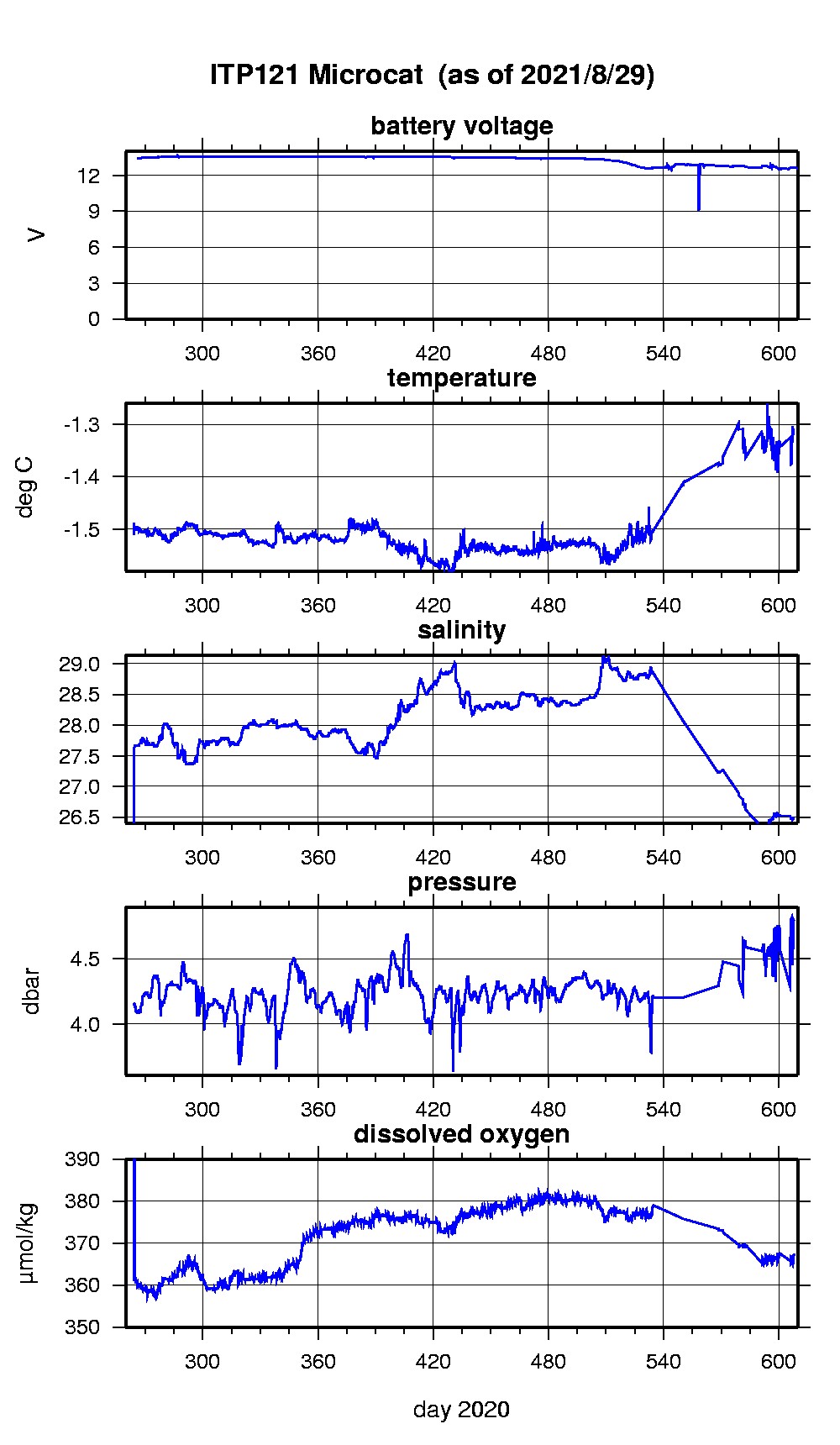
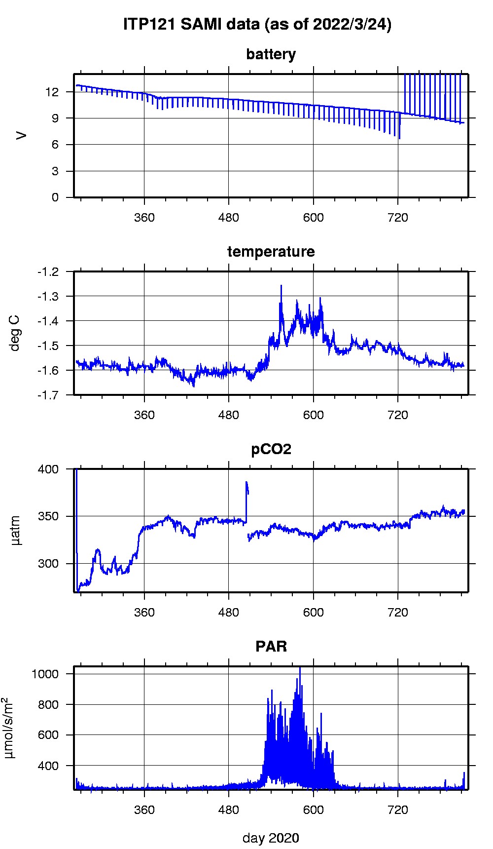
Last buoy status on 2023/12/4 19 UTC : temperature = -13.25 °C, battery = 9.968 V Last position on 2023/12/4 19 UTC : 83.8037° N, 125.7137° W Last profile (number 1100) on 2022/3/24 602 UTC Last profile mean motor current = 96.5195 mA, mean battery = 10.5164 V Last profile depth: minimum = 6.3941, maximum = 760.5704 m Last profile temperature: minimum = -1.5135, maximum = 0.75546 °C Last profile salinity: minimum = 27.873, maximum = 34.8454 Last Microcat sample (number 8219) on 2021/8/29 201604 UTC Last temperature = -1.3112 °C, salinity = 26.4839 Last Dissolved Oxygen = 367.5733 μmol/kg Last SAMI IMM transfer on 2022/3/24 70215 UTC Last SAMI pCO2 sample (number 31468) on 2022/3/24 61516 UTC Last pCO2 = 352.7176 μatm The raw GPS buoy location data are available in an ASCII file: itp121rawlocs.dat Depth averaged profiler data files (with interpolated location) and time series SAMI data are available in two formats: ITP121 was deployed on a 2.3 m ice floe in the Beaufort Sea on September 20, 2020 at 77° 22.3 N, 137° 16.4 W as part of the Beaufort Gyre Observing System (BGOS) during the JOIS 2020 cruise on the CCGS Louis S. St. Laurent. On the same icefloe, a US Army Cold Regions Research and Engineering Laboratory (CRREL) Seasonal Ice Mass Balance Buoy 3 was also installed. The ITP is operating on a standard sampling schedule of 2 one-way profiles between 7 and 760 m depth each day and includes a fixed SAMI PCO2 with PAR and SBE-37 microcat with dissolved oxygen at 5 m depth.
|