Ice Tethered Profiler 119 Data Data from ITP119 deployed in September 2019
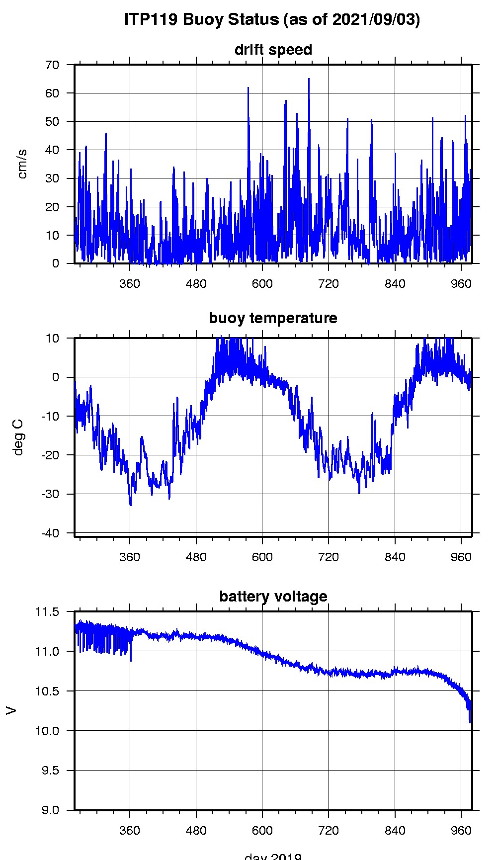
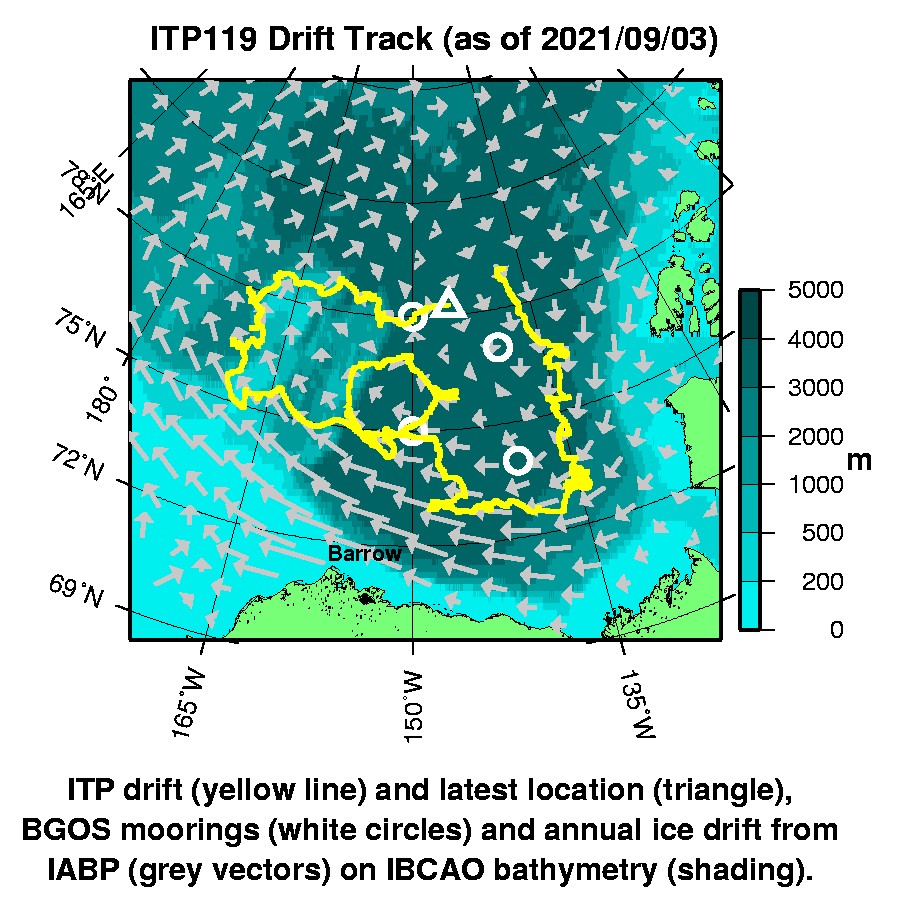
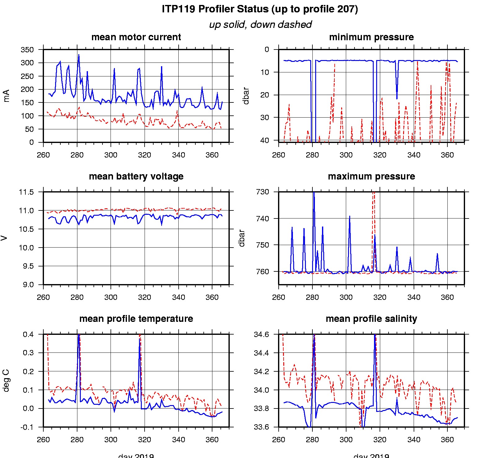
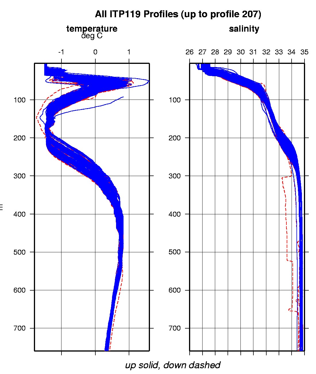
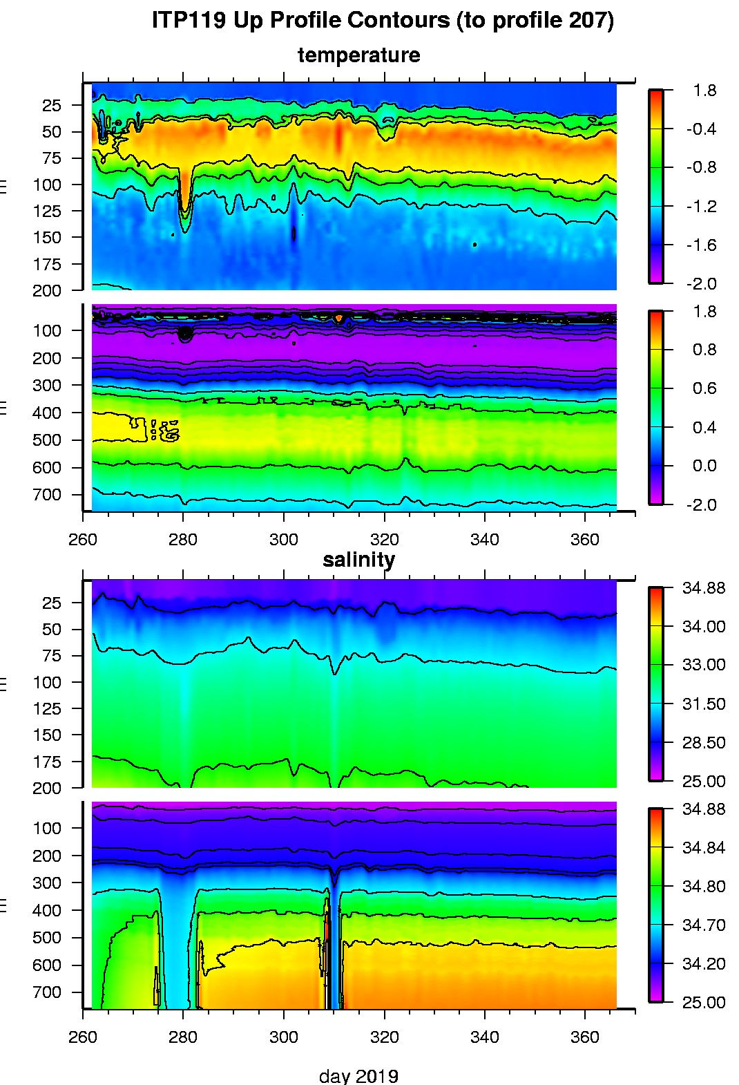
Last buoy status on 2021/9/3 30047 UTC : temperature = -1.75 °C, battery = 10.361 V Last position on 2021/9/3 30047 UTC : 78.222° N, 145.2998° W Last profile (number 207) on 2020/1/1 2 UTC Last profile mean motor current = 153.1699 mA, mean battery = 10.8468 V Last profile depth: minimum = 5.4837, maximum = 759.9205 m Last profile temperature: minimum = -1.4983, maximum = 0.7382 °C Last profile salinity: minimum = 27.5133, maximum = 34.861 The raw GPS buoy location data are available in an ASCII file: itp119rawlocs.dat Depth averaged profiler data files (with interpolated location) are available in two formats: ITP119 was deployed in open water in the Beaufort Sea on September 18, 2019 at 79° 0.3 N, 137° 4.3 W as part of the Beaufort Gyre Observing System (BGOS) during the JOIS 2019 cruise on the CCGS Louis S. St. Laurent. The ITP is operating on a standard sampling schedule of 2 one-way profiles between 5 and 760 m depth each day.
|