Ice Tethered Profiler 118 Data Data from ITP118 deployed in September 2019
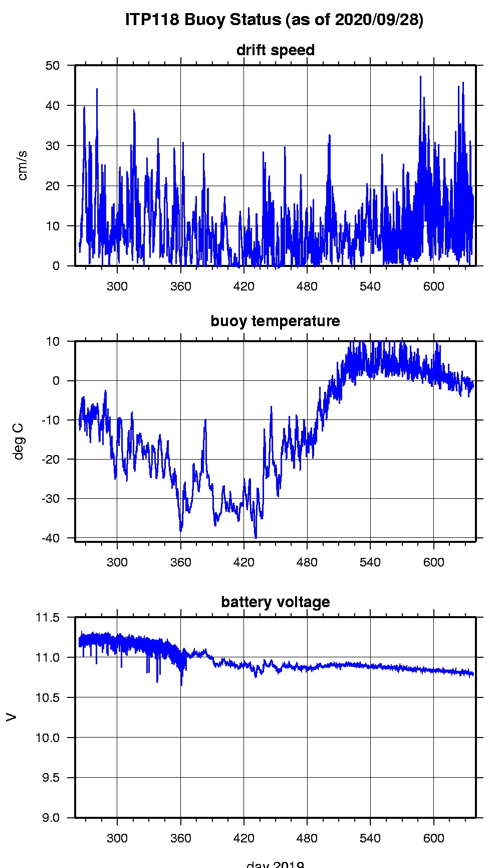
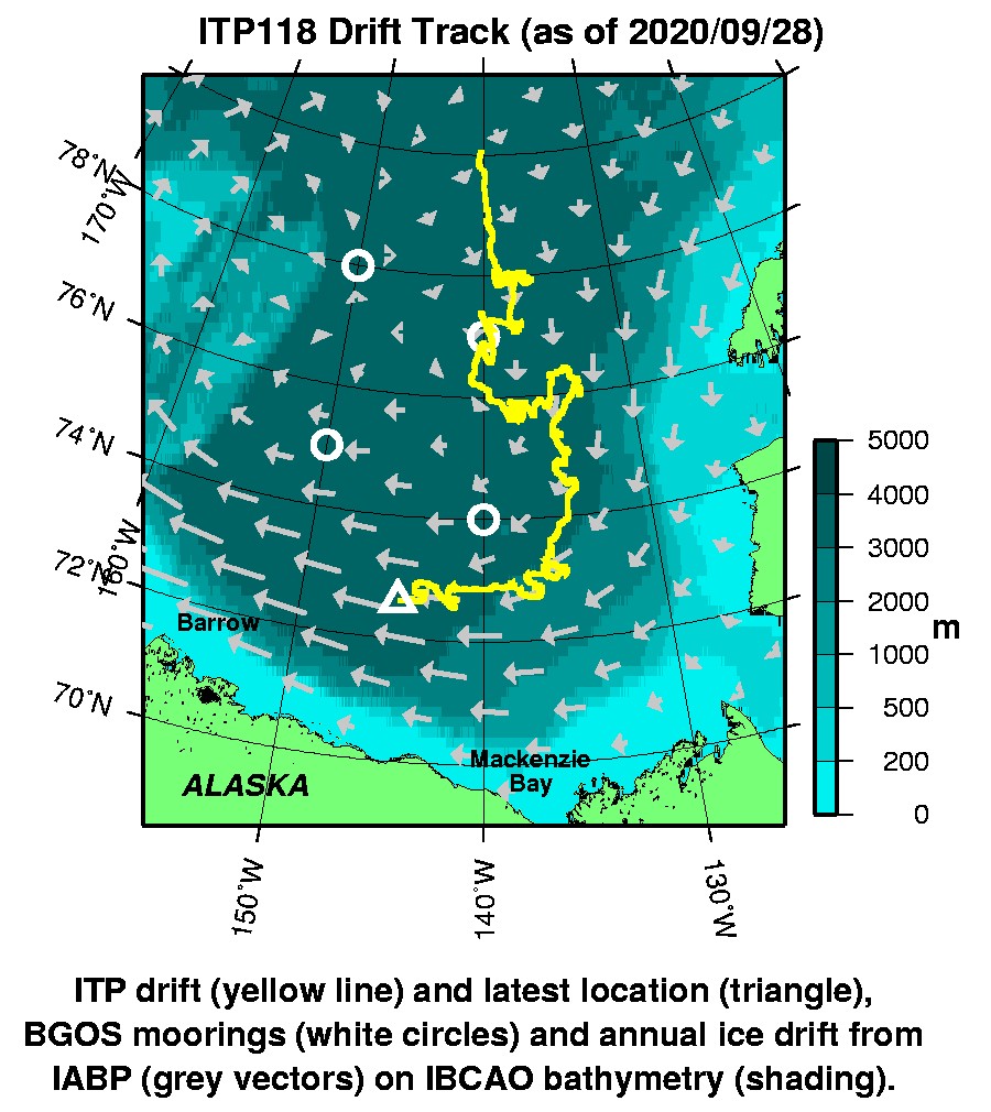
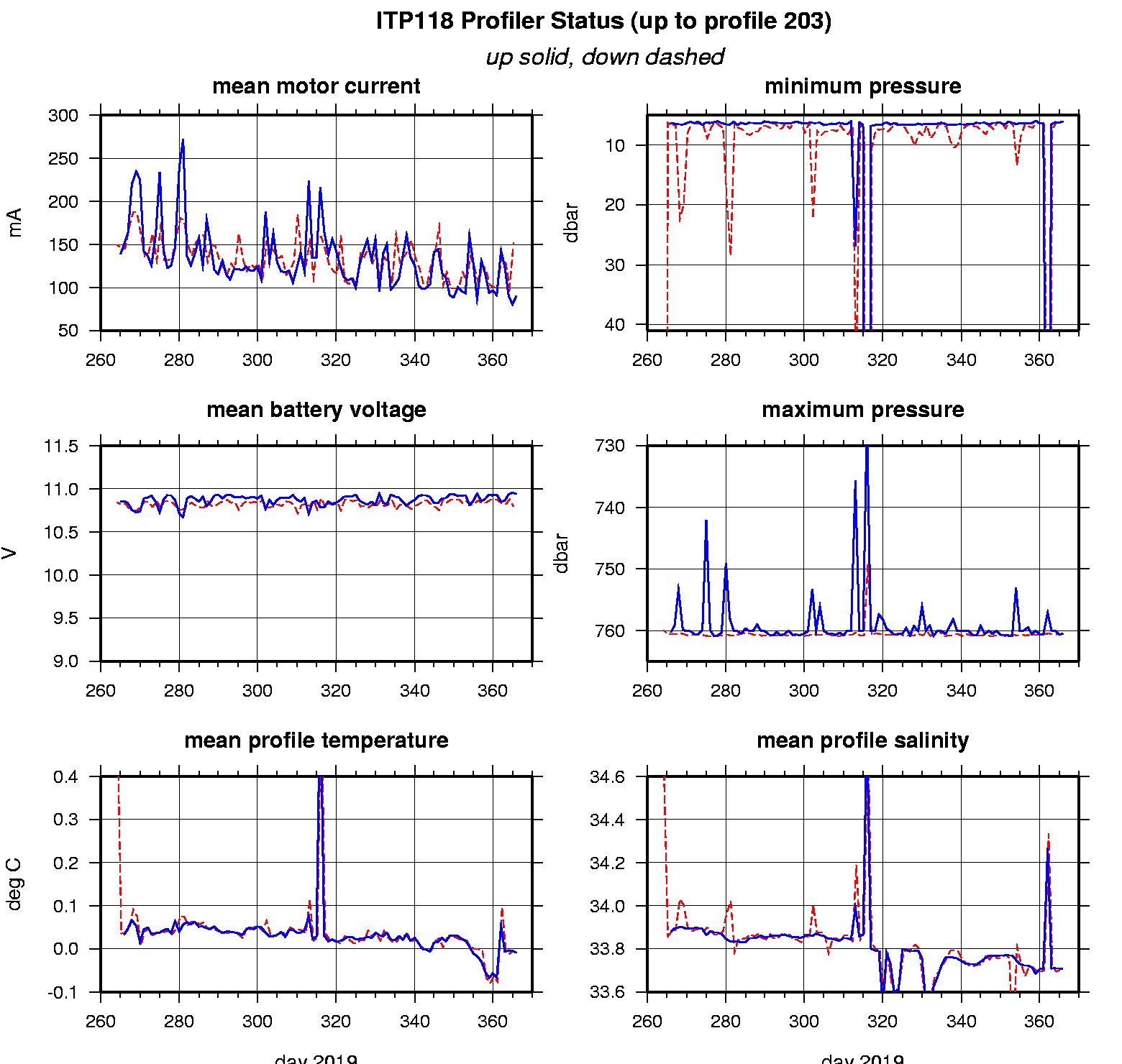
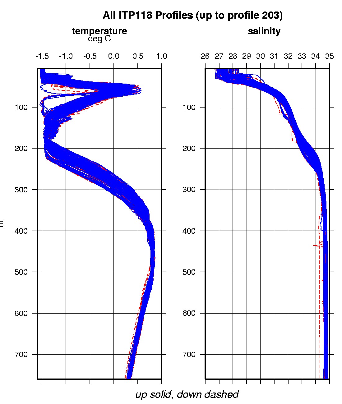
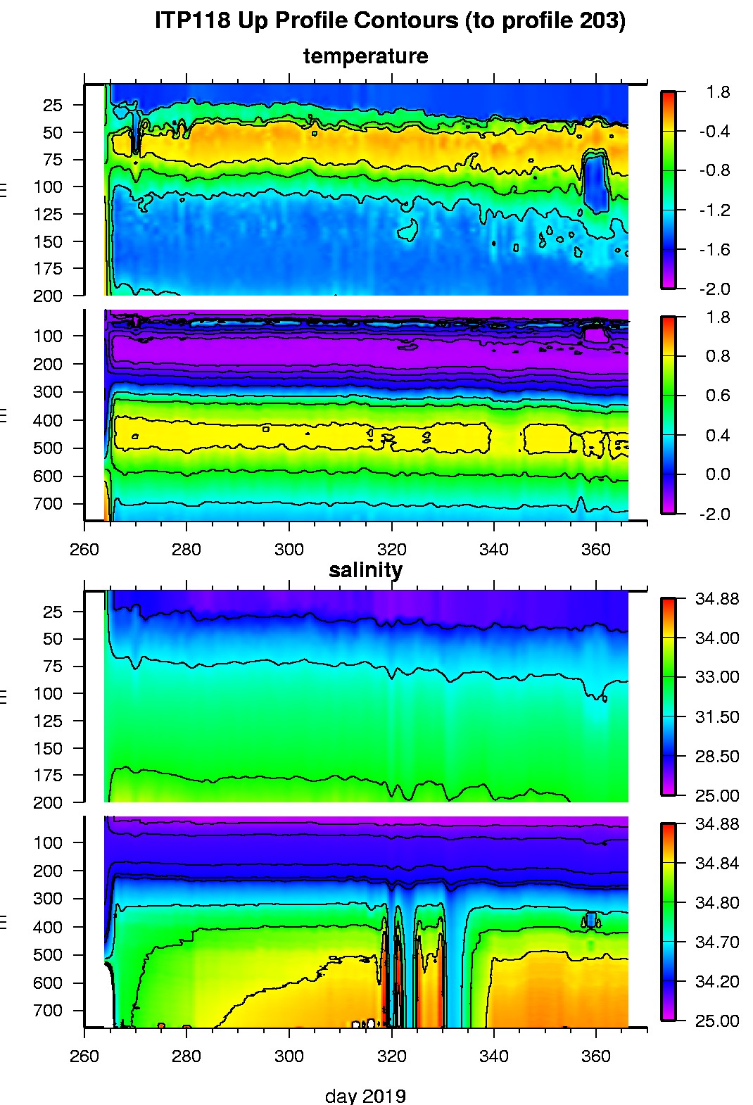
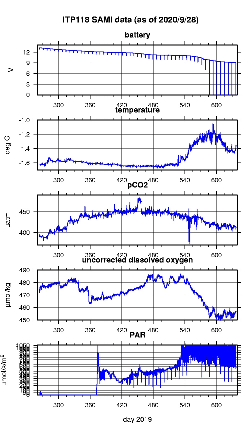
Last buoy status on 2020/9/28 130117 UTC : temperature = -1.0625 °C, battery = 10.797 V Last position on 2020/9/28 130117 UTC : 72.6079° N, 144.6818° W Last profile (number 203) on 2020/1/1 2 UTC Last profile mean motor current = 90.6256 mA, mean battery = 10.9369 V Last profile depth: minimum = 6.0675, maximum = 760.4649 m Last profile temperature: minimum = -1.5232, maximum = 0.8214 °C Last profile salinity: minimum = 27.9314, maximum = 34.8567 Last SAMI pCO2 sample (number 13518) on 2020/9/28 121517 UTC Last pCO2 = 412.5063 μatm Last SAMI ODO sample (number 13519) on 2020/9/28 121530 UTC Last uncorrected Dissolved Oxygen = 456.9702 μmol/kg Last SAMI PAR sample (number 13520) on 2020/9/28 121537 UTC Last PAR = 599.6261 μmol/s/m^2 The raw GPS buoy location data are available in an ASCII file: itp118rawlocs.dat Depth averaged profiler data files (with interpolated location) and time series SAMI data are available in two formats: ITP118 was deployed on a 1.0 m ice floe in the Beaufort Sea on September 20, 2019 at 80° 2.5 N, 140° 10.2 W as part of the Beaufort Gyre Observing System (BGOS) during the JOIS 2019 cruise on the CCGS Louis S. St. Laurent. The ITP is operating on a standard sampling schedule of 2 one-way profiles between 7 and 760 m depth each day and includes a fixed SAMI PCO2 with ODO and PAR at 5 m depth.
|