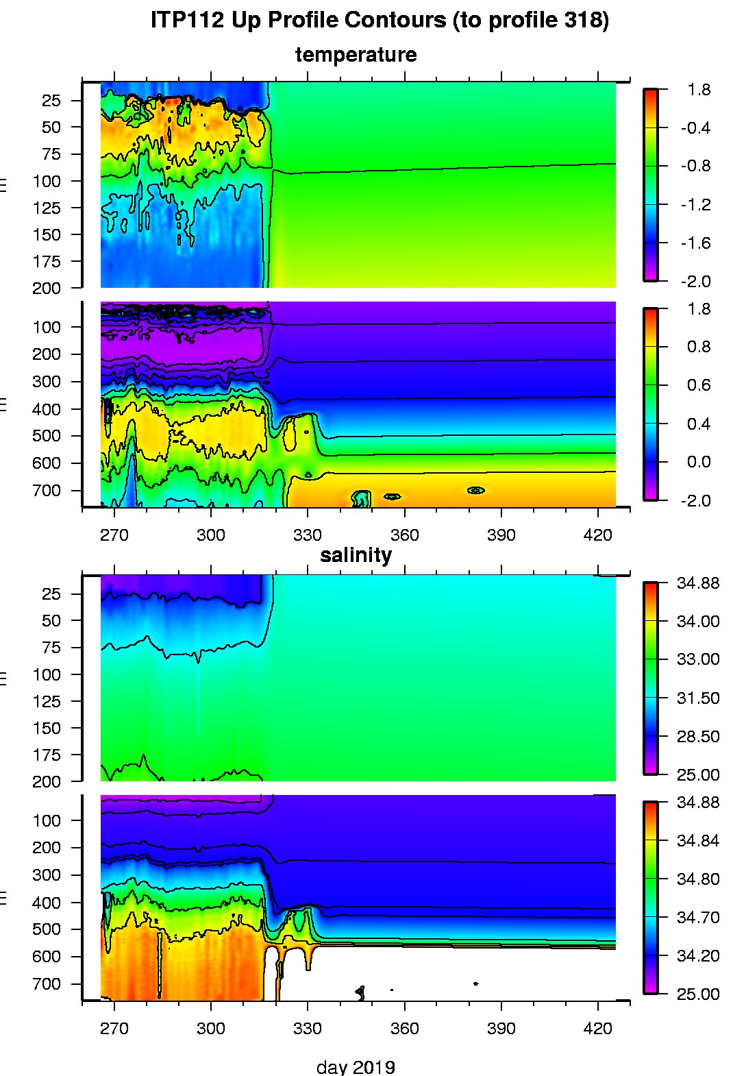
Ice Tethered Profiler 112 Data Data from ITP112 deployed in September 2019
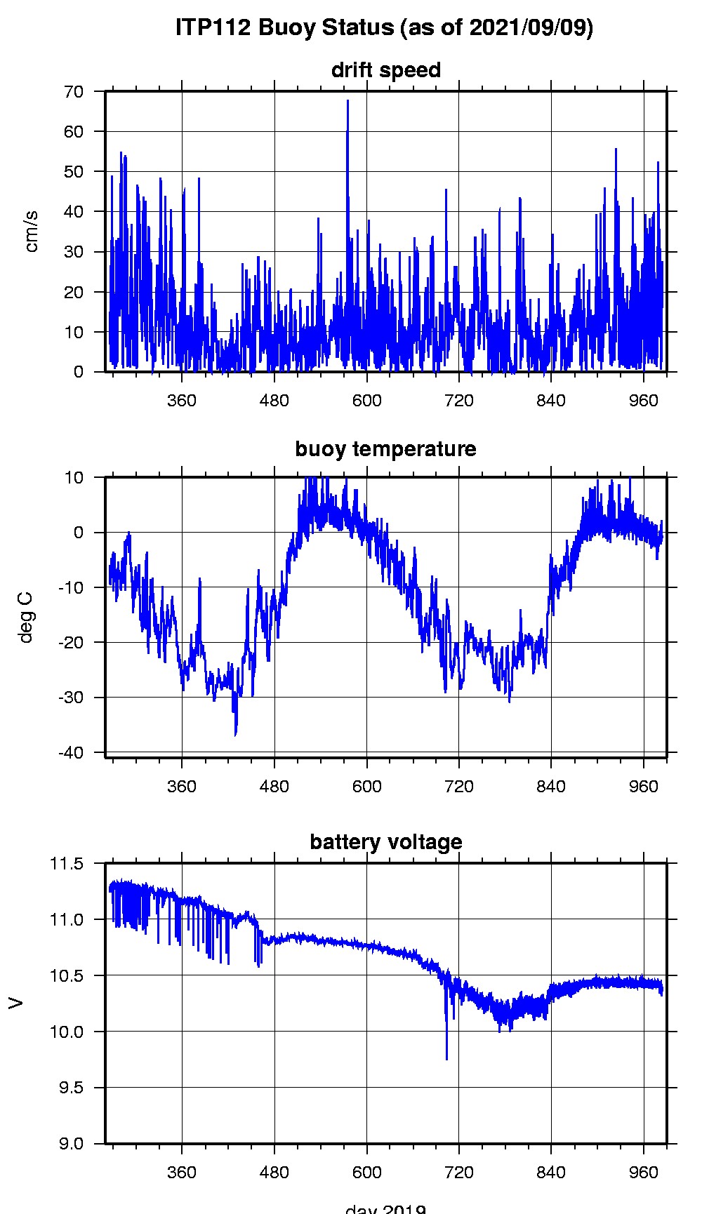
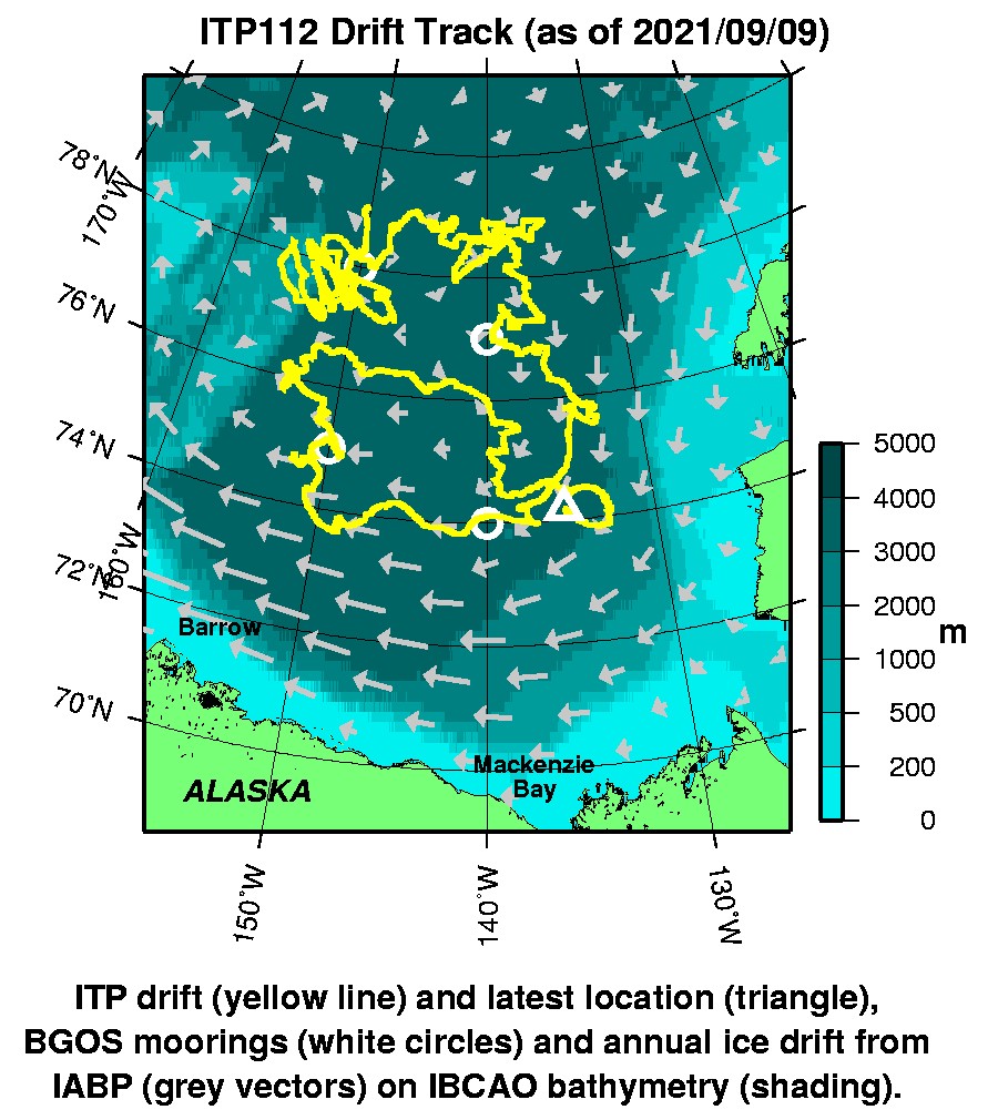
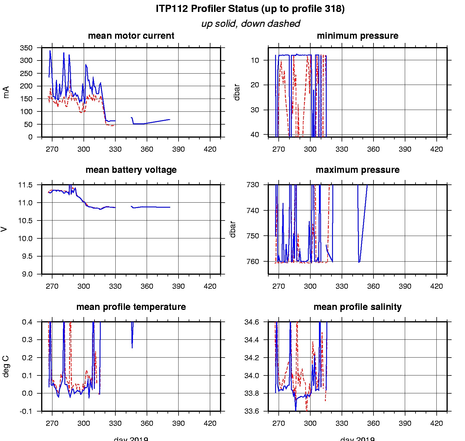
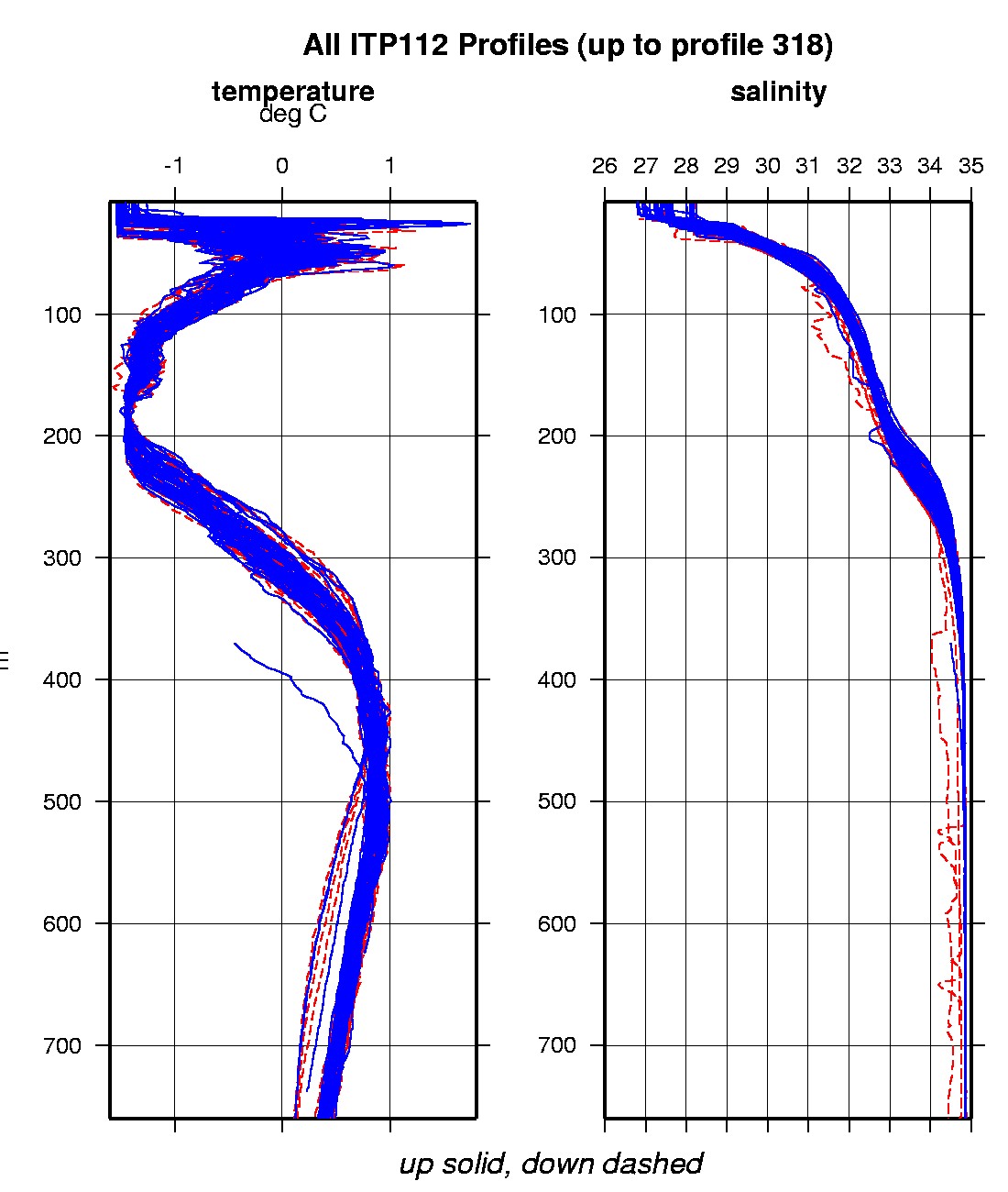
Last buoy status on 2021/9/9 160101 UTC : temperature = -0.75 °C, battery = 10.401 V Last position on 2021/9/9 160101 UTC : 74.1948° N, 135.4191° W Last profile (number 318) on 2020/2/29 600 UTC Last profile mean motor current = 43.2676 mA, mean battery = 10.8414 V Last profile depth: minimum = 598.8039, maximum = 598.8039 m Last profile temperature: minimum = 0.67967, maximum = 0.67967 °C Last profile salinity: minimum = 34.8463, maximum = 34.8463 The raw GPS buoy location data are available in an ASCII file: itp112rawlocs.dat Depth averaged profiler data files (with interpolated location) are available in two formats: ITP112 was deployed on a 0.7 m thick ice floe in the Beaufort Sea on September 22, 2019 at 78° 59.7 N, 150° 8.4 W as part of the Beaufort Gyre Observing System (BGOS) during the JOIS 2019 cruise on the CCGS Louis S. St. Laurent. The ITP is operating on a standard sampling schedule of 2 one-way profiles between 7 and 760 m depth each day.
|