Ice Tethered Profiler 110 Data Data from ITP110 deployed in September 2018
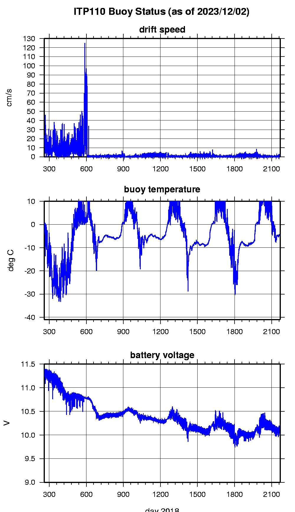
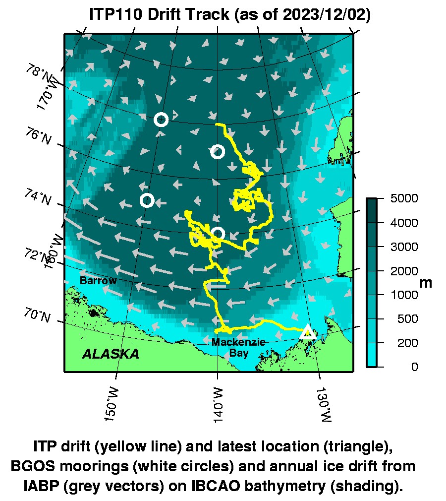
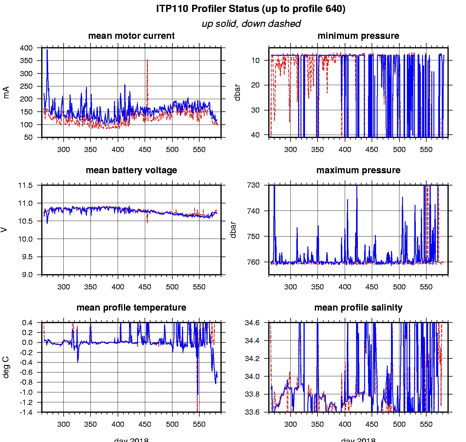
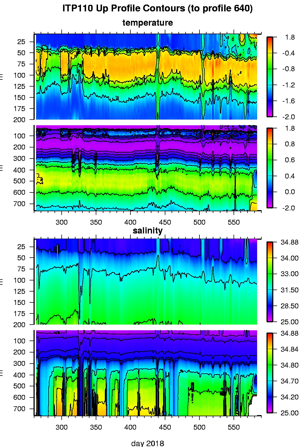
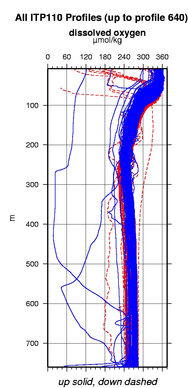
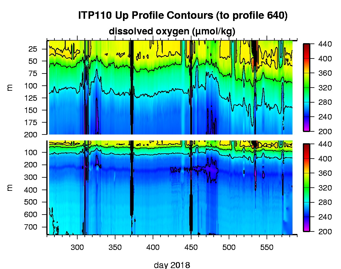
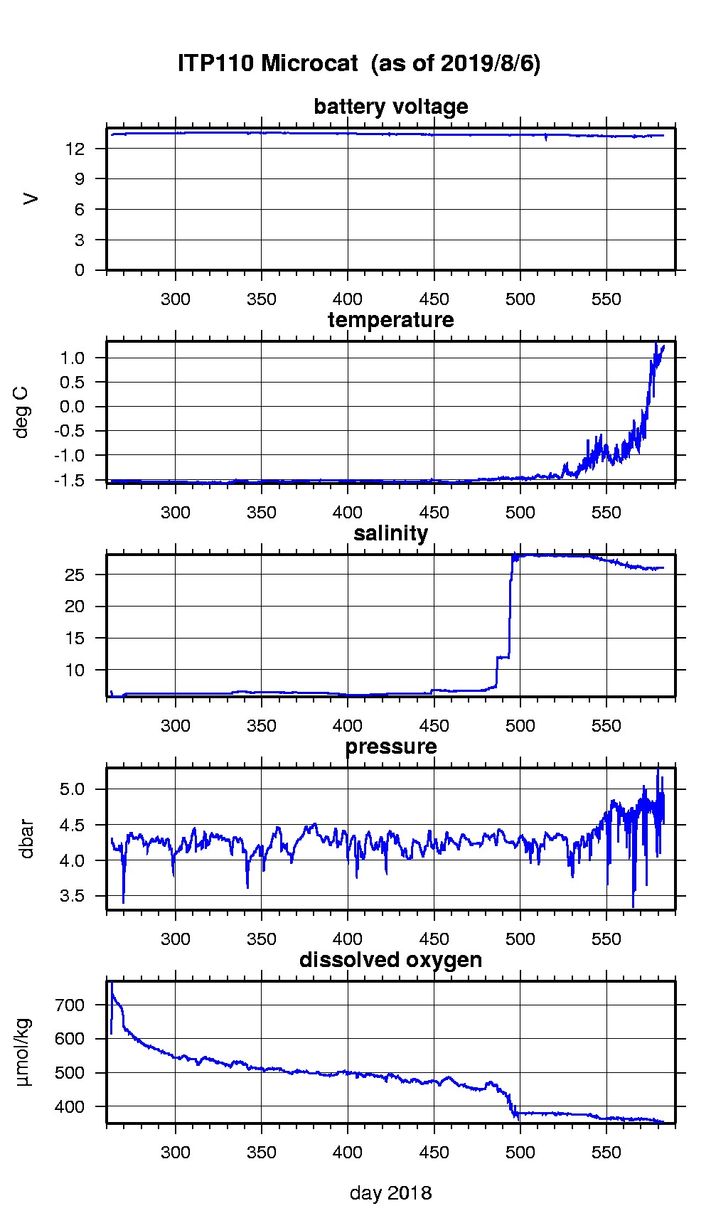
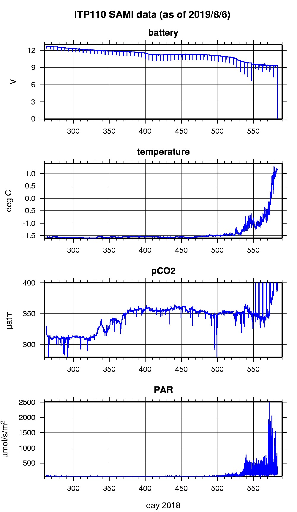
Last buoy status on 2023/12/2 180117 UTC : temperature = -4.75 °C, battery = 10.077 V Last position on 2023/12/2 180117 UTC : 70.1192° N, 130.4084° W Last profile (number 640) on 2019/8/6 602 UTC Last profile mean motor current = 95.5023 mA, mean battery = 10.806 V Last profile depth: minimum = 376.2331, maximum = 760.4287 m Last profile temperature: minimum = 0.3307, maximum = 0.73026 °C Last profile salinity: minimum = 34.6426, maximum = 34.8304 Last profile dissolved oxygen: minimum = 249.3422, maximum = 272.398 μmol/kg Last Microcat sample (number NaN) on 2019/8/6 61603 UTC Last temperature = 1.1849 °C, salinity = 26.0673 Last Dissolved Oxygen = 354.1623 μmol/kg Last SAMI IMM transfer on NaN/NaN/NaN NaN UTC Last SAMI pCO2 sample (number 15458) on 2019/8/6 61511 UTC Last pCO2 = 399.8999 μatm The raw GPS buoy location data are available in an ASCII file: itp110rawlocs.dat Depth averaged profiler data files (with interpolated location) and time series SAMI data are available in two formats: ITP110 was deployed on an 0.8 m ice floe in the Beaufort Sea on September 19, 2018 at 78° 1.4 N, 140° 15.0 W as part of the Beaufort Gyre Observing System (BGOS) during the JOIS 2018 cruise on the CCGS Louis S. St. Laurent. The ITP includes a dissolved oxygen sensor and is operating on a standard sampling schedule of 2 one-way profiles between 7 and 760 m depth each day and includes a fixed SAMI PCO2 with PAR and SBE-37 microcat with dissolved oxygen at 6 m depth.
|