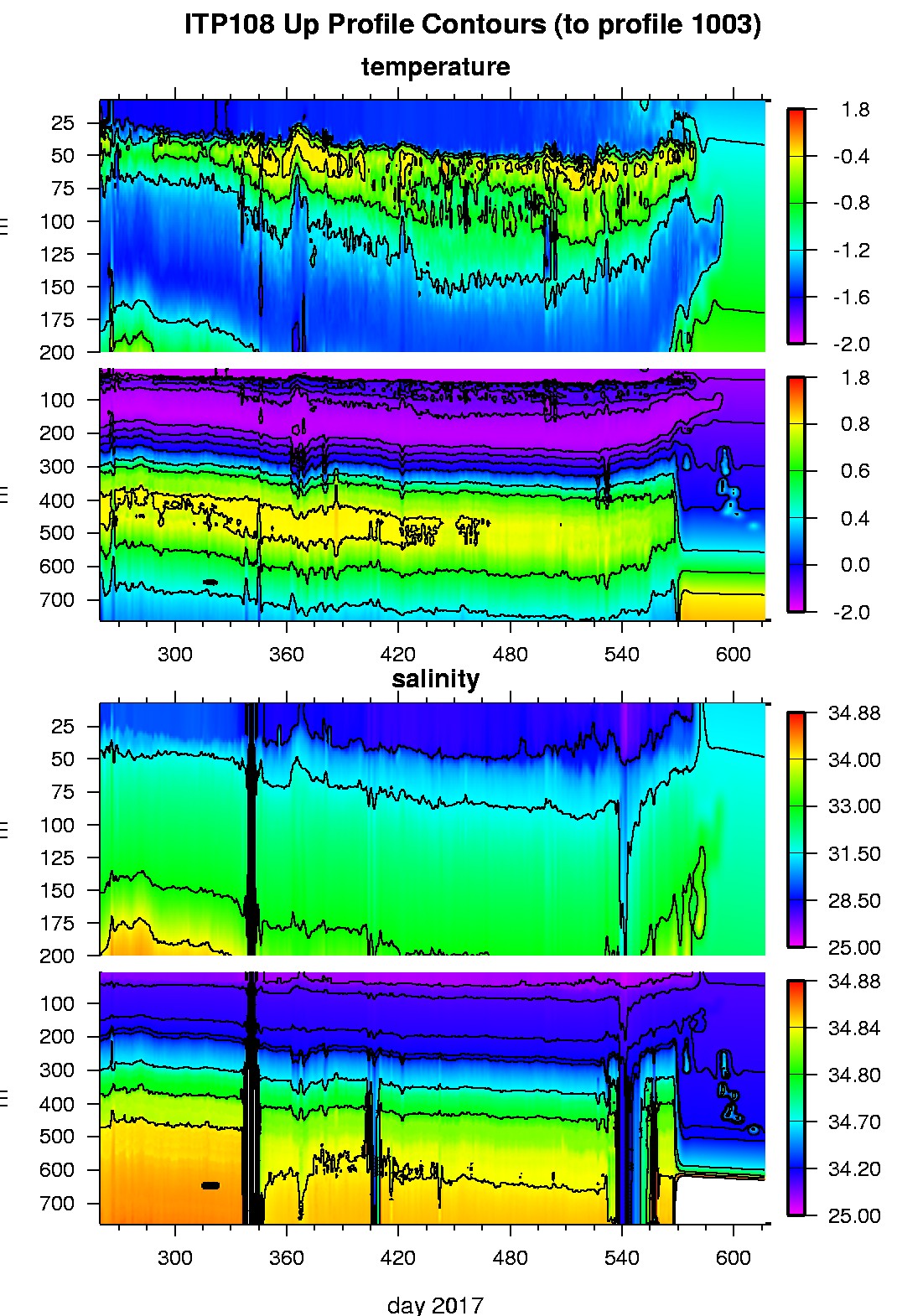
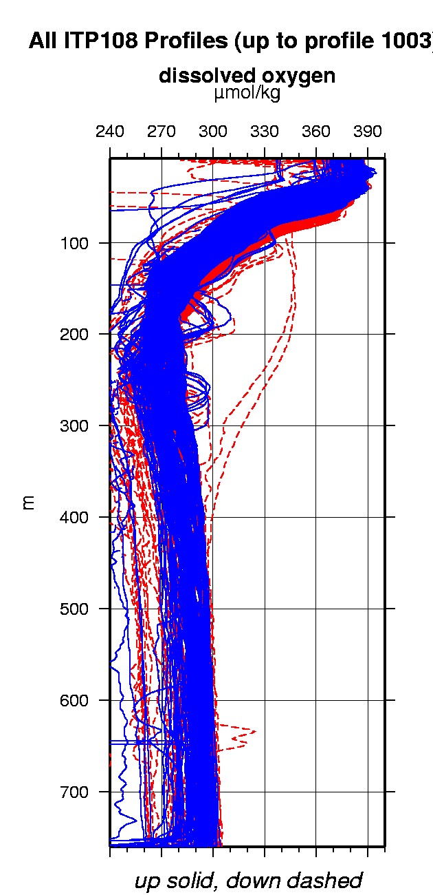
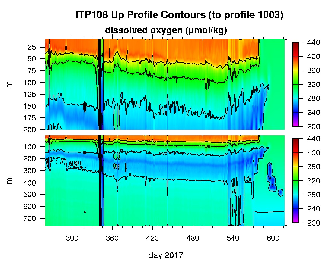
Ice Tethered Profiler 108 Data Data from ITP108 deployed in September 2017
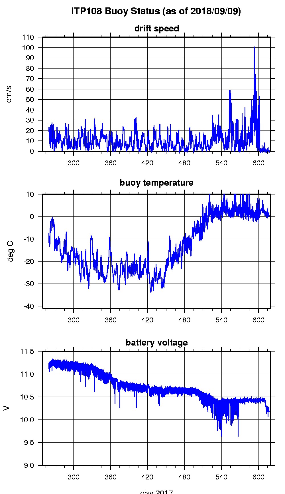
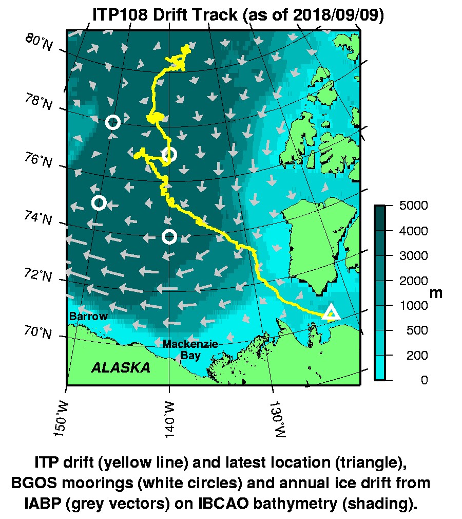
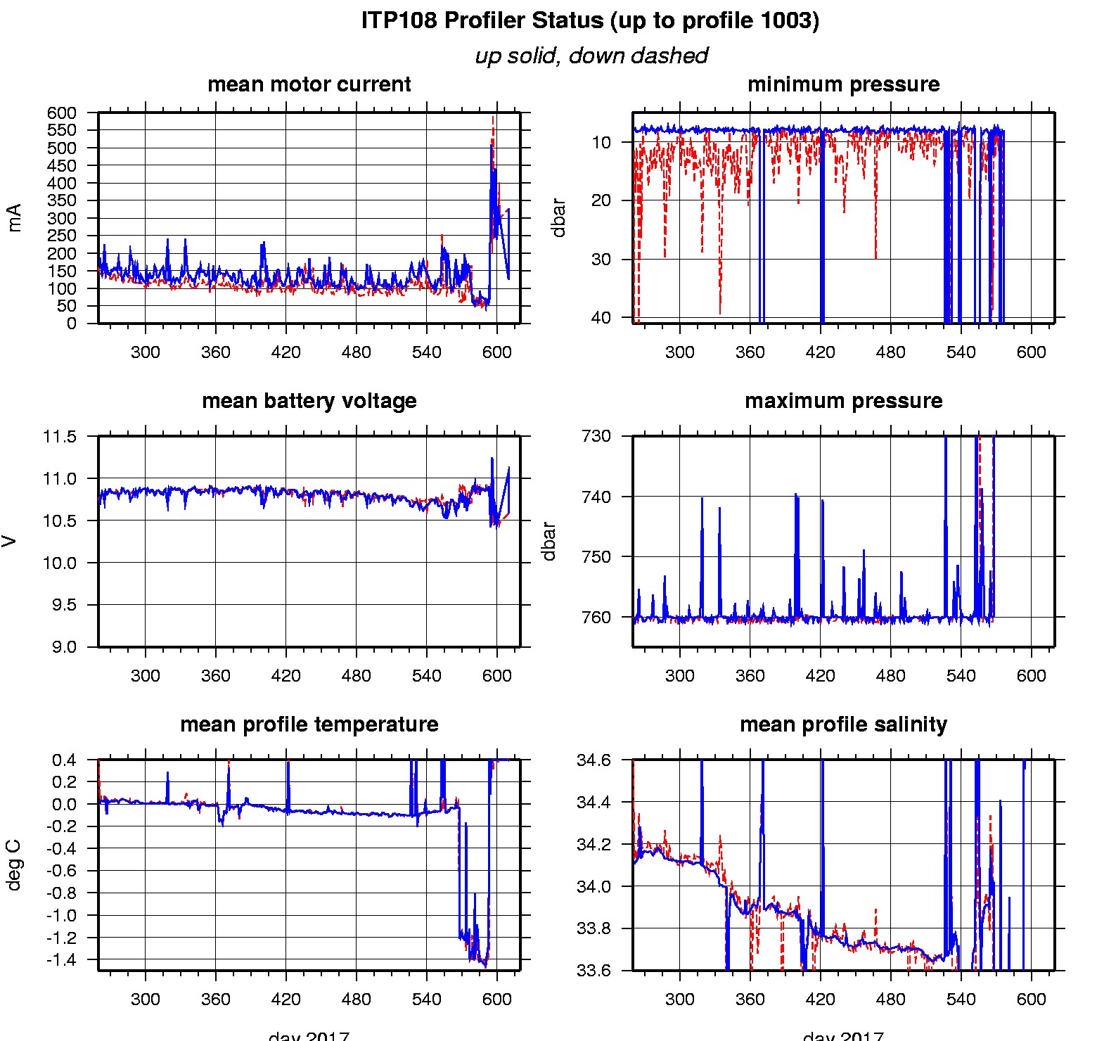
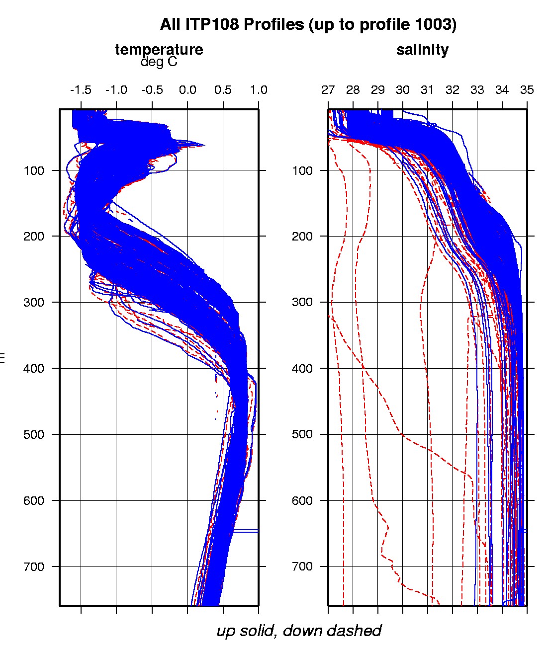
Last buoy status on 2018/9/9 120042 UTC : temperature = 0.125 °C, battery = 10.198 V Last position on 2018/9/9 120042 UTC : 70.2933° N, 122.4108° W Last profile (number 1003) on 2018/9/8 902 UTC Last profile mean motor current = 257.9139 mA, mean battery = 10.43 V Last profile depth: minimum = 473.2997, maximum = 473.2997 m Last profile temperature: minimum = 0.39363, maximum = 0.39363 °C Last profile salinity: minimum = 34.7417, maximum = 34.7417 Last profile dissolved oxygen: minimum = 238.4783, maximum = 238.4783 μmol/kg The raw GPS buoy location data are available in an ASCII file: itp108rawlocs.dat Depth averaged profiler data files (with interpolated location) are available in two formats: ITP108 was deployed on a 0.5 m thick ice floe in the Beaufort Sea on September 16, 2017 at 80° 32.2 N, 140° 44.8 W as part of the Beaufort Gyre Observing System (BGOS) during the JOIS 2017 cruise on the CCGS Louis S. St. Laurent. On the same icefloe, a US Army Cold Regions Research and Engineering Laboratory (CRREL) Seasonal Ice Mass Balance Buoy 3 was also installed. The ITP includes a dissolved oxygen sensor and is operating on a standard sampling schedule of 2 one-way profiles between 7 and 760 m depth each day.
|