Ice Tethered Profiler 107 Data Data from ITP107 deployed in September 2018
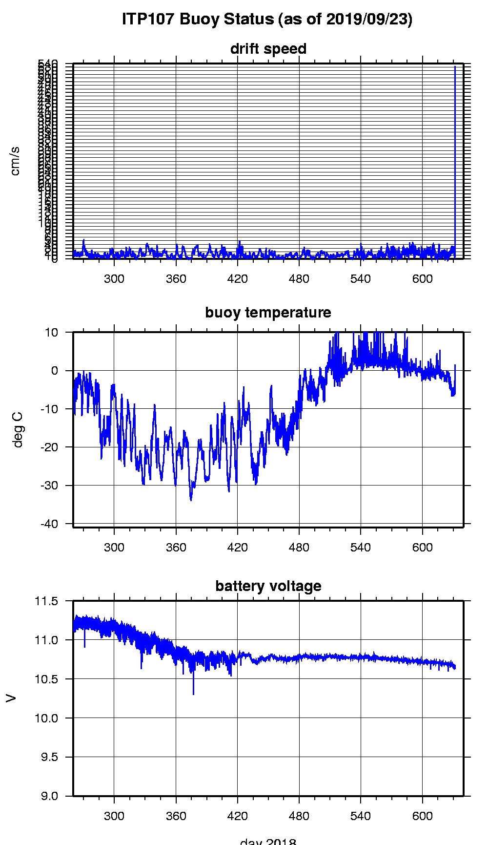
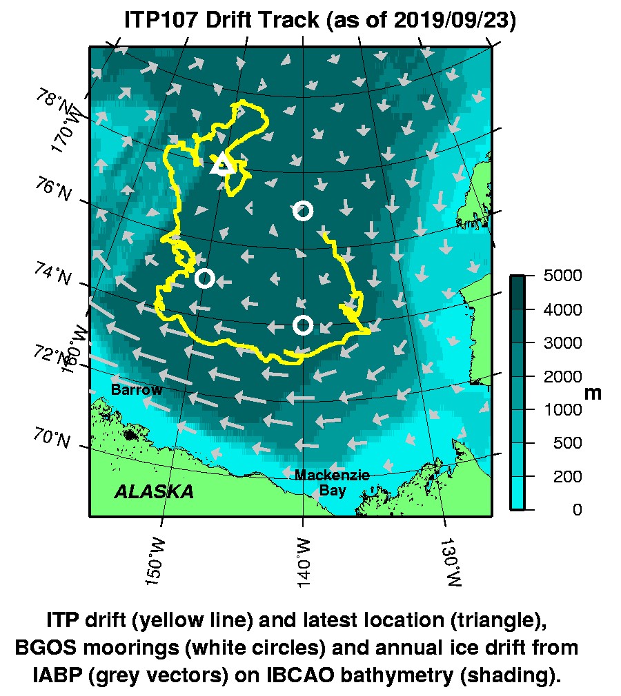
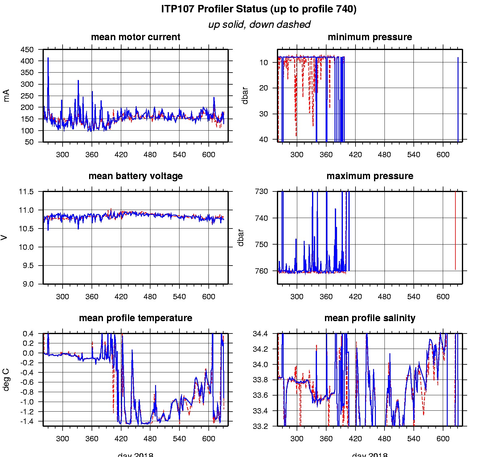
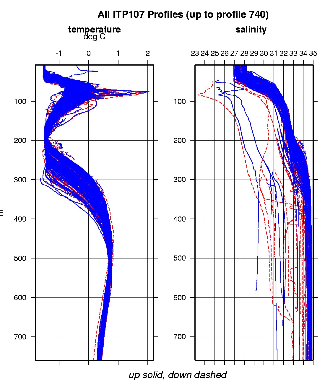
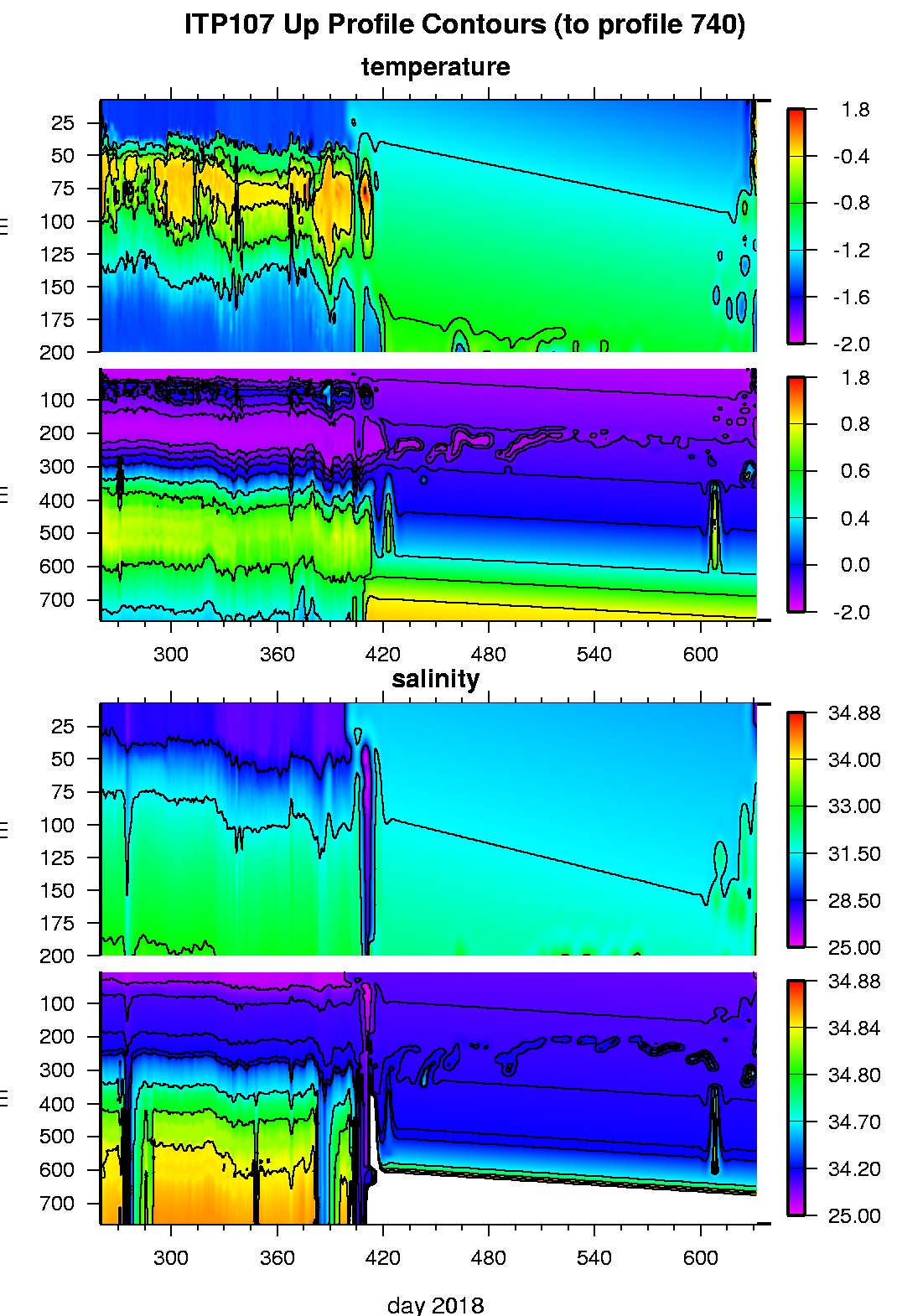
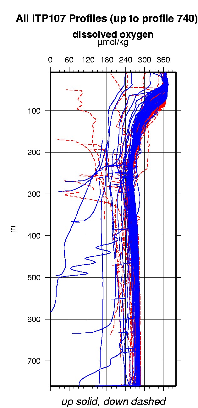
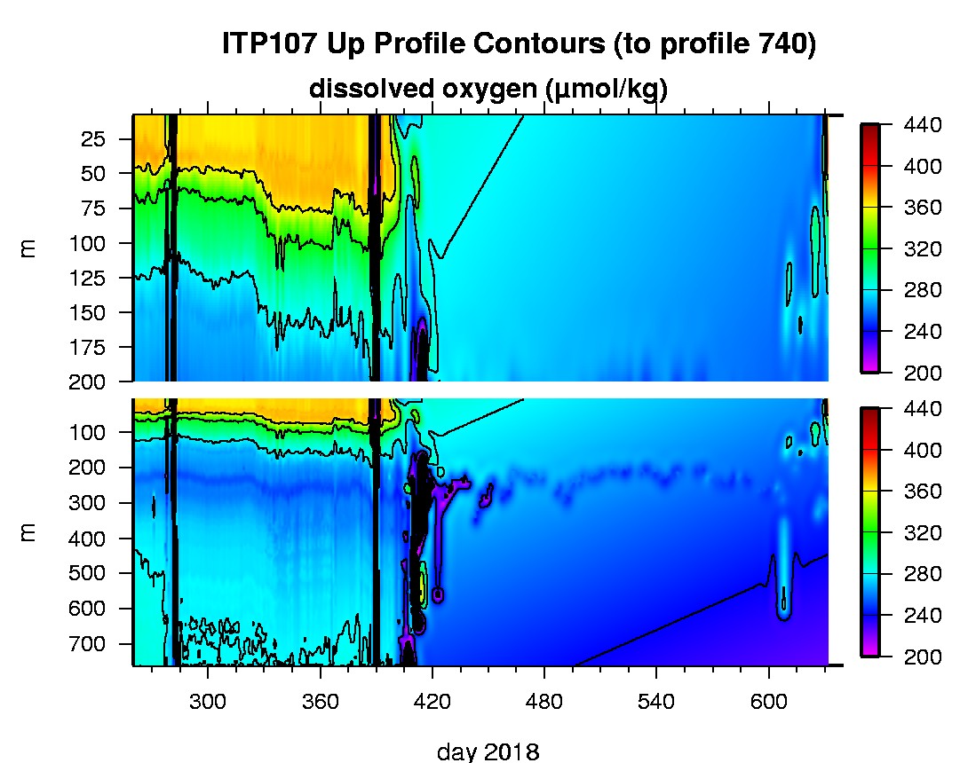
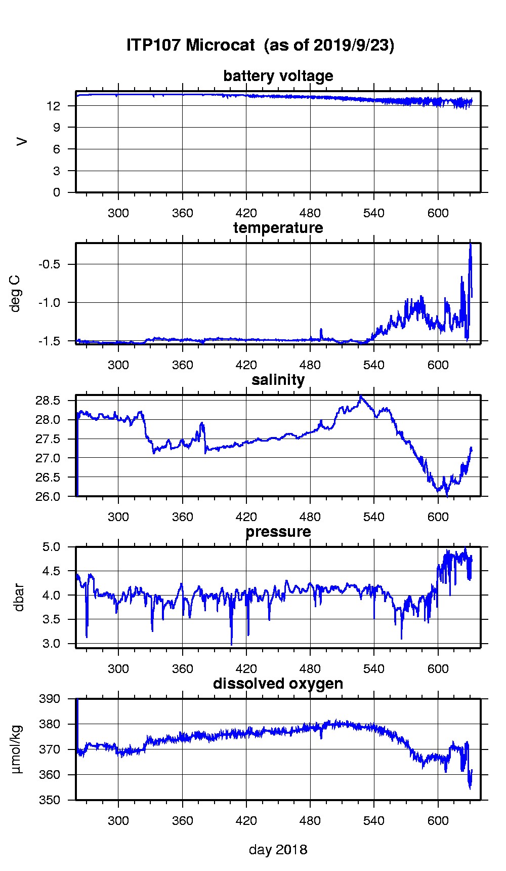
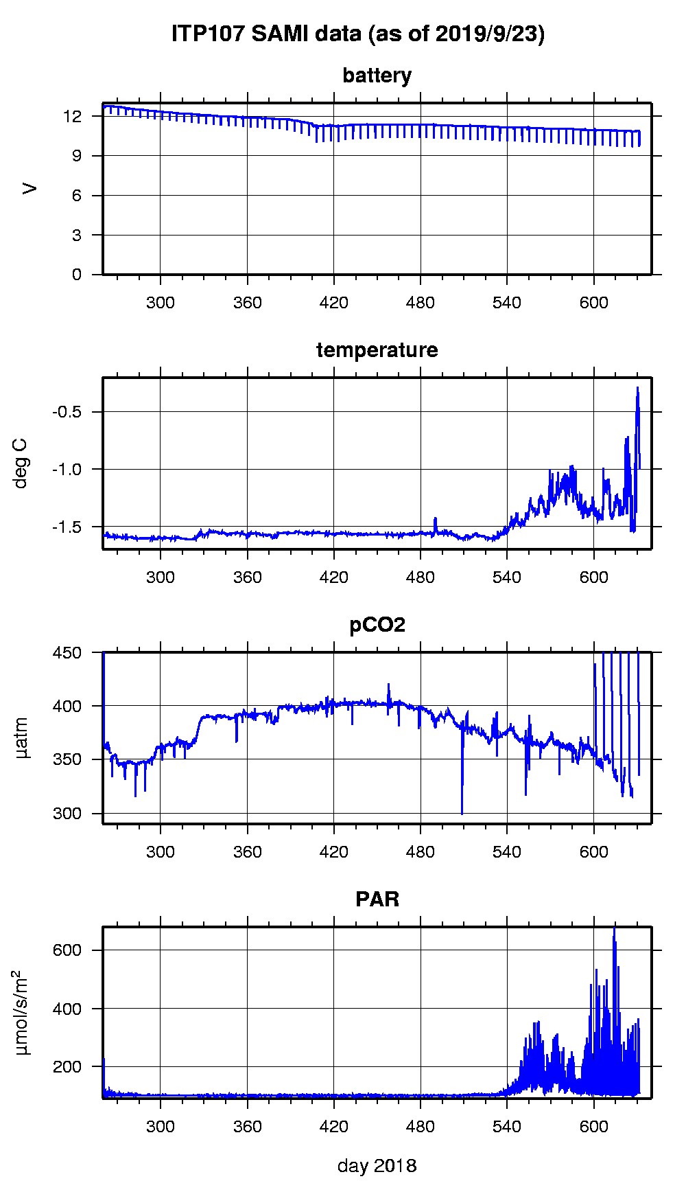
Last buoy status on 2019/9/23 200046 UTC : temperature = 1.5 °C, battery = 10.654 V Last position on 2019/9/23 200046 UTC : 77.9972° N, 150.2358° W Last profile (number 740) on 2019/9/23 602 UTC Last profile mean motor current = 181.356 mA, mean battery = 10.7608 V Last profile depth: minimum = 112.7671, maximum = 133.3831 m Last profile temperature: minimum = -1.1768, maximum = -1.1322 °C Last profile salinity: minimum = 32.3147, maximum = 32.5113 Last profile dissolved oxygen: minimum = 278.8239, maximum = 287.4689 μmol/kg Last Microcat sample (number 8908) on 2019/9/23 151603 UTC Last temperature = -0.9347 °C, salinity = 27.1752 Last Dissolved Oxygen = 362.1316 μmol/kg Last SAMI IMM transfer on 2019/9/23 160131 UTC Last SAMI pCO2 sample (number 18057) on 2019/9/23 151511 UTC Last pCO2 = 2612.5801 μatm The raw GPS buoy location data are available in an ASCII file: itp107rawlocs.dat Depth averaged profiler data files (with interpolated location) and time series SAMI data are available in two formats: ITP107 was deployed on a 0.8 m thick ice floe in the Beaufort Sea on September 17, 2018 at 76° 22.9 N, 137° 37.3 W as part of the Beaufort Gyre Observing System (BGOS) during the JOIS 2018 cruise on the CCGS Louis S. St. Laurent. On the same icefloe, a US Army Cold Regions Research and Engineering Laboratory (CRREL) Seasonal Ice Mass Balance Buoy 3 was also installed. The ITP includes a dissolved oxygen sensor and is operating on a standard sampling schedule of 2 one-way profiles between 7 and 760 m depth each day and includes a fixed SAMI PCO2 with PAR and SBE-37 microcat with dissolved oxygen at 6 m depth.
|