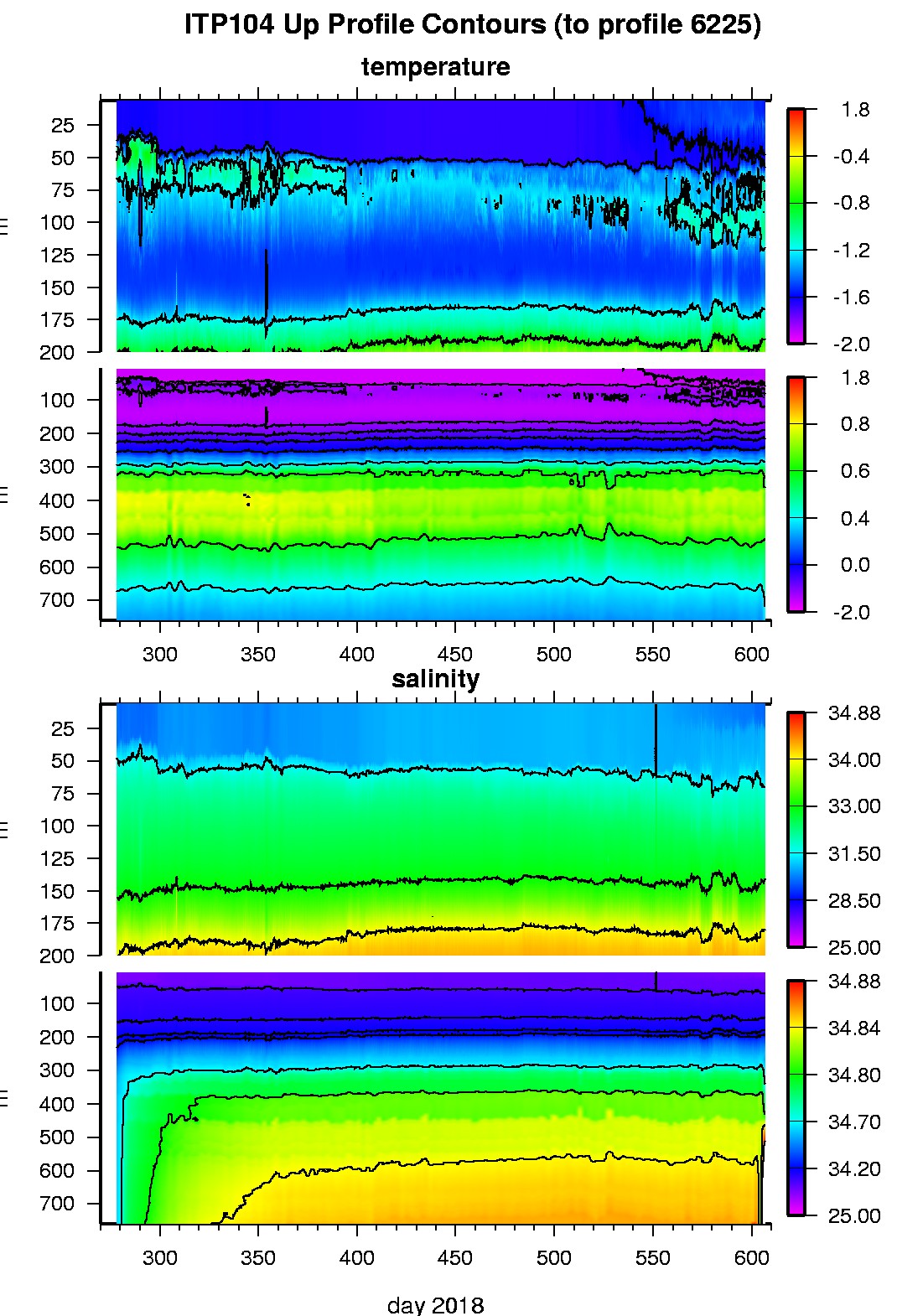
Ice Tethered Profiler 104 Data Data from ITP104 deployed in October 2018
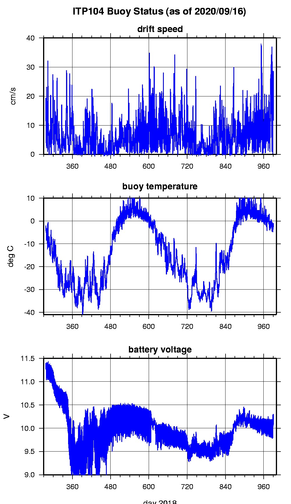
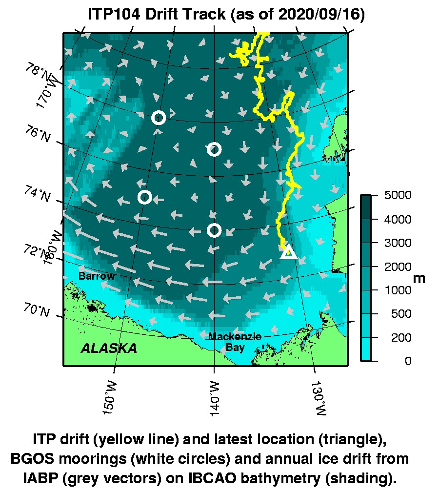
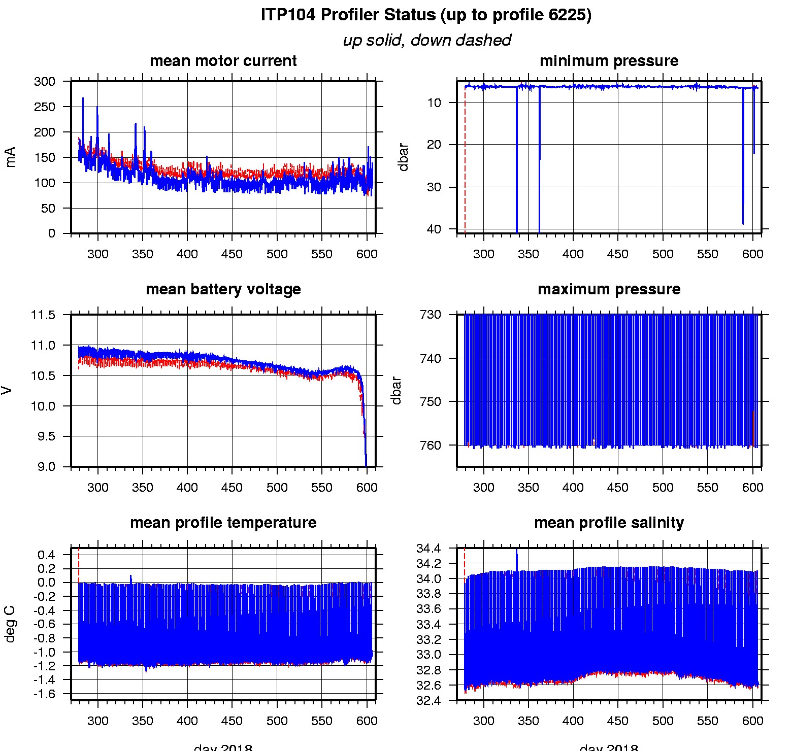
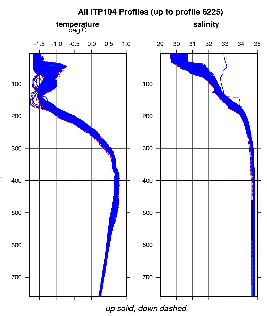
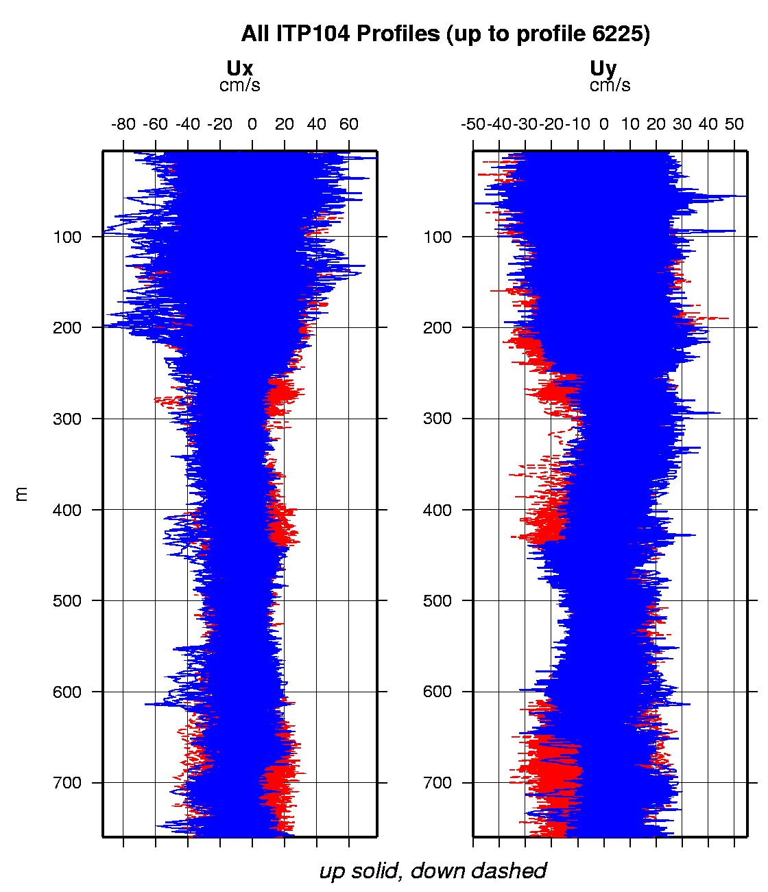
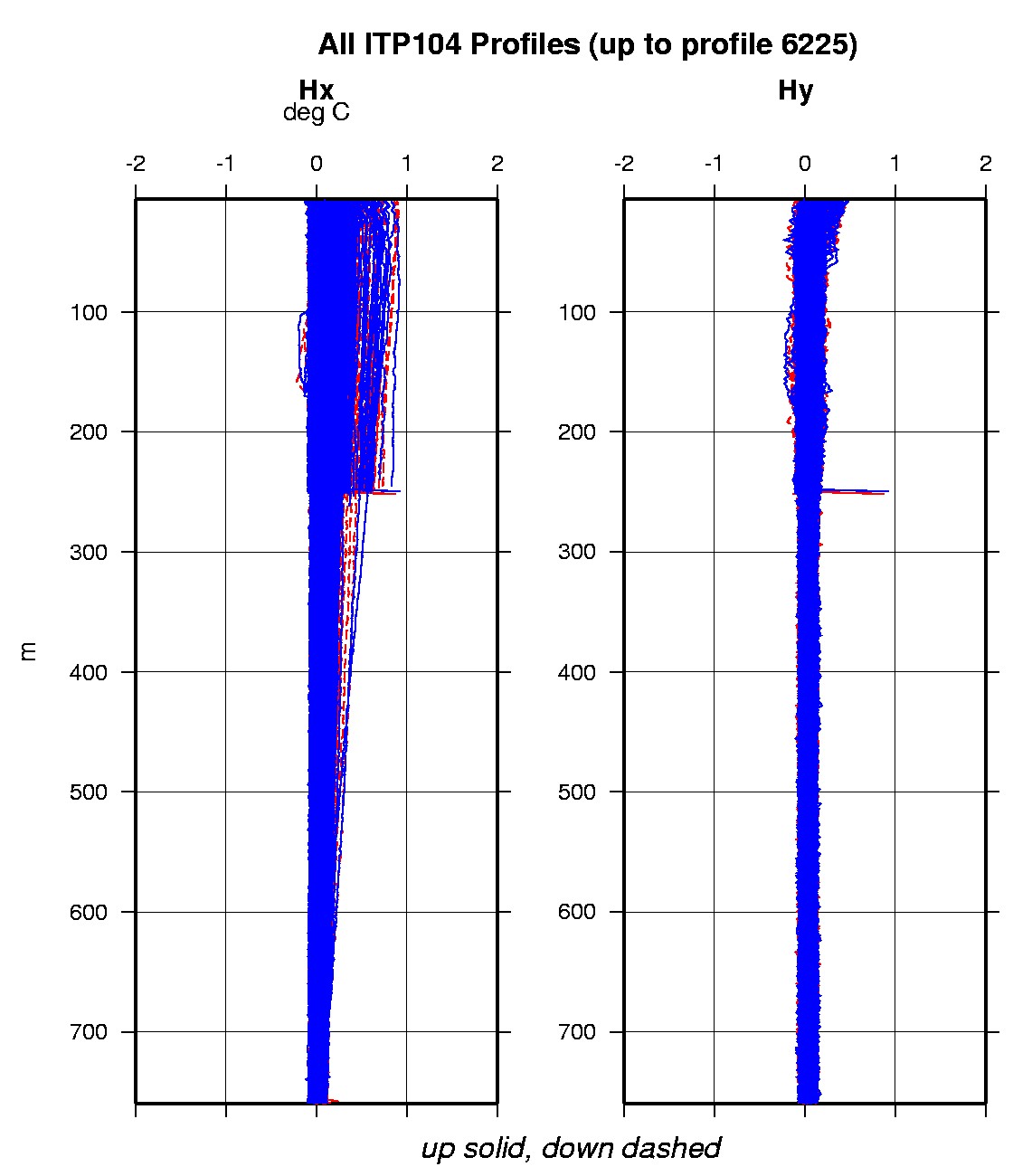
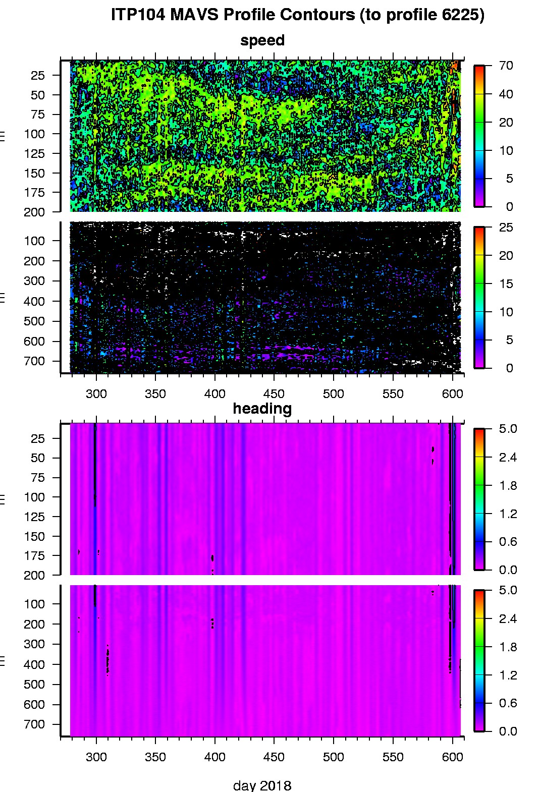
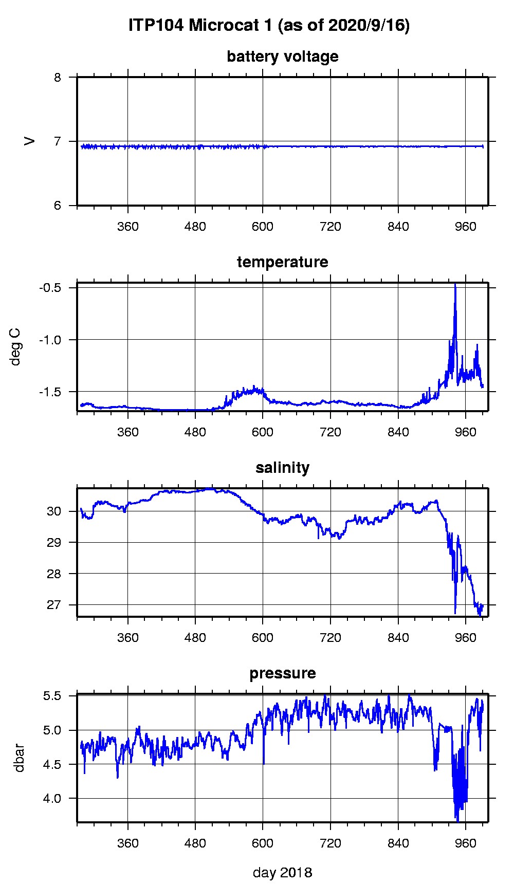
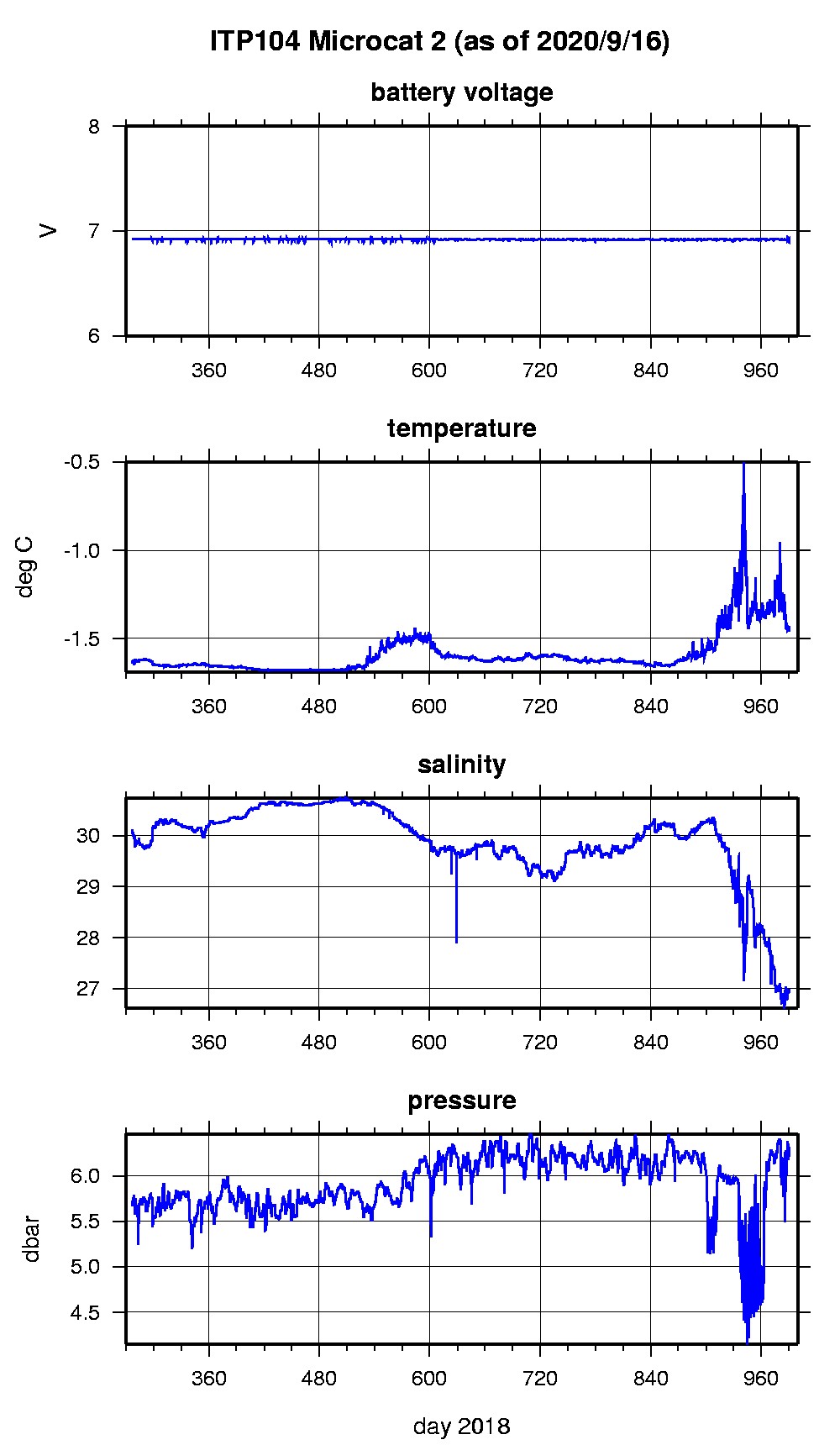
Last buoy status on 2020/9/16 200016 UTC : temperature = -1.125 °C, battery = 10.11 V Last position on 2020/9/16 200016 UTC : 72.9169° N, 130.6448° W Last profile (number 6225) on 2019/8/29 1332 UTC Last profile mean motor current = 0 mA, mean battery = 8.4874 V Last profile depth: minimum = 6.5444, maximum = 6.5444 m Last profile temperature: minimum = -1.5667, maximum = -1.5667 °C Last profile salinity: minimum = 29.6906, maximum = 29.6906 Last Microcat 1 sample (number 70188) on 2020/9/16 200001 UTC Last battery = 6.92 V, depth = 5.328 dbar, temperature = -1.4564 °C, salinity = 26.9262 Last Microcat 2 sample (number 70188) on 2020/9/16 200001 UTC Last battery = 6.92 V, depth = 6.256 dbar, temperature = -1.4568 °C, salinity = 26.9248 The raw GPS buoy location data are available in an ASCII file: itp104rawlocs.dat Depth averaged profiler data files (with interpolated location) and time series microcat data are available in two formats: ITP104 was deployed on a 1.5 m thick ice floe in the Beaufort Sea on October 3, 2018 at 80° 31.9 N, 136° 39.0 W as part of the Stratified Ocean Dynamics of the Arctic (SODA) project from the USCGC Healy. On the same icefloe, a Naval Postgraduate School Arctic Ocean Flux Buoy (AOFB), and ice mass balance buoy were also installed. The ITP includes a second generation prototype MAVS current sensor operating on a pattern profiling schedule including 2 one-way profiles between 7 and 760 m depth each day and SBE-37 microcats fixed at 5m and 6 m depths.
|