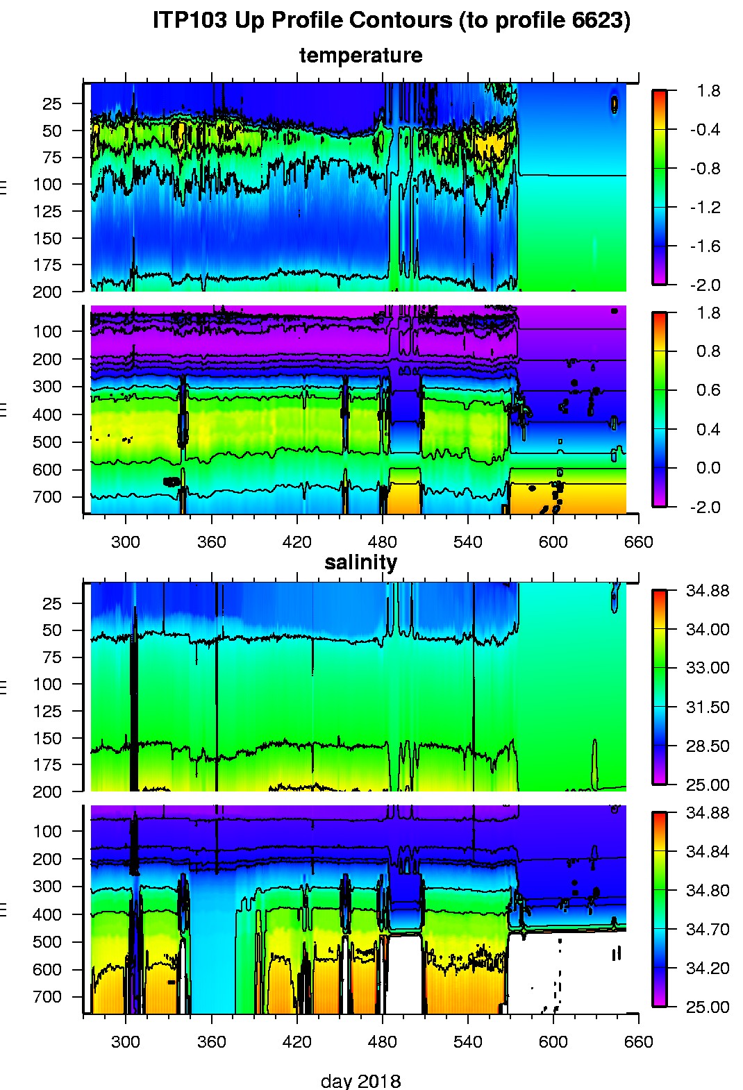
Ice Tethered Profiler 103 Data Data from ITP103 deployed in October 2018
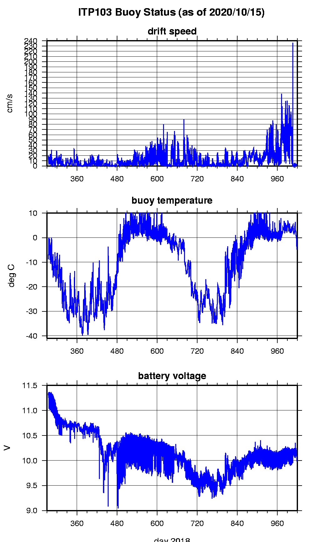
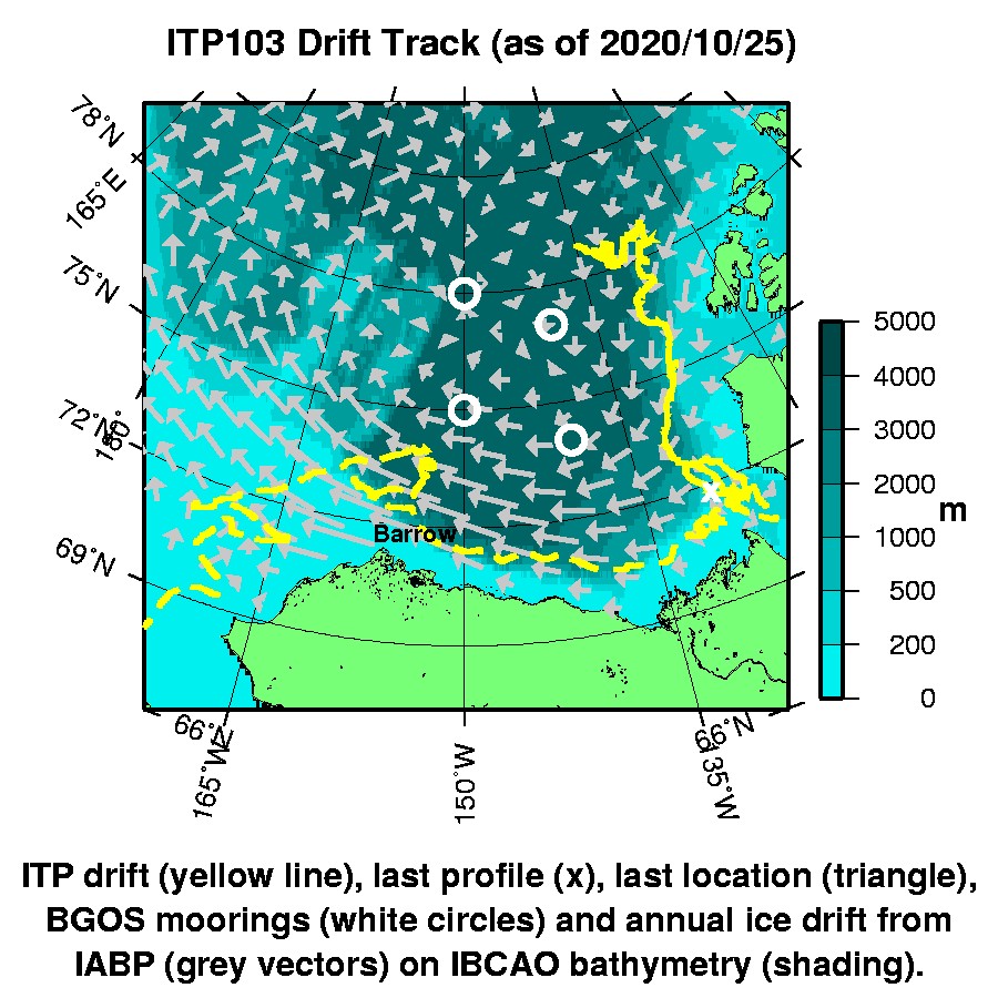
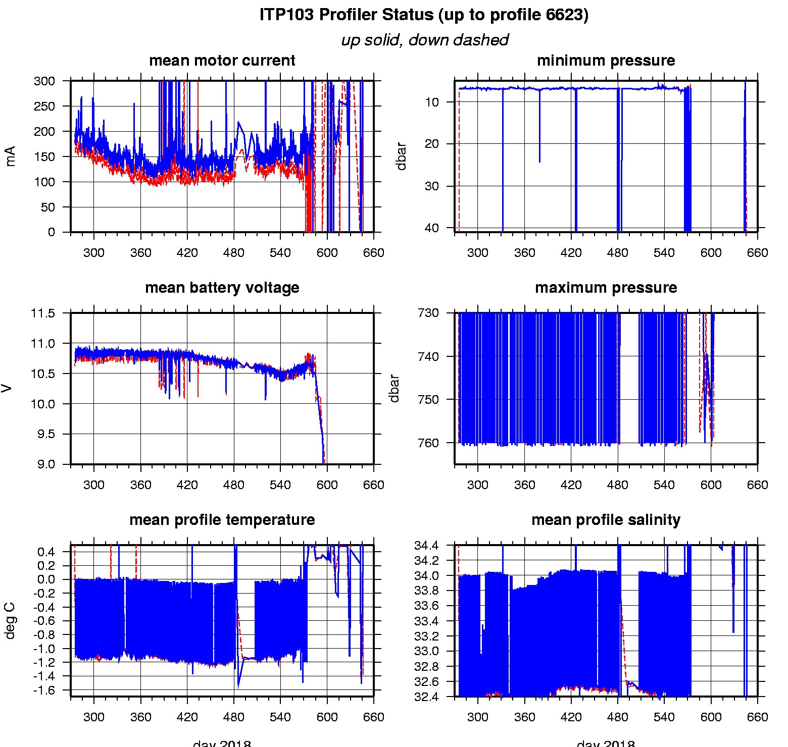
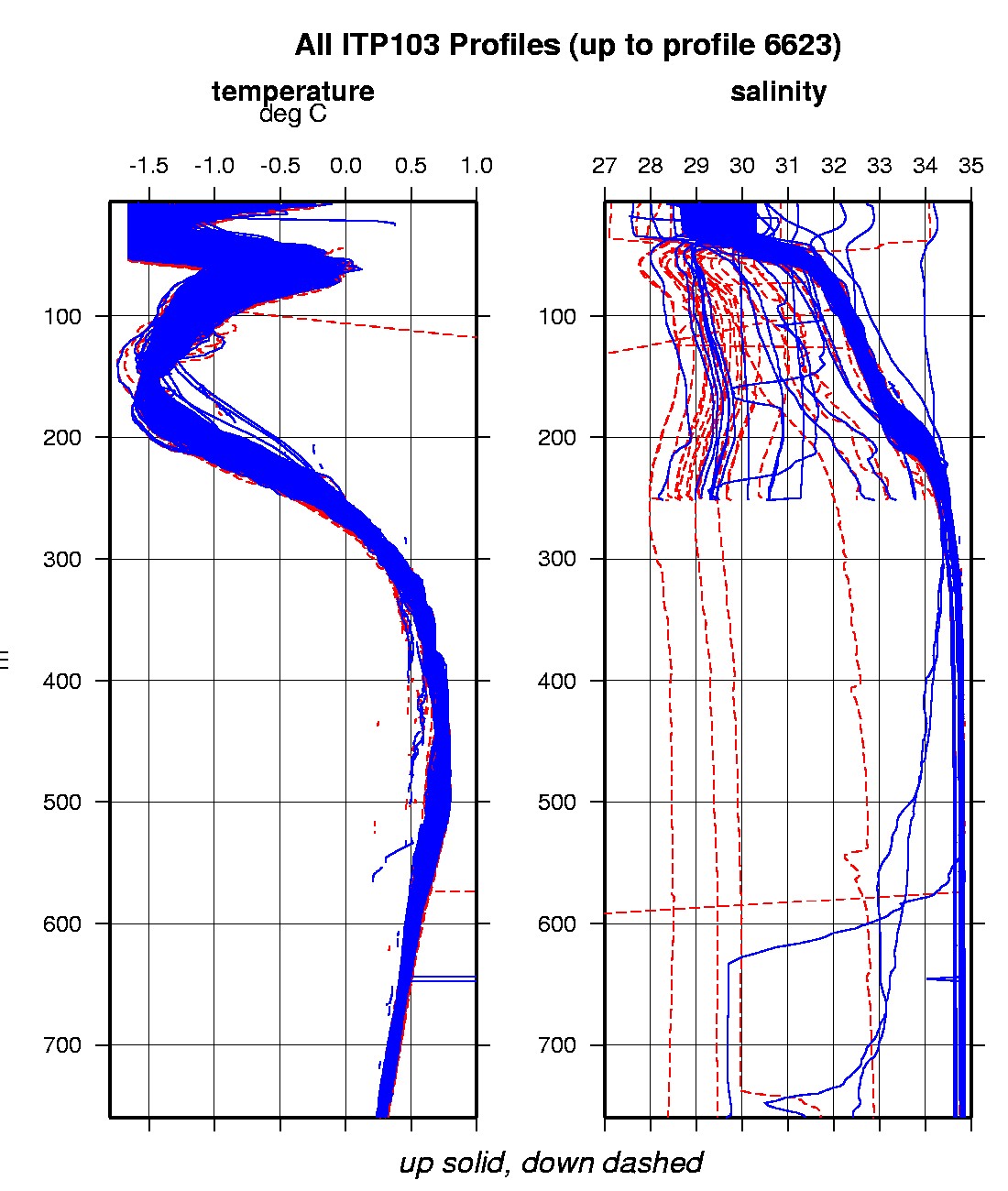
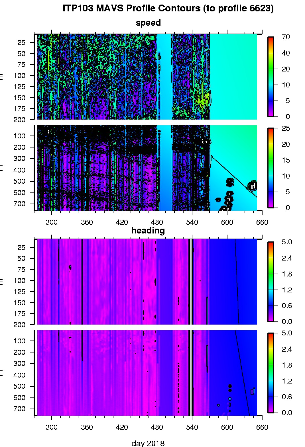
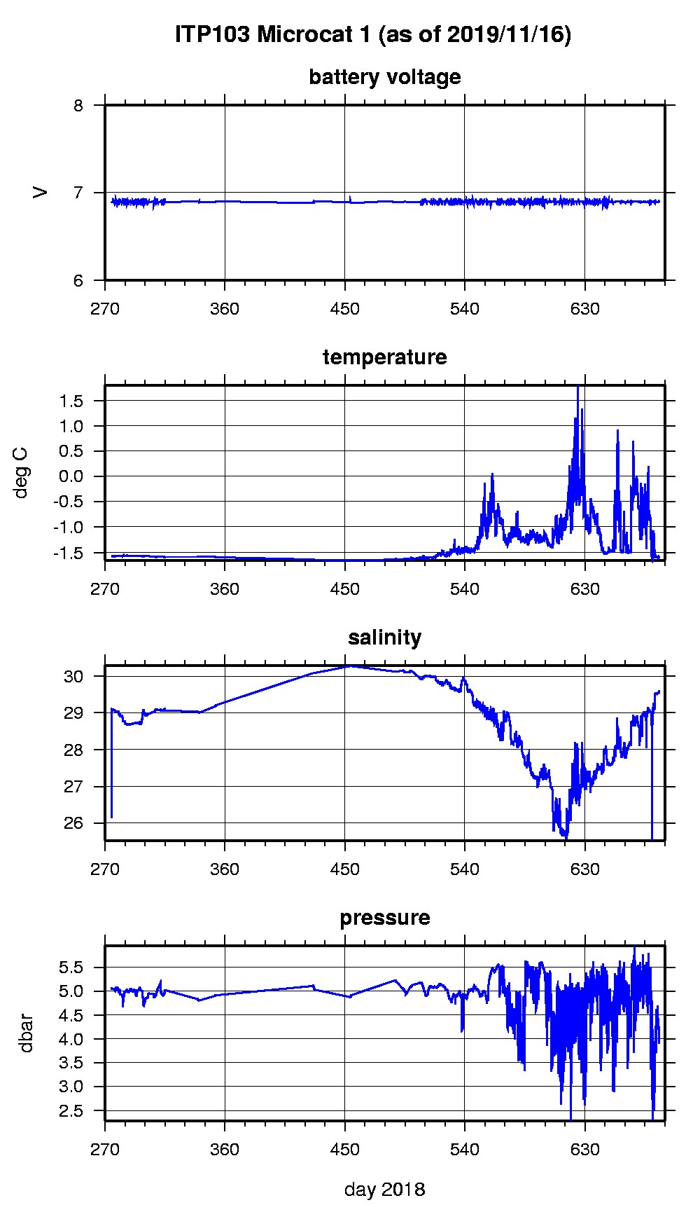
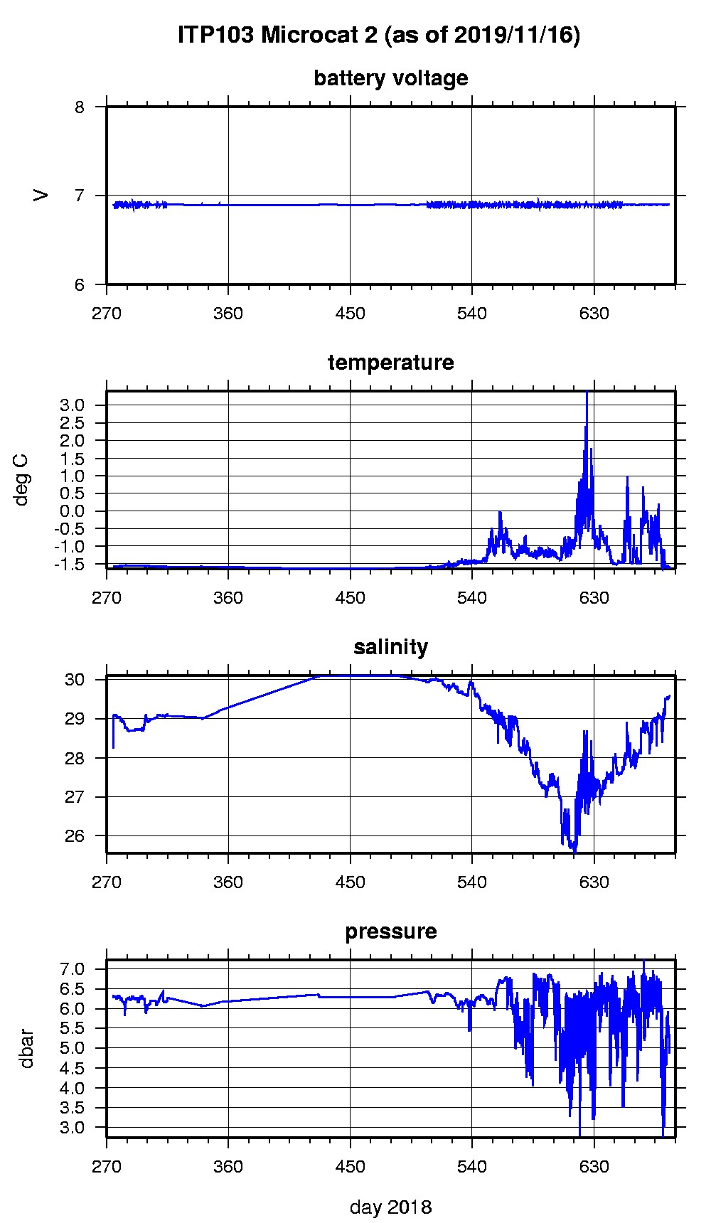
Last buoy status on 2020/10/25 226 UTC : temperature = 0.75 °C, battery = 10.096 V Last position on 2020/10/25 226 UTC : 65.587° N, 170.9908° W Last profile (number 6623) on 2019/10/12 2307 UTC Last profile mean motor current = 417.4411 mA, mean battery = 8.2821 V Last profile depth: minimum = 27.3811, maximum = 27.3811 m Last profile temperature: minimum = 0.70448, maximum = 0.70448 °C Last profile salinity: minimum = 30.1782, maximum = 30.1782 Last Microcat 1 sample (number 40922) on 2019/11/16 231501 UTC Last battery = 6.89 V, depth = 4.078 dbar, temperature = -1.6104 °C, salinity = 29.5643 Last Microcat 2 sample (number 40922) on 2019/11/16 231501 UTC Last battery = 6.9 V, depth = 5.102 dbar, temperature = -1.6077 °C, salinity = 29.5631 The raw GPS buoy location data are available in an ASCII file: itp103rawlocs.dat Depth averaged profiler data files (with interpolated location) and time series microcat data are available in two formats: ITP103 was deployed on a 2.2 m thick ice floe in the Beaufort Sea on October 1, 2018 at 78° 53.3 N, 134° 52.4 W as part of the Stratified Ocean Dynamics of the Arctic (SODA) project from the USCGC Healy. On the same icefloe, a Naval Postgraduate School Arctic Ocean Flux Buoy (AOFB), and ice mass balance buoy were also installed. The ITP includes a second generation prototype MAVS current sensor operating on a pattern profiling schedule including 2 one-way profiles between 7 and 760 m depth each day and SBE-37 microcats fixed at 5m and 6 m depths.
|