Ice Tethered Profiler 101 Data Data from ITP101 deployed in September 2017
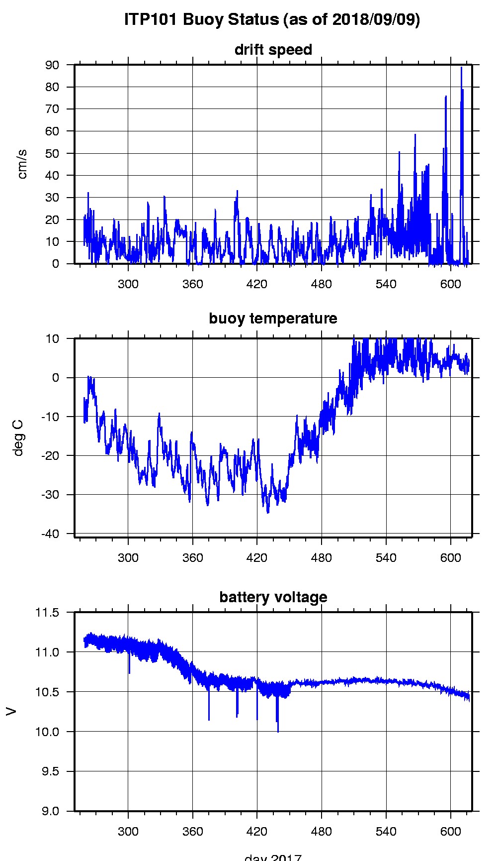
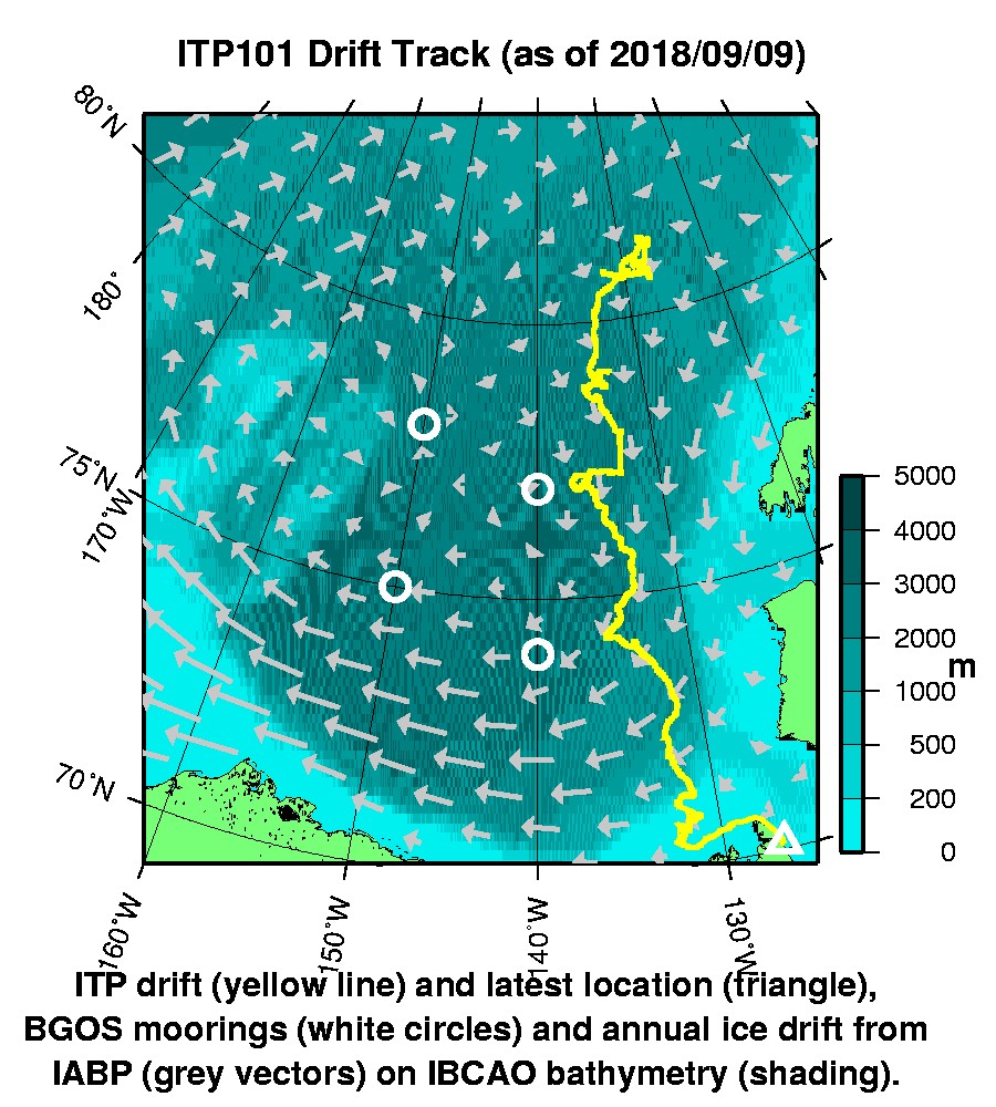
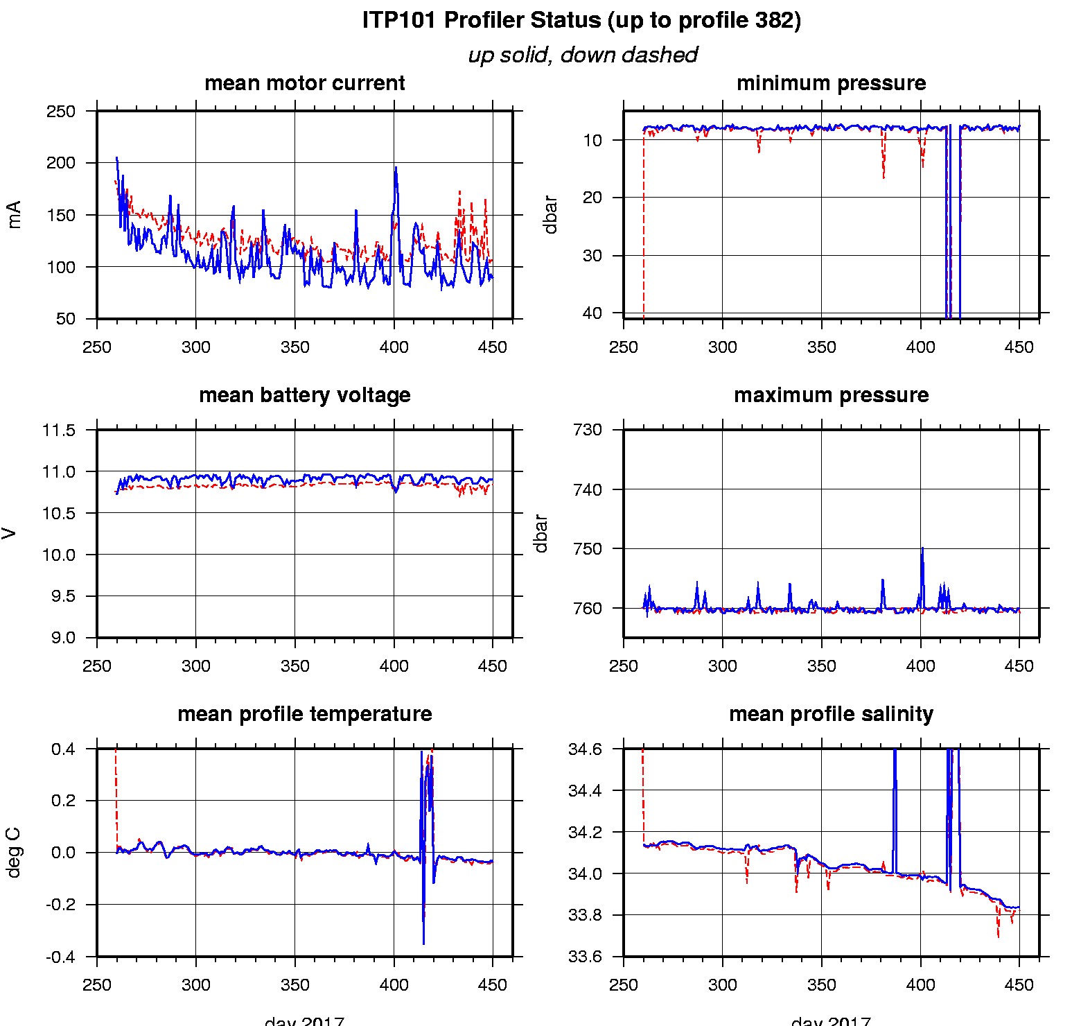
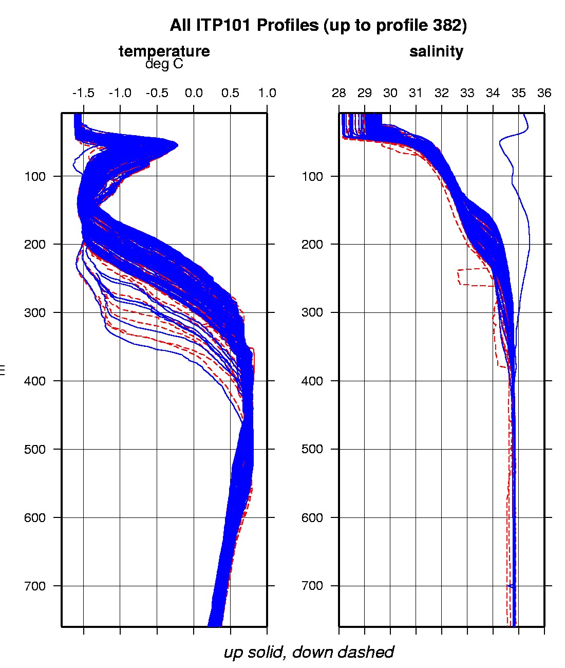
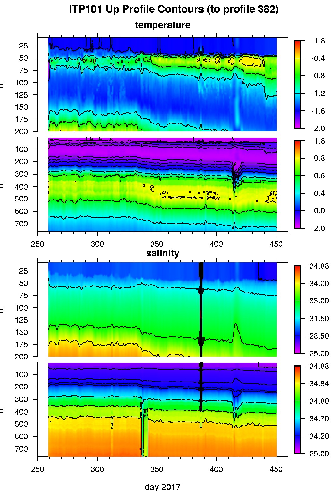
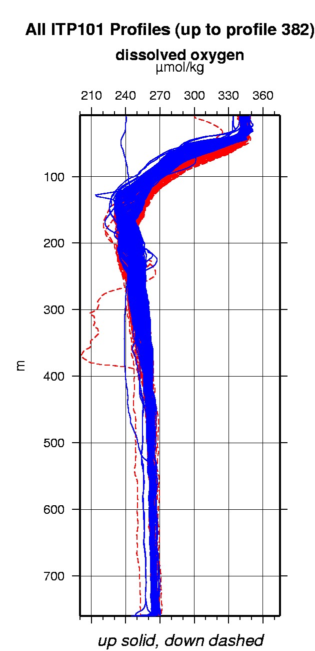
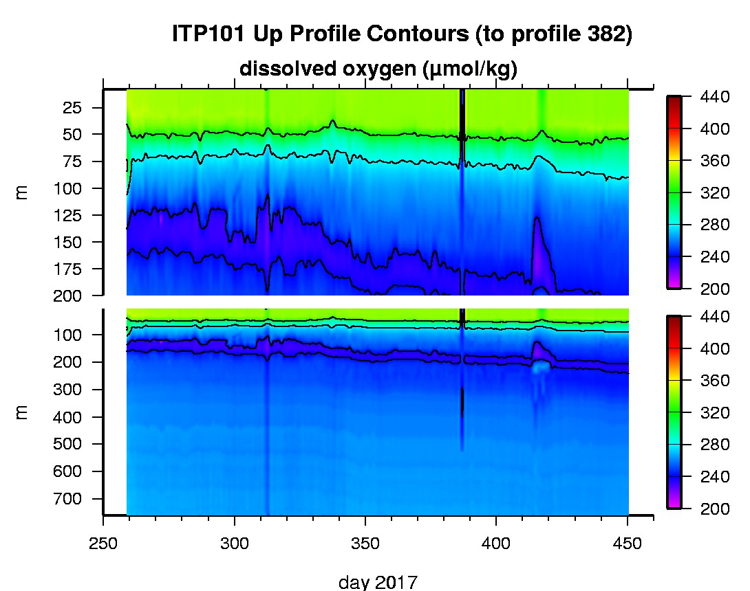
Last buoy status on 2018/9/9 70303 UTC : temperature = 2.875 °C, battery = 10.433 V Last position on 2018/9/9 70303 UTC : 70.0993° N, 126.9255° W Last profile (number 382) on 2018/3/26 602 UTC Last profile mean motor current = 104.5486 mA, mean battery = 10.8407 V Last profile depth: minimum = 7.4983, maximum = 760.8962 m Last profile temperature: minimum = -1.5368, maximum = 0.80927 °C Last profile salinity: minimum = 28.1626, maximum = 34.8602 Last profile dissolved oxygen: minimum = 235.1014, maximum = 341.9291 μmol/kg The raw GPS buoy location data are available in an ASCII file: itp101rawlocs.dat Depth averaged profiler data files (with interpolated location) are available in two formats: ITP101 was deployed on a 1.25 m thick ice floe in the Beaufort Sea on September 15, 2017 at 80° 53.8 N, 132° 23.0 W as part of the Beaufort Gyre Observing System (BGOS) during the JOIS 2017 cruise on the CCGS Louis S. St. Laurent. On the same icefloe, a US Army Cold Regions Research and Engineering Laboratory (CRREL) Seasonal Ice Mass Balance Buoy 3 was also installed. The ITP includes a dissolved oxygen sensor and is operating on a standard sampling schedule of 2 one-way profiles between 7 and 760 m depth each day.
|