Ice Tethered Profiler 100 Data Data from ITP100 to be deployed in September 2017
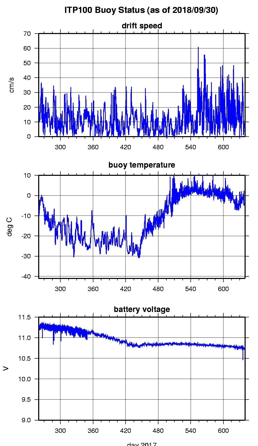
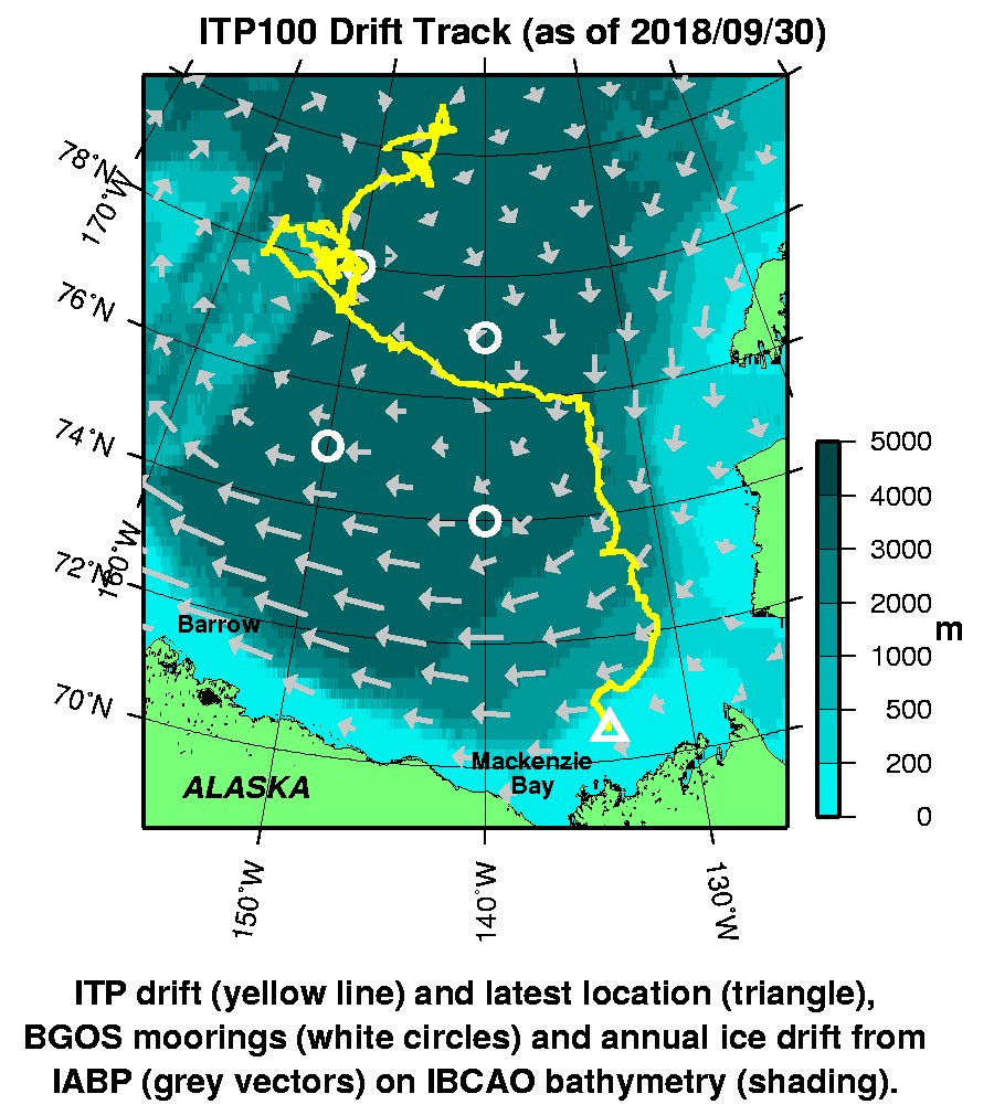
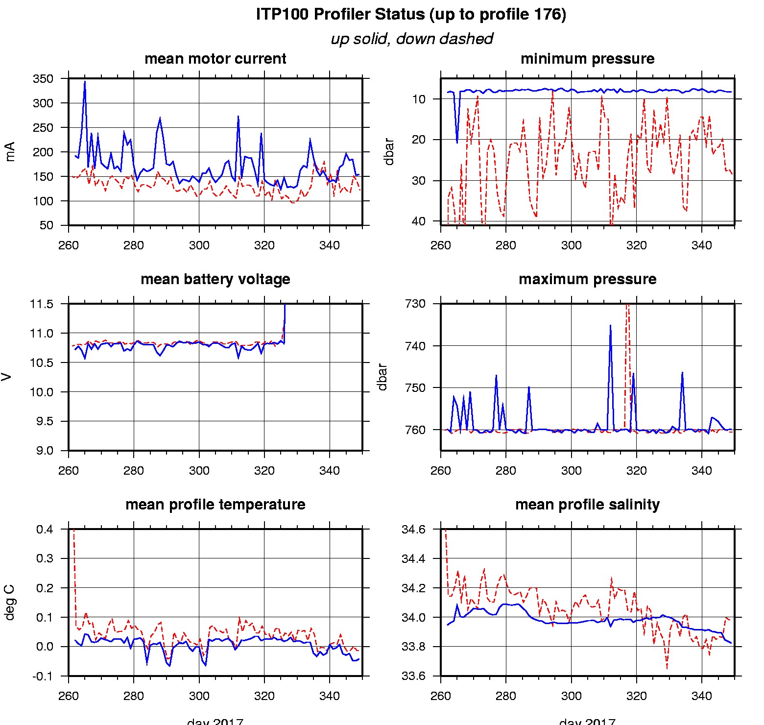
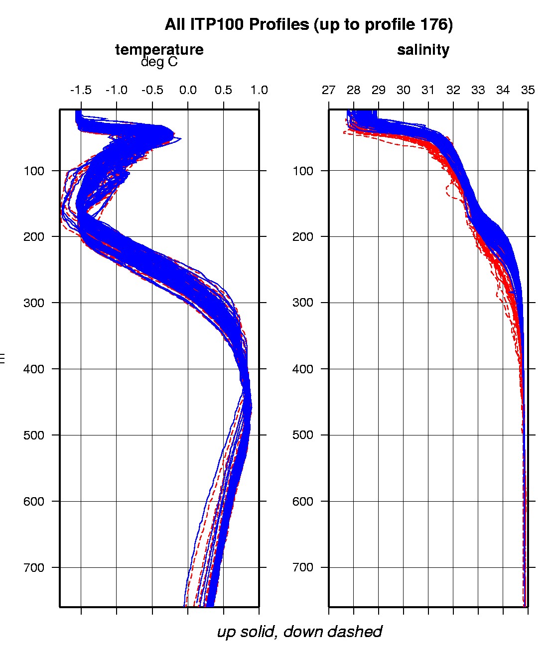
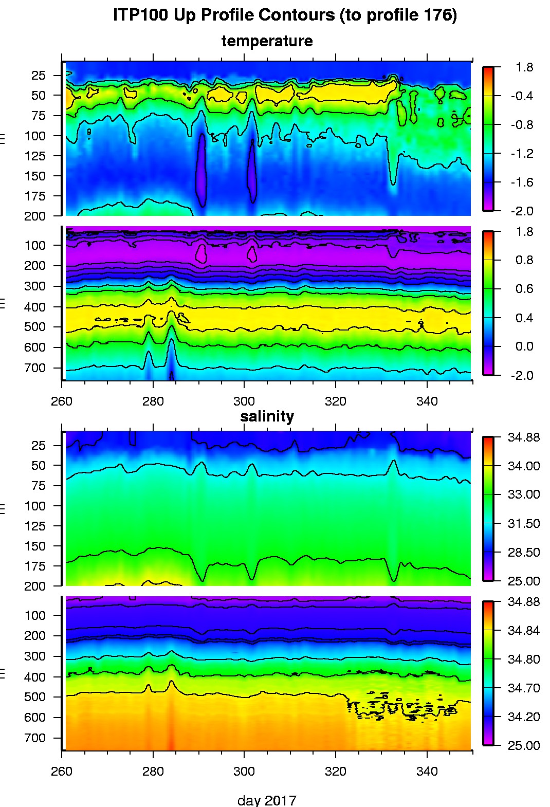
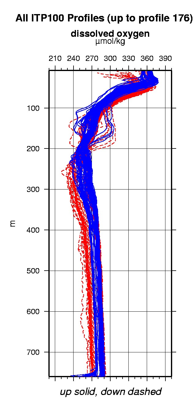
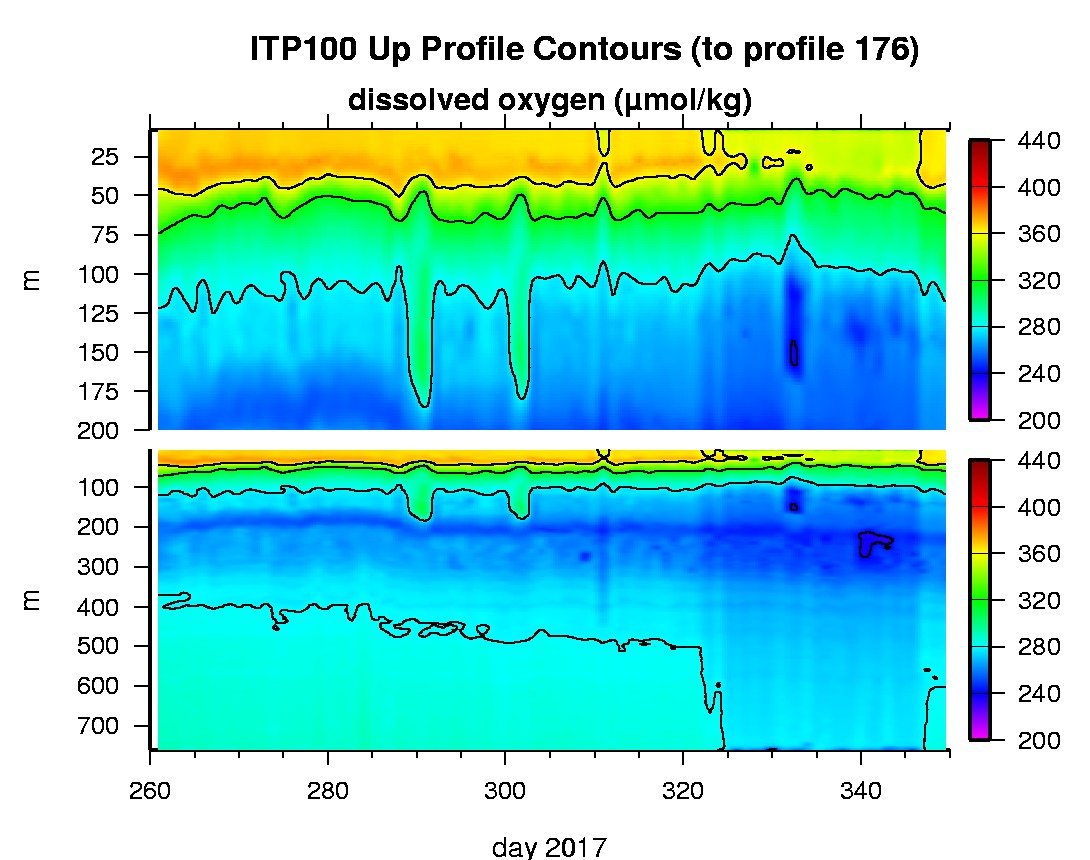
Last buoy status on 2018/9/30 73132 UTC : temperature = -4.5 °C, battery = 10.733 V Last position on 2018/9/30 73132 UTC : 70.4916° N, 133.9713° W Last profile (number 176) on 2017/12/15 602 UTC Last profile mean motor current = 121.2648 mA, mean battery = 13.4047 V Last profile depth: minimum = 28.5531, maximum = 760.6036 m Last profile temperature: minimum = -1.5178, maximum = 0.84775 °C Last profile salinity: minimum = 27.7632, maximum = 34.8562 Last profile dissolved oxygen: minimum = 251.8393, maximum = 362.9575 μmol/kg The raw GPS buoy location data are available in an ASCII file: itp100rawlocs.dat Depth averaged profiler data files (with interpolated location) are available in two formats: ITP100 was deployed in open water in the Beaufort Sea on September 17, 2017 at 79° 59.1 N, 149° 43.5 W as part of the Beaufort Gyre Observing System (BGOS) during the JOIS 2017 cruise on the CCGS Louis S. St. Laurent. The ITP includes a dissolved oxygen sensor and is operating on a standard sampling schedule of 2 one-way profiles between 7 and 760 m depth each day.
|