Ice Tethered Micro 2 Data Data from ITM2 deployed in August 2012
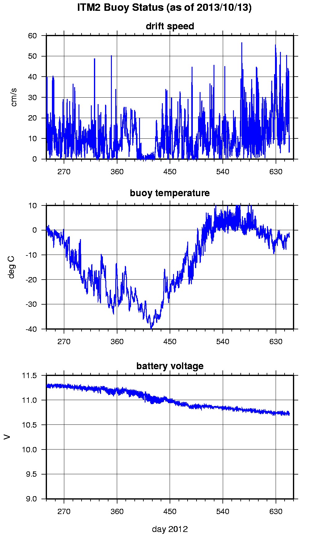
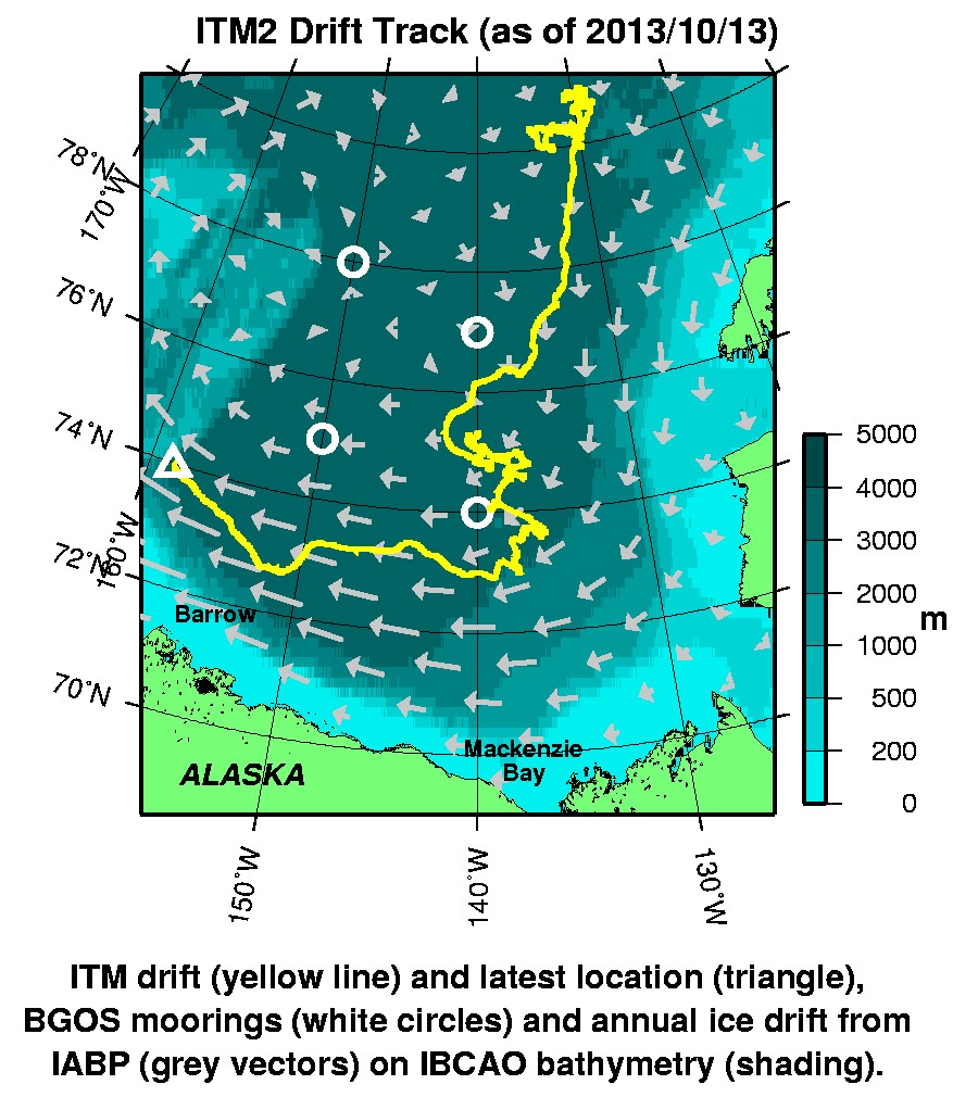
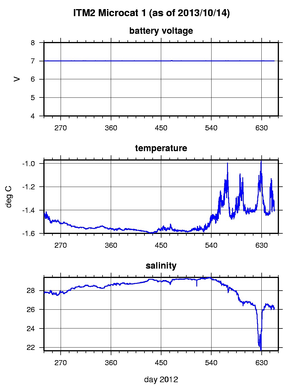
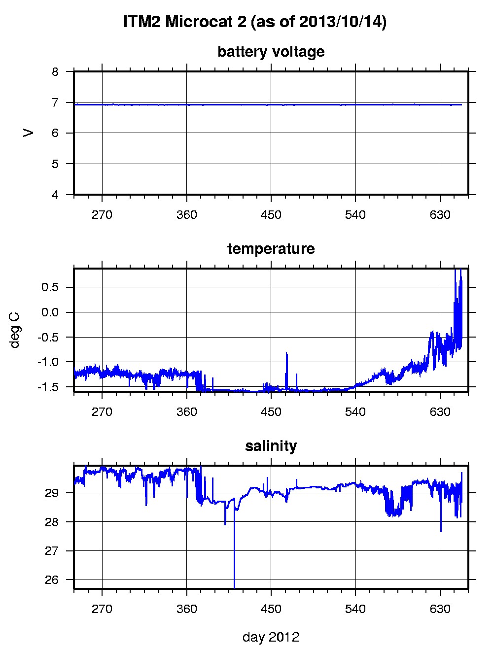
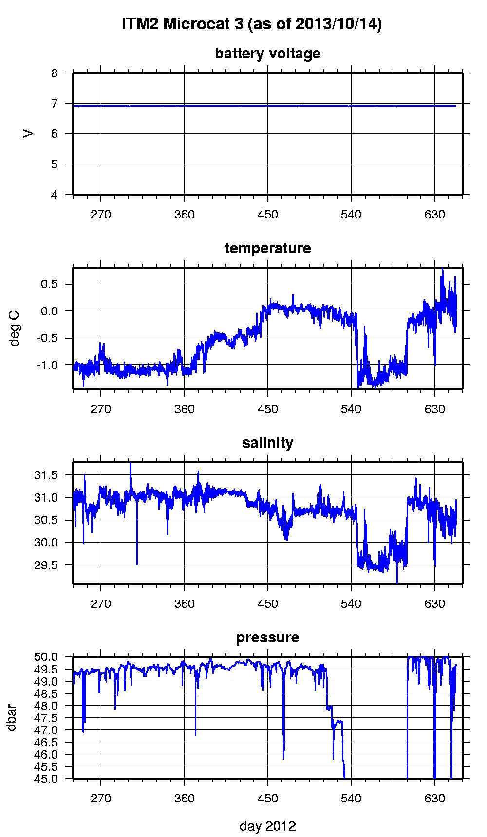
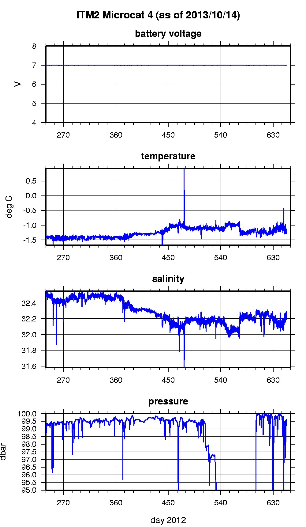
Last buoy status on 2013/10/13 233008 UTC : temperature = -2.58 °C, battery = 10.73 V Last position on 2013/10/13 233008 UTC : 73.9495° N, 158.5774° W Last Microcat 1 sample (number 39638) on 2013/10/14 0 UTC Last battery = 7.01 V, temperature = -1.396 °C, salinity = 26.1713 Last Microcat 2 sample (number 39637) on 2013/10/14 0 UTC Last battery = 6.92 V, temperature = 0.026 °C, salinity = 28.9887 Last Microcat 3 sample (number 39637) on 2013/10/14 0 UTC Last battery = 6.92 V, depth = 49.6317 dbar, temperature = -0.0818 °C, salinity = 30.4647 Last Microcat 4 sample (number 39637) on 2013/10/14 0 UTC Last battery = 7 V, depth = 99.5966 dbar, temperature = -1.2357 °C, salinity = 32.2538 The raw GPS buoy location data are available in an ASCII file: itm2rawlocs.dat Time series microcat data files are available in two formats: ITM2 was deployed in open water in the Beaufort Sea on August 27, 2012 at 80° 12.7 N, 130° 2.3 W as part of the Beaufort Gyre Observing System (BGOS) during the JOIS 2010 cruise on the CCGS Louis S. St. Laurent. On the same icefloe, an Ice-Tethered Profiler (66) , a US Army Cold Regions Research and Engineering Laboratory (CRREL) Ice Mass Balance Buoy (IMB), an autonomous atmospheric chemistry buoy (O-Buoy) were also installed. The ITM includes fixed SBE-37 microcats at 5, 30, 50, and 100 m depths sampling at 15 minute intervals.
|