Ice Tethered Micro 1 Data Data from ITM1 deployed in August 2012
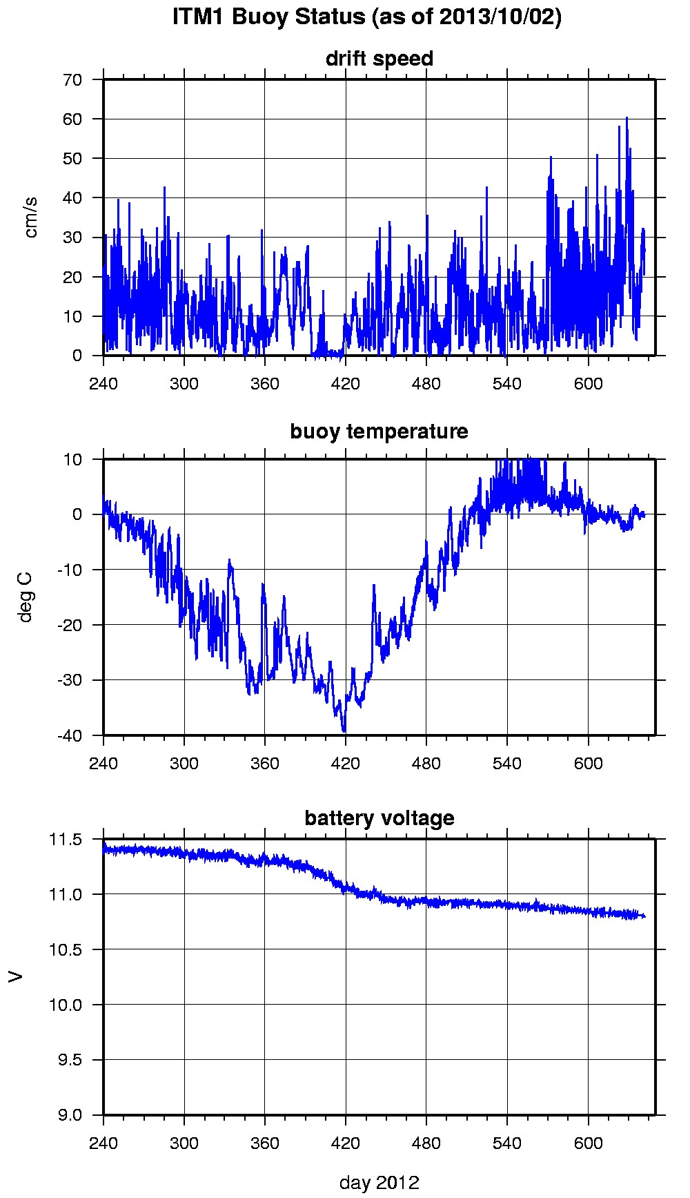
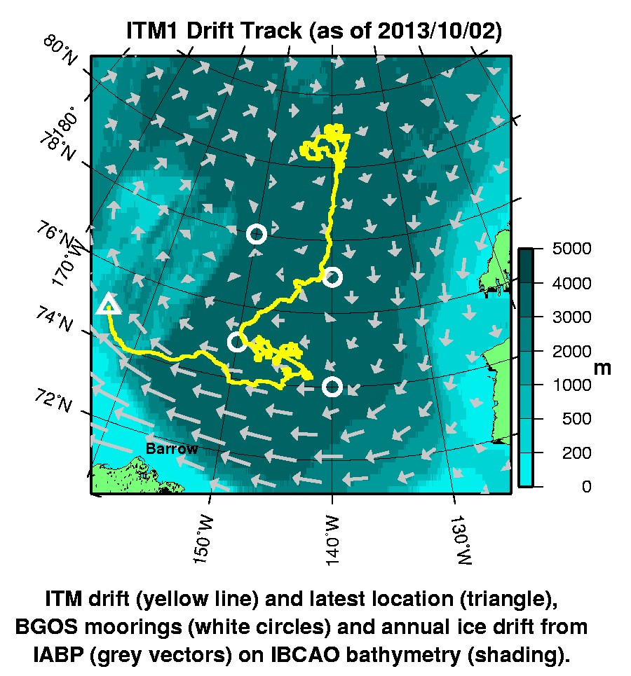
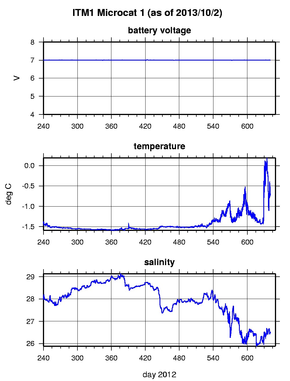
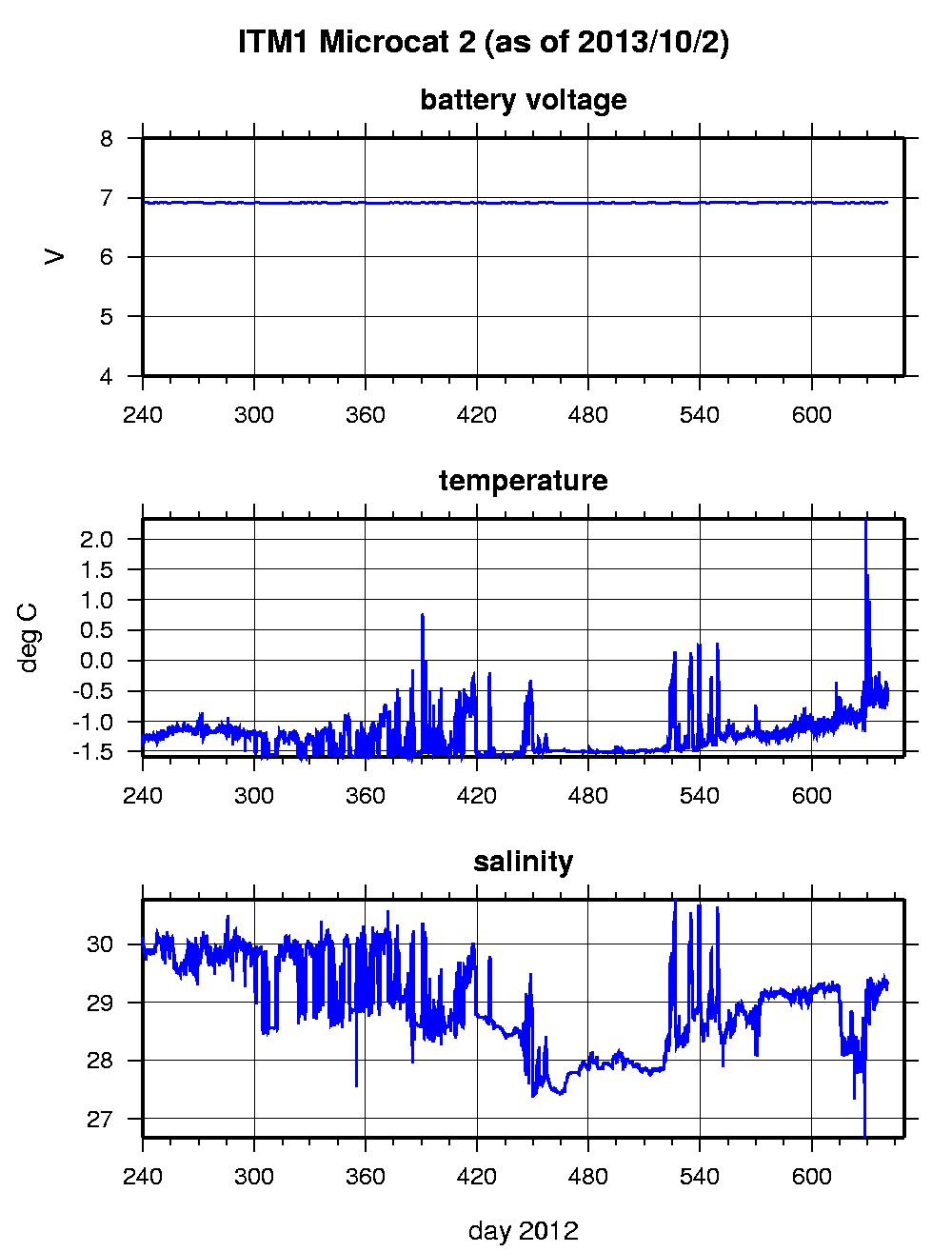
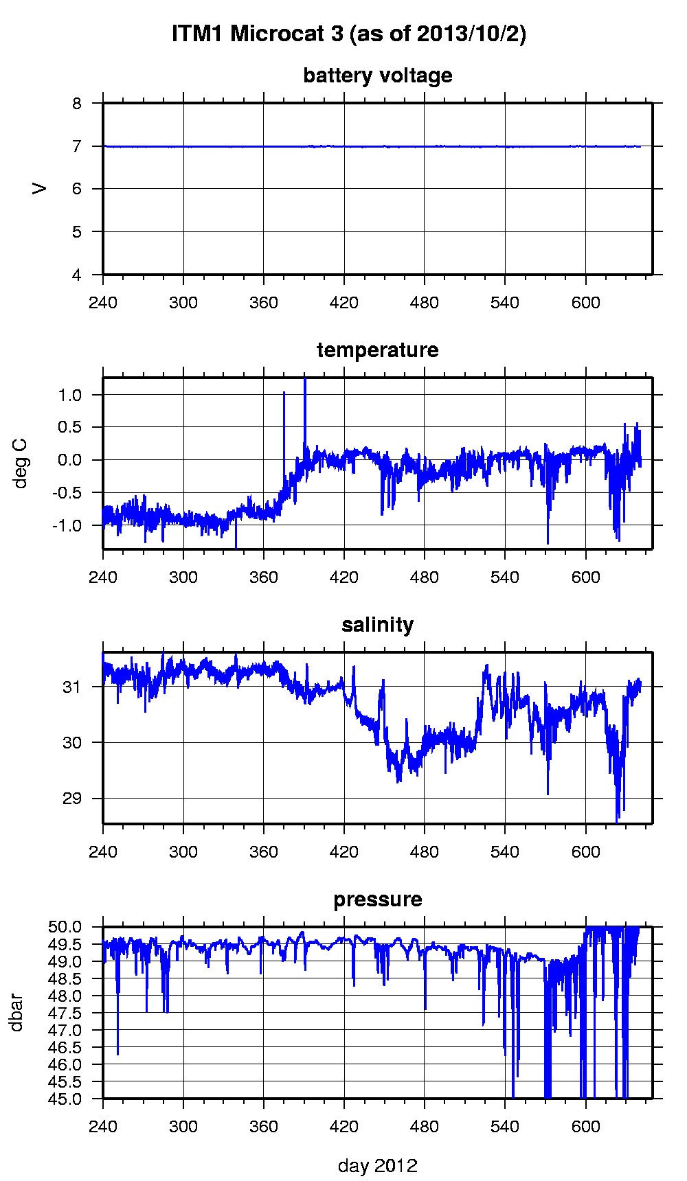
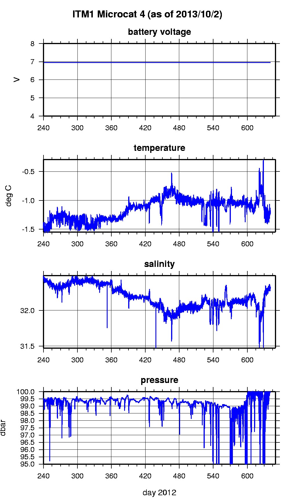
Last buoy status on 2013/10/2 233159 UTC : temperature = 0.08 °C, battery = 10.79 V Last position on 2013/10/2 233200 UTC : 74.8911° N, 164.0465° W Last Microcat 1 sample (number 38604) on 2013/10/2 0 UTC Last battery = 7 V, temperature = -0.6979 °C, salinity = 26.5196 Last Microcat 2 sample (number 38604) on 2013/10/2 0 UTC Last battery = 6.91 V, temperature = -0.451 °C, salinity = 29.3451 Last Microcat 3 sample (number 38604) on 2013/10/2 0 UTC Last battery = 6.98 V, depth = 50.3205 dbar, temperature = 0.0506 °C, salinity = 31.0828 Last Microcat 4 sample (number 38604) on 2013/10/2 0 UTC Last battery = 6.96 V, depth = 100.2674 dbar, temperature = -1.1758 °C, salinity = 32.316 The raw GPS buoy location data are available in an ASCII file: itm1rawlocs.dat Time series microcat data files are available in two formats: ITM1 was deployed on a 1.5 m thick ice floe in the Beaufort Sea on August 27, 2012 at 80° 53.4 N, 137° 25.8 W as part of the Beaufort Gyre Observing System (BGOS) during the JOIS 2012 cruise on the CCGS Louis S. St. Laurent. On the same icefloe, an Ice-Tethered Profiler (65) , a US Army Cold Regions Research and Engineering Laboratory (CRREL) Ice Mass Balance Buoy (IMB), an autonomous atmospheric chemistry buoy (O-Buoy) were also installed. The ITM includes fixed SBE-37 microcats at 5, 30, 50, and 100 m depths sampling at 15 minute intervals.
|