Data from TOP21
Last surface buoy status
| Time (UTC) |
2026-07-26 00:30:15 |
| Latitude |
74.34451 |
| Longitude |
-147.24521 |
| temperature (deg C) |
1.5625 |
| battery voltage |
10.549 |
Last profile statistics
| Last profile number |
1569 |
| Profile Time (UTC) |
2026-07-26 00:00:27 |
| mean motor current (mA) |
158.270 |
| mean battery voltage |
10.090 |
| minimum pressure (dbar) |
-0.330 |
| maximum pressure (dbar) |
296.590 |
| minimum temperature (C) |
-1.437 |
| maximum temperature (C) |
0.676 |
| minimum salinity (PSU) |
26.513 |
| maximum salinity (PSU) |
34.490 |
| minimum oxygen (μmol/kg) |
N/A |
| maximum oxygen (μmol/kg) |
N/A |
Description
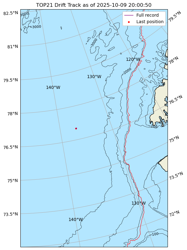
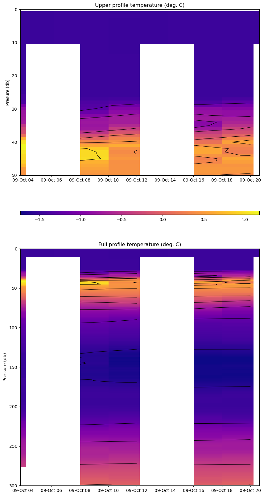
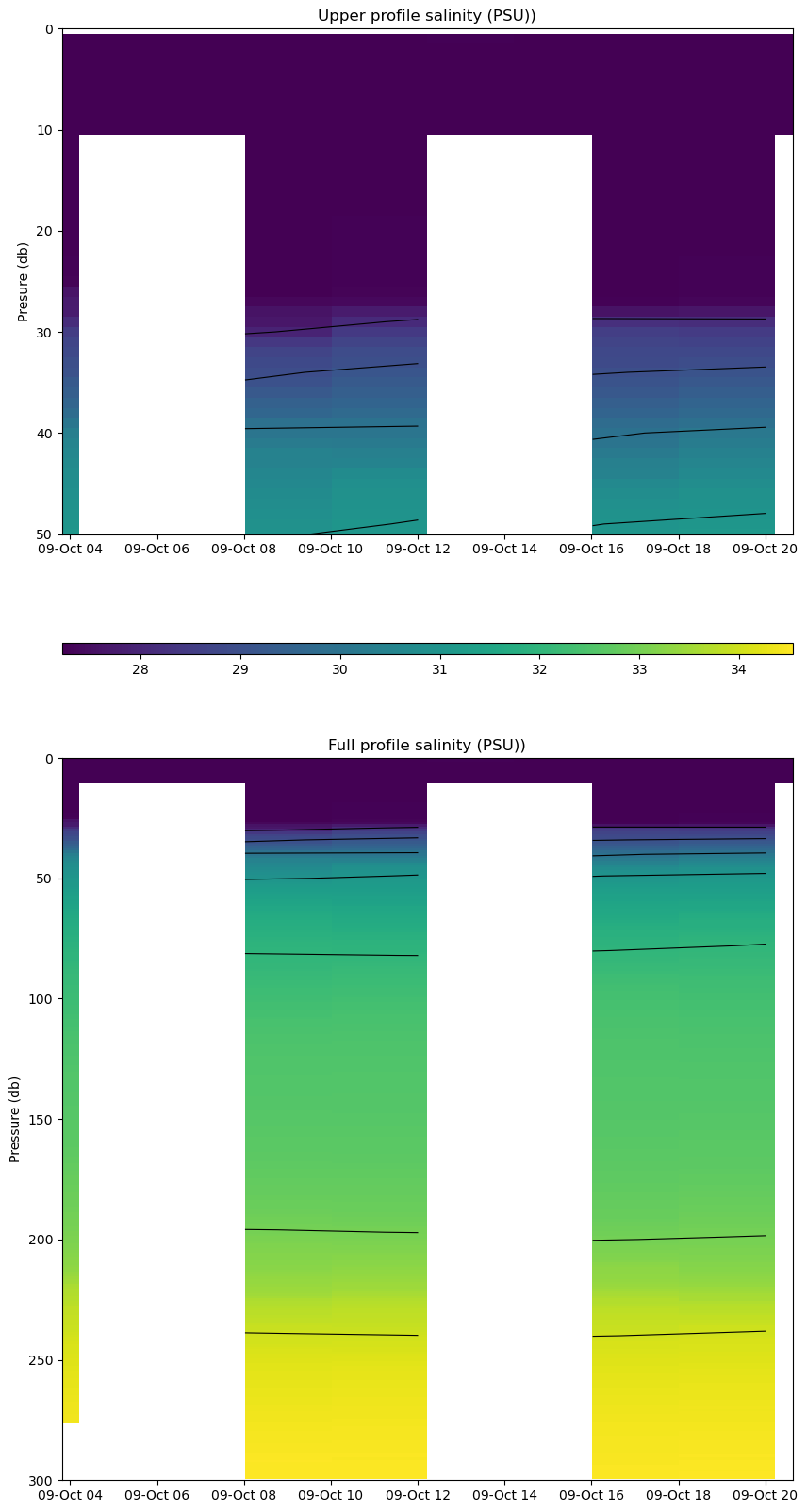
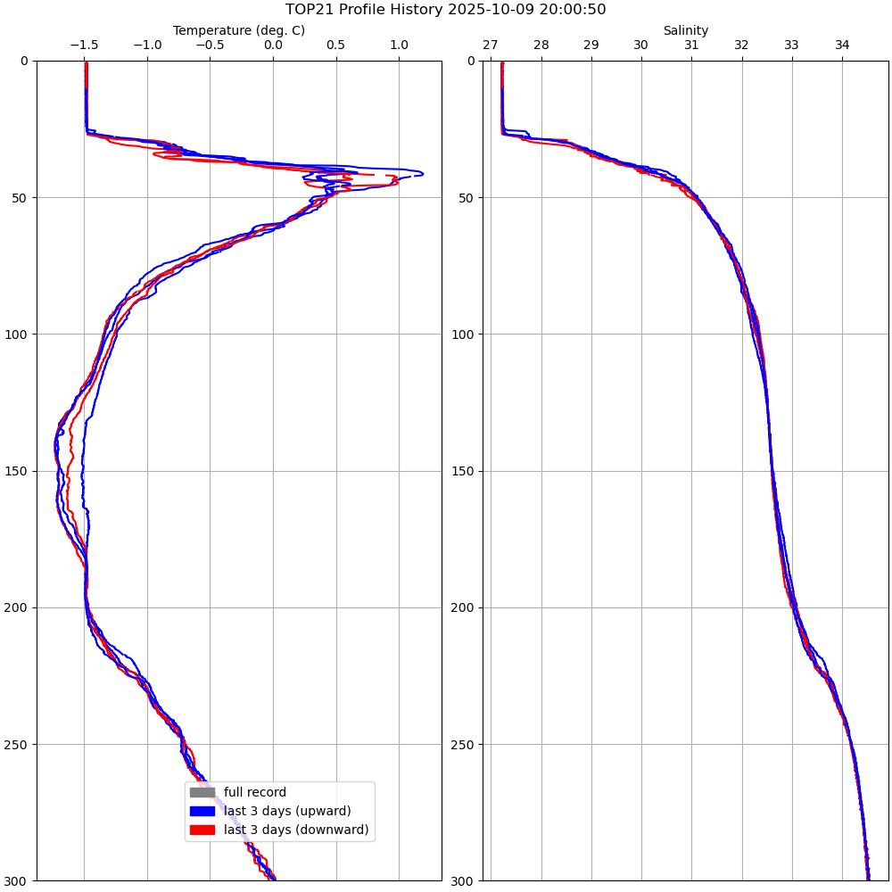
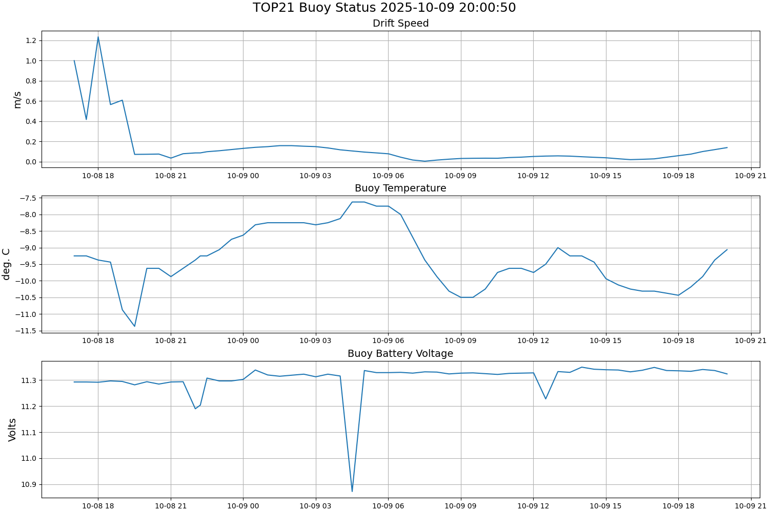
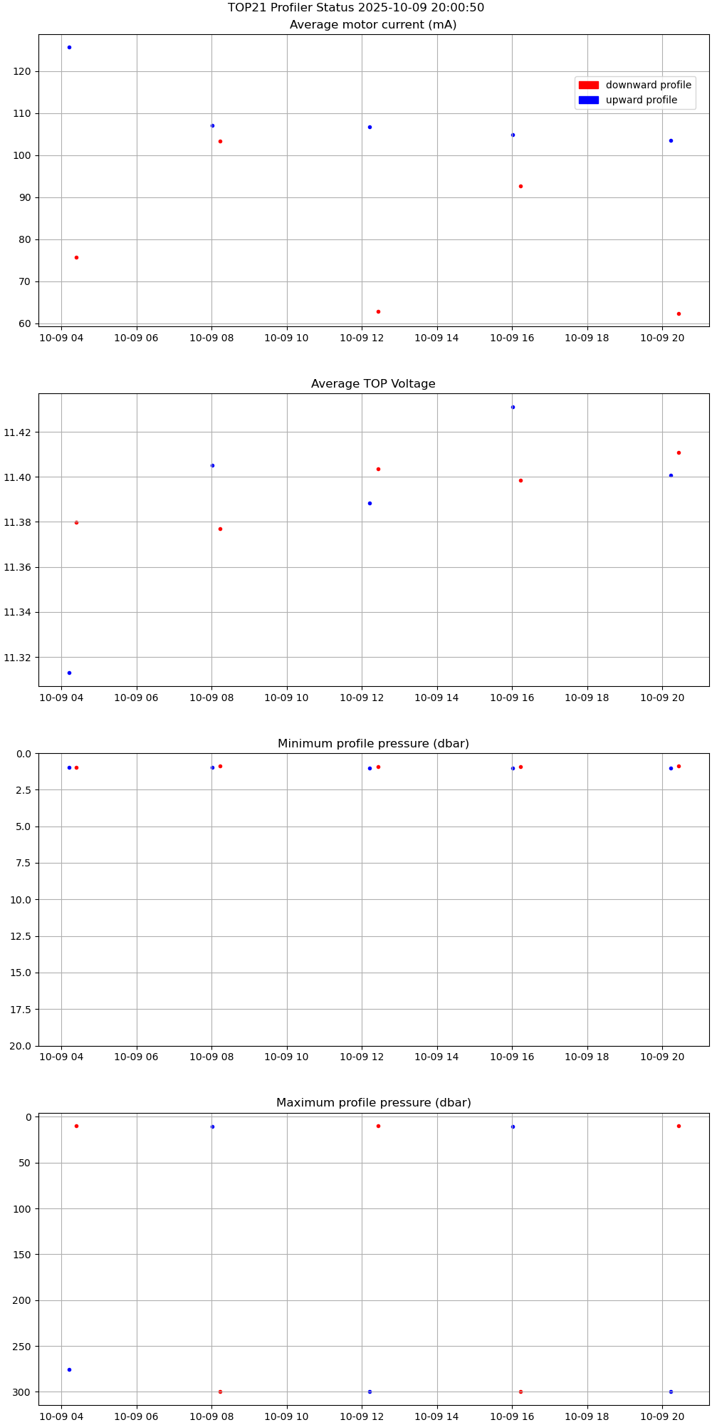
TOP 21 was deployed on 30cm thick ice in a variable thickness ice floe on 8 October 2025 at 77° 0.715’ N, 136° 43.645’ W as part of the Beaufort Gyre Observing System (BGOS) cruise on the CCGS Louis S. St. Laurent heavy icebreaker. The TOP began operating on a sampling schedule of 6 two-way or “yo-yo” profiles between 1 and 760 meters each day. The surface buoy contains a Keller pressure sensor for recording atmospheric pressure alongside the buoy’s position.
| Temperature Contour Plot |
Salinity Contour Plot |
Profile History Plot |
 |
 |
 |
| Buoy Status |
Profiler Status |
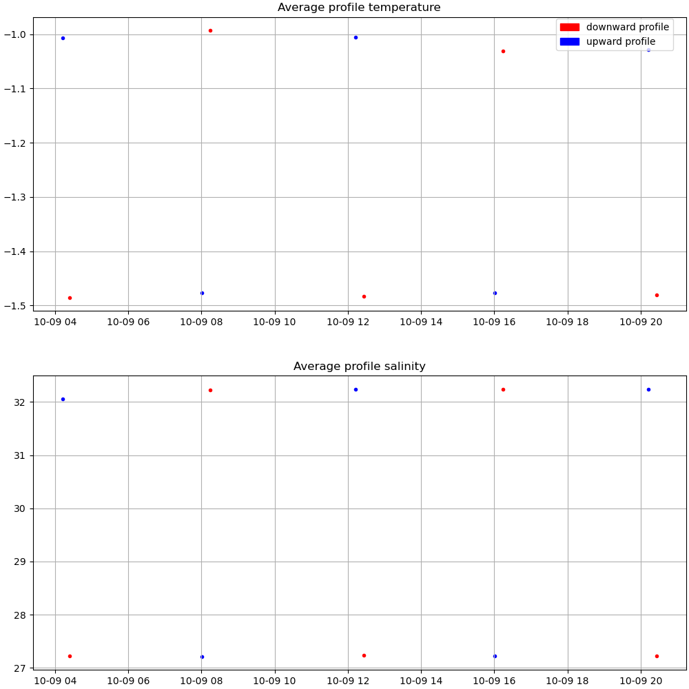
Mean Profile Temperature-Salinity |
 |
 |
 |