Data from TOP20
Last surface buoy status
| Time (UTC) |
2026-07-17 16:05:41 |
| Latitude |
84.99310 |
| Longitude |
136.04065 |
| temperature (deg C) |
6.0000 |
| battery voltage |
10.779 |
Last profile statistics
| Last profile number |
67 |
| Profile Time (UTC) |
2025-10-10 16:00:41 |
| mean motor current (mA) |
156.810 |
| mean battery voltage |
11.290 |
| minimum pressure (dbar) |
15.930 |
| maximum pressure (dbar) |
25.390 |
| minimum temperature (C) |
-1.640 |
| maximum temperature (C) |
-1.487 |
| minimum salinity (PSU) |
27.600 |
| maximum salinity (PSU) |
32.800 |
| minimum oxygen (μmol/kg) |
N/A |
| maximum oxygen (μmol/kg) |
N/A |
Description
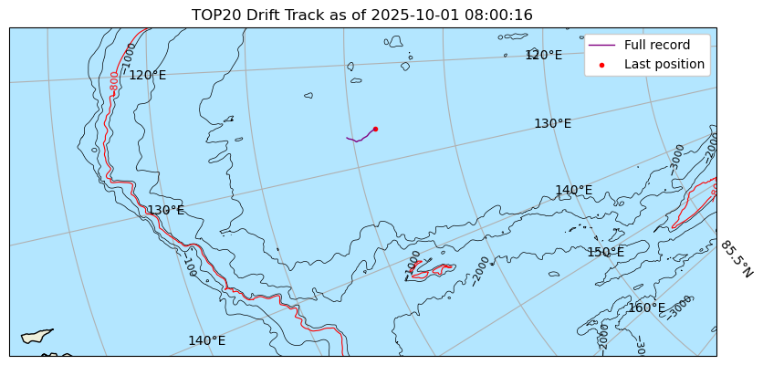
TOP-20 was deployed in open water in the Eurasian Basin / Makarov Basin on September 29, 2025 at approximately 80° 54.827 N, 126 58.477° W in coordination with the Nansen and Amundsen Basins Observational System (NABOS) project from the USCGC Healy. The TOP began operating on a sampling schedule of 6 profiles from the surface to 760 m depth each day.
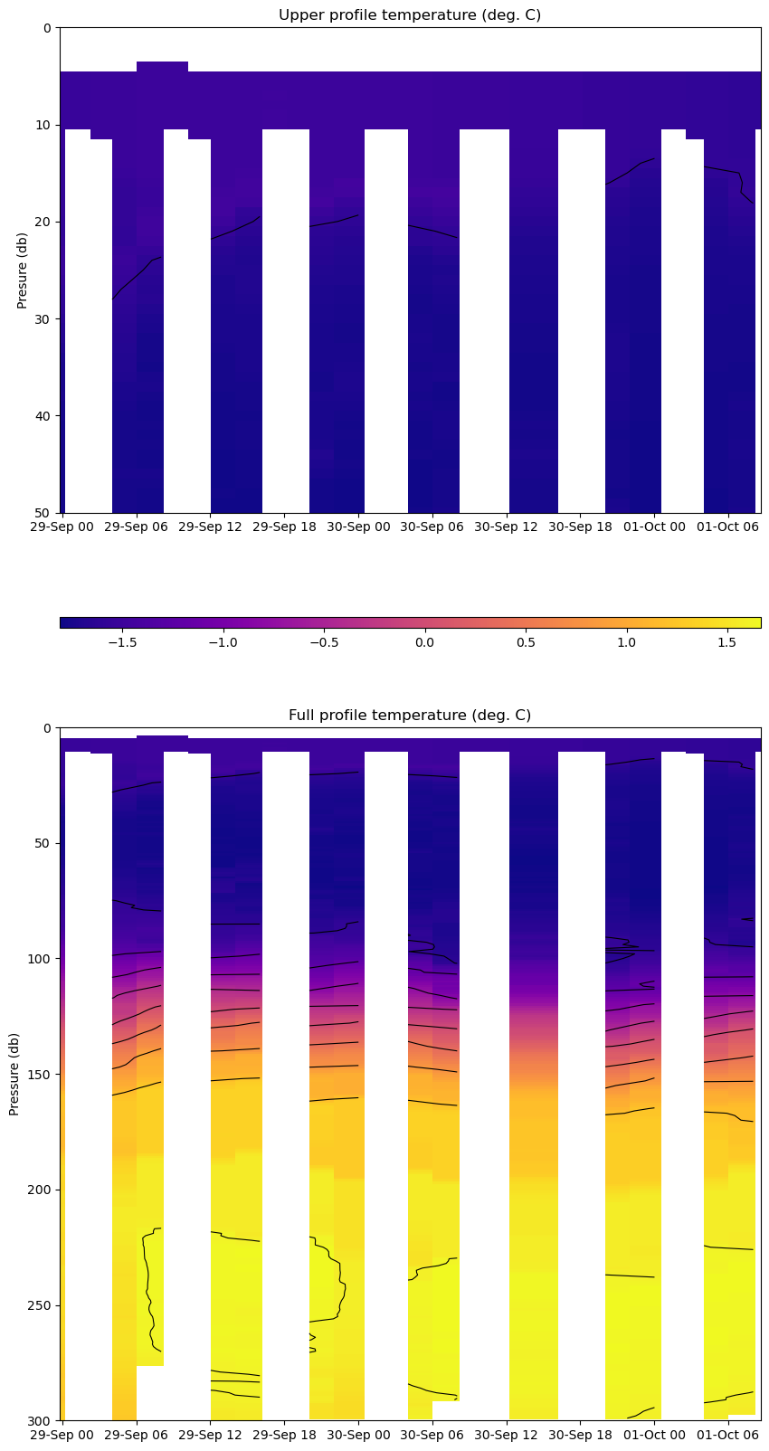
| Temperature Contour Plot |
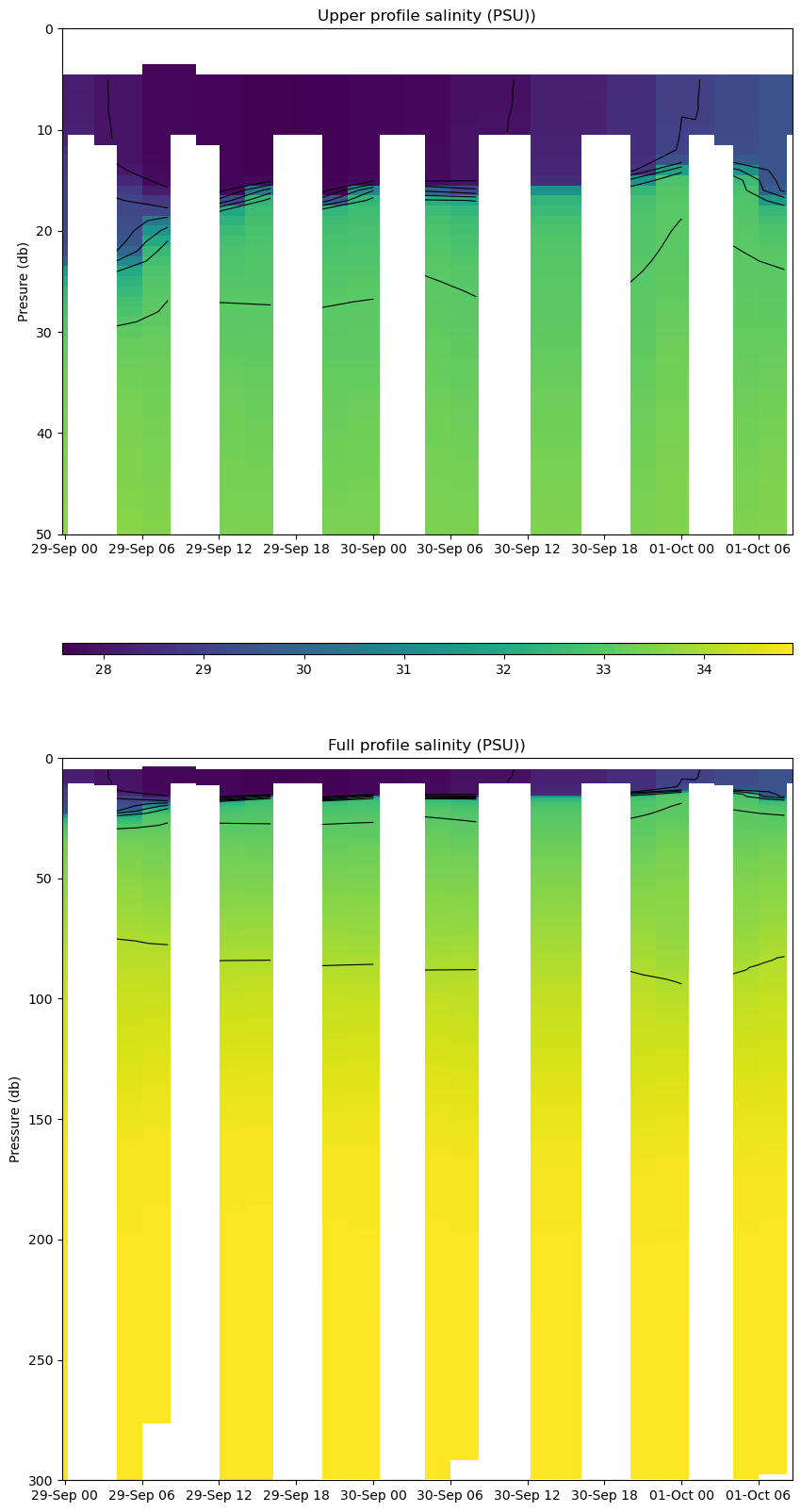
Salinity Contour Plot |
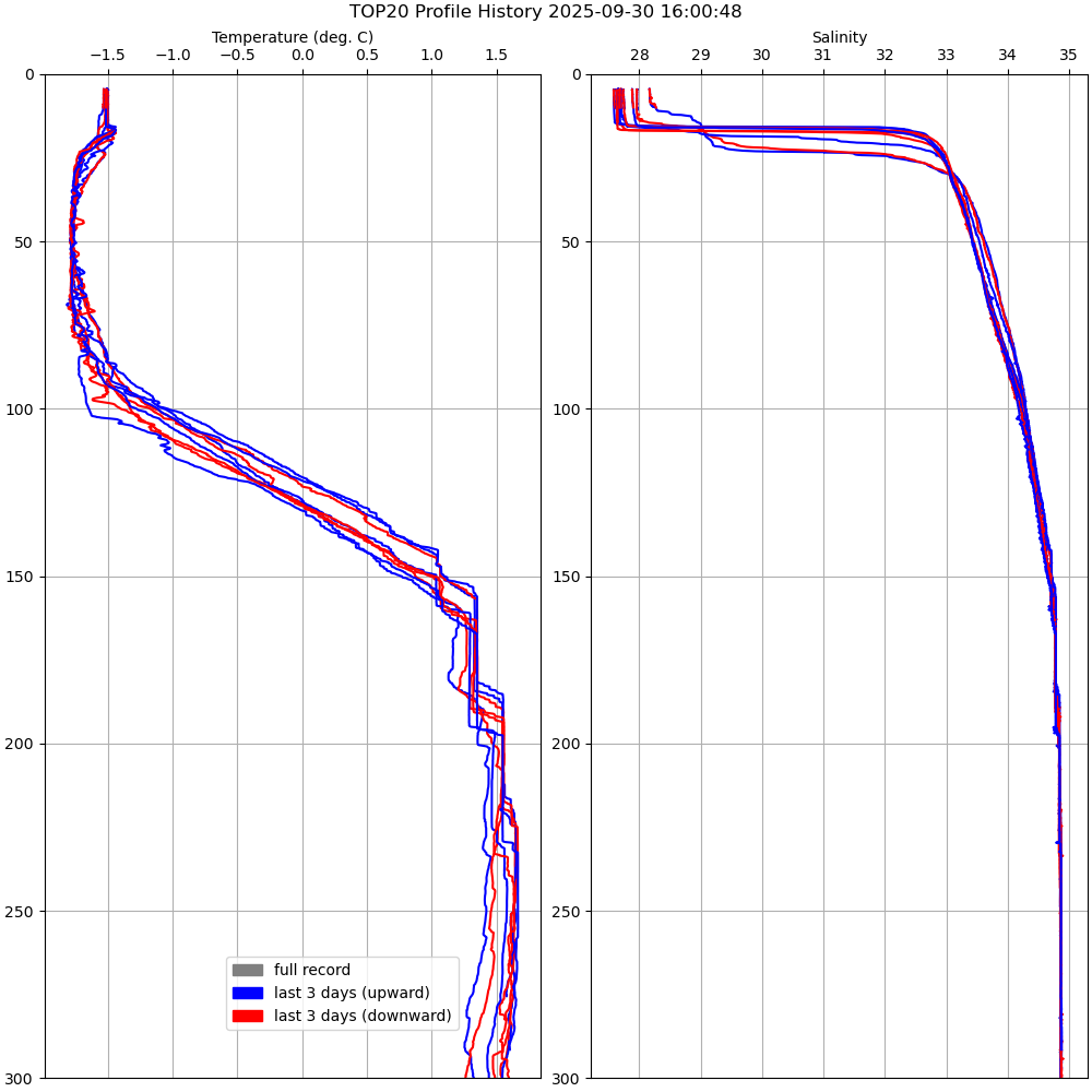
Profile History Plot |
 |
 |
 |
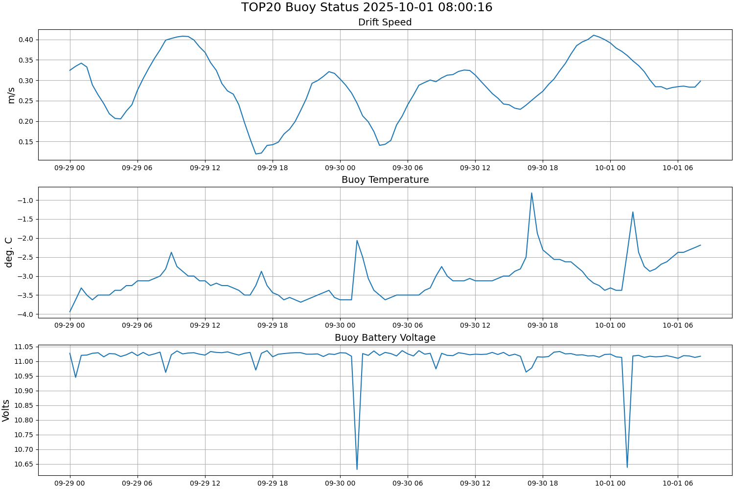
| Buoy Status |
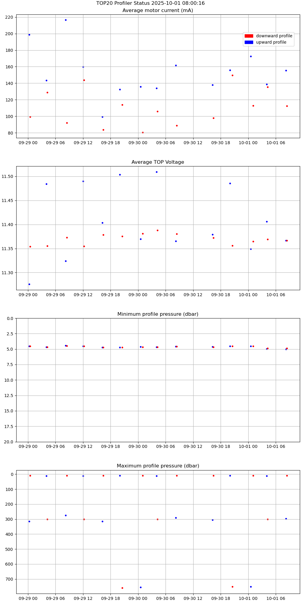
Profiler Status |
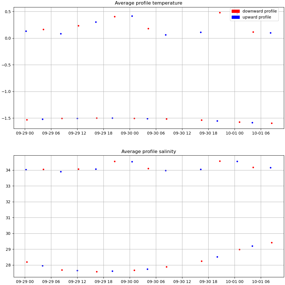
Mean Profile Temperature-Salinity |
 |
 |
 |