Data from TOP2
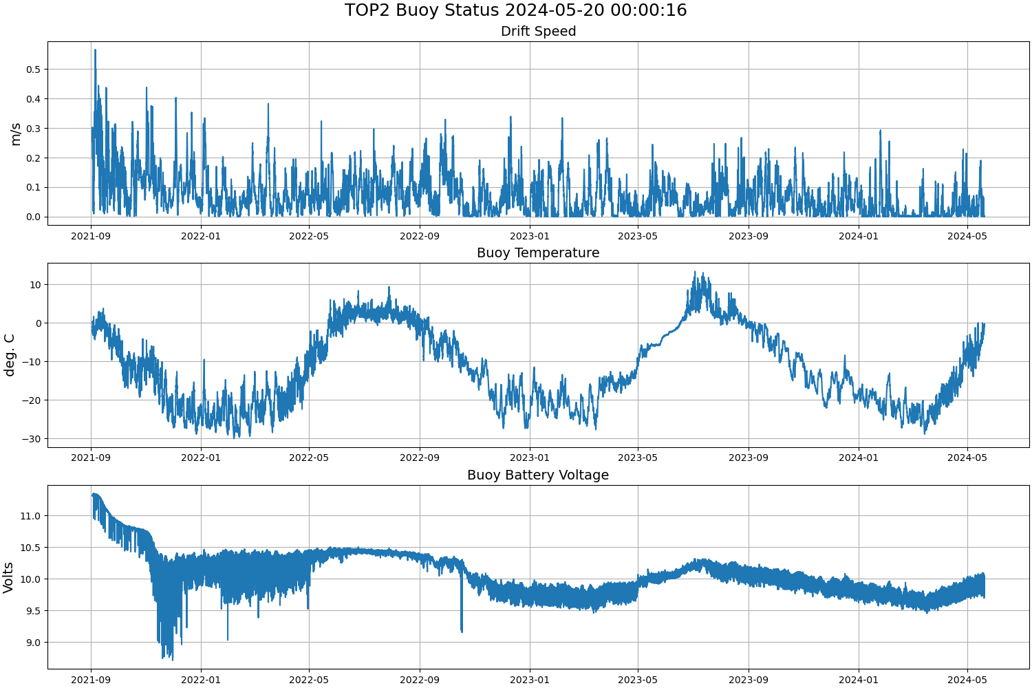
Last surface buoy status
| Time (UTC) |
2026-07-18 00:00:15 |
| Latitude |
81.44173 |
| Longitude |
-98.73598 |
| temperature (deg C) |
5.3750 |
| battery voltage |
9.879 |
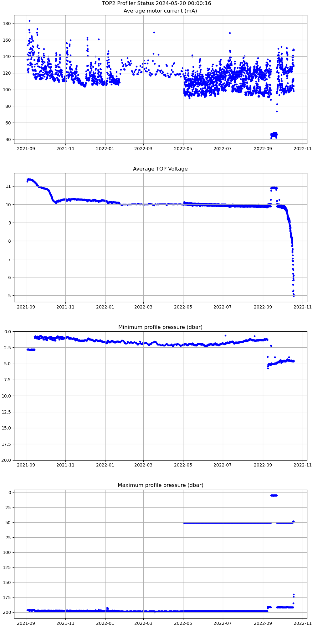
Last profile statistics
| Last profile number |
2986 |
| Profile Time (UTC) |
2022-10-18 06:33:26 |
| mean motor current (mA) |
147.530 |
| mean battery voltage |
4.970 |
| minimum pressure (dbar) |
4.620 |
| maximum pressure (dbar) |
170.140 |
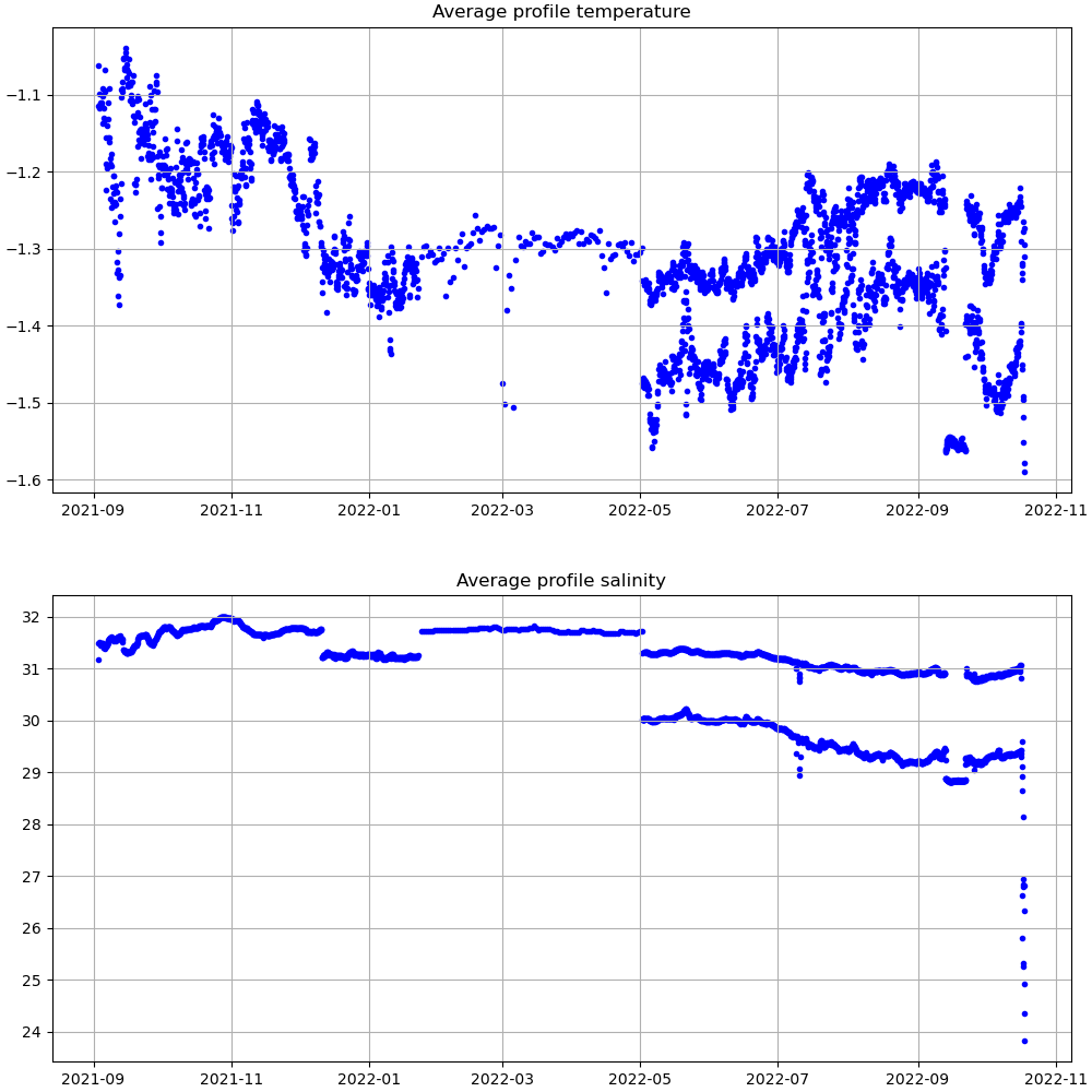
| minimum temperature (C) |
-14.801 |
| maximum temperature (C) |
6.685 |
| minimum salinity (PSU) |
17.072 |
| maximum salinity (PSU) |
30.337 |
| minimum oxygen (μmol/kg) |
N/A |
| maximum oxygen (μmol/kg) |
N/A |
Description
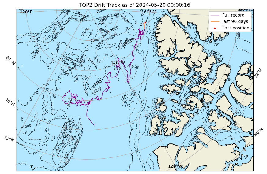
TOP2 was deployed on an 0.85 m thick ice floe in the Beaufort Sea on September 2, 2021 at 78° 34.9 N, 147° 15.5 W as part of the Beaufort Gyre Observing System (BGOS) during the JOIS 2021 cruise on the CCGS Louis S. St. Laurent. On the same icefloe, an Ice-Tethered Profiler (ITP127), and a US Army Cold Regions Research and Engineering Laboratory (CRREL) Seasonal Ice Mass Balance Buoy 3 were also installed. The TOP is operating on a standard sampling schedule of 6 two-way profiles from the surface to 200 m depth each day.
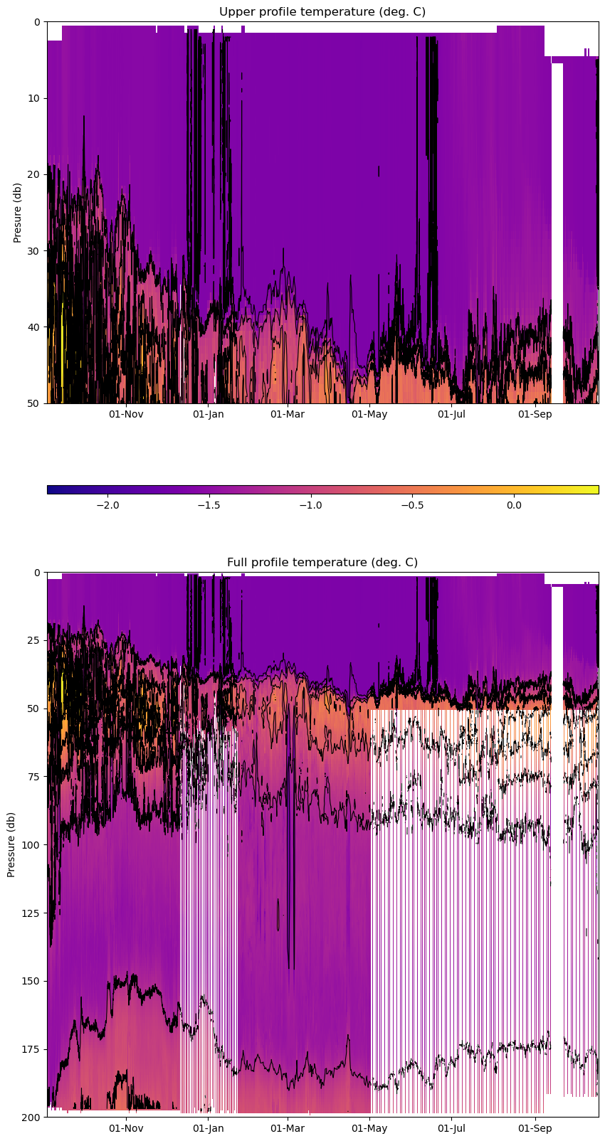
| Temperature Contour Plot |
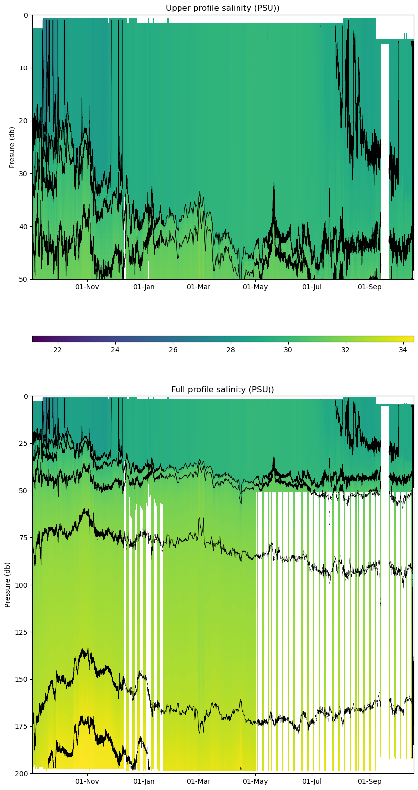
Salinity Contour Plot |
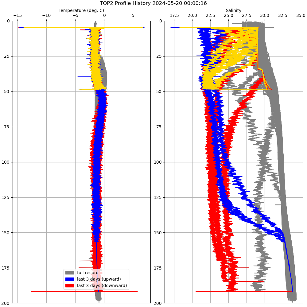
Profile History Plot |
 |
 |
 |
| Buoy Status |
Profiler Status |
Mean Profile Temperature-Salinity |
 |
 |
 |