Data from TOP19
Last surface buoy status
| Time (UTC) |
2026-07-25 14:47:03 |
| Latitude |
77.62768 |
| Longitude |
-130.68419 |
| temperature (deg C) |
-0.1875 |
| battery voltage |
10.523 |
Last profile statistics
| Last profile number |
1170 |
| Profile Time (UTC) |
2026-07-03 04:00:40 |
| mean motor current (mA) |
111.250 |
| mean battery voltage |
10.270 |
| minimum pressure (dbar) |
3.340 |
| maximum pressure (dbar) |
760.610 |
| minimum temperature (C) |
-1.495 |
| maximum temperature (C) |
0.793 |
| minimum salinity (PSU) |
28.564 |
| maximum salinity (PSU) |
34.879 |
| minimum oxygen (μmol/kg) |
N/A |
| maximum oxygen (μmol/kg) |
N/A |
Description
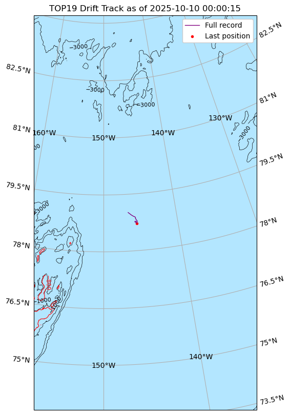
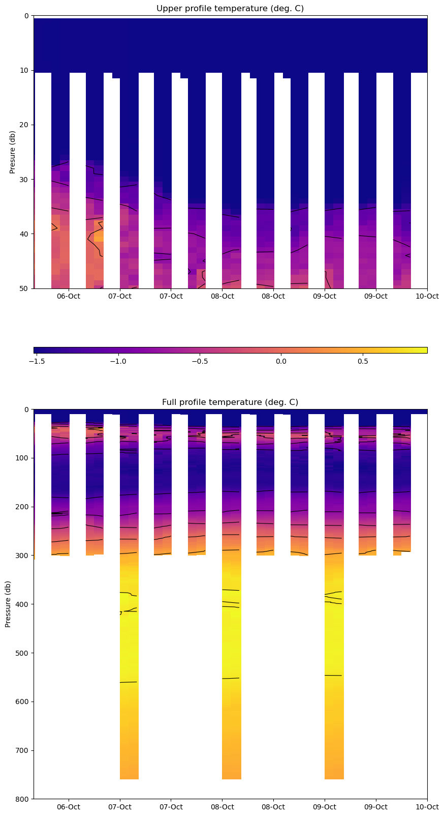
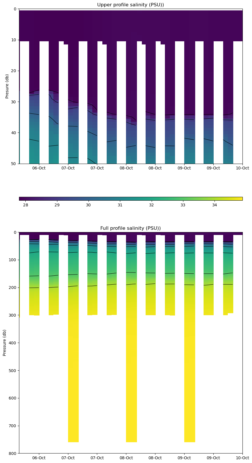
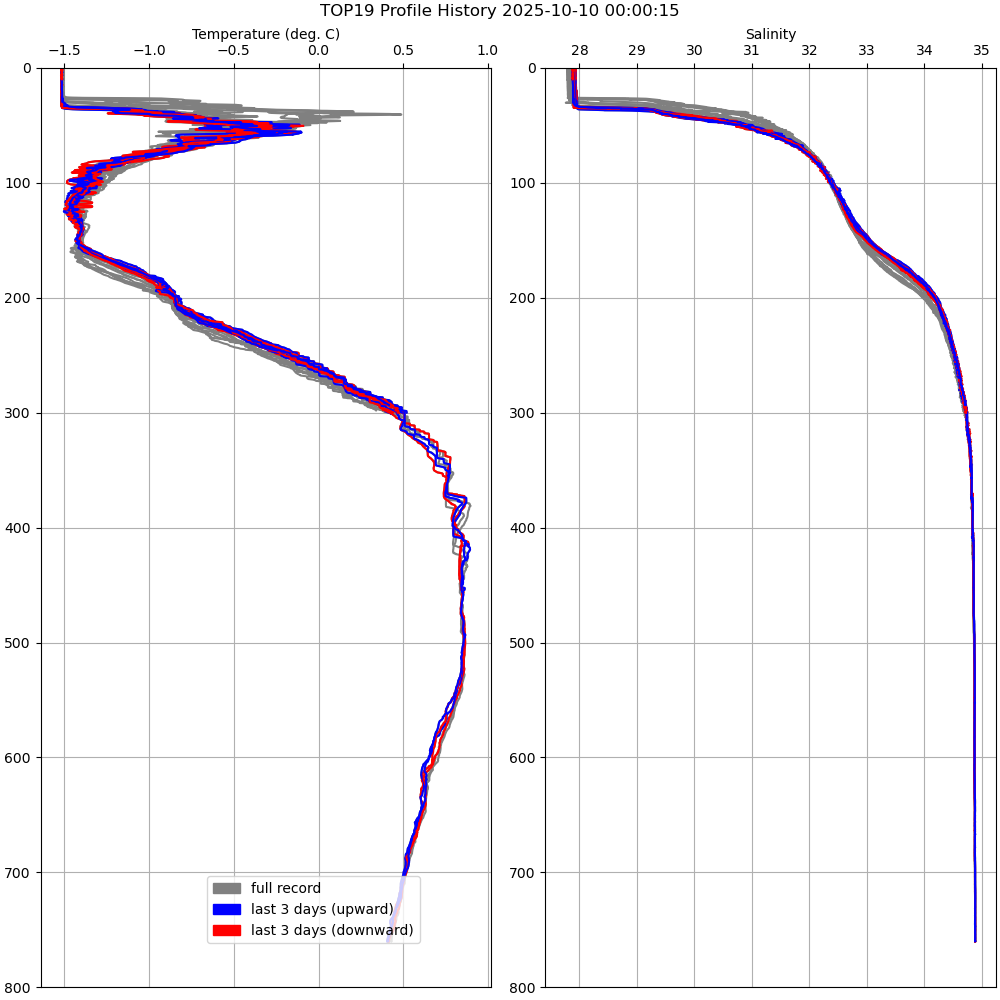
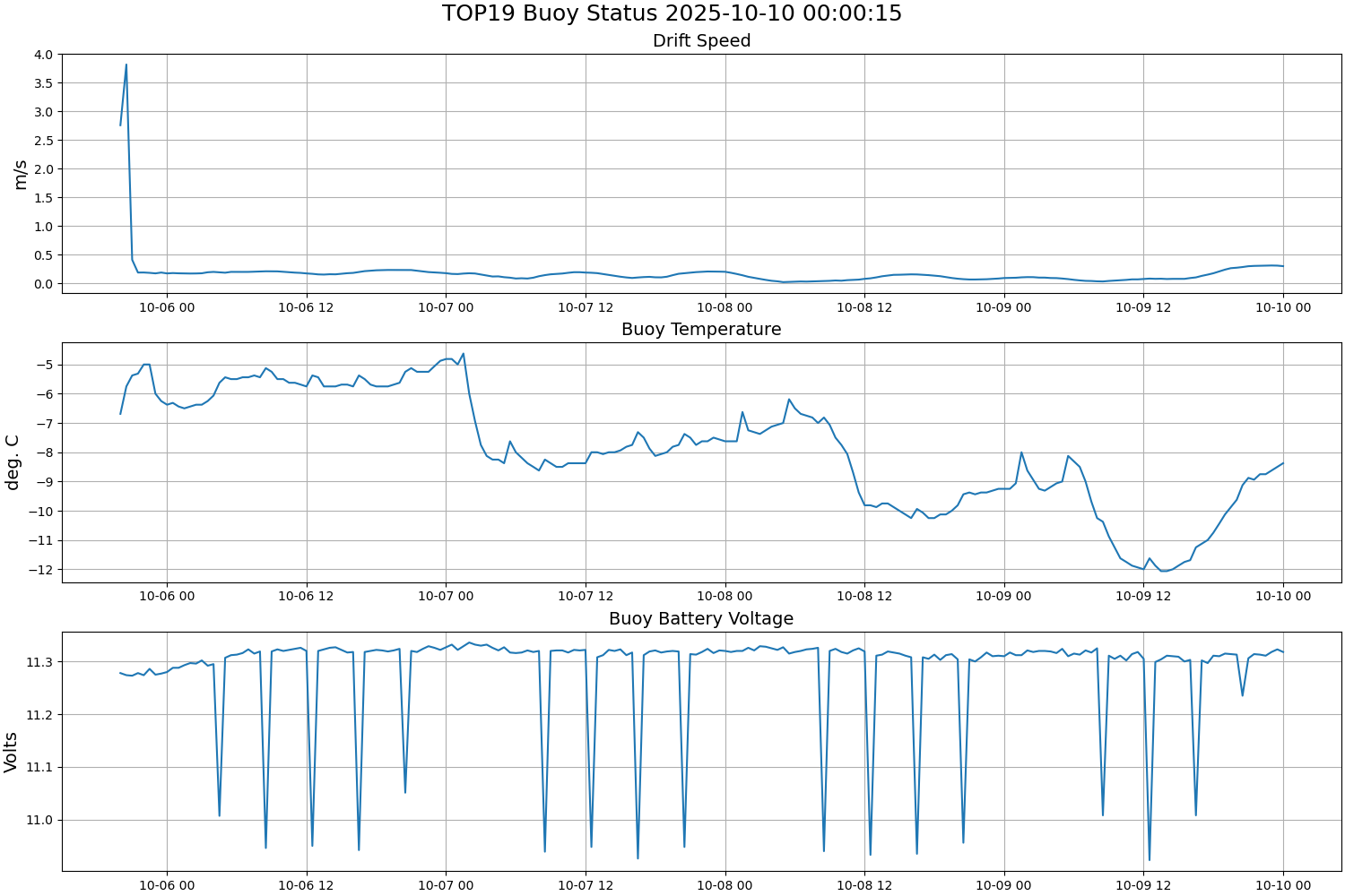
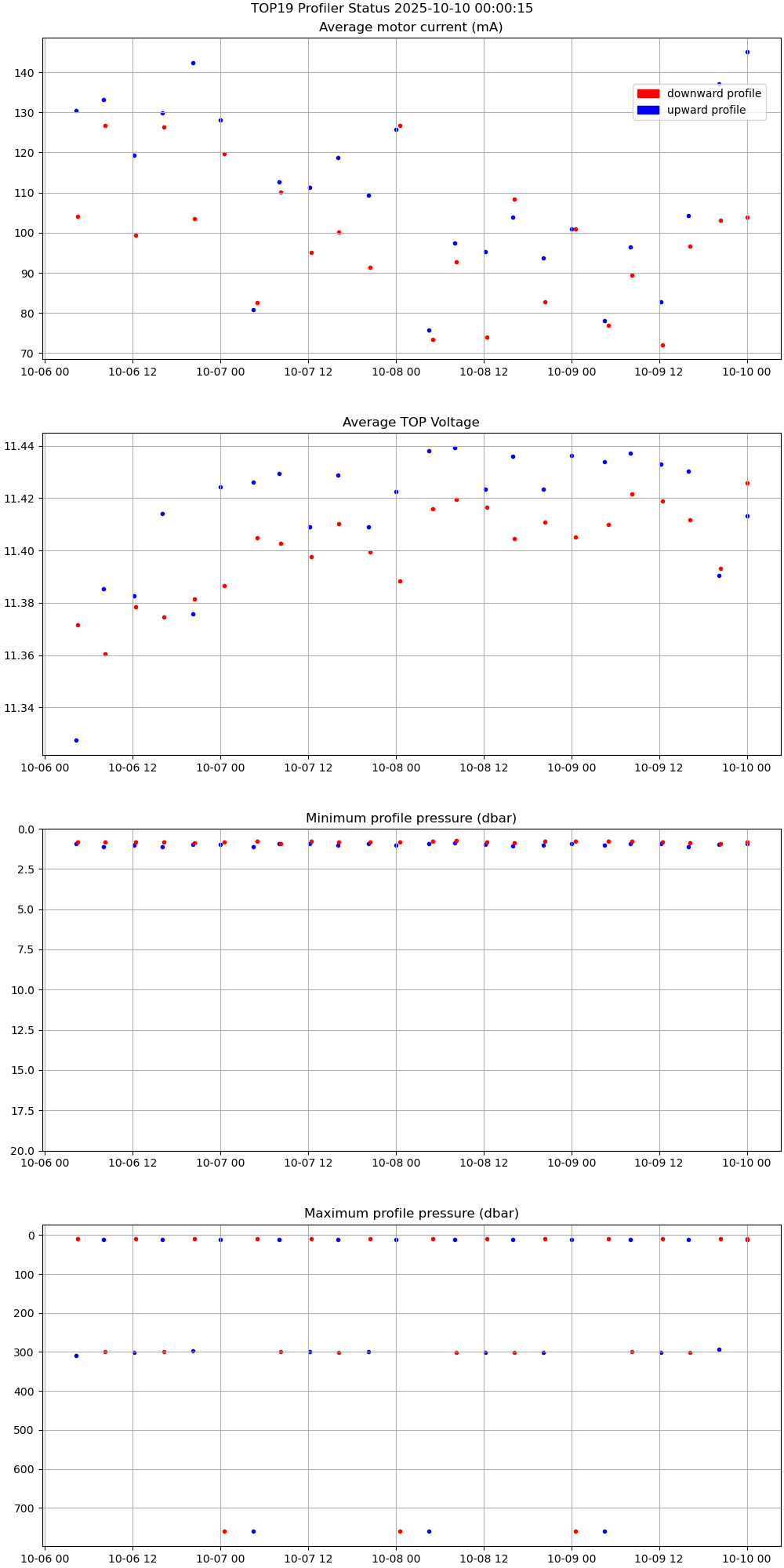
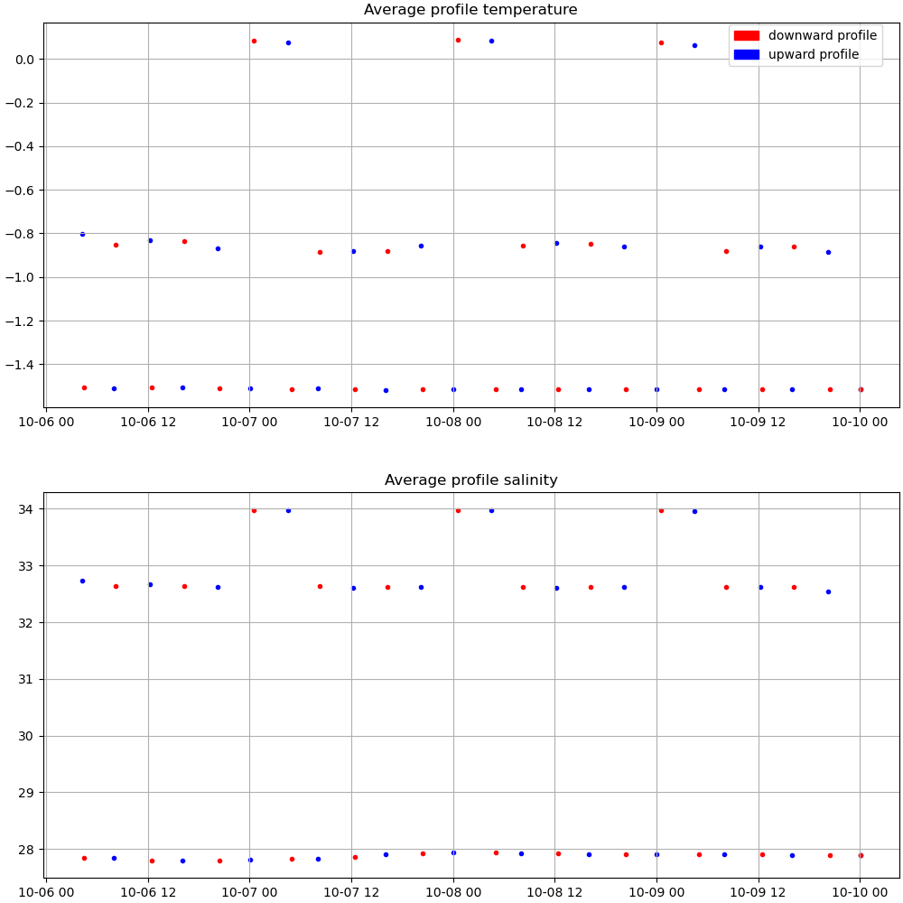
TOP 19 was deployed on a small ice floe made up of smaller multi-year ice pieces fused with new ice, approximately 35cm thick, on 5 October 2025 at 78° 57.511’ N, 146° 13.912’ W. This deployment was part of the Beaufort Gyre Observing System (BGOS) cruise on the CCGS Louis S. St. Laurent heavy icebreaker. The TOP began operating on a sampling schedule of 6 two-way or “yo-yo” profiles between 1 and 760 meters each day.
| Temperature Contour Plot |
Salinity Contour Plot |
Profile History Plot |
 |
 |
 |
| Buoy Status |
Profiler Status |
Mean Profile Temperature-Salinity |
 |
 |
 |