Data from TOP18
Last surface buoy status
| Time (UTC) |
2026-07-17 20:31:02 |
| Latitude |
74.01755 |
| Longitude |
-151.80473 |
| temperature (deg C) |
6.2500 |
| battery voltage |
10.498 |
Last profile statistics
| Last profile number |
1521 |
| Profile Time (UTC) |
2026-07-17 20:00:41 |
| mean motor current (mA) |
81.890 |
| mean battery voltage |
10.190 |
| minimum pressure (dbar) |
1.120 |
| maximum pressure (dbar) |
298.430 |
| minimum temperature (C) |
-1.419 |
| maximum temperature (C) |
0.617 |
| minimum salinity (PSU) |
27.147 |
| maximum salinity (PSU) |
34.592 |
| minimum oxygen (μmol/kg) |
N/A |
| maximum oxygen (μmol/kg) |
N/A |
Description
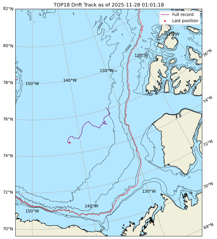
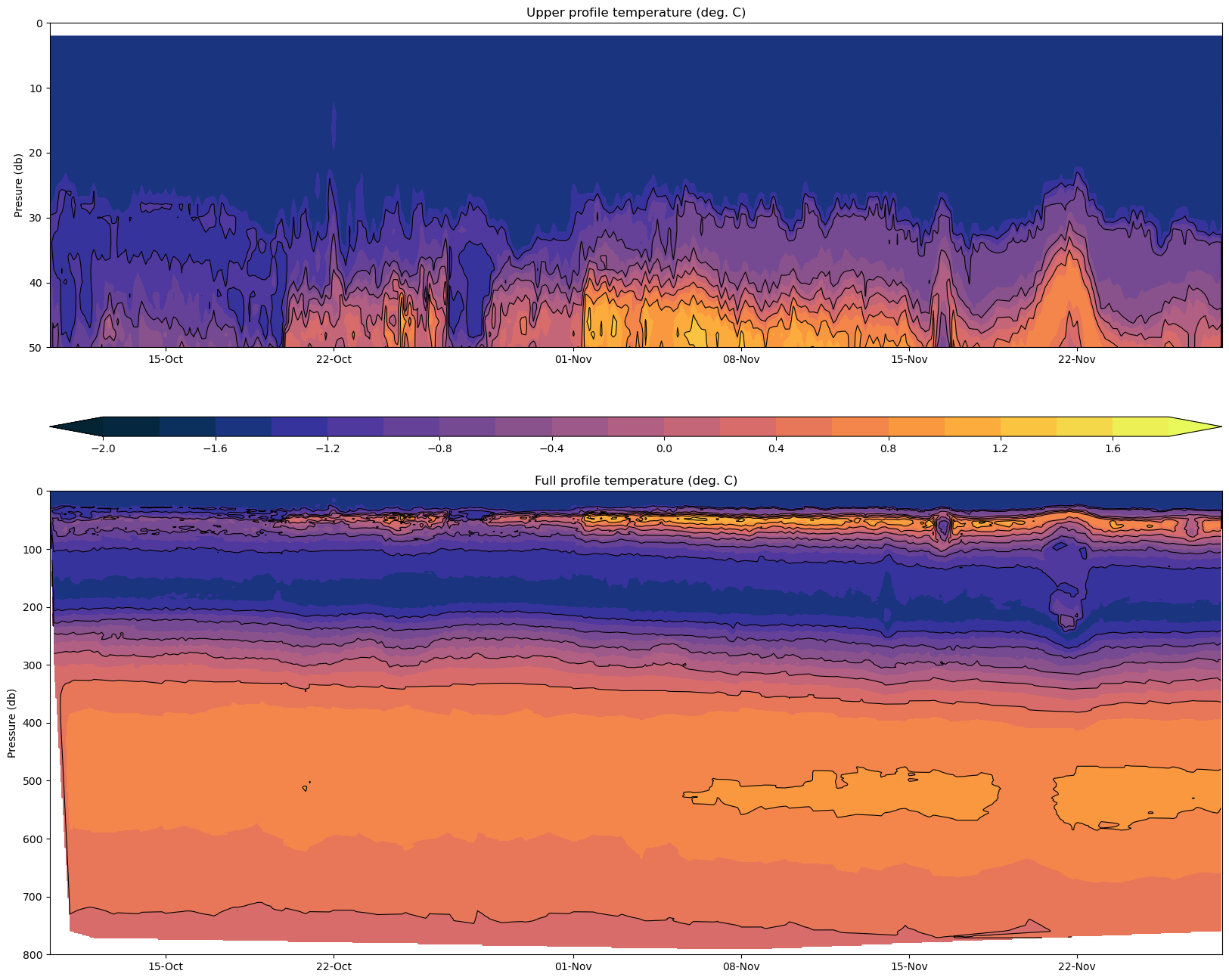
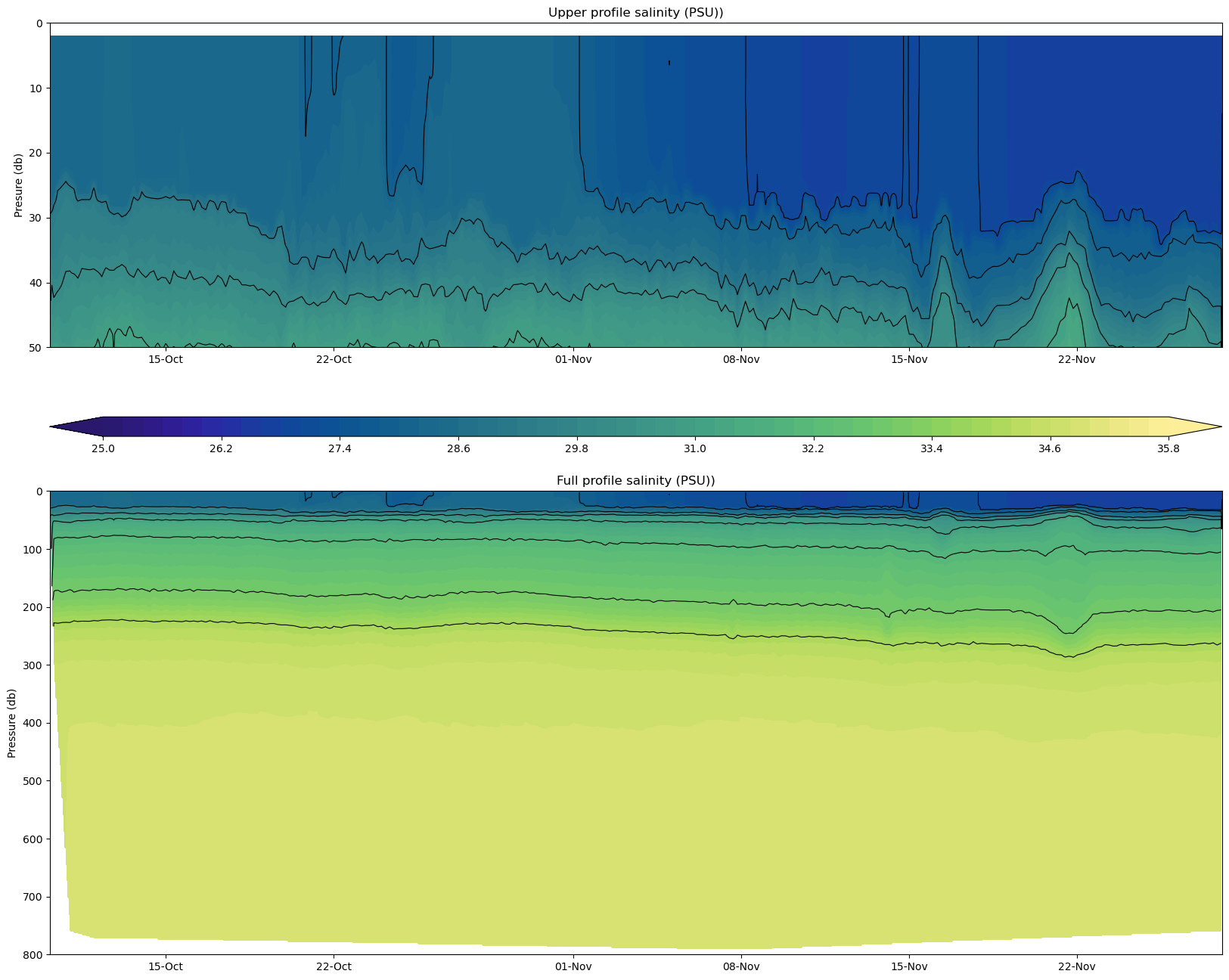
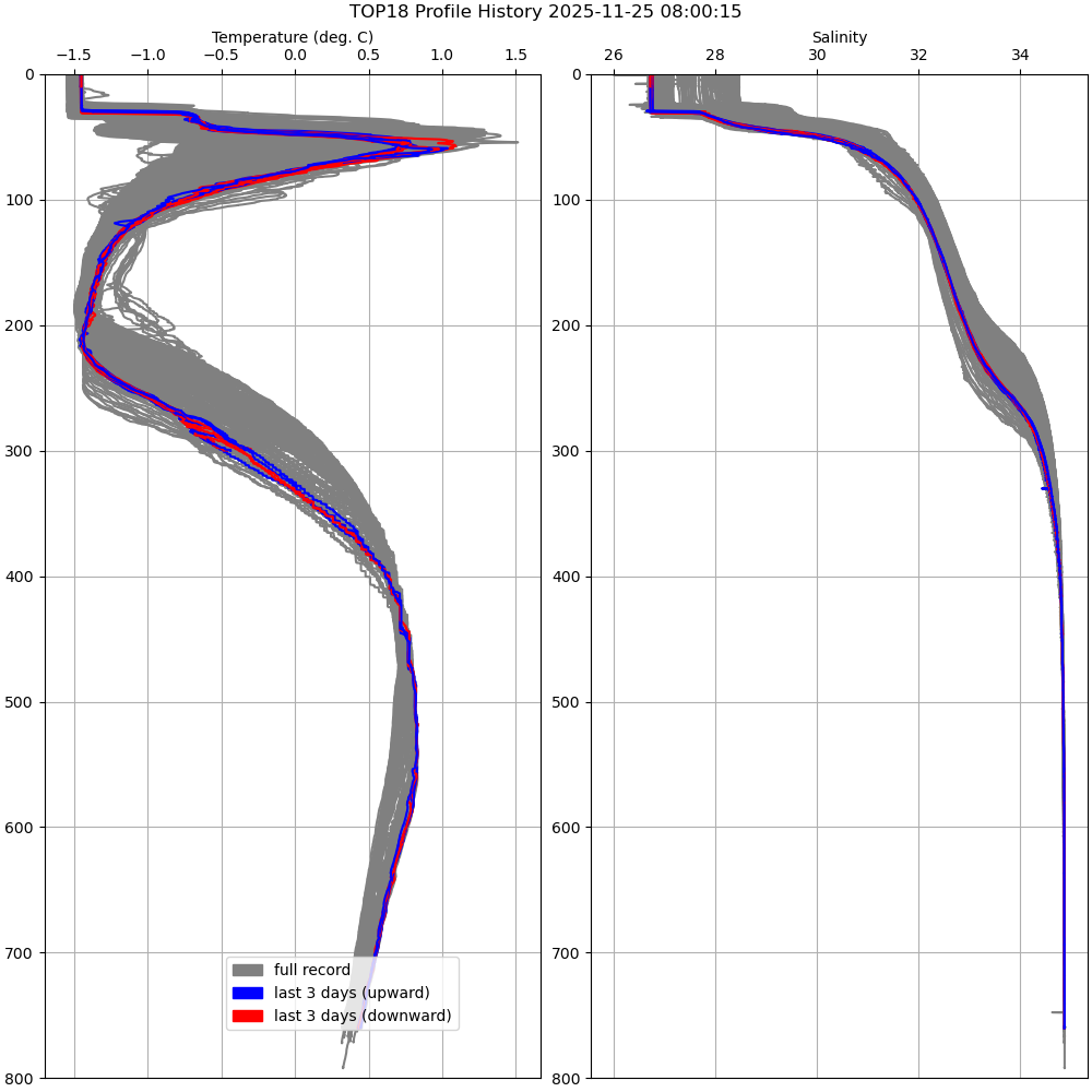
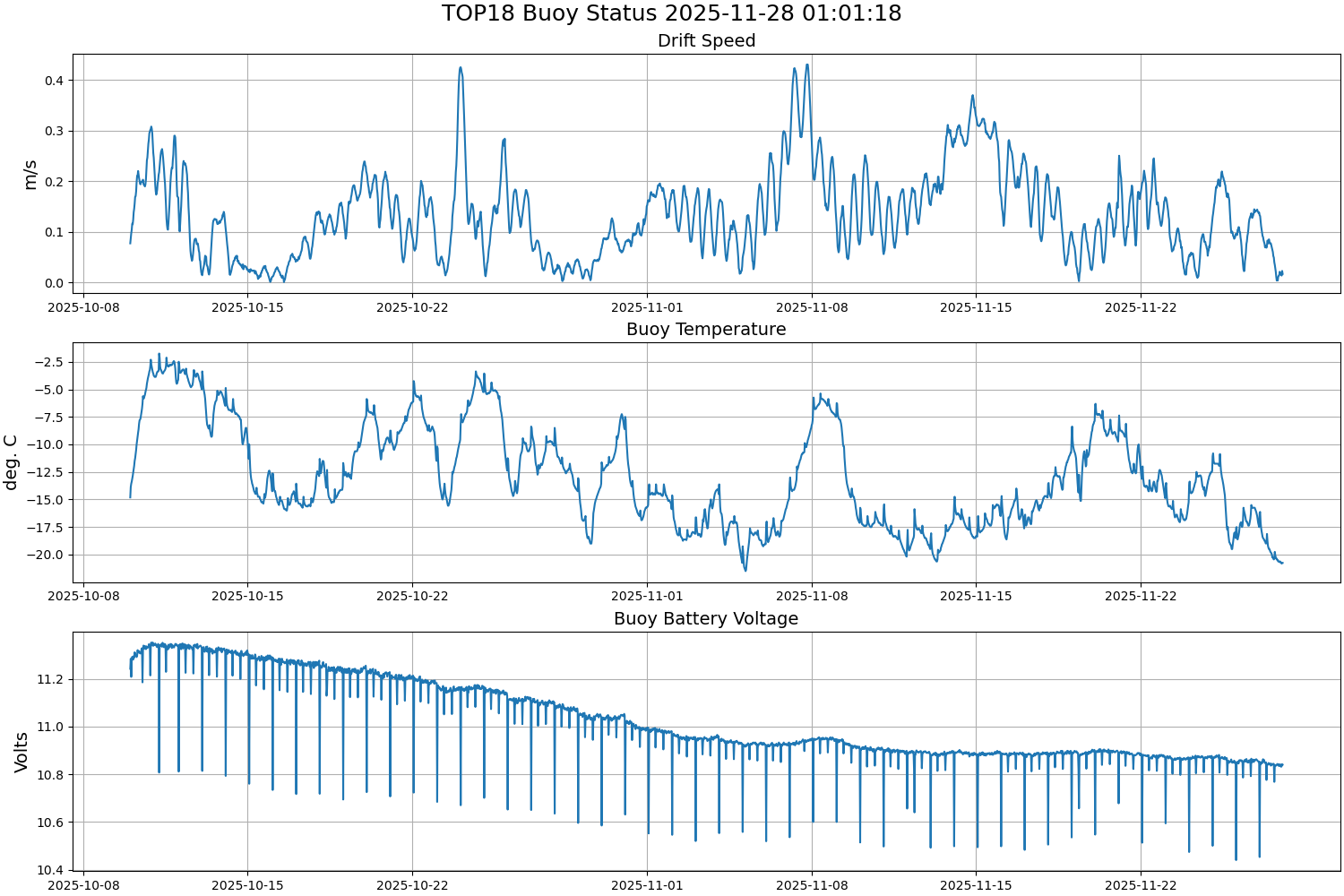
TOP 18 was deployed on 45cm thick ice in a variable thickness ice floe on 9 October 2025 at 76° 5.886’ N, 132° 56.280’ W as part of the Beaufort Gyre Observing System (BGOS) cruise on the CCGS Louis S. St. Laurent heavy icebreaker. The TOP began operating on a sampling schedule of 6 two-way or “yo-yo” profiles between 1 and 760 meters each day.
| Temperature Contour Plot |
Salinity Contour Plot |
Profile History Plot |
 |
 |
 |
| Buoy Status |
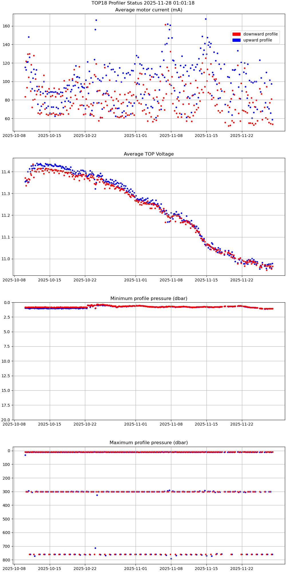
Profiler Status |
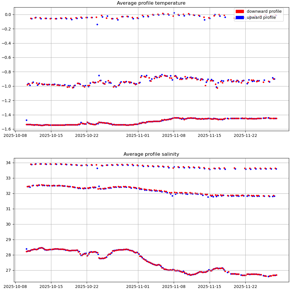
Mean Profile Temperature-Salinity |
 |
 |
 |