Data from TOP16
Last surface buoy status
| Time (UTC) |
2026-07-18 16:09:32 |
| Latitude |
55.86990 |
| Longitude |
-42.63936 |
| temperature (deg C) |
10.2500 |
| battery voltage |
10.407 |
Last profile statistics
| Last profile number |
2876 |
| Profile Time (UTC) |
2026-05-23 16:00:23 |
| mean motor current (mA) |
81.920 |
| mean battery voltage |
11.490 |
| minimum pressure (dbar) |
3.980 |
| maximum pressure (dbar) |
4.390 |
| minimum temperature (C) |
1.417 |
| maximum temperature (C) |
1.624 |
| minimum salinity (PSU) |
7.668 |
| maximum salinity (PSU) |
7.721 |
| minimum oxygen (μmol/kg) |
N/A |
| maximum oxygen (μmol/kg) |
N/A |
Description
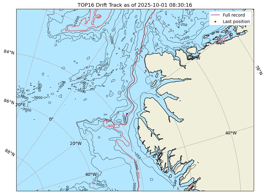
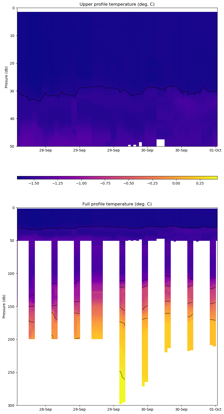
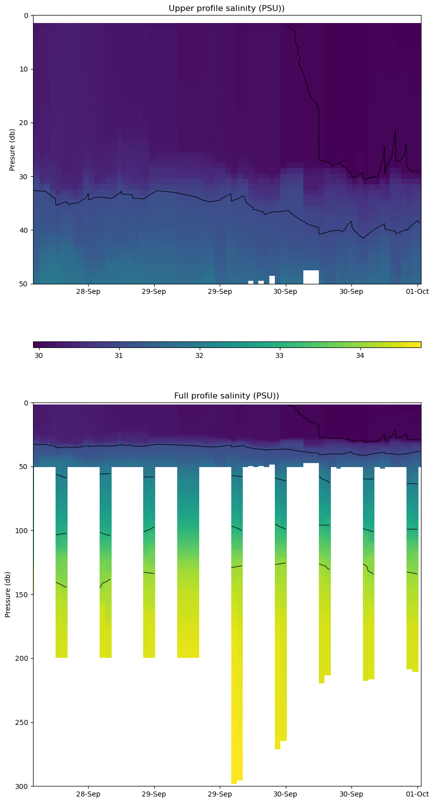
TOP 16 was deployed on 1.35m thick ice on 25 September 2025 off northeast Greenland at 83°53.431’ N, 024°15.868’ W as part of the R/V Polarstern expedition PS150 (EGCSources). It was co-deployed with SIMB3 #12. The TOP began operating on a sampling schedule of 12 two-way or “yo-yo” profiles between 1 and 200 meters each day.
| Temperature Contour Plot |
Salinity Contour Plot |
Profile History Plot |
 |
 |
 |
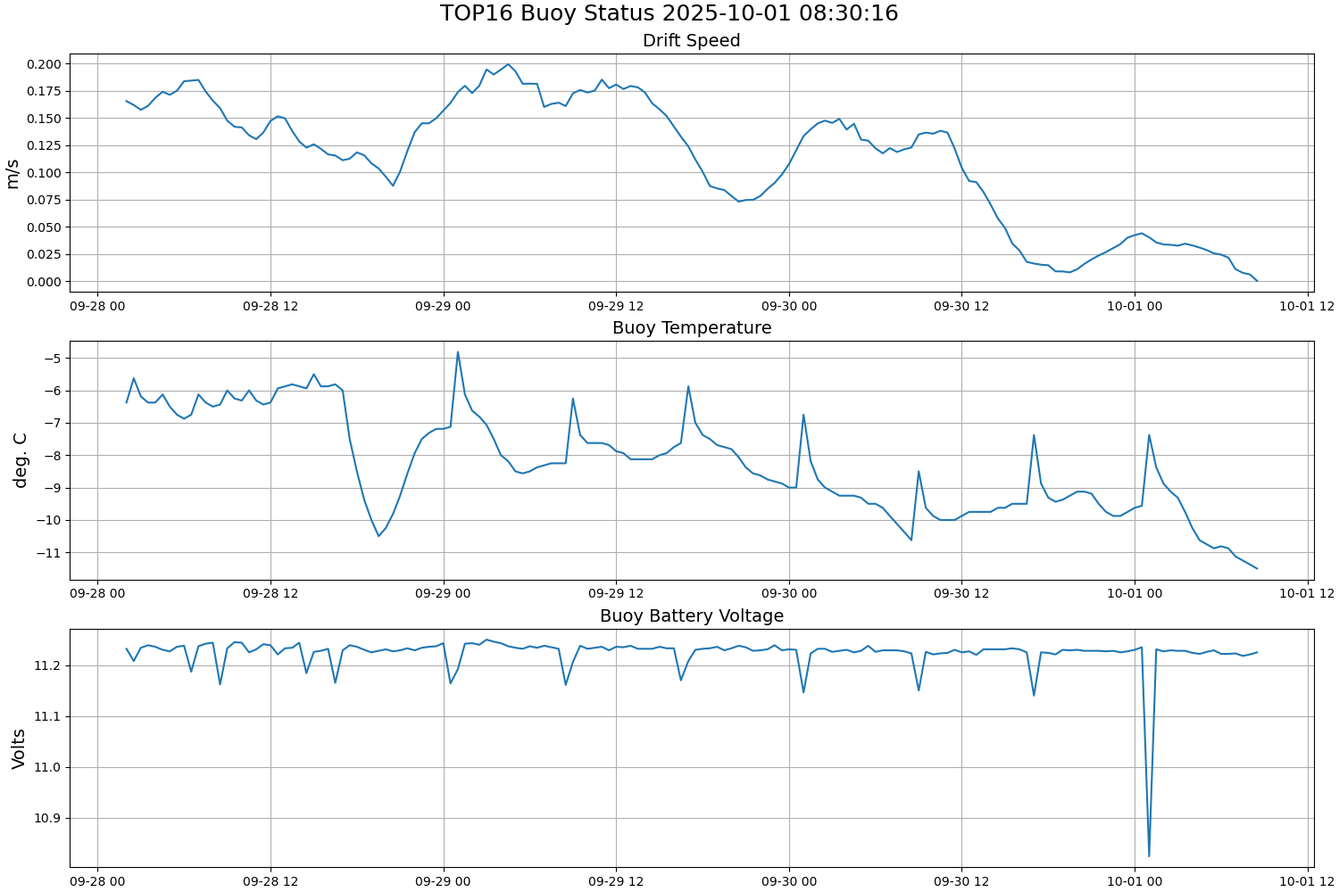
| Buoy Status |
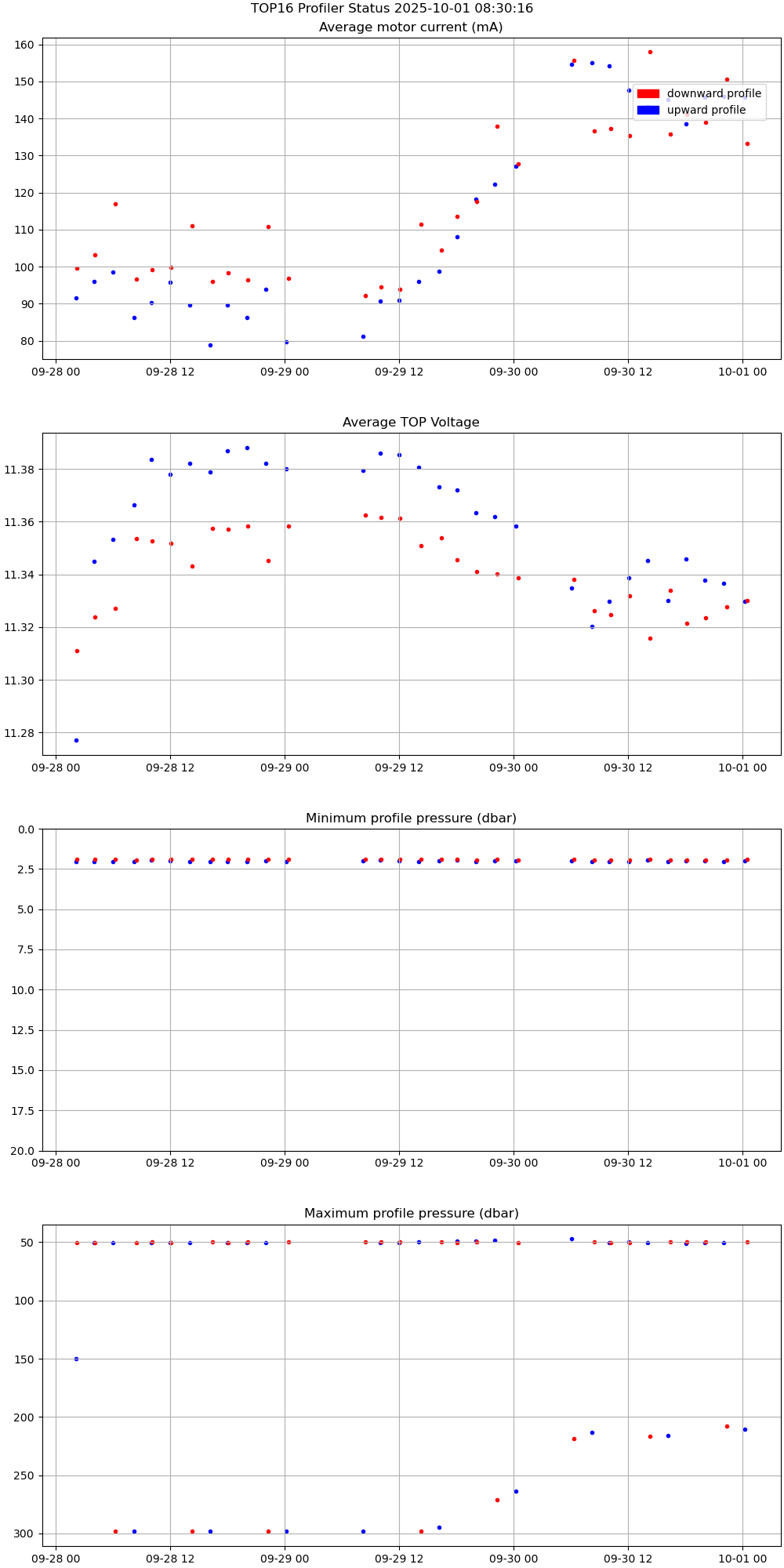
Profiler Status |
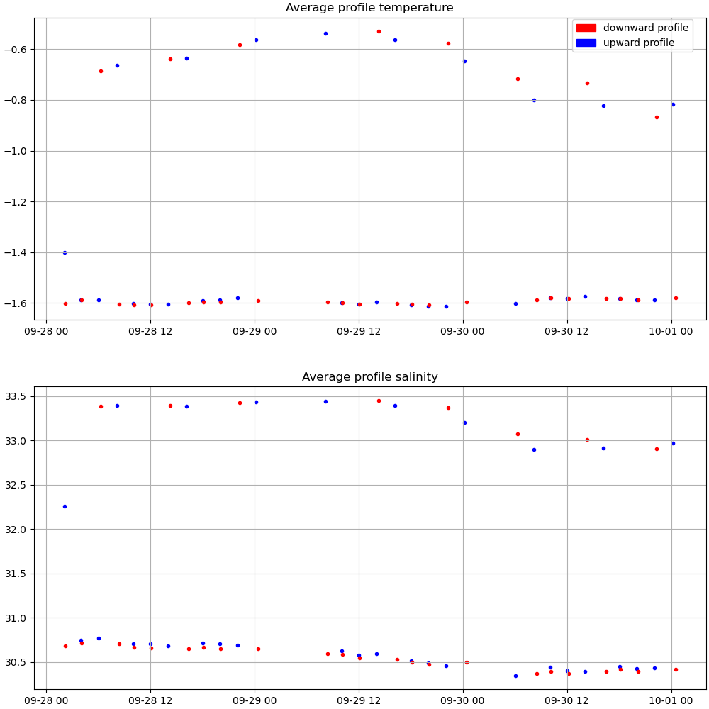
Mean Profile Temperature-Salinity |
 |
 |
 |