Data from ITP127
Last surface buoy status
| Time (UTC) |
2026-07-24 01:10:51 |
| Latitude |
81.42312 |
| Longitude |
-98.71585 |
| temperature (deg C) |
2.0000 |
| battery voltage |
10.251 |
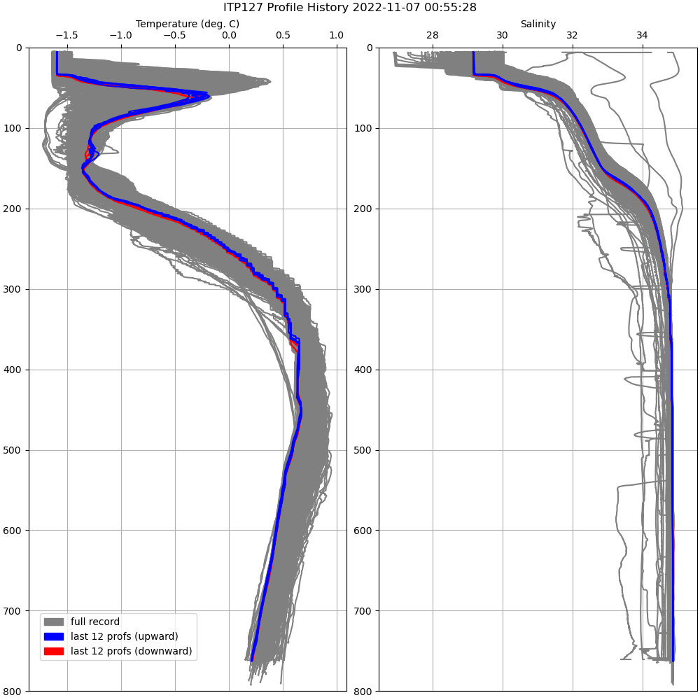
Last profile statistics
| Last profile number |
861 |
| Profile Time (UTC) |
2022-11-07 00:00:05 |
| mean motor current (mA) |
137.890 |
| mean battery voltage |
10.480 |
| minimum pressure (dbar) |
6.210 |
| maximum pressure (dbar) |
763.120 |
| minimum temperature (C) |
-1.594 |
| maximum temperature (C) |
0.669 |
| minimum salinity (PSU) |
29.187 |
| maximum salinity (PSU) |
34.871 |
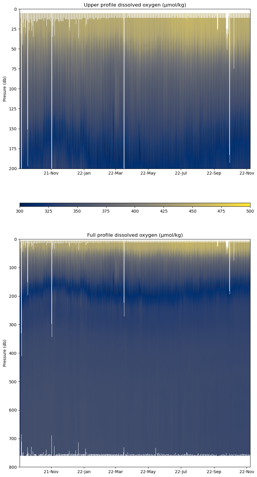
| minimum oxygen (μmol/kg) |
287.601 |
| maximum oxygen (μmol/kg) |
462.640 |
Description
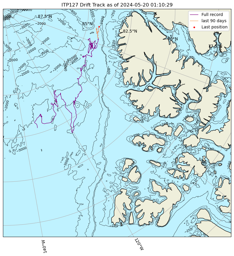
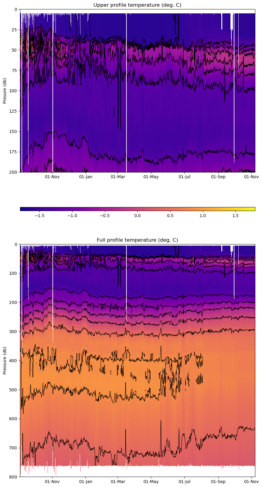
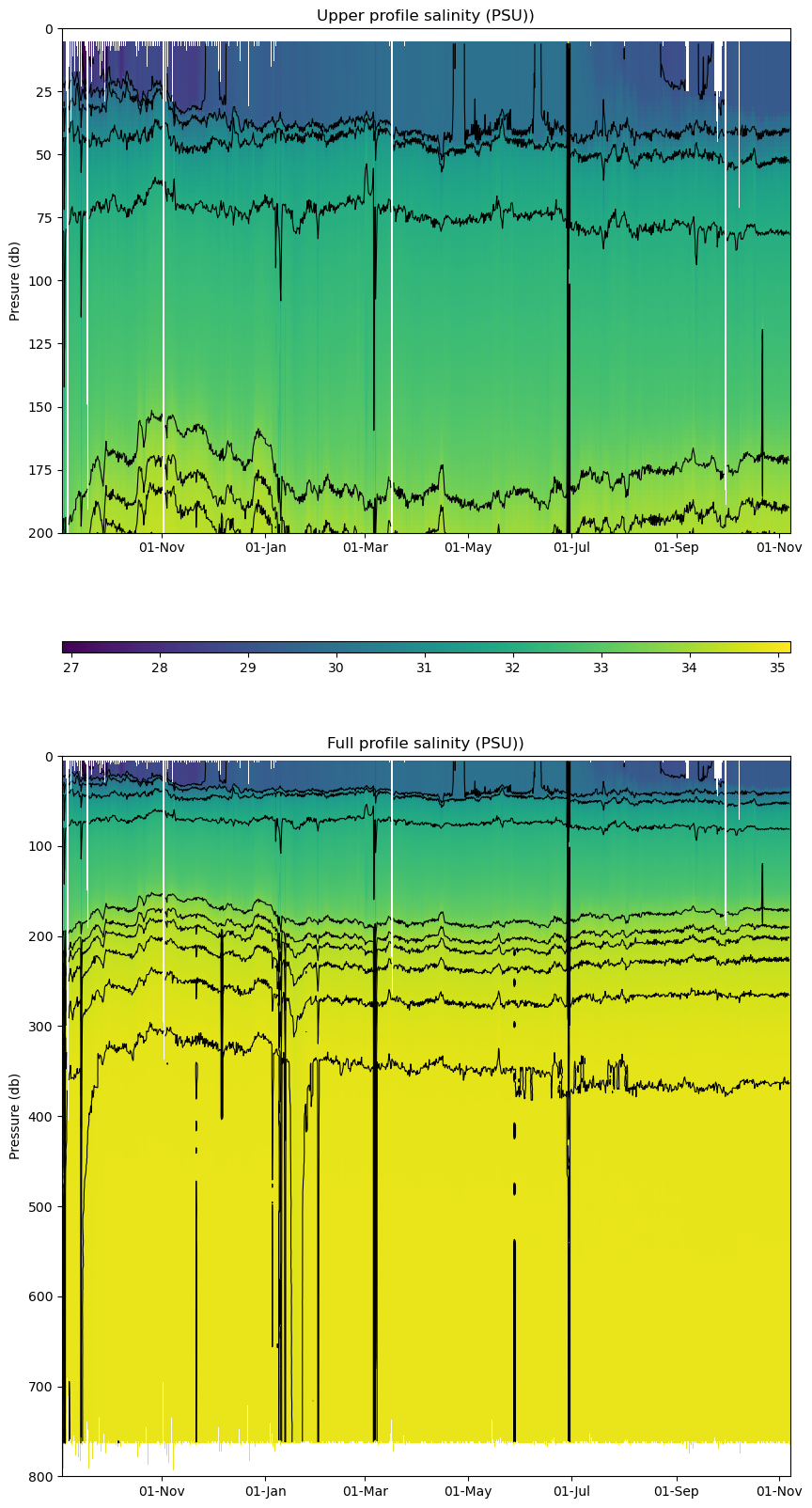
ITP127 was deployed on a 0.85 m ice floe in the Beaufort Sea on September 2, 2021 at 78° 34.9 N, 147° 19.3 W as part of the Beaufort Gyre Observing System (BGOS) during the JOIS 2021 cruise on the CCGS Louis S. St. Laurent. On the same icefloe, a Tethered Ocean Profiler (TOP2), and a US Army Cold Regions Research and Engineering Laboratory (CRREL) Seasonal Ice Mass Balance Buoy 3 were also installed. The ITP is operating on a standard sampling schedule of 2 one-way profiles between 7 and 760 m depth each day and includes a fixed SAMI PCO2 with ODO and PAR at 5 m depth.
| Temperature Contour Plot |
Salinity Contour Plot |
Profile History Plot |
 |
 |
 |
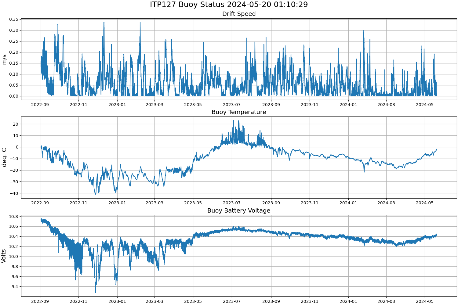
| Buoy Status |
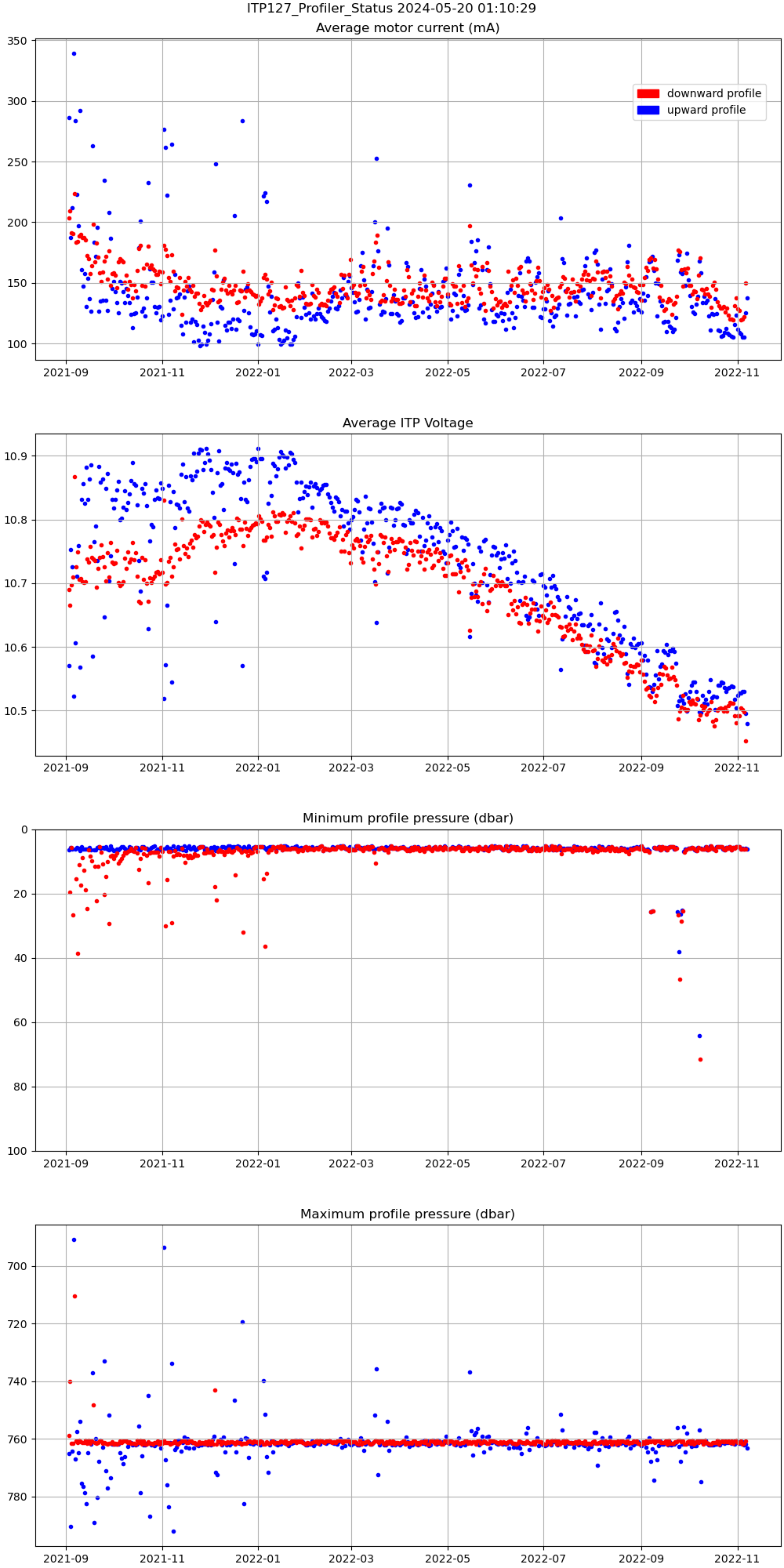
Profiler Status |
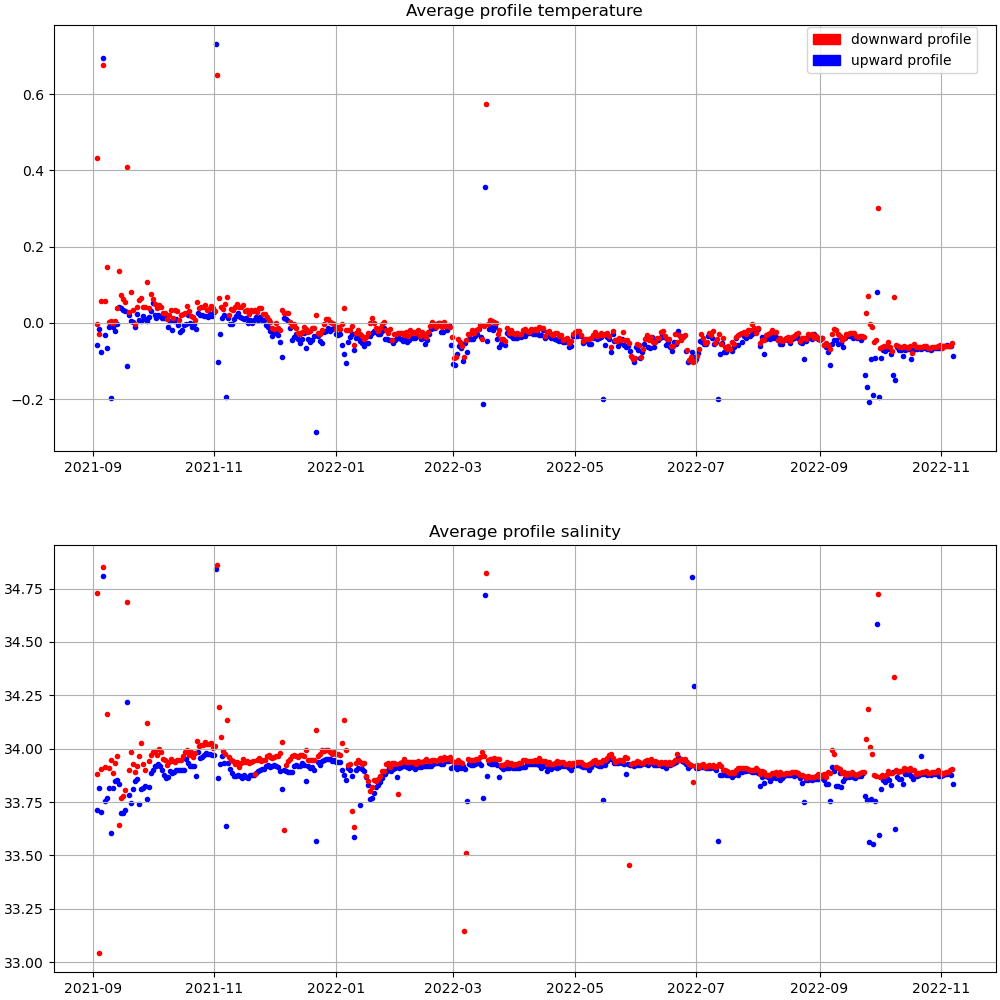
Mean Profile Temperature-Salinity |
 |
 |
 |
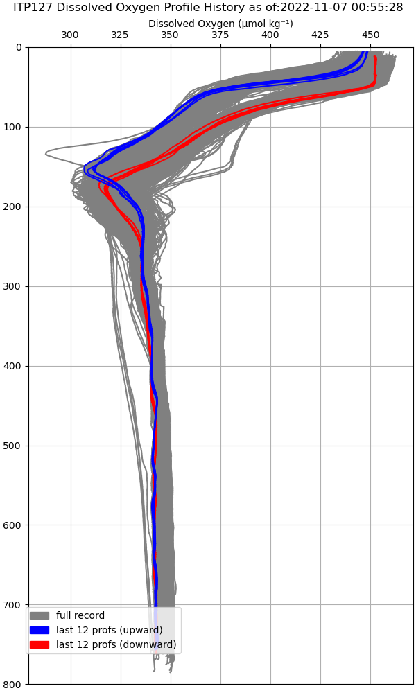
| Oxygen Profile History |
Oxygen Contour Plot |
 |
 |
| SAMI Timeseries |
 |