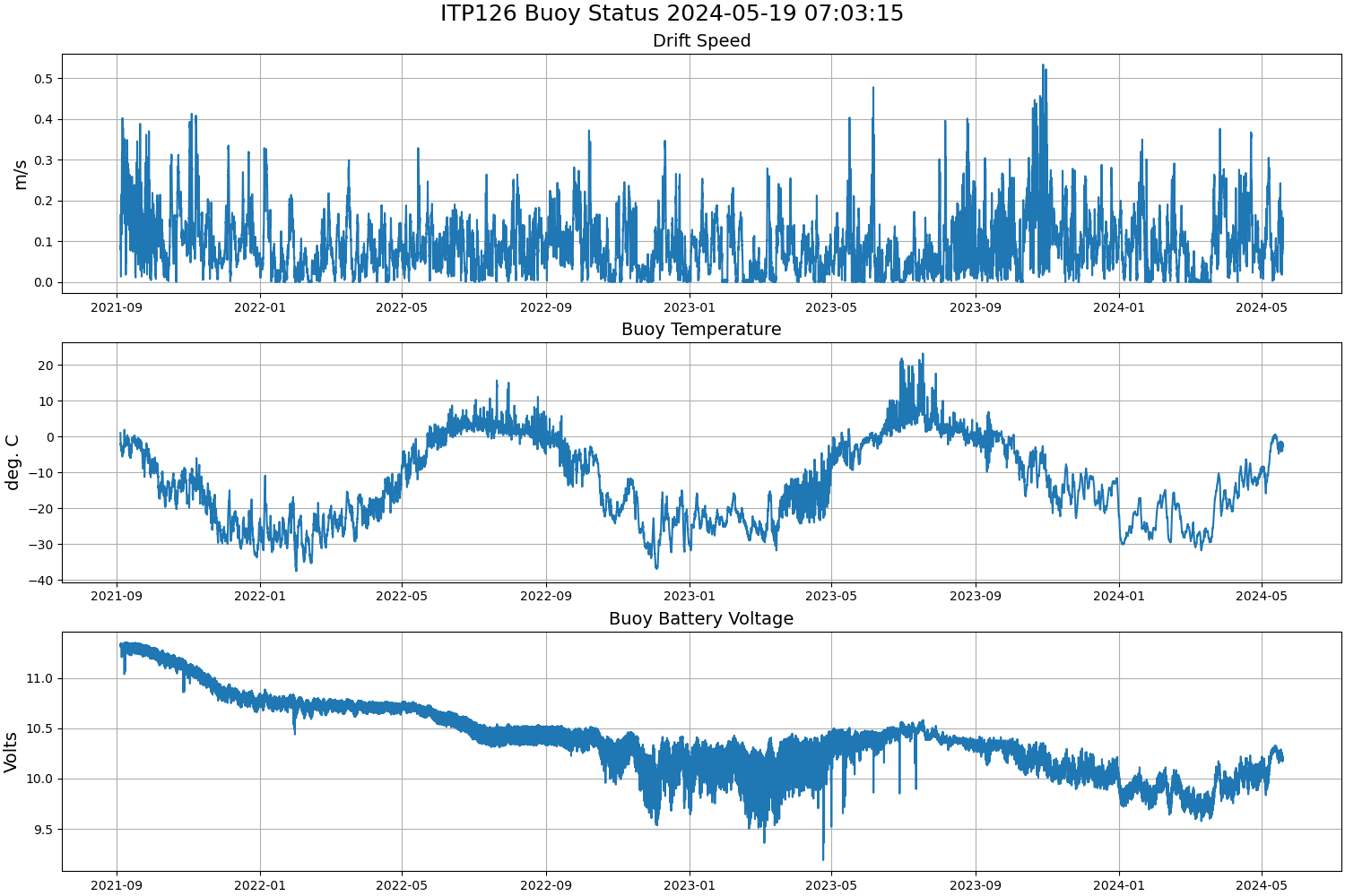
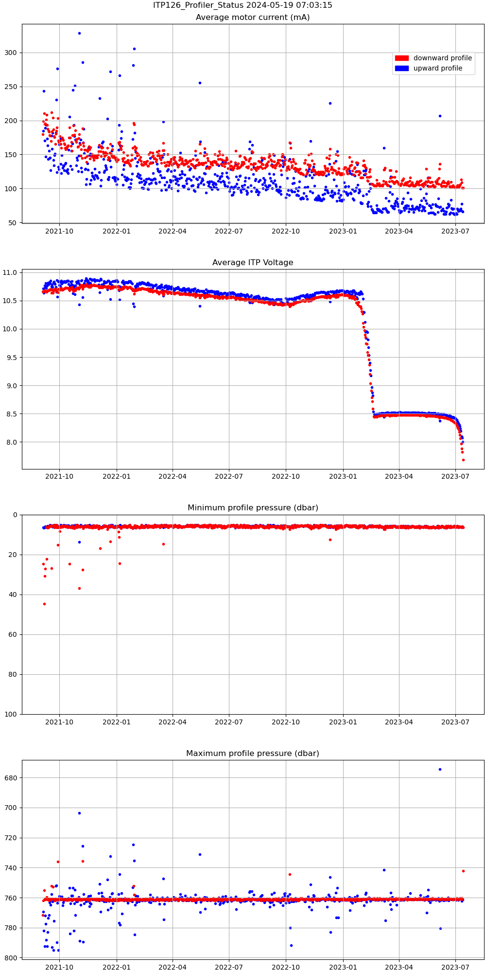
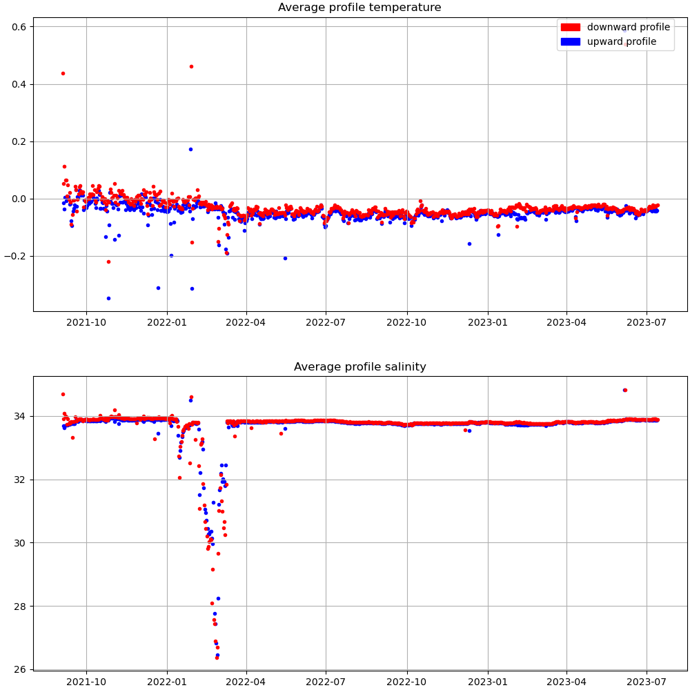
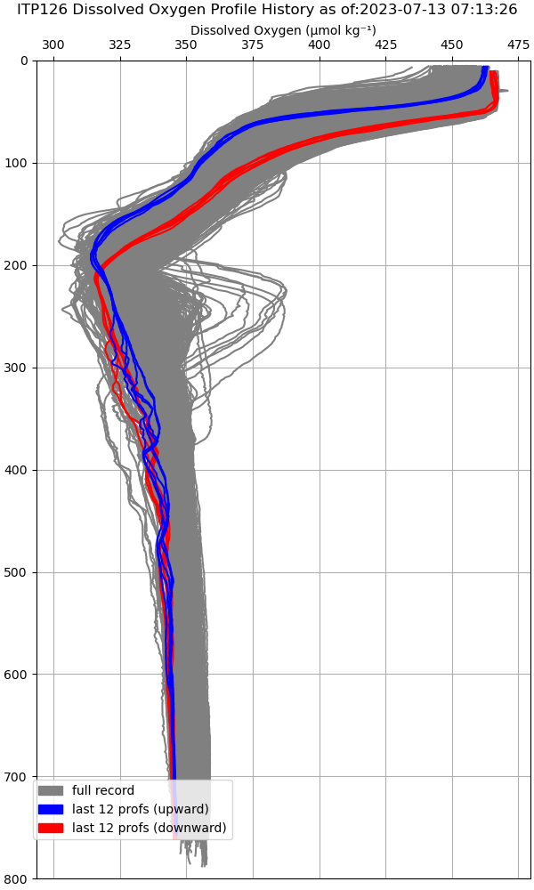
Data from ITP126
Last surface buoy status
| Time (UTC) |
2024-08-18 07:03:15 |
| Latitude |
75.42298 |
| Longitude |
-156.26894 |
| temperature (deg C) |
-0.6875 |
| battery voltage |
10.133 |
Last profile statistics
| Last profile number |
1354 |
| Profile Time (UTC) |
2023-07-13 06:00:05 |
| mean motor current (mA) |
100.830 |
| mean battery voltage |
7.680 |
| minimum pressure (dbar) |
6.320 |
| maximum pressure (dbar) |
742.240 |
| minimum temperature (C) |
-1.526 |
| maximum temperature (C) |
0.708 |
| minimum salinity (PSU) |
29.178 |
| maximum salinity (PSU) |
34.868 |
| minimum oxygen (μmol/kg) |
301.877 |
| maximum oxygen (μmol/kg) |
471.023 |
Description
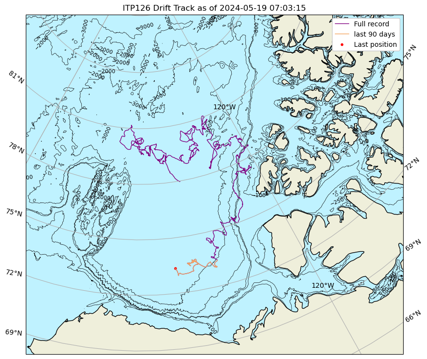
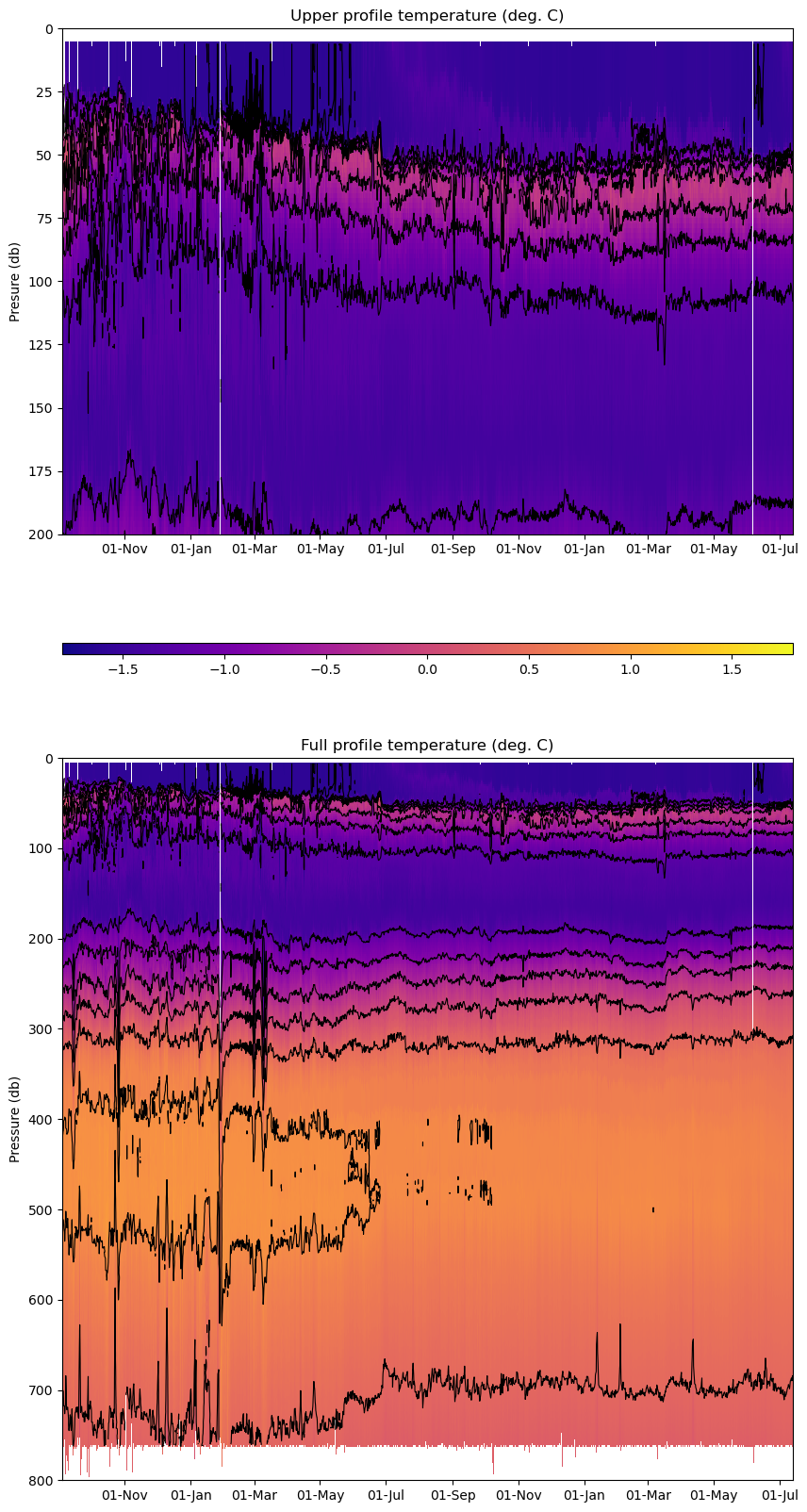
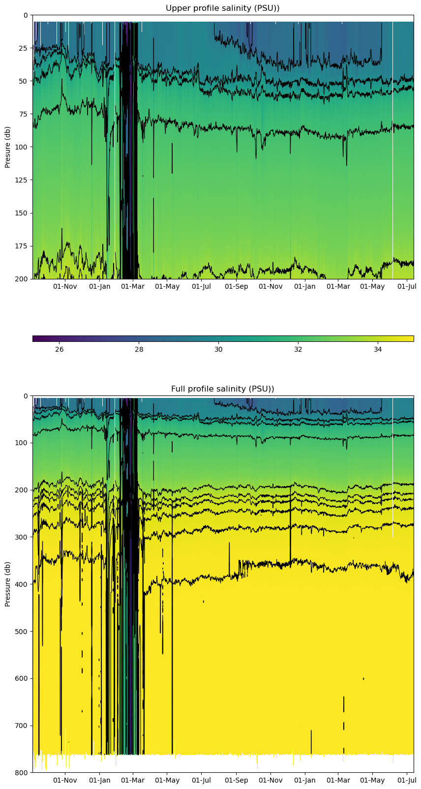
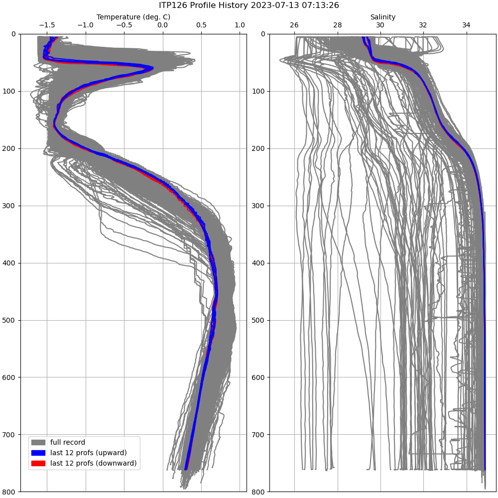
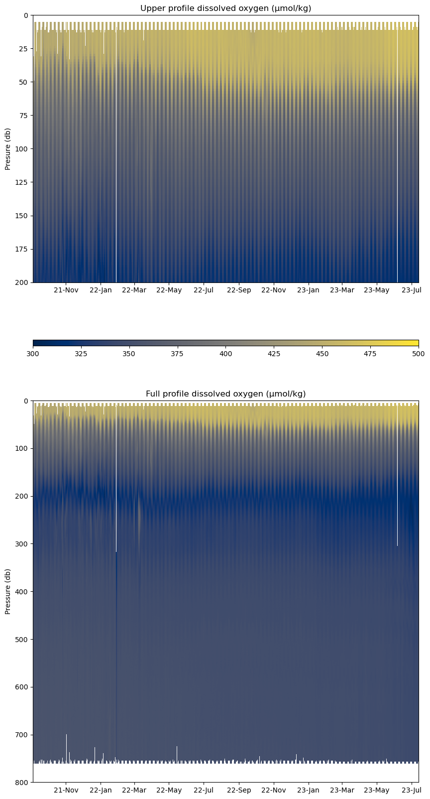
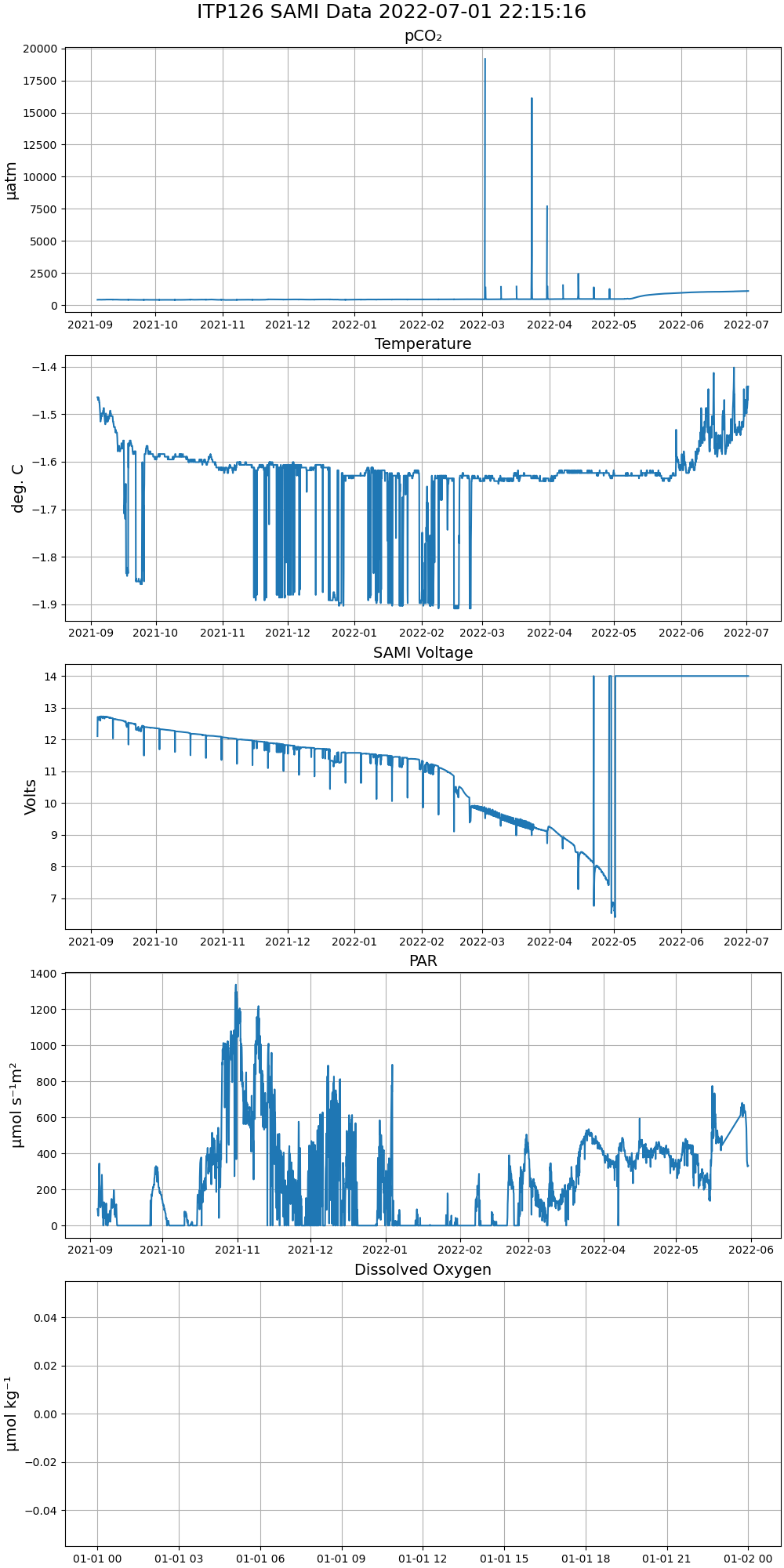
ITP126 was deployed on a 0.95 m ice floe in the Beaufort Sea on September 3, 2021 at 77° 58.5 N, 139° 47.6 W as part of the Beaufort Gyre Observing System (BGOS) during the JOIS 2021 cruise on the CCGS Louis S. St. Laurent. On the same icefloe, a prototype Tethered Ocean Profiler (TOP3) was also installed. The ITP includes a dissolved oxygen sensor and is operating on a standard sampling schedule of 2 one-way profiles between 7 and 760 m depth each day and includes a fixed SAMI PCO2 with ODO and PAR at 5 m depth.
| Temperature Contour Plot |
Salinity Contour Plot |
Profile History Plot |
 |
 |
 |
| Buoy Status |
Profiler Status |
Mean Profile Temperature-Salinity |
 |
 |
 |
| Oxygen Profile History |
Oxygen Contour Plot |
 |
 |
| SAMI Timeseries |
 |