Research Interests
I am currently working as a Senior Research Specialist in the Physical Oceanography Department at Woods Hole Oceanographic Institution with a wide range of research interests in the coastal ocean. My primary interests include the dynamics of the coastal ocean such as the general circulation, buoyancy and wind forcing, tidal rectification, sea ice annual cycles, mixing, LaGrangian (drifter) trajectories, and climate change. I approach problems using numerical modeling, field work, observations, and new instrumentation.
Projects
 |
Palmer LTER Lagrangian Current Measurements
We deployed satellite-tracked near surface drifters during the annual austral summer Palmer Long Term Ecological Research (LTER) program January cruises during 2005-2007 in order to investigate the near-surface Lagrangian currents over the Western Antarctic Peninsula (WAP) shelf between 63 and 68 S.
Palmer LTER Lagrangian Current Measurements
|
 |
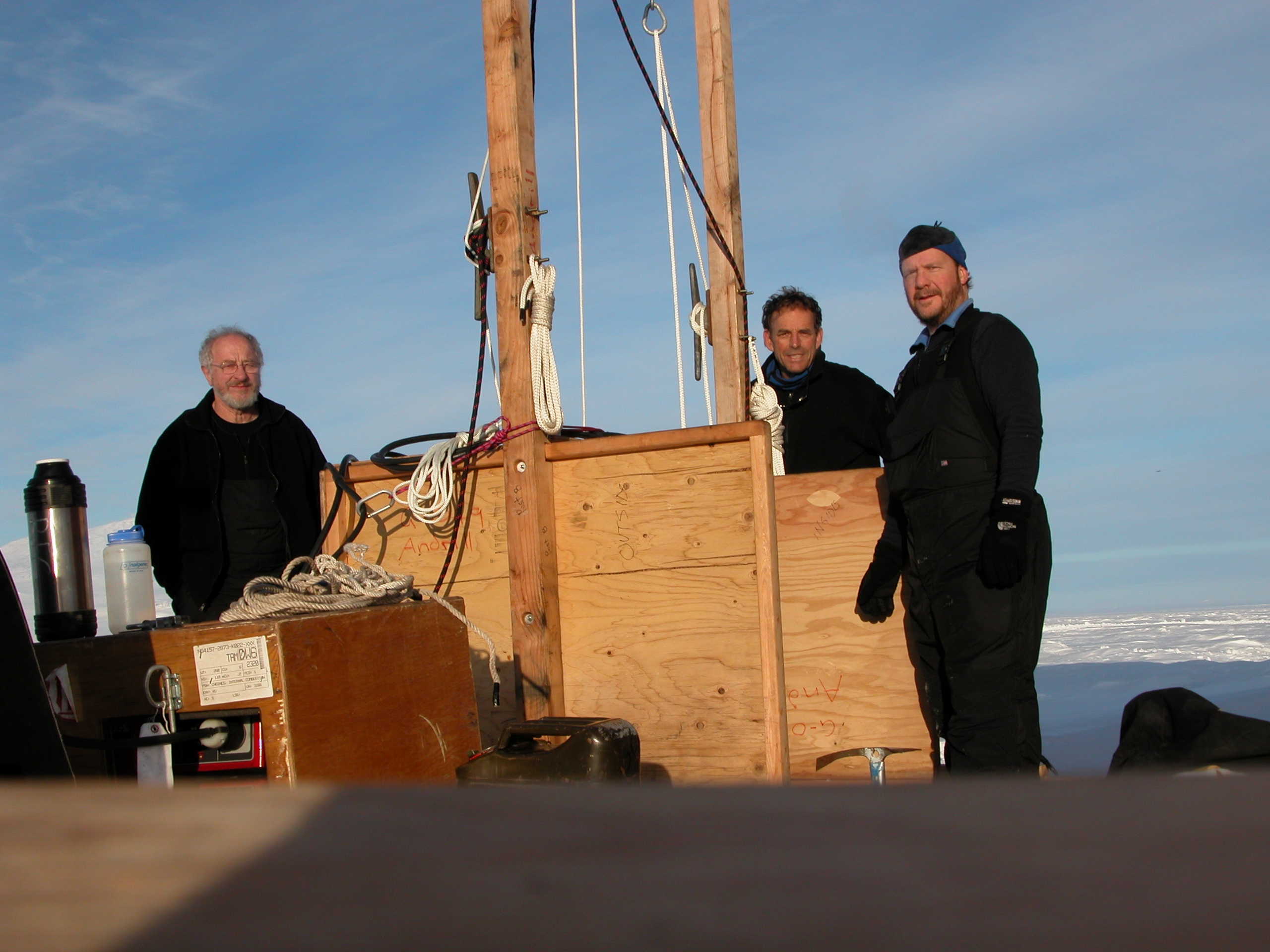
ANDRILL SMS Mooring 2006
A current meter mooring was deployed on October 25, 2006 through the frozen surface ice of the Ross Sea in support of the ANtarctic geologic DRILLing (ANDRILL) project by David Harwood (University of Nebraska), Richard Limeburner (Woods Hole Oceanographic Institution) and Peter Webb (Ohio State University). The mooring is located at the SMS site 77° 45.157 S and 165° 29.372 E, approximately 18 miles west northwest of McMurdo Station, Antarctica. The SMS mooring site is normally covered with seasonal sea ice, but at present the region has been permanently frozen for the past 10 years .
ANDRILL SMS Mooring
|
 |
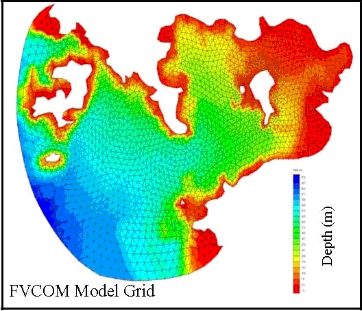
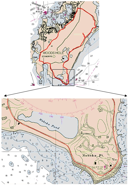
Nantucket Sound Circulation - Observations, Analysis and Model Development
Moored measurements of current, pressure, temperature and conductivity (salinity) were made on a bottom tripod located at a depth of 26m approximately half way between Nobska Point, Woods Hole and West Chop, Marthas Vineyard on four deployments during July 16, 2004 to November 22, 2006. The currents were dominated by strong semidiurnal tidal currents up to 200 cm/s. The maximum tidal current was in phase with the maximum tidal elevation indicating the local tide is characterized by a progressive wave. The mean flow was southwestward throughout the well mixed water column. The low-frequency current variability was dominated by the windstress. The moored data compared well with newly developed FVCOM model output (Chen et. al., 2007). These results are now being used to develop an operational coastal management model system for the New England Shelf (NES) with the focus on Nantucket Sound (NS) and Buzzard Bay (BB).
Nantucket Sound Circulation
|
 |
Modeling the Liquid Jungle: Biological-Physical Interactions in Isla Canales de Tierra and nearby Bahia Honda Bay, Panama
We will conduct seasonal hydrographic surveys (P, T, C(S), DO and fluorescence) in the waters surrounding Isla Canales de Tierra, Panama and apply a state-of-the-art hydrodynamic model, the Finite-Volume Coastal Ocean Model (FVCOM), to the region. The model will be used to gain a better understanding of the hydrodynamic processes and their potential impact on ecosystem dynamics in this region. The development of this tested hydrodynamic model is the first step towards our goal of building a coupled biological-physical model of the region.
Liquid Jungle Lab
|
 |
Cellular GPS Drifter
We plan to develop, test, and use a new low-cost surface drifter
equipped with a HP iPAQ 6900 Pocket PC with a built-in cell phone and GPS receiver.
The cellular GPS (CGPS) unit with battery will be mounted in a drogued cylinder designed to drift with the surface (top 1-m) mean current and transmit via cell phone an email message with an attached file containing a time series history of its past positions. The CGPS drifter can save GPS positions frequently, every few seconds if desired, with an accuracy of = 10 m. This accuracy plus a programable cell phone call rate allows the CGPS drifter to be deployed, tracked, and easily recovered in coastal areas ranging from small embayments (e.g. Waquoit Bay) to larger bodies of water (e.g. Nantucket Sound). We want to make repeated short-term deployments of these CGPS drifters to investigate Lagrangian currents in Nantucket Sound, exchange with Waquoit Bay, and friction/topography-generated vorticity on scales ranging from 10s of m to 10s of km, and compare these new measurements with high-resolution FVCOM (Finite-Volume Coastal Ocean Model) simulations of tide- and wind-generated flow in Nantucket Sound.
|
 |
Errata
In this section you can access my publications and CV. In the future, photos and links will be available.
Education
CV [PDF document]
Photos
|
 | Support from the National Science Foundation, Smith Chair, Sea Grant and the Woods Hole Oceanographic Institution Ocean Life Institute is gratefully acknowledged. |  |
|