 |
|
|
|
 |
|
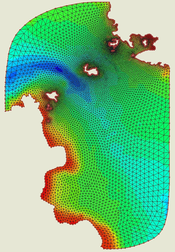
Figure 1- Model grid of the region near Isla Canales. |
|
 |
|
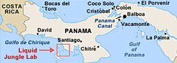
Figure 2. Liquid Jungle Lab location. |
|
|
|
|
Overview - Background
Liquid Jungle Laboratory (LJL) water properties and modelling.
Brief Outline
There is an increasing demand for the understanding of regional hydrodynamic processes and their potential impacts on the ecosystem in the coastal waters surrounding Isla Canales de Tierra and nearby Bahia Honda Bay (ICT-BHB). This demand comes from the on-going OLI research conducted in this region, such as the installation of Panama Liquid Jungle Laboratory Underwater Tropical Observatory (PLUTO) (S. Gallager), laval transport and recruitment of coastal invertebrates in Bahia Honda Bay (J. Pineda), Tunicate distribution and invasion (M. Carman), and tropic mangrove ecosystem study (I. Valiela). A biological-physical coupled modeling system will provide a unique tool to study this tropical marine ecosystem relatively untouched by pollution and development, providing critical information in terms of circulation pattern, stratification/mixing dynamics, and the potential impact of hydrodynamic processes on the distribution and transport of biological quantities including nutrients and plankton.
High resolution coastline and bathymetry data collected recently by R. Ji and S. Gallager, along with the data from PLUTO and a hydrographic survey proposed here will make it possible for the development of a high-resolution hydrodynamic model in ICT-BHB. This model will serve as a first step towards building a coupled biological-physical modeling system in this region. We propose to conduct hydrographic surveys of temperature, salinity, dissolved oxygen, and fluorescence in the coastal waters around the Isla Canales de Tierra during the dry (February 2007) and wet (October 2008) seasons, and to apply a state-of-the-art hydrodynamic model, the Finite-Volume Coastal Ocean Model (FVCOM), driven by tidal forcing, fresh water input, and surface forcing (wind, heating, and net precipitation). The objective of this modeling study is to (1) quantify the seasonal variation and spatial distribution of water properties, such as temperature and salinity; (2) study the dynamics of stratification/mixing during dry and wet seasons and under different meteorological forcing conditions; (3) gain a better understanding of the dominant hydrodynamic processes that are likely to impact ecosystem dynamics; and (4) identify the needs for future observation and modeling efforts and optimize the design of field work for both physical and ecological studies. We plan to use a lightweight profiling CTD deployed from a small boat supplied by the Liquid Jungle Laboratory (LJL) on Canales and the surveys will extend both east and west along the coast from Canales and include Bahia Honda. The resulting maps of water properties will define the basic temperature, salinity, density structure, their seasonal change, and help identify the relative importance of tidal currents and mixing, surface buoyancy (rain, radiation), terrestrial runoff, wind forcing and mixing, and offshore forcing on local water properties, stratification, and circulation.
To read the full proposal (PDF format), click here.
This project is funded by the Ocean Life Institute.
Website Updated September 7, 2011. R. Limeburner
|
|
|