 |
|
|
|
 |
|
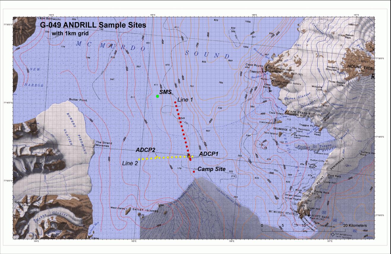
Figure 1- Location of the 2006 SMS ANDRILL Mooring labelled ADCP1 above. |
|
 |
|
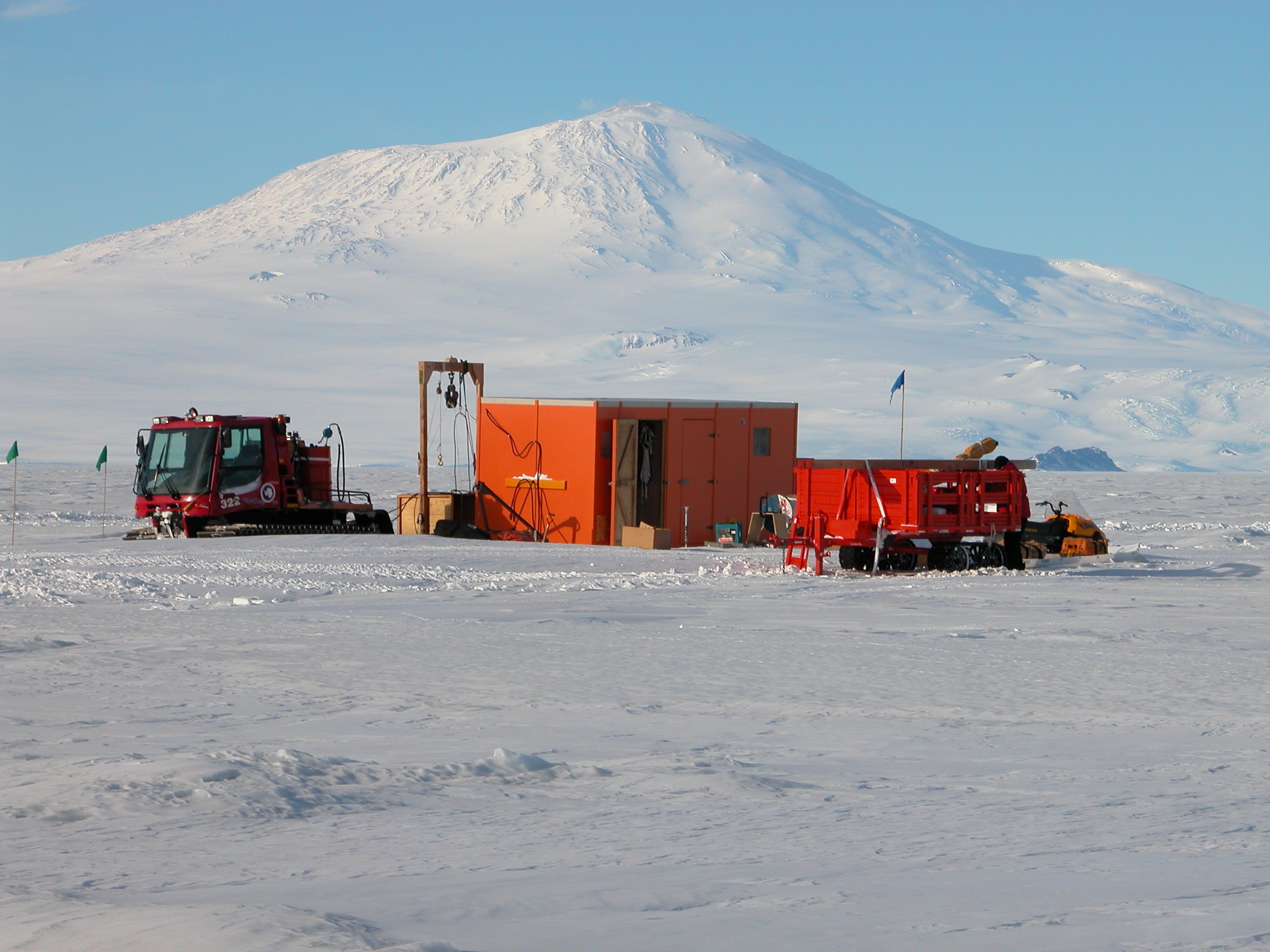
Figure 2- The 2006 SMS ANDRILL Mooring site. Mt Erebus is in the background . |
|
 |
|
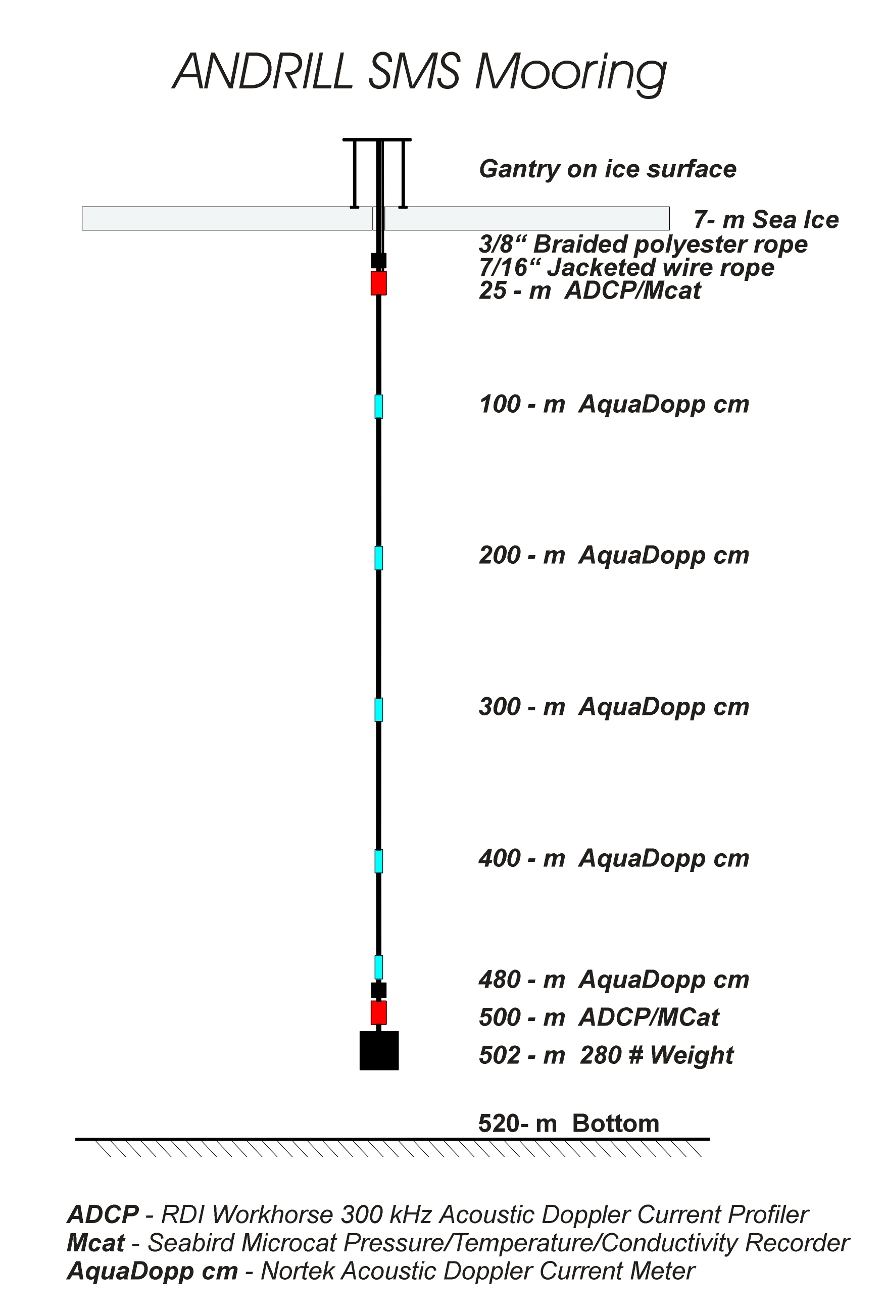
Figure 3- Schematic of the 2006 SMS ANDRILL Mooring. |
Overview - Background
ANDRILL SMS Mooring Measurements 2006
Brief Outline
A current meter mooring was deployed on October 25, 2006 through the frozen surface ice of the Ross Sea in support of the ANtarctic geologic DRILLing (ANDRILL) project by David Harwood (University of Nebraska), Richard Limeburner (Woods Hole Oceanographic Institution) and Peter Webb (Ohio State University). The mooring is located at the SMS site 77° 45.157 S and 165° 29.372 E, approximately 18 miles west northwest of McMurdo Station, Antarctica. The SMS mooring site is normally covered with seasonal sea ice, but at present the region has been permanently frozen for the past 10 years (Figure 1). The mooring was recovered on December 5, 2006. The edited data is presented here and a full analysis will be done in 2007.
Scientific Background
The NSF funded ANDRILL (ANtarctic geological DRILLing) is a multinational collaboration comprised of more than 200 scientists, students, and educators from five nations (Germany, Italy, New Zealand, the United Kingdom and the United States) to recover stratigraphic records from the Antarctic margin using Cape Roberts Project (CRP) technology. The chief objective is to drill back in time to recover a history of paleoenvironmental changes that will guide our understanding of how fast, how large, and how frequent were glacial and interglacial changes in the Antarctica region. Future scenarios of global warming require guidance and constraint from past history that will reveal potential timing frequency and site of future changes. The purpose of the ANDRILL moored measurements is to characterize the ocean currents t the SMS site from the near surface (under the 7-m surface ice) to the ocean bottom at a depth of approximately 520-m. These moored observations will be critical to the design and installation of an ANDRILL drilling platform planned for 2007.
Approach
We departed McMurdo Station at 0500 GMT on Saturday October 21, 2006 with the mooring equipment, ice melting equipment, and food and camping supplies loaded on a "Piston Bully" track vehicle towing a medium size container-like box on skis and a Skidoo (Figure 2).
Air temperatures on the Ross Sea ice were generally in the range of -40° to -15° C during October and winds over 25 m/s were common. We arrived at the mooring site after a 4 hour transit in whiteout conditions. The next morning we set up a wooden gantry with blocks and cleats to facilitate the deployment. We then began melting a 24' diameter hole centered on the gantry in the sea ice. The hole melting process was slow and was done by placing a copper coil heated with glycol on the ice . The coil was attached with 2 pressure hoses to a pump and boiler. Equipment failures were frequent due to the cold harsh operating conditions. Finally, on October 25 the melt hole reached the underlying seawater at a depth of 7-m. We then began deploying the mooring as shown in the schematic in Figure 3.
Mooring Recovery
The mooring was recovered on December 5, 2006.
To read the full proposal (PDF format), click here.
This project is funded by the National Science Foundation.
Website Updated May 15, 2007. R. Limeburner
|
|
|

